Planning a ghost town road trip to North Muroc means chasing a place that’s fundamentally vanished twice — once when desert settlers left, and again when Edwards Air Force Base absorbed it. Today it’s called North Edwards, sitting at roughly 2,290 feet in California’s Mojave Desert. You’ll need exact GPS coordinates (35°00′18″N 117°49′08″W), offline maps, and serious desert preparation since there are no facilities, signs, or structures waiting for you. There’s much more to uncover ahead.
Key Takeaways
- North Muroc is located at 35°00′18″N 117°49′08″W in Kern County’s Mojave Desert, now known as North Edwards near Edwards Air Force Base.
- Load exact GPS coordinates before departure, as North Muroc appears on no modern maps and the terrain offers no obvious landmarks.
- Download offline maps and carry printed backups, since cell service is unreliable throughout the remote Mojave Desert region.
- Pack ample water, fuel, sun protection, and layered clothing, as services are sparse and temperatures swing dramatically in the high desert.
- Expect no ruins, signs, or facilities—only open desert scrubland remains, requiring full self-sufficiency and imagination to appreciate the site’s history.
What North Muroc Was and Why It Disappeared
Once a quiet desert settlement tucked into the high Mojave terrain of Kern County, North Muroc sat at roughly 2,290 feet above sea level before vanishing so completely that today most maps don’t even carry its name.
North Muroc history traces a familiar arc of desert abandonment — a community that existed, served a purpose, then quietly dissolved.
How the Edwards Air Force Base Area Erased North Muroc
The story of North Muroc’s disappearance doesn’t end with simple abandonment — it ends with a name swap tied directly to military expansion.
As the air force claimed dominance over the Mojave landscape, desert settlements like North Muroc got absorbed, renamed, or erased entirely. The area you’d find on a 1947 map as North Muroc eventually became North Edwards, a name reflecting Edwards Air Force Base’s growing footprint.
That kind of urban expansion doesn’t just redraw boundaries — it strips away cultural memory and historical significance tied to the original community.
You’re fundamentally looking at community displacement written in cartography. If preserving the freedom to remember vanished places matters to you, North Muroc stands as a quiet but powerful reminder of how military growth reshapes identity across California’s desert.
Where North Muroc Sits in the Mojave Desert
You’ll find North Muroc sitting in the high desert terrain of Kern County, California, at coordinates 35°00′18″N 117°49′08″W—precise enough to plot on any mapping tool before you hit the road.
The settlement rested at roughly 2,290 feet above sea level, placing it squarely in the arid, sun-baked landscape that defines the Mojave.
That elevation and location put you in a region where dry winds, sparse vegetation, and wide-open skies set the tone for the entire drive.
High Desert Terrain Location
Sitting at roughly 2,290 feet above sea level, North Muroc occupies the high desert terrain of the Mojave in Kern County, California — a landscape defined by wide-open scrubland, dry air, and a horizon that seems to stretch forever.
The geographical features here shaped both the settlement history and its eventual disappearance, as environmental challenges like extreme heat, limited water, and harsh winters made long-term community survival difficult.
You’ll notice the landscape changes as you drive into this region — the terrain flattens, the vegetation thins, and the silence deepens.
The cultural significance of this vanished place connects directly to what the land demanded of its settlers.
Plan your travel logistics carefully, because historical remnants won’t greet you at a visitor center — they exist only in records, coordinates, and open desert.
Precise Coordinates For Mapping
Knowing exactly where to look changes everything when your destination no longer exists on a modern road sign. North Muroc sits at 35°00′18″N 117°49′08″W, placing it precisely within the Mojave Desert‘s high terrain.
Plug those coordinates into your GPS or mapping app before you leave, and you’ll navigate with confidence instead of guesswork.
For serious desert exploration, export the coordinates into a GIS tool or satellite map layer. You’ll spot landscape features that connect directly to ghost town history, even where structures no longer stand.
The site’s elevation of 2,290 feet means you’re reading real high desert topography.
Print a backup map, too. Cell service gets unreliable out there, and you don’t want a dead signal erasing your only guide to a vanished settlement.
Elevation And Regional Context
At 2,290 feet above sea level, North Muroc occupies genuine high desert terrain, where the Mojave’s open basin stretches wide and the air carries that dry, sharp quality that reminds you exactly how far you’ve traveled from the coast.
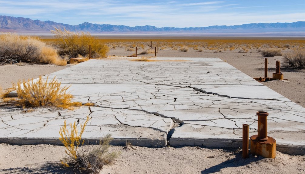
The elevation significance here shapes everything from temperature swings to visibility, giving you sweeping sightlines across ancient lakebed geology that tells the region’s story better than any marker could. Regional geology reveals a landscape carved by tectonic forces and dried by centuries of arid climate.
Picture the terrain this way:
- Pale alkali flats shimmering under midday sun
- Distant mountain ridgelines cutting sharp edges against a cloudless blue sky
- Cracked earth stretching toward the horizon with almost nothing interrupting the view
You’re standing inside a landscape that erased a town completely.

How do you navigate to a place that no longer exists? Start with coordinates: 35°00′18″N 117°49′08″W. Plug them into a GPS app or overlay them onto a topographic map for precision.
North Muroc vanished from active use long ago, but its desert history leaves a traceable footprint through historical maps, particularly those dated around 1947.
North Muroc may be gone, but its desert past endures in the faded lines of 1947 maps.
Cross-reference the coordinates with the modern North Edwards area, since that name replaced both Edgemont Acres and North Muroc over time. You’re fundamentally tracking abandoned settlements through name changes rather than standing structures.
Download offline maps before you leave — cell service across the Mojave is unreliable. Bring printed backup maps.
The freedom of desert exploration demands preparation, and pinpointing a ghost town rewards the traveler who does the homework first.
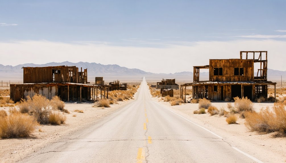
What the North Muroc Site Actually Looks Like Today
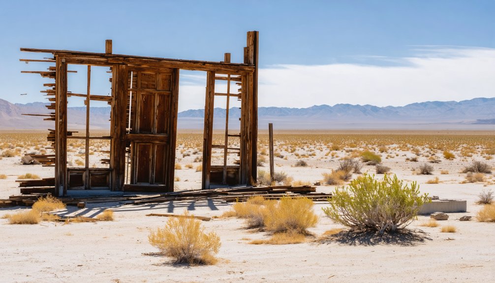
When you arrive at the coordinates for North Muroc, expect open desert rather than ruins. No abandoned landmarks mark the spot. The Mojave simply reclaimed what people left behind, leaving desert history written in sand and silence rather than standing walls.
You’ll find yourself scanning a landscape that tells its story through absence:
- Flat, scrubby terrain stretching toward distant mountain ridges under a wide, unfiltered sky
- Dry soil broken by creosote bushes and scattered rock, with no structural remnants visible
- The quiet hum of wind replacing what were once voices, engines, and daily life
That emptiness isn’t disappointing — it’s the point. North Muroc doesn’t perform for visitors. It simply exists as coordinates on a map, asking you to imagine everything that once filled the space.
Kern County Ghost Towns Worth Adding to Your Route
That empty stretch of Mojave makes a powerful impression, but you don’t have to end your road trip there. Kern County holds several abandoned communities worth threading into your route.
Each site adds another layer of desert history and deepens your understanding of how people settled, struggled, and eventually disappeared from this landscape.
Muroc, a separate former settlement in the same regional pocket, sits close enough to visit alongside North Muroc. Both names connect directly to what eventually became the Edwards Air Force Base area, giving your trip a clear historical thread to follow.
For contrast, consider adding a preserved California ghost town like Bodie to your itinerary.
Seeing standing structures beside a vanished settlement like North Muroc sharpens how differently abandonment plays out across the desert.
What to Know Before Driving Out to North Muroc
Before you load up the car, understand that North Muroc offers no visitor facilities, no marked trails, and no signage waiting to greet you at the site.
You’ll need the precise coordinates — 35°00′18″N 117°49′08″W — to locate the original settlement, since it no longer exists as a populated or mapped destination.
The high desert terrain sits at roughly 2,290 feet, so check road conditions, pack water, and plan your drive carefully before heading out.
No Visitor Facilities Exist
If you’re planning a drive out to North Muroc, know this upfront: there’s nothing waiting for you when you arrive. No signs mark the ghost town allure of this vanished settlement. No ranger stations, restrooms, or interpretive displays acknowledge its historical significance.
You’re driving into open desert with coordinates and curiosity as your only guides.
Pack accordingly before you leave civilization behind:
- Water and fuel — the Mojave punishes the unprepared, and services are sparse along desert routes
- Printed maps or offline GPS — cell coverage drops fast once you’re deep into Kern County terrain
- Sun protection and layers — high desert elevation at 2,290 feet means intense sun and sharp temperature swings
This place rewards self-sufficient explorers who need no hand-holding.
Precise Coordinates Required
North Muroc doesn’t exist on most modern maps, which means you’ll need exact coordinates before you even think about pointing your car toward the Mojave: 35°00′18″N 117°49′08″W.
These mapping challenges are real — the settlement vanished from active use long ago, leaving behind little more than desert terrain and historical significance tied to what eventually became the Edwards Air Force Base region.
Load those coordinates into your GPS or preferred mapping app before you leave home. Cross-reference them against satellite imagery so you recognize the landscape when you arrive.
You’re traveling toward a place that sat at roughly 2,290 feet elevation in high desert country, and the surrounding terrain offers few obvious landmarks.
Preparation separates a successful desert excursion from a frustrating, fuel-wasting detour.
Desert Terrain Conditions
Getting those coordinates locked in is only half the work — the Mojave itself will test your vehicle and your planning the moment you leave paved roads behind.
Desert ecosystems shift fast here, and climate extremes mean scorching midday heat or unexpected cold snaps depending on the season. The terrain challenges are real — geological features like dry washes, loose hardpan, and eroded ridgelines can strand an unprepared driver miles from help.
Picture what you’re driving into:
- Cracked alkali flats stretching toward distant mountain silhouettes with zero shade
- Joshua trees and scrub brush showcasing remarkable wildlife adaptations built for survival
- Wind-carved rock formations carrying geological features and historical significance dating back centuries
Travel early, carry extra water, and respect the Mojave’s unforgiving rhythm.
Frequently Asked Questions
Is North Muroc the Same Location as Modern North Edwards Today?
Yes, you’re exploring the same general area! North Muroc history shows it evolved into modern North Edwards. This North Edwards comparison reveals a fascinating name transformation tied to Edwards Air Force Base’s growing regional influence over time.
What Year Did North Muroc First Appear on Official Maps?
You’ll find North Muroc’s historical significance locked in 1947, the year it last appeared on official maps. That snapshot captures the settlement’s mapping evolution before it vanished, leaving only coordinates and desert silence behind.
How Does North Muroc Compare to More Famous Ghost Towns Like Bodie?
Bodie’s a museum; North Muroc’s a ghost. In Bodie comparisons, you’ll find preserved buildings and crowds, while North Muroc history offers raw, unfiltered desert silence — no structures, no signs, just freedom and open Mojave sky.
What Is the Exact Elevation of the North Muroc Settlement Site?
You’ll find North Muroc’s elevation significance sits at 2,290 feet (698 m) above sea level. That high desert height adds rich historical context, shaping the harsh, rugged environment that ultimately swallowed this forgotten Mojave settlement whole.
Are There Any Visitor Facilities or Museums Near the North Muroc Site?
Don’t let the lack of visitor resources discourage you — North Muroc’s raw, untouched desert landscape *is* the attraction. You’ll feel its historical significance most powerfully by arriving prepared with maps, coordinates, and an adventurous spirit.
References
- https://en.wikipedia.org/wiki/List_of_ghost_towns_in_California
- https://www.weirdca.com/location.php?location=511
- https://kids.kiddle.co/North_Muroc
- https://www.tripadvisor.com/Attractions-g28926-Activities-c47-t14-California.html
- https://www.pbssocal.org/shows/socal-wanderer/where-to-find-the-mojaves-greatest-ghost-towns
- https://www.wikiwand.com/en/articles/List_of_ghost_towns_in_California
- https://en.wikipedia.org/wiki/North_Muroc
- https://www.ghosttowns.com/states/ca/cainyo.html
- https://wikimapia.org/24567754/Muroc-California
- https://nvtami.com/kern-county-california-ghost-towns/


