Planning a ghost town road trip to Lithia, South Dakota means chasing a town that’s literally underwater. Once a tiny frontier settlement in Fall River County, Lithia housed just six residents in 1909 before fading into history. Today, it’s believed to be submerged beneath Angostura Lake, erased by the dam’s creation. You’ll start your journey in Hot Springs, about 16 miles northwest of the site. Stick around to uncover everything you need to explore this hauntingly drowned piece of history.
Key Takeaways
- Lithia, South Dakota, is a ghost town in Fall River County, roughly 16 miles southeast of Hot Springs, now submerged beneath Angostura Lake.
- Begin your road trip in Hot Springs, the nearest town, then travel southeast approximately 16 miles using Angostura Lake as your primary landmark.
- No structures, foundations, or markers remain visible, as the dam’s creation permanently concealed the original townsite underwater.
- Bring county maps and historical records to better understand where Lithia’s buildings once stood along the lake’s eastern shoreline.
- Expand your trip by exploring additional nearby ghost towns throughout Fall River County and the broader Black Hills corridor.
What Was Lithia, South Dakota?
Lithia was a small frontier settlement in Fall River County, South Dakota, standing about 16 miles southeast of Hot Springs. By 1909, it held a population of just six people, a figure that captures the historical context of boom-and-bust settlement patterns across the western frontier.
Like hundreds of other South Dakota communities, Lithia likely grew around a post office, railroad connection, or resource opportunity before fading just as quickly as it appeared. Hot Springs served as its nearest railroad point, anchoring the region’s economy while smaller outposts like Lithia struggled to survive.
Today, the former townsite is believed to lie beneath Angostura Lake, making it one of South Dakota’s most intriguing lost communities. You’re not visiting ruins here — you’re tracing a vanished way of life.
Where Exactly Did Lithia Stand?
Tucked about 16 miles southeast of Hot Springs, Lithia sat in Fall River County within the broader Black Hills region of South Dakota. Its nearest railroad connection ran through Hot Springs, making that town your practical anchor point for any visit today.
To pin down Lithia’s place in history, focus on three key geographic facts:
- Angostura Lake now covers the likely townsite, swallowing whatever remained.
- The historical population reached just 6 residents in 1909, reflecting a settlement that never gained traction.
- Fall River County’s mining history shaped dozens of small communities like Lithia, most of which vanished just as quickly as they appeared.
You won’t find a marker or structure, but understanding exactly where Lithia stood makes the story hit harder.
Is Lithia Buried Under Angostura Lake?
When Angostura Reservoir filled after the dam was completed, it likely swallowed whatever physical trace Lithia had left behind. Modern infrastructure has a way of erasing history without ceremony, and Angostura’s creation was no exception.
When Angostura Reservoir filled, it swallowed Lithia whole — history erased without ceremony beneath still water.
The environmental impact of damming the Cheyenne River reshaped the entire landscape southeast of Hot Springs, permanently altering what you’d find at the surface.
If Lithia once had structures, foundations, or roads, the reservoir buried them. You won’t walk through remnants here. Instead, you’re looking out over water, knowing a forgotten community of six people once existed somewhere beneath it.
That’s a powerful image for any road tripper chasing lost history. The lake becomes the landmark, and the ghost town becomes the mystery hiding below it.
How Do You Get to the Lithia Ghost Town Site?
Start your trip in Hot Springs, the nearest town and the historic railroad point closest to Lithia’s former site.
From Hot Springs, head roughly 16 miles southeast, using Angostura Lake as your primary geographic landmark since the old townsite likely sits beneath or near its waters.
You won’t find signs pointing to Lithia, so pull up a county map before you go and use the lake’s shoreline to orient yourself.
Starting Point: Hot Springs
Hot Springs, South Dakota, sits about 16 miles northwest of where Lithia once stood, making it your logical launching point for this ghost-town detour. The town gives you fuel, food, and a chance to dig into local legends before you head southeast toward Angostura Lake.
From Hot Springs, your approach breaks down simply:
- Stock up on supplies, since you won’t find services near the site.
- Pull county maps or historical records to pinpoint where abandoned structures once stood before the lake swallowed them.
- Drive southeast along roads skirting Angostura Lake, watching the landscape shift from town to open terrain.
You’re chasing a town that barely exists above the waterline now, so treat Hot Springs as your research hub, not just a pit stop.
Route From Hot Springs
From Hot Springs, you’ll head southeast on roads that curve around the Angostura Lake area, covering roughly 16 miles before you reach the zone where Lithia once stood. The drive itself rewards you with open prairie views and quiet stretches that feel worlds away from crowded tourist routes.
As you approach Angostura Lake, remember that the water likely swallowed whatever physical traces Lithia left behind. Local legends about submerged settlements add a haunting layer to the landscape, turning an ordinary reservoir into something far more compelling.
Preservation efforts haven’t targeted this site specifically, so you won’t find markers or maintained paths. Instead, bring county maps, study the shoreline, and let the geography tell the story. The freedom here is in the searching, not in a polished destination.
Angostura Lake Reference Point
Once you’ve made your way southeast out of Hot Springs, Angostura Lake becomes your primary landmark for zeroing in on the Lithia site.
Local legends suggest the original townsite now rests beneath the lake’s surface, which means abandoned structures aren’t waiting on dry land.
Use these three reference points to orient yourself:
- Angostura Recreation Area — your closest official access point near the former townsite
- The lake’s eastern shoreline — the general zone where Lithia once stood
- County road intersections — cross-reference older maps against current roads to track the original settlement grid
You’re fundamentally visiting a submerged chapter of history.
Bring historical maps, study the shoreline, and let the landscape tell the story that no standing walls can.
What Remains at the Lithia Site Today
What you’ll find at Lithia today is fundamentally nothing—and that’s by nature, not neglect. The former townsite almost certainly rests beneath Angostura Lake’s surface, erasing any chance of spotting historical artifacts or townsite markers above the waterline. No preserved structures, no interpretive signs, no roadside plaques signal where those six residents once lived in 1909. The lake swallowed the evidence completely.
That erasure is actually part of Lithia’s power as a road-trip destination. You’re not visiting ruins—you’re standing at the edge of a drowned history. Scan the water, check your map coordinates, and let the landscape tell the story.
Sometimes the most compelling ghost towns leave you with nothing but questions, open sky, and the quiet freedom to imagine what once stood there.
Which Ghost Towns Near Lithia Are Worth Adding to Your Route?
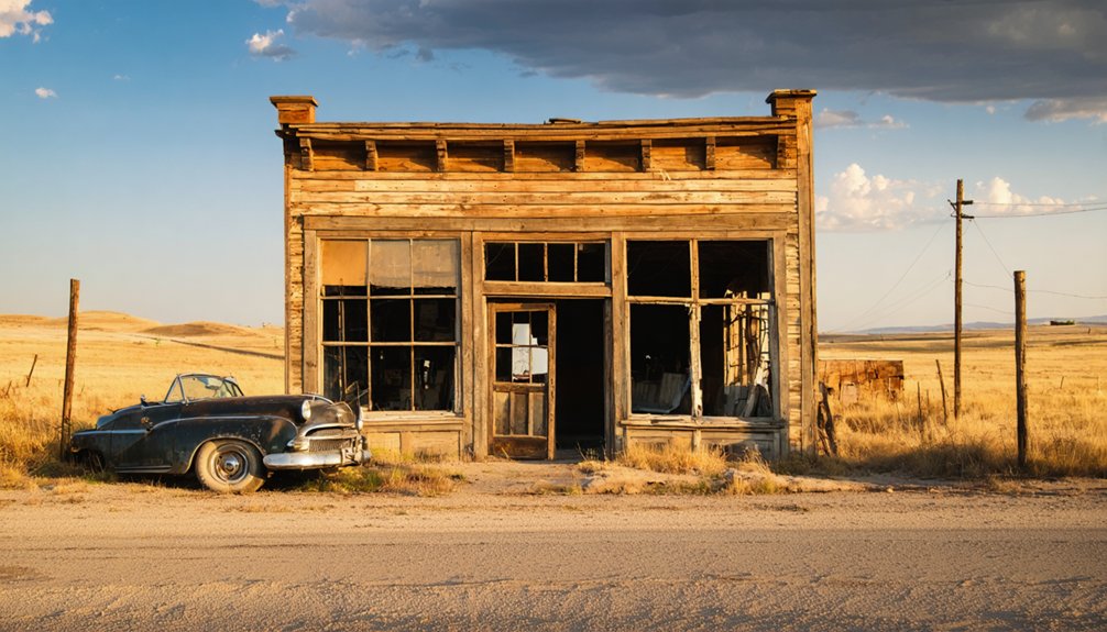
Lithia doesn’t have to be the end of your route—it can be the anchor for a broader Fall River County ghost-town loop. The Black Hills region holds well over 600 abandoned sites, so you’ve got options worth chasing.
Add these stops to your itinerary:
- Hot Springs – Your practical base camp and a gateway to deeper ghost town stories tucked into the surrounding hills.
- Angostura Lake area – Explore the shoreline where Lithia likely rests beneath the water, connecting landscape to history.
- Black Hills ghost-town corridor – Push north to uncover mining-era abandoned sites that reveal South Dakota’s boom-and-bust past in vivid detail.
Each stop builds a richer picture of how quickly frontier settlements rose, faded, and disappeared entirely.
Frequently Asked Questions
What Is the Best Time of Year to Visit Lithia?
You’ll find late spring and early fall offer the best seasonal weather for exploring Lithia. You’ll avoid summer’s visitor crowds, enjoy mild temperatures, and experience the haunting, open landscape at its most atmospheric and accessible.
Are There Any Guided Ghost Town Tours Available Near Hot Springs?
Like a treasure map waiting to be followed, you’ll find historical preservation efforts near Hot Springs, but formal guided tours are scarce—explore independently, consult local visitor centers, and uncover South Dakota’s ghost town secrets on your own terms.
Is the Angostura Lake Area Safe for Visitors to Explore?
You’ll find Angostura Lake generally safe for exploration, but keep these safety concerns in mind: watch for uneven terrain and deep water edges. Follow basic exploration tips — stay aware, bring water, and respect posted boundaries.
Can You Combine a Lithia Trip With Black Hills National Forest Activities?
You can absolutely combine ghost town history with scenic mountain drives through Black Hills National Forest! Explore Lithia’s vanished past, then hike towering pines, discover hidden trails, and breathe in that wild, untamed freedom the Black Hills endlessly offers.
Are There Any Local Museums With Exhibits About Fall River County Ghost Towns?
With over 600 vanished communities, you’ll find Fall River County’s ghost town stories—including local legends and historic preservation efforts—at the Hot Springs Cultural Heritage Center, where exhibits bring Lithia’s forgotten world vividly to life.
References
- https://en.wikipedia.org/wiki/List_of_ghost_towns_in_South_Dakota
- https://kids.kiddle.co/List_of_ghost_towns_in_South_Dakota
- https://www.sdpb.org/rural-life-and-history/2023-08-21/some-black-hills-ghost-towns-and-their-origins
- https://espnsiouxfalls.com/ixp/481/p/south-dakota-ghost-towns-2/
- https://kids.kiddle.co/Pactola
- https://www.powderhouselodge.com/black-hills-attractions/fun-attractions/ghost-towns-of-western-south-dakota/
- https://www.facebook.com/HistoryBelowThePines/posts/episode-5-season-1-of-history-below-the-pines-recap-in-august-of-2022-we-were-gi/774401864487668/
- https://www.scottcountyhistory.org/blog/tag/Ghost+towns
- https://kids.kiddle.co/Lily
- https://www.youtube.com/watch?v=_0WNYsFLSLA