You’ll find Monte Christo’s historical marker on FM 1925’s north side, just east of FM 2993, about 17 miles northwest of McAllen. The actual townsite sits 2.5 miles north on private property, where little remains of the 1,500 settlers who fled bandit raids and broken water promises between 1914 and 1934. Bring your imagination—street layouts have vanished beneath South Texas brush, leaving only scattered foundations and the silence of reclaimed fields. The full story reveals how frontier ambition collapsed into cautionary legend.
Key Takeaways
- The historical marker is located on FM 1925’s north side, just east of FM 2993, approximately 17 miles northwest of McAllen.
- Use GPS coordinates N 26° 21.501 W 098° 18.046 to navigate directly to the roadside marker with available parking.
- The actual townsite sits 2.5 miles north on private property, where quarry operations have reshaped the original settlement area.
- Physical evidence of Monte Christo has largely vanished beneath brush, requiring permission to access privately owned townsite portions.
- Plan to view the historical marker and learn the town’s history from the roadside, as most structures are inaccessible.
The Rise and Fall of Monte Christo: A Rio Grande Valley Settlement
When the Melado Land Company platted Monte Christo in 1909, they envisioned transforming raw Rio Grande Valley brush into a thriving agricultural hub. Under Otto Woods’ management, Marshall McIlhenny cleared 640 experimental acres while Virgil Lott’s newspaper “The Hustler” promoted the dream.
In 1909, the Melado Land Company promised to turn untamed Valley brush into agricultural prosperity through aggressive land clearing and relentless newspaper promotion.
The economic trajectory soared as 1,500 settlers arrived, building two hotels, a bank, school, and cotton gin around the railroad station. The marker measures 18 x 28 inches and documents this brief prosperity.
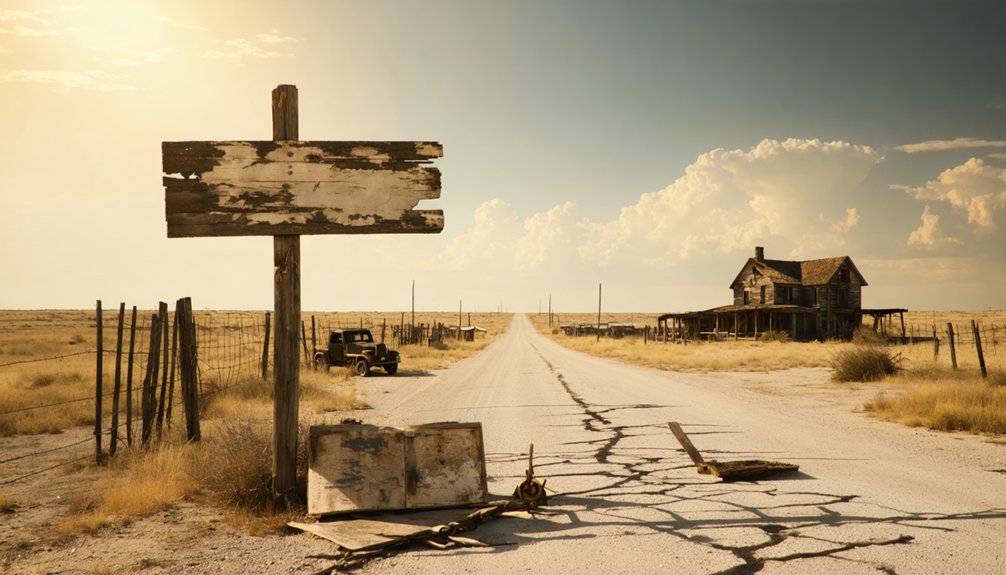
But freedom from established civilization came with consequences. The social impact of 1914-1916 bandit raids shattered confidence, while inadequate water supplies proved the Land Company’s promises hollow. By 1934, Monte Christo stood abandoned—a ghost town record to failed promotional schemes.
Today, you’ll find its historical marker near Conway Road, commemorating this cautionary tale of frontier ambition. The Texas Historical Commission erected the marker in 1985, placing it approximately 2.5 miles north of the actual town site.
What Remains Today: Finding the Ghost Town Site
You’ll find the historical marker on FM 1925’s north side, just east of FM 2993 near Alton—a modest pullout that marks the gateway to a vanished world.
The actual town site sits 2.5 miles north on private property, where quarry operations have reshaped the land that once hosted sixty residents, a store, and a railroad stop. The Melado Land Co. platted Monte Christo in 1909, establishing the grid of streets that would briefly house one of the Rio Grande Valley’s boom towns.
Otto Woods and Virgil Lott were among the first settlers to establish themselves in this promising new community.
Today, Monte Christo exists only in scattered traces: the roads that bear its name, the coordinates that pinpoint where families once built their hopes, and the silence of fields reclaiming what progress left behind.
Marker Location and Access
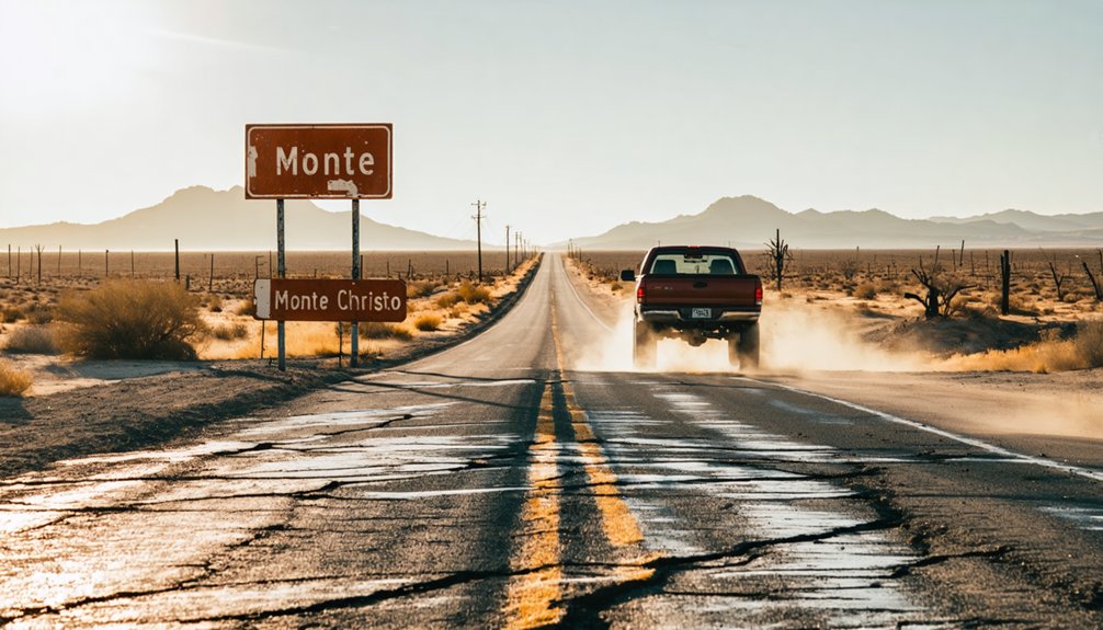
The historical marker commemorating Monte Cristo stands on the north side of FM 1925, just ten yards east of its intersection with FM 2993—though it’s worth noting this marker sits 2.5 miles south of where the actual townsite once sprawled across the Rio Grande Valley landscape.
You’ll find a small pullout with parking availability for roadside stops. From Mission, head north on FM 2993 for eight miles until you reach FM 1925, then veer east a few yards.
The 18″ x 28″ marker (#4836), erected in 1985, serves as your gateway to understanding this vanished settlement. Use coordinates N 26° 21.501 W 098° 18.046 for GPS navigation. Nearby landmarks include the Conway Road intersection, positioning you seventeen miles northwest of McAllen in Hidalgo County’s ghost town territory. Like many Texas ghost towns, Monte Cristo now exists primarily as a barren site, with most physical evidence of the settlement having disappeared from the landscape. Similar to farm-related historical markers found near places like Pattenburg, this monument preserves the memory of a community that once thrived in this rural agricultural region.
Physical Evidence of Town
Beyond the historical marker’s roadside perch, Monte Cristo’s physical footprint has largely vanished into the South Texas brush country. You’ll find no standing structures with cabin interiors to explore or personal belongings scattered across dusty floors. The townsite demands imagination rather than camera equipment.
What evidence survives exists mostly in memory and documentation:
- Street layouts have disappeared beneath decades of vegetation growth
- Foundation remnants occasionally surface through eroded soil
- Historical photographs preserved by local archives show what once stood
- Informational markers identify significant locations along vanished thoroughfares
- Scattered artifacts occasionally emerge during careful site exploration
The Monte Cristo Preservation Association has documented major sites, though you won’t stumble upon picturesque ruins. Volunteers from the association organize work parties to maintain the site and keep it accessible for visitors. Instead, you’ll experience history through landscape interpretation and archived records. Unlike Pacific Northwest ghost towns such as Monte Cristo, Washington, which features an 8.7-mile out-and-back hike through Mount Baker-Snoqualmie National Forest to reach remnants of the 19th-century mining operation, the Texas site requires minimal physical exertion to access.
Private Property Considerations
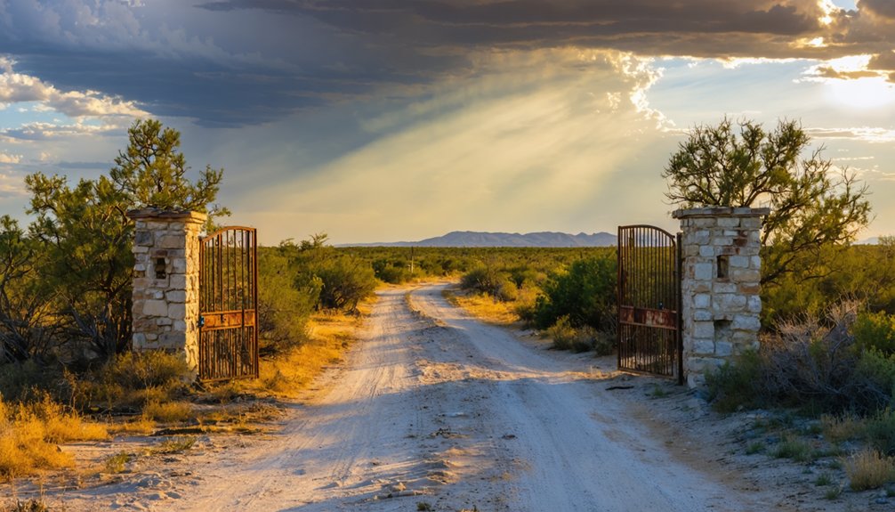
Most of Monte Cristo’s original townsite remains in private hands, presenting a significant challenge for ghost town enthusiasts accustomed to freely exploring abandoned settlements. You’ll encounter “No Trespassing” signs protecting locked cabins with active inhabitants, and padlocks securing structures in surprisingly good condition.
While the Forest Service owns approximately half the lots, the patchwork ownership requires careful navigation. The Texas Historical Commission marker itself sits on private property along FM 1925, accessible from the roadside but nothing more.
Before venturing onto any lots, respect private property access by obtaining explicit permission from current owners. Owner communication guidelines emphasize courtesy and advance contact—families who’ve inherited these mining-era parcels deserve consideration.
The camp host program maintains presence specifically to deter unauthorized visitors, so assume every standing structure belongs to someone. The Monte Cristo Preservation Association has worked to maintain the historic townsite with volunteer efforts aimed at preserving these remnants of the mining era.
Locating the Historical Marker on FM 1925
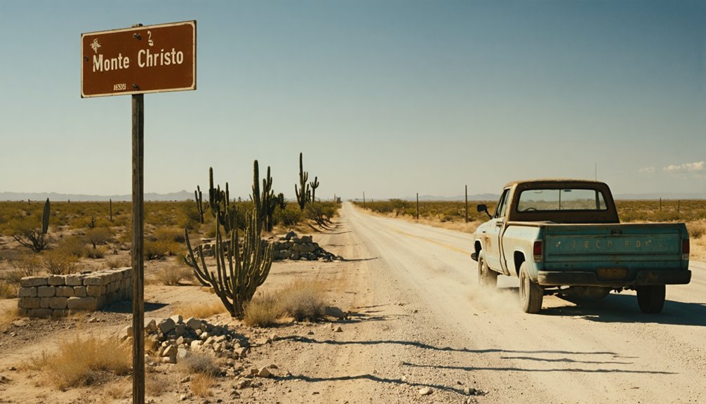
Finding Monte Christo’s historical marker requires traversing to a specific spot along FM 1925, where a small pullout on the road’s north side marks the gateway to this ghost town’s story.
You’ll discover marker #4836 positioned exactly 0.1 miles east of FM 2993 (Conway Avenue-Cantu Road). The Texas Historical Commission erected this 18″ x 28″ marker in 1985, preserving the historical significance of a settlement that vanished decades ago.
Navigate to these precise coordinates for successful marker preservation viewing:
- Latitude/Longitude: N 26° 21.501, W 098° 18.046
- UTM Coordinates: 14R E 569764 N 2915558
- Distance from Mission: 8 miles north via FM 2993
- Distance from Edinburg: 5 miles west
- Pullout Access: North side roadway shoulder
The Texas Historical Marker Program was created in 1962 to commemorate events, institutions, individuals, and sites with local historical significance throughout the state. Remember you’re visiting private property, so respect boundaries while exploring this freedom-seekers’ destination.
Getting There: Driving Directions and Road Access
Your journey to Monte Christo’s historical marker begins from either Mission or Edinburg, with both routes converging at the intersection of FM 2993 and FM 1925.
From Mission’s center, you’ll head north on FM 2993 (Conway-Cantu Road) for eight miles through open farmland. Edinburg travelers head west five miles on FM 1925 (Monte Christo Road).
Road conditions remain excellent—smooth pavement handles standard vehicles without issue. Traffic patterns stay light along these rural farm-to-market roads, giving you unobstructed passage through the Valley’s agricultural heartland.
Once you reach the intersection, turn east just ten yards on FM 1925’s north side. You’ll find a small pullout where the marker stands. The actual ghost town site lies 2.5 miles north of this commemorative point.
Best Time to Visit and What to Bring
Timing your journey to Monte Cristo, Texas, means balancing scorching heat with accessible roads—April offers the sweet spot of mild weather and sparse crowds, while late summer brings intense temperatures that can turn exploration into endurance.
You’ll need layers for cooler pockets near old mining sites, a reliable headlamp for shadowy structures, and sturdy boots built for uneven, primitive terrain. Pack extra water, sun protection, and a first-aid kit, because this remote ghost town sits far from modern conveniences where help isn’t just around the corner.
Ideal Visiting Seasons
The ghost town of Monte Cristo reveals its best secrets when autumn’s golden light filters through the canyon, transforming the 8.5-mile trail into a photographer’s dream. Picturesque fall foliage frames crumbling cabins and rusted mining equipment, while crisp air makes the moderate hike comfortable.
You’ll explore a settlement that housed over 1,000 residents in 1894, now peacefully reclaimed by nature.
Optimal visiting window includes:
- Late September through October for peak foliage and comfortable temperatures
- Early summer (June-July) when snow clears but heat remains manageable
- Weekdays to experience solitude among the ruins
- Morning starts to complete the round trip before afternoon heat
- Avoid November-May due to winter snow hazards and dangerous icicles
The trail closes entirely during winter months, making timing essential for your ghost town adventure.
Essential Gear Checklist
Success on this ghost town expedition hinges on packing smart for South Texas conditions that differ drastically from typical mountain ruins. You’ll need sturdy boots for traversing Rio Grande Valley brush, long pants protecting against thorns, and bug spray for mosquitoes.
Bring abundant water—the same inadequate supply that doomed Monte Christo still plagues this arid landscape. A camera captures the 1985 historical marker and scattered foundations, while a flashlight reveals details in crumbling structures.
Your daypack should include first aid supplies for the remote 2.5-mile trek from FM 1925. Proper gear utilization facilitates comfortable exploration while supporting site preservation efforts—respecting these fragile remnants means future adventurers can experience this freedom-filled journey through forgotten Texas history.
Weather and Safety Tips
When planning your Monte Christo expedition, you’ll find the sweet spot between March and May or September through November, when temperatures hover comfortably between 70-85°F and the brutal South Texas heat takes a merciful break. Understanding local climate characteristics helps you avoid summer’s punishing 90°F-plus days and winter’s unpredictable cold snaps.
Essential weather preparations:
- Monitor approaching storm systems through NWS, especially during spring shifts when temperatures can plummet 30+ degrees overnight
- Layer clothing for dramatic daily swings ranging from 36-91°F
- Pack wind protection against persistent 10-29 mph gusts that kick up dust across open terrain
- Carry extra water—southeast winds amplify heat index beyond actual temperatures
- Schedule morning explorations before afternoon winds peak at 26 mph
Check hourly forecasts before venturing into this remote ghost town territory.
Understanding the Bandit Raids That Emptied the Town
Between 1914 and 1916, armed raiders swept through South Texas communities like a wildfire, transforming bustling border towns into abandoned shells. Monte Christo, with its 1,500 residents, bank, and cotton gin, couldn’t withstand the onslaught.
Bandit motivations ran deeper than simple theft—they aimed to reclaim the Rio Grande region for Mexico during the chaotic Revolution. The rise of anti American sentiment fueled devastating attacks like the August 1915 Norias Ranch assault, where seventy-eight raiders armed with Mauser rifles nearly overwhelmed defenders.
You’ll find towns like Monte Christo weren’t abandoned by choice. After raiders killed ranchers, burned buildings, and derailed trains, residents fled for their lives. The Plan of San Diego‘s revolutionary goals turned thriving communities into ghost towns almost overnight.
Nearby Historical Sites and Rio Grande Valley Attractions
The historical marker standing at FM 1925‘s dusty shoulder serves as your gateway to Monte Christo‘s vanished world, positioned exactly 0.1 miles east of FM 2993 where Conway Avenue meets Cantu Road. This 18″ x 28″ bronze sentinel, erected in 1985, anchors your exploration of the Rio Grande Valley‘s forgotten settlements and their cultural significance to early pioneer settlers.
A bronze marker at FM 1925’s dusty crossroads unlocks the vanished world of Monte Christo and the Valley’s forgotten pioneer settlements.
Beyond Monte Christo’s ghostly footprint, you’ll discover:
- Mission’s thriving downtown – 8 miles south via FM 2993, offering authentic Valley dining and local history museums
- Edinburg’s north sectors – aerial remnants of agricultural communities between Monte Cristo and “M” Road
- McAllen Public Library – housing rare 1909 land survey maps and historical photographs
- Regional ghost towns – Combes, Raymondville, and Mercedes preserve similar early 20th-century settlement stories
- Texas Historical Commission markers – dozens throughout Hidalgo County documenting Valley pioneers
Photography Tips and Private Property Considerations
Capturing Monte Christo’s haunting landscape demands more than simply pointing your camera at weathered foundations and overgrown fields. You’ll need to adapt to shifting lighting conditions throughout the day—early mornings offer superior natural light while afternoon visits battle overwhelming glare.
Your film stock selection or digital camera considerations should account for the cyan-blue tones dominating shaded areas; warming filters help balance these color shifts. Polarizing filters strengthen saturation on wet rock surfaces, and tripod stability becomes essential on slippery terrain.
However, your creative freedom stops at padlocked cabins bearing “No Trespassing” signs. These preserved structures remain on private property despite the camp host program monitoring accessible zones.
Respect these boundaries while exploring established trail systems—the historical marker on Conway Road indicates you’re entering managed territory where wandering isn’t unrestricted.
Frequently Asked Questions
Who Was Otto Woods and What Role Did He Play in Monte Christo?
Otto Woods was Monte Christo’s pioneering townsite manager from 1909, wielding significant local community influence as he transformed raw land into a thriving 1,500-person settlement. Under Otto Woods’ leadership, you’ll discover he built banks, schools, and hotels before bandit raids emptied his frontier dream.
What Happened to the Cotton Gin and Other Buildings After Abandonment?
The cotton gin and buildings eventually succumbed to nature’s reclamation. You’ll find collapsed wooden structures consumed by overgrown vegetation, though specific details remain scarce. Time erased most physical evidence, leaving only memories and that 1985 historical marker behind.
Can You Still See Foundations or Structures at the Original Town Site?
Time has swallowed Monte Christo’s bones nearly whole. You won’t find visible foundation remnants or sparse structure fragments at the original site—nature’s reclaimed everything. Only the roadside marker whispers where this vanished town once thrived.
What Other Rio Grande Valley Ghost Towns Existed During This Same Period?
Several abandoned border towns dotted the Rio Grande Valley alongside Monte Christo. You’ll find frontier era settlements like Fort Ringgold, Casas Blancas, Sam Fordyce, and Run—each telling stories of boom, decline, and ghostly whispers across South Texas.
Are There Surviving Copies of “The Hustler” Newspaper Available to Read?
Like dust settling on forgotten pages, old copies of “The Hustler” have vanished into history. You won’t find this newspaper in archives—no digitized versions exist. Your best chance? Contact the Museum of South Texas History directly for potential leads.
References
- https://www.wearecousins.info/2013/09/monte-christo-historical-marker-hidalgo-county-texas/
- https://atlas.thc.texas.gov/Details/5215004836
- https://colliefarm.wordpress.com/2011/09/21/monte-cristo-ghost-town/
- https://en.wikipedia.org/wiki/List_of_ghost_towns_in_Texas
- https://www.youtube.com/watch?v=Dh_SnzukV7E
- https://www.tshaonline.org/handbook/entries/monte-christo-tx
- https://hub.catalogit.app/museum-of-south-texas-history/folder/entry/ghost-towns-monte-cristo
- https://atlas.thc.texas.gov/Details/5215004836/print
- https://www.waymarking.com/waymarks/WMJPW5_Site_of_Monte_Cristo
- https://kellycodetectors.com/content/pdf/site_locator_books/TX.pdf


