Planning a road trip to Napoleon means chasing a town that’s mostly underwater — it’s in Arkansas, not Mississippi, swallowed by the Mississippi River at its confluence with the Arkansas. You’ll want to time your visit for late summer or early fall when water levels drop low enough to expose scattered ruins. Visibility windows are short, sometimes just days, so flexibility is everything. Keep exploring to uncover everything you need to make this haunting trip unforgettable.
Key Takeaways
- Napoleon is located in Arkansas, not Mississippi, at the confluence of the Arkansas and Mississippi rivers in Desha County.
- The town was destroyed by Civil War damage and river erosion, leaving most ruins submerged underwater.
- Visit during late summer or early fall when low water levels briefly expose scattered ruins and artifacts.
- Visibility windows are short, lasting only days, so monitor river gauges before planning your visit.
- Nearby stops include Arkansas City, Gaines Landing, and McGehee, home to a salvaged historic iron church bell.
What Is Napoleon, Arkansas: and Why Did It Disappear?
Though the article title names Mississippi, Napoleon was actually a town in Arkansas, sitting at the confluence of the Arkansas and Mississippi rivers. Frederick Notrebe founded it, naming the settlement after his old commander, and it grew into a thriving river port with real historical significance.
Napoleon, Arkansas once thrived at the confluence of two mighty rivers — a port town born from ambition.
By 1838, it had become Desha County’s county seat, anchoring commerce and trade along the river.
But Napoleon’s location was also its curse. The Civil War badly damaged the town, and in 1874, the Mississippi broke through its banks and finished the job.
River erosion consumed most of what remained, swallowing streets, buildings, and history into the current.
Today, Napoleon is a ghost town — not abandoned, but literally devoured by the river that once made it matter.
Where Is the Napoleon Ghost Town Site Located?
Napoleon’s ghost town site sits at the confluence of the Arkansas and Mississippi rivers in Desha County, Arkansas — a location that’s equal parts historic and elusive. This spot once drove significant historical trade, positioning Napoleon as a crucial 19th-century river port before river erosion swallowed most of it whole.
You won’t find a marked parking lot or visitor center here. The site lies where the two rivers meet, and what remains is largely submerged or scattered across shifting sandbars. Your best chance of spotting any ruins is during unusually low water conditions — conditions like those in summer 1954, when remnants briefly surfaced.
Plan your visit around river levels, check current conditions before heading out, and keep expectations grounded in reality.
When Can You Actually See the Ruins?
Your best chance of spotting Napoleon’s ruins comes during periods of unusually low water, when the Mississippi pulls back far enough to expose what the river has swallowed. You’ll need patience and timing on your side, since normal water levels keep most remnants buried under sediment or submerged entirely.
The summer of 1954 offered one of the most notable sightings on record, proving that the ghost town can still surface — if the river decides to cooperate.
Low Water Reveals Ruins
Seeing Napoleon’s ruins isn’t as simple as pulling up to the riverbank and peering into the water—the Mississippi River decides when, and sometimes if, you’ll catch a glimpse. River erosion has swallowed most of the town, but extreme low-water conditions occasionally expose what’s left.
Summer 1954 remains a documented example of ruins surfacing on sandbars.
Here’s what shapes your chances of witnessing this rare historical preservation moment:
- Season matters – Late summer typically brings the lowest water levels.
- Check gauges – Monitor the Mississippi River water level reports before you go.
- Stay flexible – Ruins appear unpredictably, so build extra days into your road trip.
You’re chasing something the river controls, so plan accordingly and embrace the uncertainty.
Best Viewing Conditions
Catching a glimpse of Napoleon’s submerged ruins comes down to one primary factor: river level. When the Mississippi drops markedly, sandbars emerge and expose partial traces of what river erosion hasn’t permanently claimed.
Summer 1954 stands as a documented example when remains briefly surfaced during extreme low-water conditions. Historical preservation efforts remain difficult here because the site exists within a constantly shifting, unpredictable environment.
You’ll want to monitor the U.S. Geological Survey’s river gauge data before making the drive out to Desha County. Late summer and early fall typically offer the lowest water levels, giving you the best odds.
Even then, manage your expectations — you might see only fragments, or nothing at all depending on sediment movement that day.
Summer 1954 Sighting
The most documented low-water sighting of Napoleon’s ruins occurred during the summer of 1954, when the Mississippi dropped enough to push sandbars above the surface and expose partial traces of the long-submerged town.
River erosion had claimed most of the historic architecture, but observers reported seeing structural remnants briefly emerging from the riverbed.
If you’re chasing a similar sighting, keep these factors in mind:
- River levels must drop considerably below normal seasonal ranges
- Sandbar positioning shifts constantly, affecting what surfaces and where
- Visibility windows are short, sometimes lasting only days
You’ll want to monitor USGS river gauge data before making the trip.
Don’t expect a full townscape — what you’ll find are fleeting glimpses of a community the river slowly swallowed.
What You’ll Find at the Napoleon Site Today
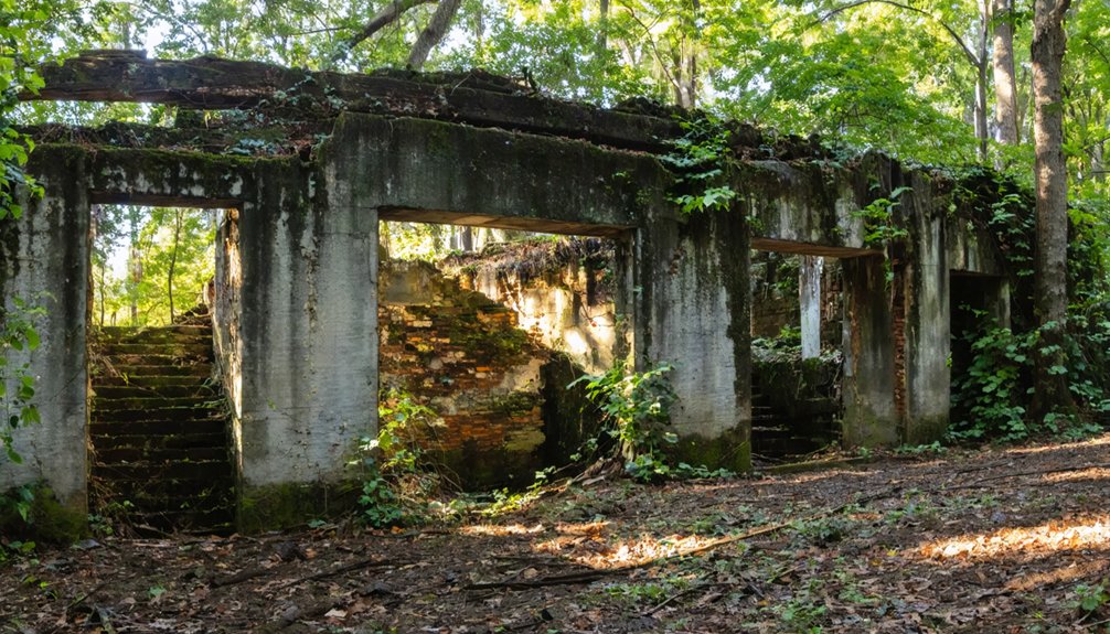
Visiting Napoleon today means accepting that nature has almost entirely reclaimed what was once a thriving river port. River erosion has swallowed most of the original settlement, leaving little for you to physically explore.
Nature has nearly swallowed Napoleon whole, leaving little trace of the river port it once was.
At normal water levels, you won’t see much beyond the Mississippi’s restless current and shifting sandbars.
When the river runs unusually low, partial ruins occasionally emerge from the sediment, offering rare glimpses into the town’s past.
Historical artifacts are scarce on-site, since most material remnants either washed away or were deliberately relocated. The iron church bell, now in McGehee, Arkansas, represents one of your best chances to connect with something tangible from Napoleon’s history.
Come prepared for a contemplative experience rather than a conventional attraction — the real story lives in what’s no longer there.
Other Vanished River Towns Worth Stopping at Near Napoleon
While Napoleon’s ghost anchors your route, the surrounding region holds more vanished towns worth folding into your itinerary. The Mississippi and Arkansas rivers swallowed more than one community, leaving behind historic landmarks, urban legends, and irresistible mystery.
- Gaines Landing, Arkansas – Once a busy river port, this forgotten settlement near the Mississippi offers rich antebellum history and eerie quiet.
- Desha County’s lost settlements – Several small river communities dissolved through flooding and erosion, leaving only courthouse records and local legend behind.
- Arkansas City, Arkansas – Repeatedly battered by floods, this town fought the river longer than most and still carries visible scars worth exploring.
Each stop deepens your understanding of how powerfully the river shaped and erased human ambition along its banks.
How to Plan Your Napoleon Ghost Town Road Trip

Planning a ghost town road trip to Napoleon requires flexibility, since the site sits in Desha County, Arkansas — not Mississippi — and what’s left of it lies beneath or along the shifting banks of the Mississippi River.
Pull up historical maps before you leave so you can visualize where the original town stood before river erosion swallowed it whole.
Time your visit around low water conditions, ideally late summer, when partial ruins occasionally surface on sandbars.
McGehee, Arkansas is worth a detour — that’s where you’ll find the iron church bell salvaged from Napoleon.
Keep your expectations grounded; you’re chasing a town the river mostly claimed.
The reward isn’t a polished landmark — it’s the raw, humbling story of a place the current erased.
Frequently Asked Questions
Who Founded Napoleon and Why Was It Named After Napoleon Bonaparte?
Ever wondered who shaped this lost town? Frederick Notrebe founded Napoleon, honoring his old commander through its name. You’ll discover local legends tied to historical architecture that once thrived before the river swallowed it whole.
Did Napoleon Ever Serve as an Official County Seat of Government?
Yes, you’ll find that this historic ghost town served as Desha County’s official county seat from 1838 to 1874, until Civil War impact and devastating river flooding ultimately stripped Napoleon of both its governance role and existence.
Was Any Physical Artifact From Napoleon Preserved and Relocated Elsewhere?
You’ll find that an iron church bell stands as one of Napoleon’s most treasured ghost town artifacts, with relic preservation efforts relocating it to McGehee, Arkansas, keeping the vanished town’s spirit gloriously alive.
How Badly Was Napoleon Damaged Specifically During the Civil War Period?
Can you imagine surviving a war only to fall to a river? Napoleon suffered severe Civil War destruction, leaving it badly damaged. Unfortunately, historical preservation efforts couldn’t save what flooding and erosion would ultimately claim forever.
What River Conditions Caused Napoleon’s Destruction in 1874?
In 1874, you’d have watched the Mississippi River burst through its banks, releasing devastating flooding hazards and relentless river erosion that swallowed Napoleon whole, proving nature’s unstoppable power over even the most strategically placed river towns.
References
- https://en.wikipedia.org/wiki/Napoleon
- https://armoneyandpolitics.com/digs-of-the-deal-napoleon-arkansas/
- https://www.facebook.com/groups/234039950342068/posts/378642432548485/
- https://www.facebook.com/groups/234039950342068/posts/234124923666904/
- https://www.hancockcountyhistoricalsociety.com/reference/alphabetfile.htm?page=262
- https://urprojects.lib.rochester.edu/s/seward/item/5781