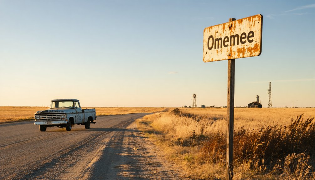
You’ll find Omemee’s ghostly remnants at coordinates 48°42’23″N 100°21’18″W on private property in Bottineau County, North Dakota. Start your journey in Bottineau, then head toward the rural coordinates where sidewalks and electric lines still mark where 650 people once thrived around seven grain elevators. Before you go, check access permissions with local landowners and stop by Bottineau County Historical Museum to see the town’s original bell. The full story of this abandoned 1890s railroad junction reveals why proper preparation makes all the difference for ghost town explorers.
Key Takeaways
- Omemee is located in Bottineau County, North Dakota at coordinates 48°42’23″N 100°21’18″W on private property.
- The town flourished from 1893-1910 as a railroad junction with two rail lines, seven grain elevators, and 650 residents.
- Railroad rerouting, farm consolidation, and automobile access to larger towns caused Omemee’s abandonment by the 1940s.
- Visible remnants include old pavement, sidewalks, and abandoned electric lines at the original townsite.
- Visit Bottineau County Historical Museum for the town bell and Cranbrook’s museum for a 1906 Soo Line sleeper car.
Discovering Omemee’s Location in Bottineau County
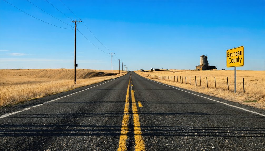
Nestled in the northern reaches of North Dakota, Omemee sits within Bottineau County—a vast expanse of 1,697 square miles where rolling prairie meets the forested slopes of the Turtle Mountain plateau. You’ll find yourself exploring county characteristics that define true frontier territory: the Canadian border marks your northern limit, while Deep River carves through the middle, flowing southward through a geographic landscape of lakes and ponds.
The terrain rises to 2,283 feet on the eastern edge before descending into gentle hills. With Bottineau—the county seat of roughly 2,200 souls—located just ten miles south of the international border, you’re venturing into one of North Dakota’s most remote corners. This is country where fewer than 6,500 people claim residence across an area larger than Rhode Island. The county takes its name from Pierre Bottineau, a legendary frontier guide who helped chart the pathways through this northern wilderness. The name Bottineau also refers to multiple places and people, which can be found listed on disambiguation pages that help direct readers to their intended destination.
The Rise of a Prairie Railroad Junction
Before the trains arrived, Omemee existed as little more than a name on postal documents—a post office petitioned by scattered homesteaders in 1890 who needed somewhere to collect their mail between Bottineau and Willow City. Postmaster George Raye named it after his Canadian hometown, unaware he’d just christened a future boomtown.
Everything changed when Great Northern Railroad laid tracks through in 1893, establishing a depot that drew merchants and dreamers alike. Then Soo Line arrived in 1905, creating prime railroading infrastructure that intersected two of North Dakota’s three major lines. You could board trains heading four directions from this prairie crossroads.
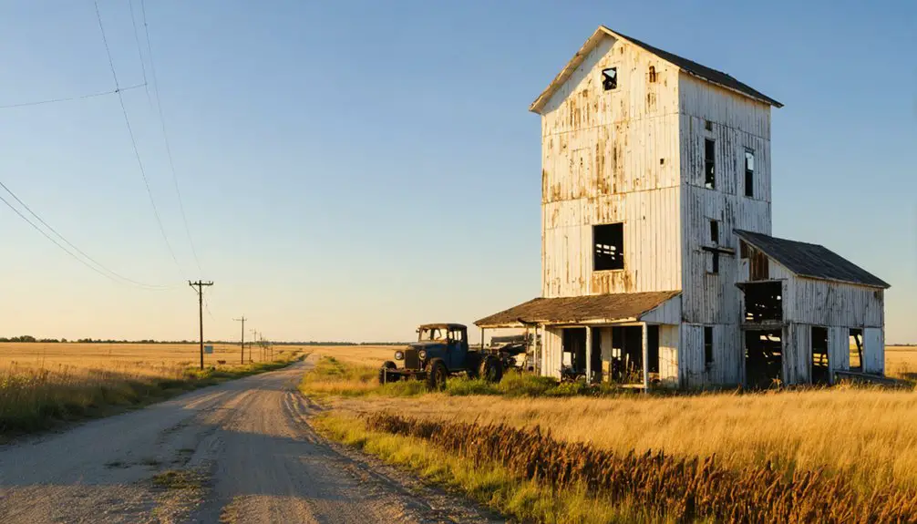
Residents watched their transportation hub aspirations materialize as population soared to 650 by 1906. Seven grain elevators rose alongside the tracks. The town featured a soda factory that produced excellent quality beverages for thirsty residents and travelers. An opera house provided entertainment alongside establishments like the hotel, restaurant, and newspaper. Omemee seemed destined to rival Bismarck itself.
Understanding What Led to Omemee’s Abandonment
You’ll notice Omemee’s downfall wasn’t dramatic—it was death by a thousand cuts. When the railroad rerouted tracks after 1910 and no promotional company stepped up to attract new residents, the town lost its competitive edge against Bottineau and Willow City.
As farms consolidated and rural families moved away through the mid-1900s, Omemee’s customer base simply evaporated, leaving storekeepers like Grace Schultz with no choice but to lock their doors for good. At its peak, this once-thriving railroad junction boasted over 600 residents who built an opera house before most places had proper roads.
Railroad Rerouting Impact
The promise of becoming North Dakota’s next great metropolis died hard in Omemee. You’ll find that railroad rerouting wasn’t actually the town’s killer—competing railroads and their junction were supposed to save it. Instead, the rails that brought life eventually witnessed death. Agricultural advancements meant fewer farmers needed, shrinking Omemee’s customer base dramatically.
The automobile revolution let residents drive to Bottineau or Minot instead of shopping locally. World War II opportunities pulled workers west to California and Seattle’s booming industries. Rural population collapse eliminated the farm families who’d sustained local businesses. Depot closure during the 1940s severed Omemee’s original purpose as a rail service hub. By 1970, the population had plummeted to just 5 residents, marking the town’s near-total abandonment. The Grand Trunk Railway absorbed the Midland Railway through amalgamation in 1893.
Missing Townsite Company
Railroad connections and geographic advantages couldn’t save Omemee from a fatal oversight: nobody was actively selling the town. While Bottineau and Willow City deployed townsite companies to aggressively promote development, Omemee’s unsuccessful local leadership never established this critical infrastructure.
A 1906 state agriculture review pinpointed this lack of entrepreneurship as the town’s death sentence. You’d think two major rail lines intersecting would guarantee boom-town status—many predicted Omemee would rival Bismarck or Fargo. Instead, the population peaked at 650 residents and flatlined. Farmers kept patronizing established neighbors because no promotional effort convinced them otherwise.
Omemee had banks, hotels, and newspapers, but without someone actively hustling for settlers and business, the town’s potential evaporated into the prairie wind. The name Omemee itself refers to distinct geographical locations scattered across North America, making the North Dakota settlement just one of several places sharing this designation.
Rural Population Decline
By 1906, Omemee stood as Bottineau County’s fourth largest town—650 residents strong with seven grain elevators, a brick factory, an opera house, and a baseball team that rivaled the state’s finest. Then everything unraveled.
Population migration patterns reshaped the region’s landscape:
- Families abandoned Omemee for Bottineau and Willow City after 1910’s railroad rerouting
- The grade school and post office shuttered in 1965 when fewer than 10 residents remained
- Grace Schultz closed her store in 1969—one of the final holdouts
- Chris Rasmussen’s soda factory followed that same year, ending an era
Economic restructuring impacts hit hard. As North Dakota’s rural population declined, farm service towns lost their purpose. You’ll find only abandoned power lines and two crumbling structures today—silent witnesses to dreams that couldn’t survive changing times.
What Remains of Omemee Today

You’ll spot remnants of pavement, sidewalks, and an abandoned electric line threading through the weeds. But tread carefully—open holes pepper the terrain, making exploration genuinely dangerous.
The site sits at 48°42′23″N 100°21′18″W on private property, so you can’t legally wander through without permission.
For tangible connections to Omemee’s past, visit the Bottineau County Historical Museum to see the town bell, or head to Cranbrook’s museum where a 1906 Soo Line sleeper car bears Omemee’s name. You can also explore more about abandoned settlements on the Ghosts of North Dakota website, which documents many ghost towns throughout the state.
Best Routes for Reaching the Ghost Town
You’ll find Omemee nestled between two small towns in Bottineau County, with your primary access routes running through either Bottineau to the north or Willow City to the south. The rural highways connecting these communities follow the old railroad corridors that once made Omemee a junction point, though you’re now driving past farmland rather than bustling depots.
Check your GPS carefully—the ghost town sits on what’s become private agricultural land, and you’ll want to navigate the country roads during daylight to spot the remaining fieldstone foundations. At its peak, this railroad junction town housed over 600 residents and even featured an opera house before its rapid decline began in 1910.
Highway Access From Bottineau
Reaching Omemee from Bottineau requires traversing Bottineau County’s rural road network through the rolling prairie landscape of North Dakota’s Souris River basin. You’ll navigate county highways that replaced the historic railroad corridors, finding your own path through this forgotten corner of the Great Plains. The ghost town’s GPS coordinates (48°42′23″N 100°21′18″W) guide modern explorers where rail passengers once traveled.
Essential Navigation Points:
- Alternate access routes connect through Wellington and Willow City, offering flexibility when exploring
- Seasonal road conditions dramatically affect prairie travel—spring thaw and winter storms can render routes impassable
- Local roads follow original railroad junction patterns from 1903
- No services exist at the site; fuel up in Bottineau before departing
Pack your independence and embrace uncertain conditions ahead.
Willow City Approach Route
The shortest path to Omemee starts in Willow City, a tiny prairie settlement of 149 souls that serves as your last outpost of civilization before venturing to the ghost town just 6-8 miles north. Head out on county roads that parallel the old Great Northern Railway tracks—the very lifeline that once connected these communities.
You’ll navigate gravel roads typical of Bottineau County’s backcountry, where freedom means endless horizons and zero traffic lights.
Follow GPS coordinates 48.70639°N, 100.35500°W for pinpoint accuracy. Watch for scattered structures and foundation remnants marking your approach. The contrast between Willow City’s maintained town status and Omemee’s complete abandonment becomes stark along this route.
Local landmarks fade as civilization yields to wind-swept grassland, preparing you for the eerie brick piles and lonely garage awaiting ahead.
Essential Preparation Tips for Your Visit

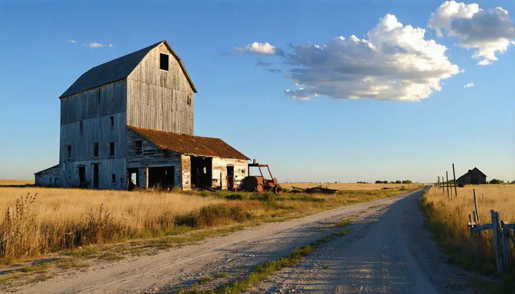
Before setting out for Omemee, understand that you’re visiting an archaeological site rather than a picturesque ghost town with weathered buildings to photograph. Since most structures were bulldozed between 2010 and 2013, you’ll need different expectations and visitor equipment than typical ghost town explorations.
Omemee is an archaeological site, not a photogenic ghost town—most buildings were demolished between 2010 and 2013.
Critical preparation considerations:
- Verify property access – The site sits on private land, so research current ownership and obtain permission before trespassing
- Pack for extreme conditions – Northwestern North Dakota’s weather demands layers, sun protection, and emergency supplies year-round
- Bring navigation tools – GPS coordinates (48°42′23″N 100°21′18″W) are essential since no signage exists
- Study historical photos beforehand – 1906 postcards and 1909 bird’s-eye views help you visualize what once stood
Respect site preservation by avoiding disturbing foundations or archaeological features during your exploration.
Nearby Attractions and Towns Worth Exploring
After exploring Omemee’s sparse remains, you’ll find northwestern North Dakota rewards curious travelers with several intriguing destinations within easy driving distance. Bottineau, home to Omemee’s relocated town bell at the County Historical Museum, sits just minutes away.
You can trace the ghost town circuit to Sims, 50 miles west of Mandan, where the active Soo Scandinavian Lutheran Church stands—First Lady Laura Bush visited in 2008. Legend claims the “Gray Lady Ghost” plays its organ. Blue Grass, another vanished settlement 35 miles northwest of Mandan, peaked at merely 20 residents. Nearby farming communities welcome explorers seeking authentic prairie experiences.
Keep your eyes open for architectural salvage opportunities among abandoned homesteads dotting these windswept plains, where fieldstone foundations whisper stories of North Dakota’s boom-and-bust railroad era.
Preserving the Memory of North Dakota’s Lost Communities
Beyond discovering these vanished settlements on your road trip, North Dakota actively fights to save what remains of its ghost town heritage before time erases every trace. The State Historic Preservation Program has pumped over $1,600,000 into matching funds for National Register-listed properties, while community restoration efforts bring places like Alcabo’s schoolhouse back to life.
Rural heritage preservation gives you tangible connections to the past:
- Crystal Springs’ 1935 WPA fountain earned National Register status in 2010
- Charbonneau’s two-room schoolhouse and grain elevators still stand defiantly
- Eight counties established preservation commissions to protect their history
- Renaissance Zones offer economic incentives for heritage tourism development
You’ll find these preservation battles happening across a landscape dotted with over 1,000 ghost towns—each fighting against abandonment, fire, and the relentless prairie winds.
Frequently Asked Questions
Is It Legal to Visit and Explore the Abandoned Omemee Townsite?
Visiting Omemee isn’t explicitly illegal, but you’ll need landowner permission since town ownership status shifted to private hands after disincorporation. The historical significance of Omemee doesn’t override property rights, so respect boundaries and watch for hazardous open cisterns.
What Is the Best Season to Visit Omemee Ghost Town?
Late spring through early fall offers ideal weather conditions for your adventure—warm temperatures reveal hidden details while providing the best time for photo opportunities. You’ll navigate safely through deteriorating structures when ground conditions aren’t obscured by snow.
Are There Any Safety Hazards at the Remaining Crumbling Structures?
Yes, you’ll face serious debris hazards from collapsed buildings and unstable rubble piles. Structural integrity concerns plague crumbling foundations, decaying fences, and fieldstone remnants that could collapse unexpectedly. Watch for open pits and unmarked holes throughout the site.
Can I Camp Overnight Near the Omemee Ghost Town Site?
You can’t camp at Omemee itself—it’s private property with hazards. However, you’ll find primitive camping opportunities at nearby Dakota Prairie Grasslands sites like Magpie, where public land access regulations allow 14-day stays on first-come basis.
Are There Guided Tours Available for Omemee and Surrounding Ghost Towns?
No guided tours exist for Omemee or nearby ghost towns—you’ll explore independently. Historical preservation efforts remain minimal, and local tourism initiatives haven’t developed here. You’ll need self-guided resources, property permissions, and your own adventurous spirit for discovery.
References
- https://ghostsofnorthdakota892857007.wordpress.com/2017/04/28/what-happened-to-ghost-town-omemee-north-dakota/
- https://kids.kiddle.co/Omemee
- https://everafterinthewoods.com/these-forgotten-ghost-towns-in-north-dakota-are-eerily-fascinating/
- https://www.ndstudies.gov/gr8/content/unit-iv-modern-north-dakota-1921-present/lesson-1-changing-landscapes/topic-3-ghost-towns-and-railroads/section-2-omemee
- https://en.wikipedia.org/wiki/Omemee
- https://ghostsofnorthdakota892857007.wordpress.com/2014/01/15/when-omemee-was-a-town/
- https://ghostsofnorthdakota892857007.wordpress.com/2014/01/16/omemee-and-the-batie-family/
- https://cool987fm.com/are-there-ghost-towns-near-bisman-lets-hear-your-stories/
- https://kids.kiddle.co/Bottineau_County
- https://uscountymaps.com/bottineau-county-map-north-dakota/