Start your ghost town road trip near Ringling and follow Highway 89 south toward San Bernardo, Oklahoma’s oldest Red River settlement. You’ll spot the roadside marker along Highway 89 pointing to where twin Wichita villages once thrived with French trade in the 18th century. The original site is private property, but Jefferson County’s nearby ghost towns like Spanish Fort, Woodford, and Sardis make perfect detours. There’s far more buried history here than a roadside marker can hold.
Key Takeaways
- Start your route near Ringling, following Highway 89 south, with the San Bernardo roadside marker as your first stop.
- San Bernardo is Oklahoma’s oldest Red River settlement, tied closely to the nearby ghost town of Spanish Fort.
- Notable Jefferson County ghost towns along your route include Woodford, Sante Fe, and Sardis for additional exploration stops.
- Respect private property boundaries, as the original San Bernardo site is privately owned and limits direct exploration.
- Bring the “Ghost-Town Tales” book as a travel companion, since each milepost presents a unique historical story.
What Makes San Bernardo Oklahoma’s Most Historic Ghost Town?
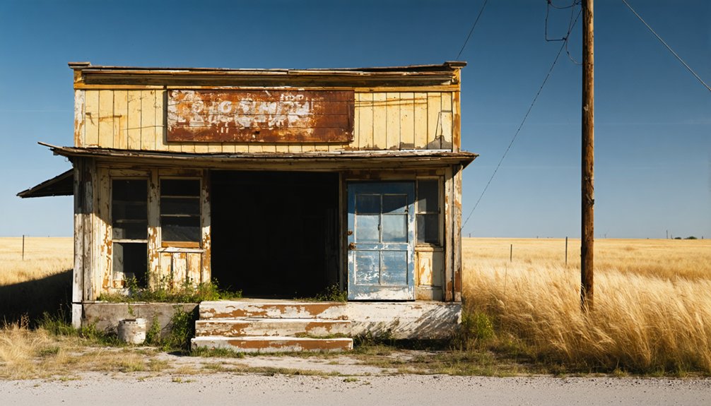
When you think of Oklahoma ghost towns, San Bernardo stands apart — it’s not just abandoned, it’s ancient.
Sitting along the Red River in Jefferson County, this site traces back to the eighteenth century, when Wichita culture thrived here long before Oklahoma had a name.
The Wichita people built twin villages — San Bernardo on the north bank, San Theodoro across the river in Texas — creating a powerful hub of historic trade.
They exchanged furs and nuts with French merchants for guns, ammunition, and cloth, operating with remarkable independence on the frontier.
In 1778, Spanish Governor Bernardo de Galvez lent the village its name.
That layered history — Indigenous roots, French commerce, Spanish conflict — is exactly what makes San Bernardo unlike any other ghost town you’ll visit.
The 1759 Battle That Stopped the Spanish Army Cold
When you picture 500 Spanish soldiers marching north from San Antonio under Colonel Diego Ortiz Parrilla, you’d expect an overwhelming victory — but the Wichita warriors had other plans.
They’d fortified San Bernardo’s northern bank with a sturdy palisade, raised a French flag in defiance, and met Parrilla’s force with a resistance so fierce that the Spanish retreated, leaving behind supplies and two cannons.
Spanish Forces Meet Resistance
In the summer of 1759, Spanish Colonel Diego Ortiz Parrilla marched 500 soldiers north from San Antonio, fuming over the destruction of Spanish missions in Texas and dead-set on punishing the Wichita people responsible.
What he found at San Bernardo wasn’t a vulnerable village — it was a fortified stronghold. The Wichita had constructed a sturdy palisade along the northern riverbank and raised a French flag, signaling their alliance and defiance simultaneously.
Understanding the historical context of this Spanish Resistance reveals how dramatically the battle shifted power. Parrilla’s forces couldn’t break through. The Wichita warriors pushed them back hard, forcing them to abandon supplies and two cannons.
Fewer than one-third of Parrilla’s soldiers made it back to San Luis de Bejar alive. The Wichita had held their ground completely.
Wichita Warriors Claim Victory
The outcome of that summer siege left no ambiguity about who controlled the Red River Valley. The Wichita warriors drove Parrilla’s 500-strong force into full retreat, leaving behind supplies and two cannons — tangible proof of their defeat. Fewer than one-third of the Spanish soldiers made it back to San Luis de Bejar.
That victory wasn’t accidental. Wichita resilience ran deep, forged through generations of defending territory while maintaining Indigenous trade networks that kept them well-armed with French weapons, ammunition, and cloth.
They’d built their palisade strategically, fought on their terms, and won decisively.
When you stand at that Highway 89 marker today, you’re standing near ground where a sovereign people successfully defended their freedom against one of history’s most powerful colonial armies.
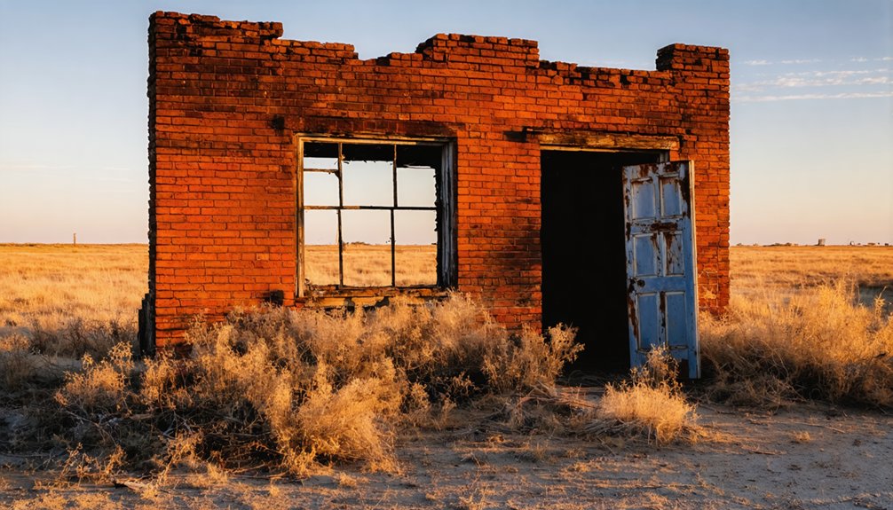
What Archaeologists Found Buried at San Bernardo?
Excavations at the Longest Site (JF-1) between 1965 and 1966 unearthed compelling evidence that this was once a thriving Wichita settlement. Archaeologists discovered circular depressions, posthole patterns, trash mounds, and storage pits that painted a vivid picture of daily life here.
Among the archaeological findings, you’ll find a fascinating mix of historical artifacts — European trade goods, mostly French in origin, alongside traditional Wichita tools and skeletal remains.
Beneath the soil, French trade goods, Wichita tools, and skeletal remains reveal a world where two cultures once converged.
Aerial photography revealed something even more striking: a large circular soil stain marking the footprint of the Wichita log stockade that once repelled Spanish soldiers.
These discoveries earned San Bernardo a spot on the National Register of Historic Places in 1982. The site proves that beneath Jefferson County’s quiet landscape, centuries of remarkable human history still wait to be understood.
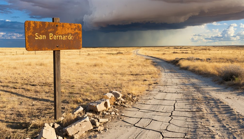
How to Find the San Bernardo Marker on Highway 89?
While those buried artifacts and soil stains tell San Bernardo’s story underground, you can still connect with this history above ground by tracking down the roadside marker along Highway 89.
The marker location sits near Ringling in Jefferson County, placing you within reach of Oklahoma’s oldest Red River town without requiring special access.
Your highway access is straightforward — drive Highway 89 and watch for the roadside sign on the western side.
The marker reads: “San Bernardo Site in immediate vicinity west Oklahoma’s oldest town on Red River,” orienting you toward the private property beyond.
Since the original village sits on restricted land, this marker becomes your closest legitimate encounter with San Bernardo.
Pair it with a Red River Valley drive for a fuller picture of this Oklahoma-Texas borderland history.
Why the Site Is Private and What You Can Still See
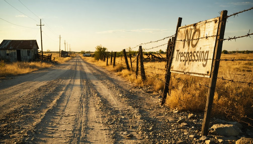
The original San Bernardo site sits on private property, so you can’t walk the grounds or explore the archaeological features firsthand.
You can, however, pull over along Highway 89 and read the roadside marker that places you within steps of Oklahoma’s oldest town on the Red River.
While you’re in the area, pairing the stop with a drive through the Red River Valley lets you take in the broader landscape where the twin villages of San Bernardo and San Theodoro once straddled the Oklahoma-Texas border.
Private Land Access Limits
Although the original San Bernardo site sits on private property, you can still connect with this remarkable slice of Oklahoma history from the roadside. Access limitations mean you won’t walk the actual ground where Wichita warriors repelled Spanish forces in 1759, but the experience remains powerful.
Pull over along Highway 89 near Ringling in Jefferson County and read the roadside marker honoring Oklahoma’s oldest Red River town. The sign places you directly in the vicinity of where San Bernardo once stood, where French traders bartered guns for furs, and where a fortified palisade once flew a French flag defiantly.
Respect the private property boundary, bring a camera, and let the landscape itself tell the story of this forgotten twin village.
Roadside Marker Viewing
Pulling off Highway 89 near Ringling puts you face-to-face with one of Oklahoma’s most overlooked historical footnotes — a simple roadside marker honoring San Bernardo, the state’s oldest known Red River settlement.
This roadside history stop costs nothing and demands only minutes, yet delivers remarkable context.
The historical marker reveals:
- Oklahoma’s oldest Red River town stood right here
- Twin villages once straddled the Oklahoma-Texas border
- Spanish forces suffered defeat nearby in 1759
- French traders actively supplied Wichita warriors with weapons
- The site earned National Register of Historic Places recognition in 1982
You won’t cross any fence lines, but you’ll leave understanding exactly why this quiet stretch of Highway 89 carries more historical weight than most people ever realize.
Nearby Historical Stops
Stepping away from the marker means leaving the historical story half-told, so it’s worth knowing why the San Bernardo site itself stays off-limits before you start planning where else to point your vehicle.
Private ownership restricts public access, protecting excavation findings that confirmed its cultural significance as a Taovayas Village. You can’t walk the ground, but you’re not stuck.
Cross the Red River into Texas and explore Spanish Fort, the ghost town directly tied to San Bernardo’s twin village history.
That stretch of highway carries genuine historical landmarks connecting two states across one legendary battle site. You’ll cover Oklahoma and Texas ground in a single drive, trading the restricted northern bank for open roads that tell the same Wichita story from a different angle.
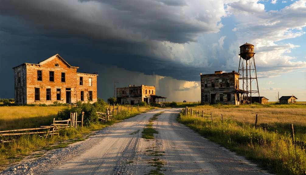
Which Jefferson County Ghost Towns Are Worth the Detour?
Why stop at just one ghost town when Jefferson County offers a handful of forgotten places worth folding into your route?
Once you’ve marked San Bernardo on your map, consider these detours:
- San Bernardo (Petersburg) — Oklahoma’s oldest Red River settlement, anchored by a roadside marker on Highway 89
- Woodford (Bywater) — a semi-abandoned Jefferson County remnant worth a slow drive-through
- Sante Fe — a quietly vanished community that once held real promise
- Sardis — another faded name worth tracking down on older county maps
- Spanish Fort connection — cross into Texas to explore San Bernardo’s twin story
You’re not just collecting coordinates — you’re stitching together a deeper picture of a region that history nearly erased entirely.
How to Drive the Red River Valley Ghost Town Route
Once you’ve mapped your Jefferson County ghost towns, connecting them into a single Red River Valley drive makes the whole trip click into place.
Start near Ringling and follow Highway 89 south toward the San Bernardo roadside marker, where ghost town legends of Wichita warriors and Spanish soldiers come alive against the flat river horizon.
From there, you’re tracing a border that once separated two nations and two villages — San Bernardo on the Oklahoma bank, San Theodoro across the Red River in present-day Texas.
This twin-village corridor represents serious historic preservation territory, so respect private property boundaries and let the landscape speak.
Keep the Ghost-Town Tales book riding shotgun — it turns every milepost into a story worth stopping for.
Frequently Asked Questions
Is There an Admission Fee to View the San Bernardo Roadside Marker?
You won’t encounter any financial obligations here! Roadside markers like San Bernardo’s don’t carry admission fees — you’re free to pull over along Highway 89 and soak in this rich Oklahoma history at no cost.
What Is the Best Time of Year to Visit Jefferson County Ghost Towns?
Spring and fall offer the best season for exploring Jefferson County’s ghost towns. You’ll enjoy mild temperatures and stunning landscapes while avoiding summer’s scorching heat. Weather considerations matter, so pack layers and embrace the open road freely!
Are Guided Tours of the Red River Valley Ghost Town Route Available?
Coincidentally, while ghost town history here runs deep, no official guided tour options exist for this route. You’ll explore San Bernardo’s Red River Valley independently, using Highway 89’s roadside marker as your fascinating, freedom-filled starting point.
Can Visitors Photograph the Highway 89 Marker Without Trespassing on Private Property?
Yes, you can freely photograph the Highway 89 marker without worrying about private property boundaries! You’ll access this roadside treasure directly from highway access, snapping vivid shots of Oklahoma’s oldest Red River town history without restriction.
How Long Does a Typical San Bernardo Road Trip Stop Usually Take?
You’ll spend about 15–20 minutes at this road trip duration stop. Follow these sightseeing tips: photograph the Highway 89 marker, soak in the historic Red River views, and you’re free to move on!
References
- https://newforums.com/our-titles/best-of-the-region/places-routes/ghost-town-tales-of-oklahoma-unforgettable-stories-of-nearly-forgotten-places/
- https://www.okhistory.org/publications/enc/entry?entry=JE001
- https://oktttp.genealogyvillage.com/ghost_towns/ghost_towns.htm
- https://www.undiscoveredamerica.tv/best-ghost-towns-in-america-worth-the-detour/
- https://www.exploratography.com/blog-66
- https://www.okgenweb.net/~okjeffer/petersburg.htm
- https://mike-boucher.com/wordpress/?page_id=141


