Planning a ghost town road trip to Sherburne, Louisiana means heading deep into the Atchafalaya Basin, where a once-thriving 1880s sawmill town now rests beneath reclaimed wetlands. You’ll find weathered remnants, scenic nature trails, and incredible wildlife along the way. Access it off Louisiana State Route 975, pay a small entry fee, and pack insect repellent and waterproof boots. There’s far more to this hauntingly beautiful destination than you’d expect.
Key Takeaways
- Sherburne, located in the Atchafalaya Basin, was a logging town that declined by the 1930s and was later cleared for the Morganza Spillway project.
- Scattered remnants like weathered frames and rusting equipment remain, with the Sherburne Nature Trail offering wildlife viewing, fishing, and paddling experiences.
- Access Sherburne via Louisiana State Route 975, with entry fees of $2 daily or $5 annually, waived with a hunting or fishing license.
- Pair your visit with nearby ghost towns like Ruddock and Red River Landing to explore Louisiana’s broader boom-and-bust industrial history.
- Visit between November and March for cooler hiking weather; pack insect repellent, waterproof boots, cash, and offline maps for remote conditions.
What Is Sherburne and Why It Became a Ghost Town?
Deep in the Atchafalaya Basin — North America’s largest freshwater swamp — the ghost town of Sherburne sits quietly within Pointe Coupee Parish, Louisiana, swallowed by the same wetlands that once made it valuable.
Forget ghost town myths about dramatic disasters or overnight collapse. Sherburne’s story is quieter but equally compelling. It emerged in the 1880s as sawmills moved in to harvest vast cypress and hardwood forests, transforming the swamp into a bustling company town built entirely around logging history.
Workers arrived, mills ran continuously, and profits flowed — until the trees ran out.
How Sherburne’s Sawmill Boom Ended Up Underwater
Once the cypress and hardwood forests surrounding Sherburne were stripped bare, the town’s entire reason for existing vanished with them.
Workers packed up and moved on, leaving behind empty mill buildings and a scattering of wooden frames that nobody bothered to tear down.
Then the federal government delivered the final blow, ordering the settlement cleared by 1939 to make way for the Morganza Spillway project, which permanently folded Sherburne’s last traces into a federally managed flood-control landscape.
Timber Depleted, Town Abandoned
When the last old-growth cypress fell in the Atchafalaya Basin around 1900, Sherburne’s fate was already sealed. The timber industry had devoured everything worth cutting, leaving behind stripped land and a town with no reason to exist.
Workers followed the mills elsewhere, and families packed whatever they could carry.
By the 1930s, you wouldn’t have found a single resident left. The hardwoods fell next, clearing out whatever the cypress loggers had missed.
Then the federal government delivered the final blow, ordering the ghost town cleared by 1939 ahead of Morganza Spillway construction.
What once hummed with sawmill noise went completely silent. Nature didn’t wait for an invitation — the swamp crept back, reclaiming land the timber industry had stripped bare just decades before.
Morganza Spillway Sealed Fate
Even after the last mill went quiet and the workers scattered, Sherburne couldn’t fully escape Washington’s reach. Federal planners pushed flood control to the forefront, and the Morganza significance became clear: the government ordered Sherburne to vacate by 1939.
The spillway project transformed private land into federally managed territory, erasing what little remained of the community.
Three realities that sealed Sherburne’s fate:
- Federal authority overrode local choice — residents couldn’t negotiate; Washington dictated the timeline.
- Flood control prioritized infrastructure over community — the spillway’s protection of downstream populations mattered more than preserving the town.
- Land ownership shifted permanently — private timber land became government conservation territory, closing the door on any rebuilding.
You won’t find freedom in federal mandates, but you’ll find history here.
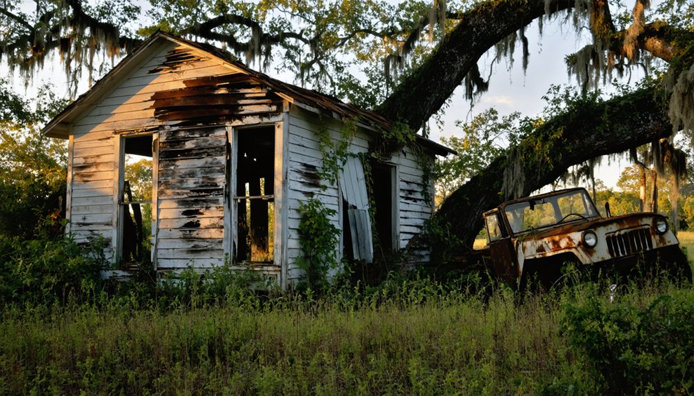
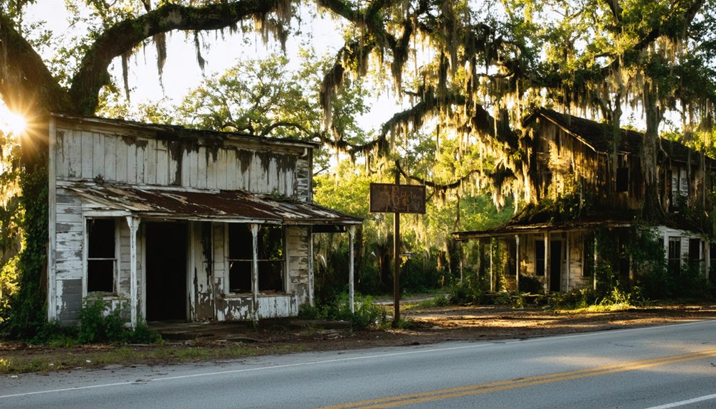
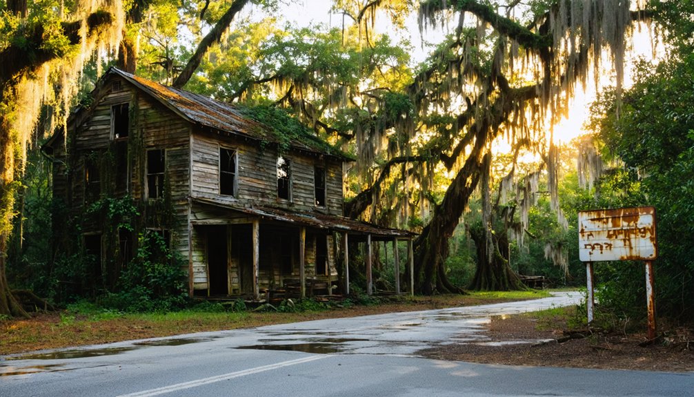
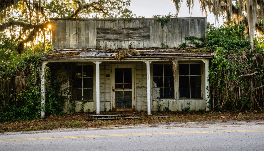
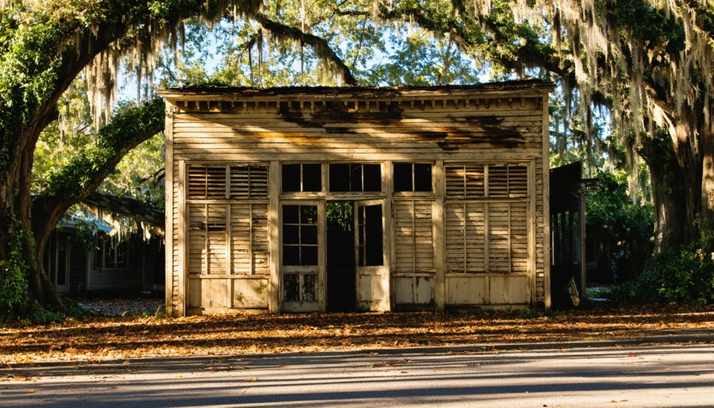
What’s Left to See at the Sherburne Ghost Town Site?
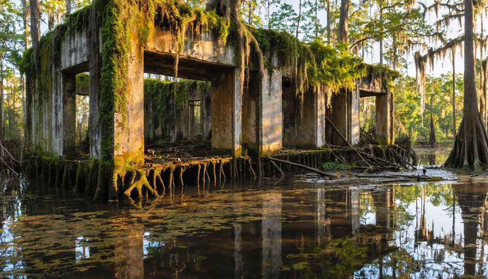
Scattered remnants are all that survive of Sherburne’s sawmill past — a few weathered wooden home frames, rusting steel equipment, and an old sawdust pile that hints at the industrial scale of operations here.
No intact village structures remain, yet the historical significance of what once stood here is undeniable. You’re walking ground where an entire company town rose, thrived, and vanished within decades.
Ghost stories aside, the real haunting comes from the landscape itself — dense swamp and hardwood vegetation now reclaiming what loggers stripped bare by the 1930s.
The Sherburne Nature Trail lets you explore this reflooded wetland on foot or by vehicle. Watch for wildlife, study the interpretive features, and let the silence do the storytelling.
Nature has quietly erased nearly everything, but not completely.
How to Get to Sherburne, Louisiana
To reach Sherburne, you’ll take Louisiana State Route 975, accessible from two directions: either north from I‑10 exit #127 at Whiskey Bay for about 15 miles, or south from US 190 near Krotz Springs until you spot the Sherburne WMA sign on the east side.
Once you turn onto the property, you’re entering a 44,000-acre complex managed by the Louisiana Department of Wildlife and Fisheries, where the old sawmill town once hummed with activity.
Plan to bring a couple of dollars for the daily entry fee, though a valid hunting or fishing license or a $5 annual wildlife stamp will also get you through the gate.
Starting Your Route
Getting to Sherburne is straightforward once you know which roads cut through the Atchafalaya Basin‘s tangle of levees and waterways.
Two reliable entry points put you deep inside this ghost town legends territory where Atchafalaya ecology still shapes every mile you drive.
- From I-10 Exit #127 (Whiskey Bay): Head north on Louisiana State Route 975 for approximately 15 miles until you reach the Sherburne WMA sign on the east side.
- From US 190 near Krotz Springs: Drive roughly 3 miles south onto LA SR 975 toward the WMA entrance.
- Entry Fees: Bring $2 for a daily pass, $5 for an annual wildlife stamp, or carry your valid hunting or fishing license.
You’re now positioned to explore what logging once consumed and wilderness reclaimed.
Key Road Landmarks
Landmarks along LA SR 975 keep you oriented as the road narrows and the swamp closes in around you. Leaving I‑10 at exit 127 near Whiskey Bay, you’ll cross elevated causeways above flooded bottomlands — your first hint that the Atchafalaya Basin is swallowing the landscape whole.
Watch for historical markers referencing Louisiana’s timber heritage as you push northward roughly 15 miles. Small roadside attractions, including fishing access points and pull‑offs overlooking cypress-edged waterways, break up the drive naturally.
If you’re approaching from US 190 near Krotz Springs instead, head south about three miles until a sign on the road’s east side announces the Sherburne Wildlife Management Area. That sign marks your arrival at what was once a thriving sawmill community.
Entry Fees And Access
Arriving at Sherburne Wildlife Management Area costs next to nothing — entry runs $2 for a daily fee, $5 for an annual wildlife stamp, or you can skip the fee entirely with a valid Louisiana hunting or fishing license.
These entry guidelines keep the refuge accessible for every kind of explorer.
Follow these visitor tips before heading out:
- Choose your route — take I‑10 exit #127 at Whiskey Bay, then drive 15 miles north on LA SR 975.
- Watch for the sign — the Sherburne WMA marker sits on the east side of LA SR 975.
- Carry your license — it doubles as your free pass, saving both time and money.
Freedom rarely costs this little.
Entry Fees and Rules for the Sherburne WMA
Before you pull into the Sherburne Wildlife Management Area, it’s worth knowing what entry will cost you and what rules apply. The fee structure is straightforward: pay a $2 daily fee, purchase a $5 annual wildlife stamp, or simply carry a valid Louisiana hunting or fishing license.
Brief headquarters visits and highway through-traffic typically get a pass on fees entirely.
The entry rules keep things simple but firm. Stay on designated roads, respect posted boundaries, and follow seasonal hunting regulations if you’re visiting during active hunting periods.
The Louisiana Department of Wildlife and Fisheries manages the area, so their guidelines govern your visit. Come prepared, move respectfully through the landscape, and you’ll have unrestricted access to 44,000 acres of rewilded swamp history worth every penny.
What to Do at Sherburne Besides Hunt for History
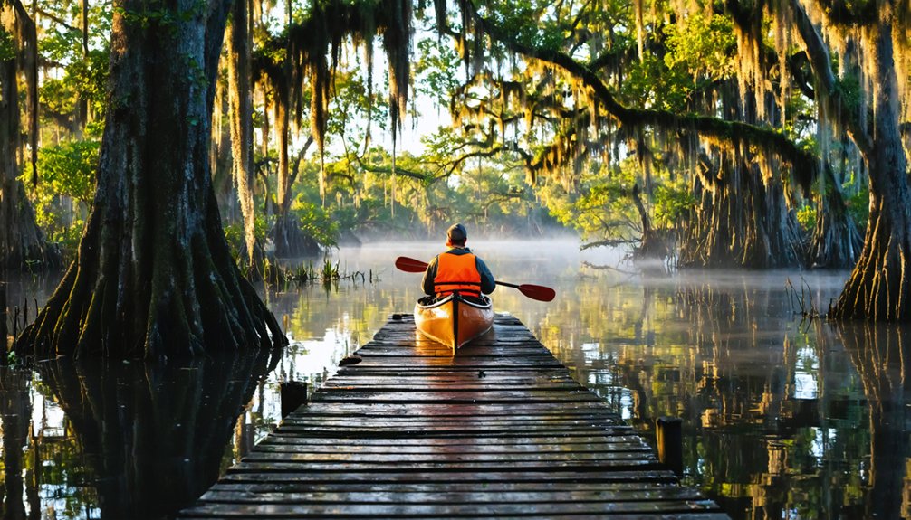
Sherburne offers 3 activities worth your time beyond poking around for ghost town remnants: walking the Sherburne Nature Trail, birdwatching across the rewilded wetlands, and fishing or paddling through the Atchafalaya Basin’s waterways.
1. Sherburne Nature Trail – Walk or drive through reflooded swampland where loggers once stripped ancient cypress.
It’s raw, quiet, and yours to explore freely.
2. Wildlife observation and nature photography – Herons, wood ducks, and white-tailed deer move through restored hardwood corridors daily, giving you compelling subjects without crowds or admission gates.
3. Fishing and paddling – Launch into Atchafalaya waterways teeming with bass and catfish, or simply drift through one of North America’s largest freshwater swamps on your own schedule.
How to Build a Full Atchafalaya Basin Day Trip From Sherburne
Once you’ve walked Sherburne’s trails and soaked in the silence of the rewilded swamp, the Atchafalaya Basin rewards you with enough adjacent stops to fill a complete day.
Head north toward Krotz Springs to explore more Atchafalaya wildlife along the river’s edge, where herons, eagles, and alligators command the shoreline.
Then swing toward Red River Landing or Ruddock, two other Louisiana ghost towns carrying their own historical significance as former logging and fishing communities swallowed by time.
Red River Landing and Ruddock stand as quiet reminders of logging and fishing communities the basin slowly reclaimed.
Each stop deepens your understanding of how industry, flood control, and federal conservation reshaped this entire region.
Pack a lunch, keep your camera ready, and move at your own pace. The basin doesn’t rush anyone, and neither should you.
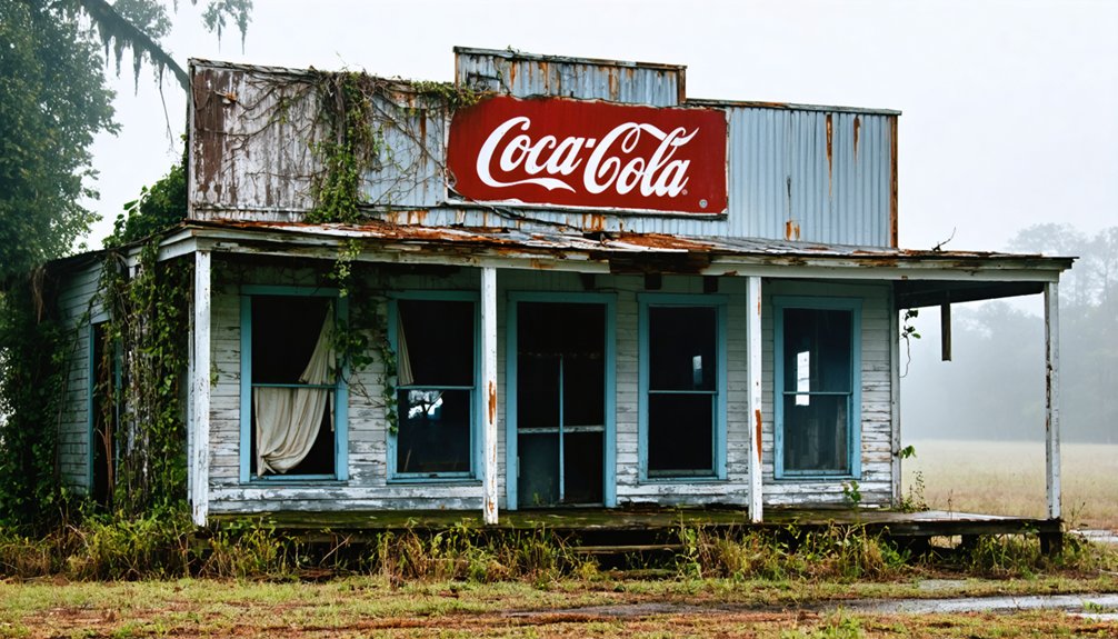
Louisiana Ghost Towns Worth Pairing With a Sherburne Visit
If you’re already making the trek to Sherburne, you’d be wise to loop in a few other Louisiana ghost towns that round out the Atchafalaya Basin story.
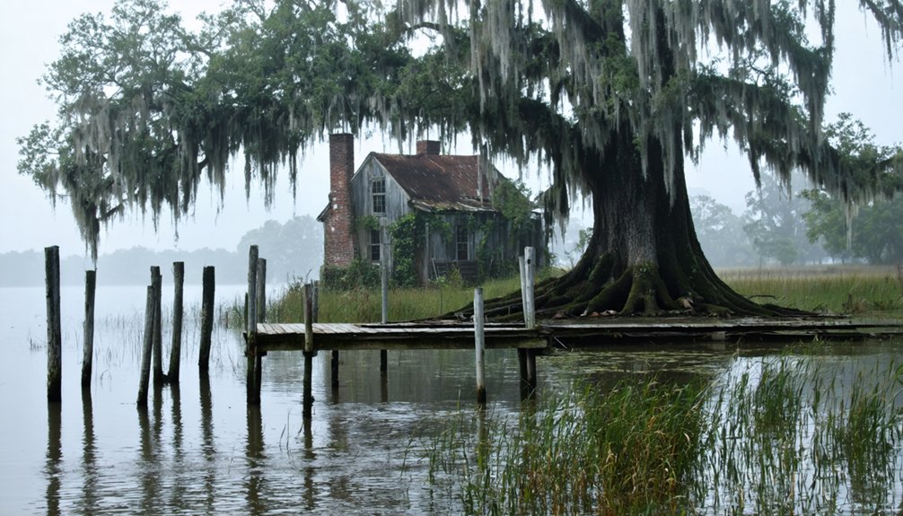
Red River Landing, a once-bustling river port now swallowed by time and floodplain, sits close enough to fold into the same day.
Ruddock carries its own haunting history as a vanished logging and oyster community, and pairing it with Sherburne gives you a richer picture of how Louisiana’s boom-and-bust industries reshaped — and ultimately erased — entire communities.
Red River Landing Nearby
Two ghost towns within striking distance of each other make for a richer road trip than either could offer alone, and Red River Landing pairs naturally with Sherburne.
Once a thriving Mississippi River port, Red River Landing now offers haunting scenic views across open water where steamboats once docked. Together, these sites tell a bigger story about Louisiana’s boom-and-bust past.
Plan your combined visit around these highlights:
- Stand at the river’s edge where the Red River meets the Mississippi and feel the raw scale of Louisiana’s waterways.
- Compare abandonment stories — logging killed Sherburne; shifting river commerce killed Red River Landing.
- Photograph the contrast between overgrown riverbanks and open sky for a compelling visual record of your journey.
Ruddock’s Haunting History
Ruddock’s story hits differently than Sherburne’s — where logging stripped one town of its purpose, a catastrophic 1915 hurricane effectively erased Ruddock from the map, washing away a once-bustling cypress-logging and fishing community nestled along the shores of Lake Maurepas.
Survivors scattered, and the town never rebuilt. Today, Ruddock Legends circulate among Louisiana historians and ghost-town enthusiasts who trace the outlines of what once stood there.
You’ll find no standing structures, no markers celebrating former prosperity — just marsh, memory, and Ghostly Echoes of a community swallowed by storm surge and time.
Pairing a Ruddock detour with your Sherburne visit sharpens your understanding of how differently Louisiana’s ghost towns met their ends — one slowly bled dry by industry’s departure, the other violently erased overnight.
Combining Multiple Ghost Towns
Sherburne and Ruddock don’t exhaust Louisiana’s ghost-town circuit — they open it. Pair them with these stops for a richer journey through vanished communities:
- Red River Landing — A once-thriving river port reduced to levee remnants, perfect for ghost town photography where light and shadow dramatize forgotten commerce.
- Ruddock — The railroad flood disaster story hits harder when you’ve already walked Sherburne’s sawdust trails, letting both tragedies speak to each other across the basin.
- Local Heritage Festivals — Several Atchafalaya communities host historical reenactments celebrating 19th-century logging and river culture, giving you living context for the silence you’ve witnessed.
String these destinations across two days, move at your own pace, and let Louisiana’s disappeared places tell their full, unfiltered story.
Best Time of Year to Visit Sherburne
Four seasons wash over the Atchafalaya Basin, but late fall through early spring gives you the best window to explore Sherburne’s ghost town remnants and wildlife refuge without battling Louisiana’s brutal summer heat and humidity.
Cooler temperatures between November and March make hiking the Sherburne Nature Trail genuinely enjoyable rather than a sweaty endurance test.
November through March transforms Sherburne’s trails from a sweaty ordeal into an actual pleasure worth lacing your boots for.
Winter months deliver ideal wildlife viewing, as migratory birds flood the wetlands and deer move actively through the bottomland hardwoods.
You’ll spot waterfowl, raptors, and wading birds with remarkable clarity once the thick summer foliage thins out.
The best seasonal activities align perfectly with hunting and fishing seasons, so plan accordingly if you want the refuge buzzing with action.
Spring shoulder months add wildflowers and emerging greenery, rewarding explorers who crave that rebirth atmosphere.
What to Pack for a Sherburne Road Trip
Packing seven essentials before you leave the pavement behind will save you real grief once you’re deep in the Atchafalaya Basin.
These road trip tips keep your adventure moving freely instead of grinding to a halt in remote swampland.
Follow these packing essentials for confidence on the trail:
- Insect repellent and sun protection — mosquitoes own this basin, and the open levee roads offer zero shade cover.
- Waterproof boots and a rain layer — afternoon showers materialize fast, and soggy ground stays soggy.
- Cash for entry fees — the WMA charges $2 daily, and digital payments won’t save you out here.
Carry extra water and a downloaded offline map, because cell service disappears before the cypress does.
Frequently Asked Questions
Can You Camp Overnight at the Sherburne Wildlife Management Area?
“Home is where you pitch your tent!” Check Sherburne WMA’s camping regulations before you go, as overnight amenities are minimal. You’ll need a valid license or fee pass to stay free beneath Louisiana’s wild, starlit skies.
Are Pets Allowed on the Sherburne Nature Trail?
The knowledge base doesn’t confirm pet policies for the Sherburne Nature Trail, so you’ll want to contact Louisiana Department of Wildlife and Fisheries directly. Following proper trail etiquette guarantees you and your pet enjoy the swamp responsibly.
Is the Sherburne WMA Accessible to Visitors With Mobility Limitations?
Spanning 44,000 acres, Sherburne WMA’s wheelchair accessibility options are limited, but you can explore the headquarters area and enjoy basic visitor amenities. You’ll find the main roads drivable, letting you experience this hauntingly beautiful swamp freely.
What Wildlife Species Are Most Commonly Spotted at Sherburne?
You’ll spot deer, alligators, and countless bird watching treasures like herons and eagles. Swamp creatures like otters, turtles, and frogs thrive here too, making every visit a wild, unforgettable encounter with Louisiana’s raw, untamed nature.
Are Guided Tours of the Sherburne Ghost Town Site Available?
You won’t find formal guided tours, but you can explore Sherburne’s ghost town history independently via the nature trail, uncovering local legends and remnants of sawmill life at your own adventurous pace.
References
- https://acadianahistorical.org/items/show/41
- https://en.wikipedia.org/wiki/Sherburne
- https://www.ghosttowns.com/states/la/sherburne.html
- https://www.youtube.com/watch?v=qbO_Koagazo
- https://classicrock1051.com/17-ghost-towns-louisiana/
- https://countryroadsmagazine.com/art-and-culture/history/remembering-sherburne/
- https://973thedawg.com/louisiana-ghost-towns/
- http://chenango.nygenweb.net/books/shr100-2.htm
- https://www.louisianasportsman.com/fishing/freshwater-fishing/atchafalaya-basin-provides-incredible-outdoor-bounty/
- https://en.wikipedia.org/wiki/List_of_ghost_towns_in_Louisiana