Planning a Tempiute ghost town road trip means heading deep into Lincoln County, Nevada, where two mining eras left behind stone foundations, mine shafts, and industrial ruins. Start your route from Rachel, just six miles northwest, and prepare for an elevation of 6,112 feet with serious temperature swings and zero on-site water. You’ll need to respect nearby military boundaries and come fully equipped. Stick around, because there’s much more to uncover about this remote desert treasure.
Key Takeaways
- Tempiute sits six miles southeast of Rachel, Nevada, in remote Lincoln County, offering an authentic ghost town experience free from crowds.
- Pack more water than expected, as no on-site sources exist and the 6,112-foot elevation accelerates dehydration quickly.
- Research current boundary maps before visiting, as the nearby Nevada Test and Training Range imposes strict restricted zones nearby.
- Plan visits around late afternoon light for optimal ghost town photography, and combine stops at Rachel, Hiko, and Caliente.
- Wear layered clothing and sturdy boots, as elevation causes extreme temperature swings and terrain accessibility varies throughout the site.
Why Tempiute Ghost Town Belongs on Your Nevada Bucket List
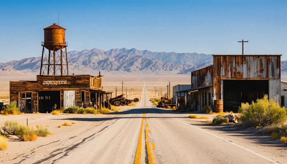
When most people think of Nevada ghost towns, they picture the well-trodden streets of Virginia City or the touristy storefronts of Rhyolite — but Tempiute sits in an entirely different category.
This remote Lincoln County site rewards those willing to venture off the beaten path with an authentic, crowd-free experience that most ghost town destinations can’t offer.
Tempiute’s mining heritage spans two distinct eras — silver in the 1860s and tungsten through the mid-1900s — giving you layered history embedded in a single location.
Stone foundations, mine shafts, and industrial ruins from both periods still stand, waiting to be explored on your own terms.
No gift shops. No entrance fees. Just open desert, high-elevation silence, and the freedom to connect directly with Nevada’s raw, unfiltered past.
From Silver Strikes to Tungsten Mines: Tempiute’s Two-Era History
When you walk through Tempiute, you’re stepping across two distinct chapters of American mining history — silver in the 1860s and tungsten decades later.
The silver era started strong in 1865 but fizzled by 1883, hampered by water scarcity and logistical nightmares that kept the population capped at roughly 50 miners.
Tungsten then breathed new life into the mountain, swelling the town to nearly 700 residents before another price collapse shuttered the mill in 1957, leaving behind the layered ruins you’ll find scattered across the site today.
Silver’s Promising Early Start
Nestled in the remote Nevada desert, Tempiute’s story begins with silver—specifically, a promising strike in 1865 on Tempiute Mountain during the broader Pahranagat mining rush.
Miners discovered additional silver lodes in 1868, prompting the formal organization of the Tem Piute Mining District. Silver mining here carried real historical significance, drawing prospectors keen to stake their claim in Lincoln County’s rugged terrain.
By the late 1870s, roughly 50 miners had settled the camp, and a post office operated intermittently between 1879 and 1883.
But the promise never fully delivered. Water scarcity forced mule teams to haul supplies from springs up to 12 miles away, crippling operations.
Tungsten Revives The Town
Decades after silver’s bust left Tempiute silent, tungsten breathed new life into the mountain in 1916.
The economic impact transformed this forgotten outpost into a thriving community of roughly 700 residents, complete with a school and post office.
Tungsten mining drove operations on and off through the mid-1980s, with the Lincoln Mine anchoring activity on the mountain’s north side.
Three key moments defined this revival era:
- 1916 — Tungsten discovery reignited Tempiute’s potential after decades of silence
- 1930–mid-1980s — Lincoln Mine sustained on-and-off operations, creating generational livelihoods
- 1957 — Declining tungsten prices shuttered the mill, emptying the town once again
You’re walking through layers of two distinct economic booms when you explore Tempiute today.
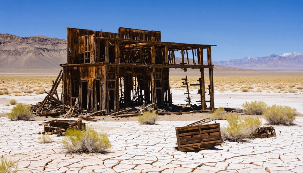
Mining’s Lasting Physical Legacy
Two eras of boom and bust have etched themselves permanently into Tempiute’s landscape, and you’ll read that story clearly as you walk the site today.
Stone cabin foundations from the 1860s silver rush sit quietly alongside the heavier industrial footprint left by tungsten operations. The contrast in mining techniques tells you everything — early miners worked small-scale with hand tools and mule transport, while mid-20th century operations demanded mills, buildings, and extensive underground workings.
Scattered mine shafts and tailings punctuate both areas of the site. Ghost town preservation here means respecting what remains rather than disturbing it, so resist the urge to explore unsecured shafts.
You’re free to roam, but the ruins survive only when visitors treat the site with genuine care.
How to Reach Tempiute From Rachel, Nevada
Reaching Tempiute from Rachel takes you just six miles southeast along the south slope of Tempiute Mountain, making it a manageable side trip if you’re already exploring the area.
The scenic routes through Lincoln County reward travelers with rugged desert landscapes carrying deep historical significance at every turn.
Before you go, keep these essentials in mind:
- Elevation awareness – You’ll arrive at 6,112 feet, so plan accordingly for temperature shifts.
- Mixed access – Some areas accommodate vehicles, while others require hiking boots and determination.
- Restricted zones – The Nevada Test and Training Range sits nearby, so respect boundary markers and obtain any necessary permissions before wandering off designated paths.
Pack water, charge your navigation device, and embrace the freedom of discovering Nevada’s forgotten corners.
Two Distinct Areas: What Survives at Tempiute Today
What greets you at Tempiute today splits into two distinct areas, each telling a different chapter of the town’s layered history.
The first holds the silver era’s remnants — stone cabin foundations quietly marking where desperate miners once lived. Your remnants exploration here feels intimate, grounded in raw historical significance.
The second area reveals the tungsten era’s larger footprint. Mills, scattered buildings, underground workings, and tailings dominate the landscape, dwarfing what the silver rush left behind.
This section’s industrial scale reflects the 700 residents who once filled this place with purpose.
Some sections you can reach by vehicle; others demand hiking. Either way, you’re walking through two completely different economic worlds layered onto the same mountain — each worth your time and attention.
Road Access, Permits, and Military Boundaries at Tempiute
Getting to Tempiute requires some planning, since the site splits into areas you can reach by vehicle and sections that demand a hike.
You’ll want to check current access conditions carefully, because the ghost town sits close to the Nevada Test and Training Range, and straying into restricted military zones can land you in serious legal trouble.
Before you go, confirm whether you need permits for the specific areas you’re targeting, and stay alert to posted boundary markers once you’re on the ground.
Vehicle Access And Permits
Driving out to Tempiute puts you squarely in the middle of some serious logistical considerations, because the ghost town sits just southeast of Rachel on the edge of restricted military airspace tied to the Nevada Test and Training Range.
Vehicle routes reach certain sections easily, but permit requirements apply near boundary zones.
Before you roll out, know these three things:
- Some areas require written permissions from military authorities before you park and explore.
- Vehicle access varies by section — the lower areas accommodate most trucks and SUVs, while upper terrain demands hiking.
- Boundary markers aren’t always obvious, so downloading current restricted zone maps before departure protects your freedom to explore without legal complications.
Respecting these boundaries keeps access open for every independent traveler who follows you.
Military Boundary Considerations
Three invisible lines define your entire Tempiute experience — the road you can legally drive, the boundary where you park and walk, and the restricted zone you never cross.
Tempiute sits uncomfortably close to the Nevada Test and Training Range, meaning military access restrictions actively shape what you can explore. Restricted zones aren’t suggestions — they’re enforced boundaries with serious legal consequences for crossing them.
Before you go, research current boundary locations using updated maps. Signage exists at some points, but don’t rely on it exclusively.
The site splits into multiple accessible areas, so you’ll find plenty of legitimate ground to cover without pushing limits.
Respect the boundaries, keep your freedom intact, and you’ll leave with memories instead of complications.
Pack Before You Go: Desert Elevation, No Water, and Restricted Terrain
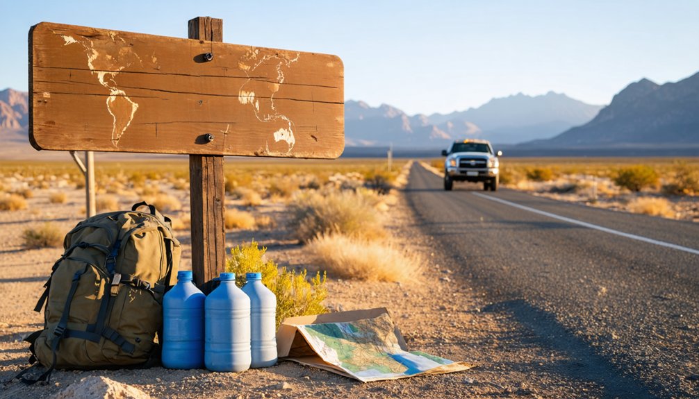
Before you load up the car and head out to Tempiute, you’ll want to pack smart—this site throws three distinct challenges at you: desert heat, high elevation, and restricted terrain.
Desert preparation and terrain navigation aren’t optional here—they’re survival basics. At 6,112 feet, temperature swings hit hard, and there’s zero water on-site. Miners once hauled water 12 miles by mule; you’ll need to bring your own.
At 6,112 feet with no water on-site, desert prep isn’t optional—it’s survival.
- Water – Carry more than you think you’ll need; dehydration sneaks up fast at elevation.
- Layered Clothing – Desert mornings run cold; afternoons burn; be ready for both.
- Boundary Awareness – The Nevada Test and Training Range borders this area; know where you’re legally allowed to walk.
Respect the land, and it’ll reward you.
Sites Worth Combining With Your Tempiute Visit
Once you’ve packed your gear and mapped your boundaries, there’s good reason to think beyond Tempiute itself—this stretch of Nevada rewards explorers who plan a multi-stop day.
Rachel, just six miles northwest, anchors the Extraterrestrial Highway and offers quirky historical signage worth photographing.
Crystal Springs and Ash Springs along Highway 93 provide reliable water stops and access to Pahranagat National Wildlife Refuge, where the valley’s layered history runs deeper than most travelers expect.
If ghost town photography is your priority, Hiko and Caliente both sit within reasonable driving distance and deliver crumbling structures with strong light in the late afternoon.
Linking these stops creates a cohesive route through Lincoln County’s mining and settlement past, making the long desert drive genuinely worthwhile rather than a single-destination sprint.
Frequently Asked Questions
What Does the Name “Tempiute” Actually Mean in Southern Paiute Language?
When you explore Tempiute’s Paiute Language roots, you’ll discover it roughly translates to “rock water people” — a name carrying deep Historical Significance that beautifully reflects the Southern Paiute’s profound connection to this rugged, water-scarce landscape.
How Many People Lived in Tempiute During Its Tungsten Mining Peak?
During Tempiute’s tungsten mining peak, you’d have found roughly 700 residents thriving there, complete with a school and post office. Population decline hit hard in 1957 when falling tungsten prices forced the mill’s closure.
Did Tempiute Ever Have a Functioning Post Office During Its History?
Yes, Tempiute’s post office history spans two brief periods — 1879-1881 and 1882-1883 — directly tied to mining operations. You’ll discover it served a small but determined community of roughly 50 silver miners before closing permanently in 1883.
How Far Away Were the Nearest Water Sources for Early Tempiute Miners?
You’d have hauled water up to 12 miles away, facing brutal water scarcity that made mining challenges incredibly tough. Those early Tempiute miners relied on distant springs, with mules carrying every precious drop to the camp.
What Spelling Variations Exist for the Tempiute Ghost Town Name?
You’ll find the Tempiute spelling varies across historical records, including Tem Piute, Tem-Pah-Ute, Tempahute, and Timpahute. Each variation carries historical significance, reflecting the evolving interpretations of this Southern Paiute name meaning “rock water people.”
References
- https://www.rachel-nevada.com/places/tempiute.html
- https://www.destination4x4.com/tempiute-nevada-lincoln-county-ghost-town/
- https://nvtami.com/2024/03/03/mesquite-presidents-weekend-trip-to-mesquite/
- https://www.loquis.com/en/loquis/6707664/Tempiute+Nevada
- https://en.wikipedia.org/wiki/Tempiute
- https://www.28dayslater.co.uk/threads/old-tempiute-mine-nr-rachel-nevada-usa.57749/
- https://www.nvexpeditions.com/lincoln/tempiute.php
- https://www.youtube.com/watch?v=DlP-fR2qAQw
- https://guardianmetalresources.com/project/tempiute-project/
- https://www.instagram.com/p/DDacUPwT4J_/


