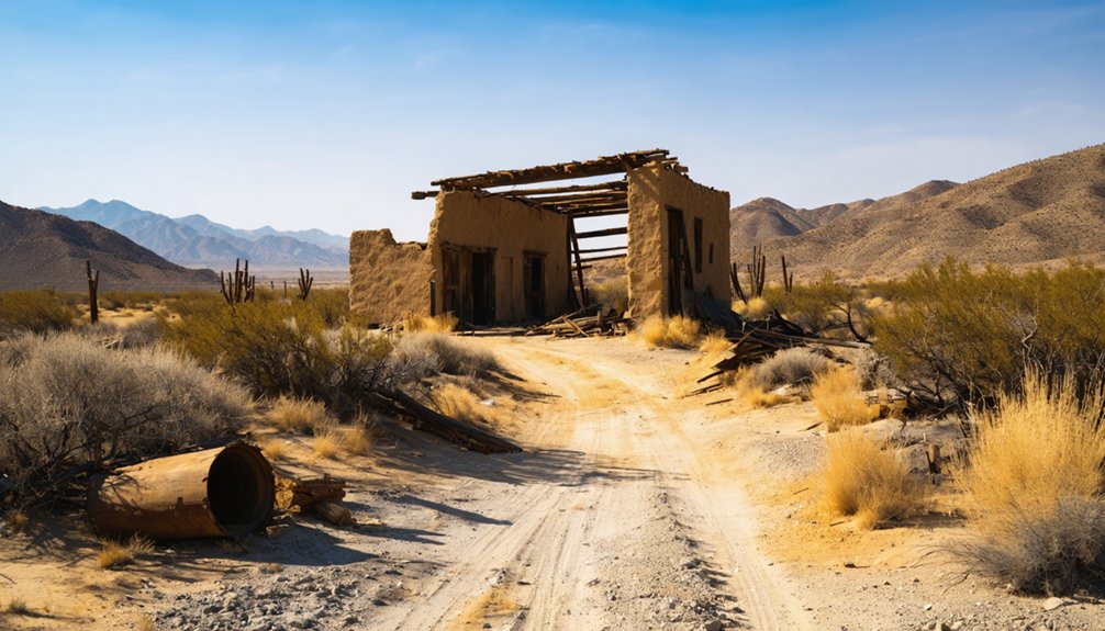
Planning a ghost town road trip to Woolsey Flat means embracing Nevada County’s rugged backcountry on its own terms. You’ll navigate unmarked rural roads to reach this remote site on San Juan Ridge, sitting at roughly 4,200 feet elevation about 17 miles northeast of Nevada City. Fuel up early, download offline maps, and pack supplies since cell service is unreliable. There’s no visitor center or signage — just raw, authentic Gold Rush history waiting to be discovered. Keep going to uncover everything you need to plan your trip.
Key Takeaways
- Woolsey Flat sits on San Juan Ridge in Nevada County, approximately 17 miles northeast of Nevada City at 4,200 feet elevation.
- Use precise coordinates (39.41139°N, 120.86806°W) and offline maps, as cell service is unreliable on rural Nevada County roads.
- Plan a loop route connecting Nevada City, North Bloomfield, and Woolsey Flat for a comprehensive Gold Rush-era road trip experience.
- Fuel up early, pack water and supplies, and arrive before dusk, as this remote backcountry site has no modern amenities.
- Combine your visit with nearby Malakoff Diggins State Historic Park and North Bloomfield for additional authentic Gold Rush history.
What Is Woolsey Flat and Why Does It Matter?
Tucked into the San Juan Ridge of Nevada County, Woolsey Flat was a Gold Rush-era mining town that time has quietly swallowed up. Sitting at roughly 4,200 feet elevation, about 17 miles northeast of Nevada City, this remote site represents California’s raw mining history at its most unfiltered.
You won’t find a gift shop or a paved parking lot here — you’ll find silence, mountain air, and the weight of a vanished community.
Its preservation status is minimal, which is exactly what makes it compelling. Unlike commercialized ghost towns, Woolsey Flat rewards curious, independent travelers who prefer discovery over convenience.
If you’re drawn to places that exist outside the tourist circuit, this forgotten Sierra Nevada settlement deserves a spot on your road trip map.
Where Is Woolsey Flat Located in Nevada County?
You’ll find Woolsey Flat perched on San Juan Ridge in Nevada County, roughly 17 miles northeast of Nevada City and about 3 miles northeast of North Bloomfield.
The site sits approximately 1 mile south of the Middle Yuba River at an elevation of around 4,200 feet, giving you a true Sierra Nevada mountain setting.
If you want to pin it precisely before you head out, the coordinates are 39.41139°N, 120.86806°W.
Nevada County Ridge Location
Perched on San Juan Ridge in Nevada County, California, Woolsey Flat sits about 17 miles northeast of Nevada City and roughly 3 miles northeast of North Bloomfield. It is located deep in the heart of Gold Country’s rugged Northern Sierra terrain.
At roughly 4,200 feet elevation, the site rests about a mile south of the Middle Yuba River. It is surrounded by wild, open landscape that local folklore says once buzzed with Gold Rush activity.
Three key geographic facts orient your visit:
- Elevation reaches approximately 4,200 feet
- The Middle Yuba River flows about 1 mile north
- North Bloomfield sits just 3 miles southwest
Preservation efforts remain limited here, so expect a quiet, undeveloped historic site rather than a polished attraction — which is exactly what makes it worth exploring.
Distance From Nevada City
From Nevada City, Woolsey Flat sits about 17 miles to the northeast, a drive that carries you out of Gold Country’s most celebrated historic district and up into the quieter, wilder terrain of San Juan Ridge. Nevada City itself rewards a stop — its Victorian storefronts and mining history run deep — but Woolsey Flat offers something different: a rawer, less curated encounter with the past.
As you leave town, the road climbs steadily toward 4,200 feet, and the crowds thin fast.
Ghost town preservation here isn’t polished or packaged. You’re reading the landscape itself.
North Bloomfield appears about 3 miles before you reach Woolsey Flat, making it a natural warm-up stop.
Plan the miles carefully — mountain terrain and rural distances demand respect.
Elevation And Coordinates
Woolsey Flat sits at roughly 4,200 feet in Nevada County, placing it well above the lower Gold Country foothills and squarely in the cooler, denser forests of San Juan Ridge.
If you’re plotting your route to explore its mining history and ghost town preservation story, these coordinates lock it in:
- Latitude/Longitude: 39.41139°N, 120.86806°W
- Elevation: Approximately 4,200 feet above sea level
- Nearest Reference Points: About 17 miles northeast of Nevada City and 3 miles northeast of North Bloomfield
Plug those coordinates into your navigation app before you head out, because rural Nevada County roads aren’t always clearly marked.
The elevation also means cooler temperatures year-round, so pack layers and plan accordingly.
What Will You Actually Find When You Get There?
Unlike the more commercialized ghost towns on California’s tourist circuit, Woolsey Flat offers a quietly historical experience with no visitor center, no gift shop, and no manicured walking trail to guide you through.
No visitor center, no gift shop — just raw history waiting to be discovered on your own terms.
What you’ll find instead is a raw slice of mining history set against the rugged terrain of San Juan Ridge. Ghost town preservation here is minimal, so don’t expect restored storefronts or interpretive signs.
You’re fundamentally visiting a place where time stopped and nature moved back in. Bring your own curiosity, a reliable map, and a willingness to read the landscape for clues.
The surrounding forest and elevation create a solitary, almost meditative atmosphere. It’s the kind of stop that rewards historically minded travelers who prefer discovery over convenience.
Nearby Nevada County Ghost Towns Worth Combining
Because Woolsey Flat sits just three miles northeast of North Bloomfield, you’ve already got a natural starting point for a broader Nevada County ghost-town loop.
Historical preservation efforts across this region give you real Gold Rush texture without heavy tourist amenities crowding the experience.
Combine your visit with these three nearby stops:
- North Bloomfield – A well-documented mining-era settlement with Malakoff Diggins State Historic Park offering strong historical preservation context.
- Nevada City – Only 17 miles southwest, it blends living history with walkable Victorian architecture and locally run shops.
- San Juan Ridge sites – Scattered mining remnants along the ridge reward explorers who prefer raw history over polished tourist amenities.
Together, these stops build a focused, freedom-driven Gold Country route worth every mile.
How to Build a Northern Sierra Ghost Town Route
Start your route in Nevada City, then work northeast toward North Bloomfield and Woolsey Flat.
Weaving together several Gold Rush-era stops into one cohesive drive.
You’ll want to map key landmarks in sequence so you’re not backtracking across the ridge.
Keep mountain terrain in mind—rural Nevada County roads demand patience, so build extra time into your schedule.
Start Your Route Planning
Planning a Northern Sierra ghost town route around Woolsey Flat is straightforward once you use Nevada City as your anchor point. From there, you can build a flexible loop that honors the historical significance of Gold Rush–era settlements while steering through the mountain terrain at your own pace.
- Begin in Nevada City — your 17-mile southwestern base for supplies, lodging, and context.
- Drive northeast to North Bloomfield — only 3 miles from Woolsey Flat. This stop deepens your understanding of preservation challenges facing mining-era sites.
- Finish at Woolsey Flat — located at 4,200 feet on San Juan Ridge, about 1 mile south of the Middle Yuba River.
Keep your schedule loose. Rural Nevada County roads reward explorers who aren’t rushing toward a finish line.
Key Stops Along The Way
Building a Northern Sierra ghost town route means linking Nevada City, North Bloomfield, and Woolsey Flat into a sequence that tells a coherent Gold Rush story rather than just hitting coordinates on a map.
Start in Nevada City, where restored Victorian architecture and local legends about hydraulic mining fortunes set the historical tone.
Drive northeast toward North Bloomfield, a site where preservation efforts have kept Malakoff Diggins State Historic Park genuinely worth your time.
From there, Woolsey Flat sits just three miles further northeast, offering a quieter, unpolished contrast to the managed park experience.
You’re moving through layers of abandonment rather than a single snapshot. Each stop deepens the next, giving you a route that rewards curiosity over convenience.
Mountain roads in Nevada County don’t forgive lazy preparation. At 4,200 feet, Woolsey Flat sits deep in rugged Sierra Nevada terrain where conditions shift fast. You’re trading tourist amenities for raw historical preservation and genuine Gold Rush atmosphere.
Build your Northern Sierra route with these priorities:
- Check road conditions before leaving Nevada City — mountain routes near North Bloomfield close seasonally or after storms.
- Fuel up early — rural distances between stops are longer than they appear on maps, and services disappear quickly past Nevada City.
- Plan daylight hours carefully — arriving at historic sites before dusk gives you better visibility and safer return driving.
Respect the terrain, stay flexible, and you’ll move through Gold Country on your own terms.
Road and Access Conditions to Know Before You Go
Because Woolsey Flat sits at roughly 4,200 feet in Nevada County’s rugged Sierra Nevada terrain, you’ll want to check road conditions before you head out. Mountain roads in this area can shift dramatically with seasonal weather, and winter snowpack or spring runoff may temporarily close rural routes leading toward the San Juan Ridge.
Keep in mind that Woolsey Flat prioritizes historical preservation over modern convenience, meaning you won’t find visitor facilities like restrooms, paved parking, or posted signage waiting for you. Fuel up, pack water, and download offline maps before leaving Nevada City.
Cell service gets unreliable fast once you push northeast into the backcountry. Treat this drive as a genuine backcountry excursion, and you’ll arrive prepared to explore this quiet Gold Rush-era site on its own terms.
Frequently Asked Questions
Is There an Entrance Fee to Visit Woolsey Flat Ghost Town?
No entrance fee blocks your path to Woolsey Flat’s historic preservation site. You’ll roam freely, capturing stunning photography tips-worthy shots of this quiet Nevada County ghost town without spending a dime on admission.
What Is the Best Time of Year to Visit Woolsey Flat?
Late spring and early fall are your best bets! You’ll enjoy mild temperatures perfect for exploring historical preservation sites, encounter vibrant local wildlife, and avoid harsh Sierra Nevada winters that can make mountain roads inaccessible and treacherous.
Are Pets Allowed When Exploring Woolsey Flat and Nearby Historic Sites?
No confirmed pet policies exist for Woolsey Flat, but you’ll want to research animal restrictions before visiting nearby historic sites. Keep your furry companion leashed, respect the land, and embrace the wild freedom responsibly.
Can You Camp Overnight Near Woolsey Flat in Nevada County?
You’ll find camping options near Woolsey Flat, though you should research local wildlife and historical preservation guidelines first. Nevada County’s rugged Sierra terrain offers freedom-seekers dispersed camping opportunities on surrounding national forest lands nearby.
Is Woolsey Flat Accessible to Visitors With Limited Mobility?
Woolsey Flat likely won’t offer you accessible pathways or wheelchair friendly trails — it’s a rugged, undeveloped ghost town. Imagine rolling terrain and uneven ground, so plan accordingly if mobility’s a concern before visiting.
References
- https://en.wikipedia.org/wiki/Woolsey_Flat
- https://en.wikipedia.org/wiki/List_of_ghost_towns_in_California
- https://nypost.com/2022/09/12/drought-reveals-wild-west-ghost-town-in-california/
- https://adventure.com/ghost-town-emerges-from-shrinking/
- https://www.visitcalifornia.com/road-trips/ghost-towns/



