Uniontown, Kansas isn’t just one ghost town — it’s two separate destinations requiring different routes. You’ll find the original settlement in Shawnee County, abandoned after the 1858 Potawatomi Pay Station closure, and the relocated version in Bourbon County. Both locations feature cemetery remnants, Oregon-California Trail markers, and layers of frontier history. Spring and fall offer the most scenic drives through the Marmaton River Valley. Stick around, and you’ll uncover everything you need to plan the perfect ghost town road trip.
Key Takeaways
- Uniontown exists in two locations—Shawnee County and Bourbon County—each requiring separate travel routes for a complete ghost town experience.
- Start your route on US-54 heading east through Fort Scott, then navigate south toward coordinates 37°50′50″N, 94°58′32″W.
- Key attractions include historic cemetery remnants, Oregon-California Trail markers, and National Register Potawatomi heritage sites worth exploring.
- Visit in spring (April–May) or fall (September–October) for the best scenic conditions and comfortable weather during your trip.
- Weekday visits allow crowd-free exploration of ghost town remnants, while winter trips offer solitude but may involve rough road conditions.
Two Uniontowns: Which One Are You Actually Visiting?
When you start planning a road trip to Uniontown, Kansas, you’ll quickly discover there are actually two distinct places carrying that name — and confusing them means the difference between exploring a living Bourbon County town and hunting for archaeological traces of a ghost settlement near Topeka.
The original Uniontown sits in Shawnee County, born from Potawatomi Pay Station activity along the Oregon-California Trail. Its Uniontown origins trace back to the 1850s, when 300 residents once filled streets lined with blacksmiths, gunsmiths, and a sawmill.
Cholera outbreaks and the pay station’s 1858 closure erased it completely.
Today’s Uniontown stands in Bourbon County, relocated and renamed by 1873.
Both locations offer genuine ghost town attractions worth your time, but you’ll need to plan separate routes to experience each one fully.
How Cholera and a Closed Pay Station Killed Uniontown
When you trace Uniontown’s collapse, two killers emerge: cholera and bureaucracy.
In 1849 and again in 1852, cholera swept through the Oregon-California Trail corridor, burning the town and wiping out residents who’d no immunity to diseases carried by the estimated 300,000 travelers passing through.
Then, in 1858, the government shuttered the Potawatomi Pay Station, and without that economic lifeline, the remaining residents scattered, leaving Uniontown with zero people and a future as a ghost town.
Cholera’s Devastating Trail Impact
Cholera hit Uniontown like a slow-burning fuse, and by the time the smoke cleared, the town was finished. The 1849 cholera outbreaks tore through the Oregon-California Trail with brutal efficiency, burning the settlement and leaving survivors scrambling.
You’ve got to understand the trail impact here — 300,000 travelers passed through, carrying disease alongside their dreams of westward freedom. Native Potawatomi had zero immunity, making every wagon train a potential death sentence.
The 1852 outbreak hit even harder, ravaging what remained of a community that had clawed its way to 300 residents. Cholera didn’t just kill people; it killed momentum, commerce, and confidence.
The town that once buzzed with blacksmiths, gunsmiths, and a sawmill was rapidly becoming a memory before the pay station even closed.
Disease Burned The Town
By 1852, disease had already done most of Uniontown’s killing. The cholera outbreak didn’t just sicken residents — it burned the town entirely, twice.
Yet settlers rebuilt, proving community resilience ran deep. Then 1858 arrived, and the pay station closed. Without that economic anchor, everyone simply left.
Here’s what sealed Uniontown’s fate:
- 1849 cholera outbreak torched the original settlement
- Native Potawatomi had zero immunity against trail-carried diseases
- December 1852 brought a second devastating cholera outbreak
- 300 residents vanished after the pay station shuttered in 1858
- No economy meant no reason to stay
You’re visiting a place where disease and bureaucracy combined to erase a thriving community.
That cemetery you’ll walk through? It’s the last honest record of everything Uniontown once was.
Pay Station Closure Effects
The Potawatomi Pay Station’s closure in 1858 didn’t just shrink Uniontown — it erased it. When the federal government shut down operations, the economic decline hit instantly. Traders packed up. Residents followed. The pay station legacy had kept everything alive — commerce, population, purpose. Without it, zero people remained.
You’d think a town of 300 could survive one closure, but Uniontown wasn’t built on independent enterprise. It existed because the government placed it there, funded it, and controlled it. The moment that support vanished, freedom to rebuild meant nothing without economic foundation.
Walking those original grounds today, you’re standing where ambition collapsed overnight. No gradual fade — just sudden silence where blacksmiths, gunsmiths, and wagon makers once defined a thriving frontier community.
Why the Oregon-California Trail Still Runs Through Uniontown
When you trace the route through Uniontown, you’re following the same geographic corridor that once funneled an estimated 300,000 westward-bound travelers across the Kansas plains.
The trail didn’t just pass through this land — it carved its path along natural features like river crossings and open terrain that still define the area’s layout today.
You can feel that history underfoot when you walk the same ground where pioneers, traders, and Potawatomi communities once converged at this critical waypoint on the Oregon-California Trail.
Trail’s Lasting Geographic Imprint
Stretching across the Kansas landscape like a scar that never quite healed, the Oregon-California Trail didn’t just pass through Uniontown — it shaped it. Its trail geography permanently carved the region’s layout, influencing where settlers built, traded, and buried their dead.
These historic routes weren’t accidental; they followed the land’s natural logic.
You’ll still see the trail’s imprint today through:
- Cemetery placement aligned with westward travel patterns
- Road alignments echoing original wagon paths
- Farmstead positions clustered near trail access points
- Trading post remnants marking former commercial hubs
- Natural river crossings that dictated settlement clustering
When you drive these roads, you’re literally following decisions made by 300,000 travelers. The trail didn’t disappear — it just got paved over.
300,000 Travelers’ Historical Legacy
Beyond the pavement and property lines, those 300,000 travelers didn’t just pass through — they wrote Uniontown’s entire reason for existing. Every wagon rut, trading post transaction, and cholera-stricken campfire shaped this land’s historical significance long before Kansas ever became a state.
You’re walking ground where westward-bound families made desperate decisions — resupply here, rest here, push forward or turn back. Their traveler experiences weren’t romantic adventures; they were calculated survival moves across unforgiving terrain.
The Kansas Historical Society confirms those staggering numbers, and you feel their weight standing near the original trail path. Those weren’t just migrants — they were freedom-seekers moving toward open land and self-determined lives, exactly the spirit that drew settlers to eventually plant roots and build what became Uniontown itself.
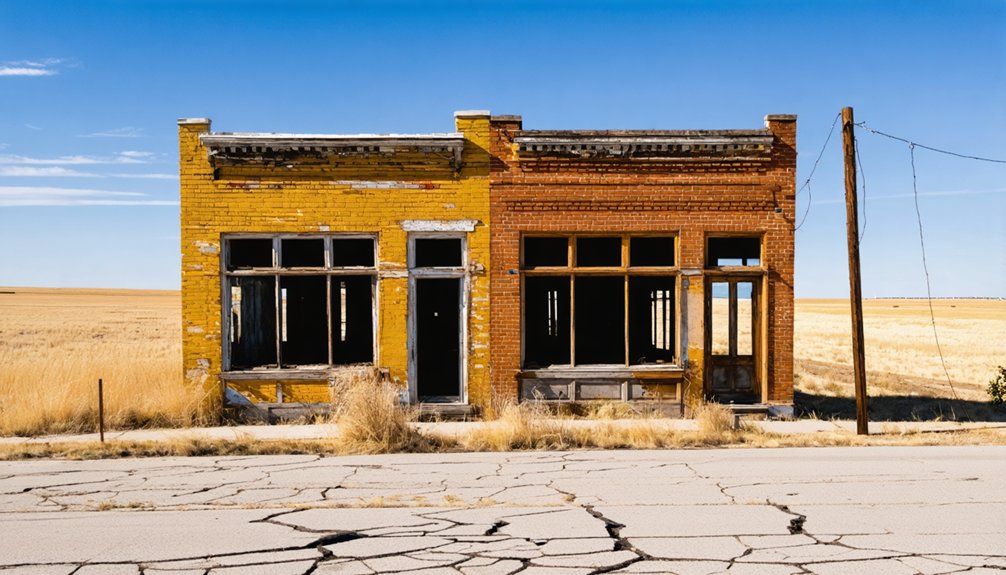
What’s Actually Left to See in Uniontown Today
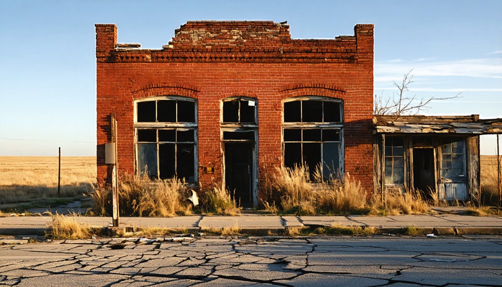
Visiting Uniontown today means trading grand historical spectacle for quieter, more intimate discoveries.
You’ll find a town that wears its history honestly, offering real touchstones rather than polished tourist traps.
Here’s what you can explore:
- Cemetery Remnants — three distinct stone-walled sections marking the original settlement’s soul
- Oregon-California Trail markers — walk paths that 300,000 travelers once crossed
- Agricultural Heritage sites — fertile Marmaton River Valley land still reflecting early farming roots
- Plowboy trading post area — the former commercial hub connecting communities until the 1880s
- National Register historic designations — recognized landmarks honoring Potawatomi history
You’re not chasing reconstructed facades here.
Instead, you’re reading a landscape that speaks directly, rewarding anyone willing to slow down and look carefully.
Driving to Uniontown: The Bourbon County Ghost Town Route
Once you’ve decided Uniontown’s quiet landmarks are worth the drive, getting there becomes part of the experience. Uniontown sits in Bourbon County in southeastern Kansas, roughly near the Missouri border, giving you open highway freedom the entire way.
From the west, take US-54 east through Fort Scott, then navigate south toward Uniontown’s coordinates at 37°50′50″N, 94°58′32″W. The Marmaton River Valley frames your approach with fertile farmland and rolling terrain that rewards unhurried travelers.
Head east on US-54 through Fort Scott, then drift south into the Marmaton River Valley’s quiet, rewarding terrain.
Stop along the route to connect with the broader ghost towns narrative shaping this region’s past. Bourbon County itself carries layered history beneath its quiet roads.
You’re not just driving to a destination — you’re tracing a corridor where settlements rose, collapsed, and occasionally survived against considerable odds.
When to Visit Uniontown and What the Drive Actually Looks Like

Timing matters when you’re planning a road trip to a place as quiet as Uniontown. Spring and fall offer the best travel times, giving you mild weather and open roads through Bourbon County’s scenic routes.
Here’s what to expect on your drive:
- Spring (April–May): Wildflowers line the Marmaton Valley roads, making every mile rewarding.
- Fall (September–October): Harvest colors frame the historic trail markers beautifully.
- Summer: Hot but manageable; cemetery and trail sites stay accessible.
- Winter: Roads can be rough; visit only if you’re chasing solitude.
- Weekdays: You’ll have ghost town remnants almost entirely to yourself.
You’ll pass rolling farmland, quiet crossroads, and trail echoes stretching back 170 years.
Uniontown rewards those who arrive unhurried and curious.
Frequently Asked Questions
Did the Missouri Pacific Railroad Help Revive Uniontown After Its Abandonment?
Like a lifeline stitching wounds, the Missouri Pacific Railroad’s railroad impact breathed community revival into Uniontown. You’d find it transformed from a ghost town shell into a resilient Bourbon County settlement, thriving through the 20th century.
Who Were the Specific Agents That Established the Potawatomi Pay Station?
You’ll discover that agents R.W. Cummins and A.J. Vaughan established the Potawatomi Pay Station, creating one of Kansas’s most fascinating historic landmarks tied to rich Potawatomi history south of the Kansas River.
How Many Stone-Walled Sections Remain in Uniontown’s Historic Cemetery Today?
Like echoes frozen in stone, you’ll find three stone-walled sections standing in Uniontown’s historic cemetery. Their cemetery preservation speaks volumes about the site’s historical significance, letting you touch the past as you explore this remarkable Kansas landmark.
When Was the Methodist Church Officially Organized in Modern Uniontown?
You’ll discover that Uniontown’s Methodist history came alive in 1878, when Church organization officially began with 40 founding members. It’s a reflection of the community’s enduring spirit and resilient faith forged on the frontier.
How Many Estimated Travelers Passed Through Uniontown on the Oregon-California Trail?
Sure, just *casually* stroll the same path as 300,000 travelers! You’d be treading through rich trail history, where countless traveler experiences unfolded as pioneers pushed westward through Uniontown on the legendary Oregon-California Trail.
References
- https://www.potawatomi.org/blog/2024/10/31/researchers-search-for-uniontown/
- https://octa-trails.org/wp-content/uploads/2023/05/Ellis-Uniontown-and-Plowboy–-Potawatomi-Ghost-Towns.pdf
- https://octa-trails.org/archaeology/uniontown-and-plowboy-potawatomi-ghost-towns-enigmas-of-the-oregon-california-trail/
- https://www.potawatomi.org/blog/2018/10/03/remembering-uniontown/
- https://legendsofkansas.com/uniontown-kansas/
- https://en.wikipedia.org/wiki/Uniontown
- https://www.youtube.com/watch?v=uWhi8B0IxYU


