You’ll find Point Pleasant, Indiana‘s vanished settlement at the meeting point of Big Pine Creek and Mud Pine Creek, where John H. Bartlett established his vision in 1830. Despite plans for a thriving community, this Warren County ghost town never expanded beyond Bartlett’s residence and a local liquor store. The wilderness has since reclaimed the land where this “paper town” once stood, leaving only old plat maps as evidence of its brief existence. Its mysterious story holds more secrets than first meets the eye.
Key Takeaways
- Point Pleasant was founded by John H. Bartlett in 1830 near Rocky Ford, at the meeting point of Big Pine and Mud Pine creeks.
- The settlement primarily consisted of Bartlett’s residence and a liquor store, never developing beyond these core structures.
- Point Pleasant became a “paper town,” existing mainly on maps rather than developing into a thriving community.
- Geographic isolation, flooding challenges, and possible disease concerns contributed to the settlement’s eventual abandonment.
- The site has been completely reclaimed by nature, with no physical remnants remaining except for documentation in old plat maps.
The Birth of an Unrealized Dream
Optimism filled the air on July 14, 1830, when John H. Bartlett laid out his vision for Point Pleasant, Indiana.
You can imagine his dreaming development as he surveyed the promising location near the confluence of Big Pine Creek and Mud Pine Creek, an area known as Rocky Ford in Warren County.
Like many land speculators of the time, Bartlett hoped to attract farmers and businesses to establish a thriving community.
Much like the Friends Quaker Church that would establish Pleasant Plain decades later in 1870, this settlement aimed to build a spiritual foundation.
Nestled in the northwestern half of section 33’s northeast quarter, township 23, range 8, Point Pleasant embodied the hopeful spirit of early Indiana settlements.
In a remote corner of Indiana’s frontier, Point Pleasant stood as a testament to pioneer optimism and territorial ambition.
You’d think its strategic position near waterways would’ve guaranteed success, much like other frontier towns of the era.
Yet this settlement’s unrealized potential became evident as time passed. Despite Bartlett’s ambitious plans, Point Pleasant never grew beyond his residence, a solitary liquor store, and possibly a saw mill.
Life Along the Creek Banks
You’ll find that the settlers of Point Pleasant built their lives around the creek banks of Big Pine and Mud Pine Creek, where water access shaped their daily routines.
Living along these waterways meant residents could fish, collect fresh water, and potentially transport goods, though they faced the challenge of seasonal flooding and isolation. Much like the Uncle Jakeys Tavern that first established community gathering in early Point Pleasant Beach, these creek settlements needed central meeting places to thrive. Similar to Colonel Lewis’s troops choosing strategic high ground near the Ohio River, the settlers positioned themselves carefully along the waterways.
The scattered settlement pattern along the creeks ultimately hindered the development of a cohesive community, contributing to Point Pleasant’s failure to thrive beyond its initial platting.
Creek Settlement Patterns
Life along the creek banks shaped the development of early settlements, as communities strategically positioned themselves to maximize access to essential water resources and transportation routes.
You’ll find these settlement dynamics reflected in how Point Pleasant’s residents organized their homes and communal spaces around the waterway, creating a tight-knit community structure that supported shared activities.
The creek wasn’t just a water source – it became the lifeblood of the settlement’s economy. You could’ve seen residents farming the fertile banks, fishing the waters, and trading goods along the waterway. Located at the rivers’ confluence, the settlement was ideally situated to control trade routes between the Kanawha and Ohio Rivers.
These communal resources fostered strong social bonds while supporting diverse economic activities. The community’s careful positioning also provided natural protection, though they’d need to manage challenges like flooding and soil erosion through collective effort and planning. The area’s historical significance was later recognized when it became Tu-Endie-Wei State Park, preserving the legacy of this strategic settlement.
Waterside Living Challenges
While the creek provided essential resources for Point Pleasant’s residents, waterside living presented significant challenges that required constant vigilance and adaptation.
You’d find yourself constantly battling the elements without modern flood control infrastructure, as seasonal rains and snowmelt regularly threatened to inundate your property. Bank erosion could undermine your buildings, and you’d need to maintain or relocate structures near the retreating shoreline.
Water management wasn’t just about protecting property – it affected your daily life. The Herberts Creek waterway meandered through the settlement before canal construction forever changed the natural flow patterns in the 1920s. Just like other Point Pleasant places, this settlement required careful navigation through various waterways.
Though the creek’s waters were initially clean enough to see the bottom, supporting fishing and harvesting, you’d have to monitor water quality closely. The lack of engineered stabilization meant you’d face ongoing challenges with sediment deposits, ice jams, and spring freshets that could disrupt transportation and damage agricultural lands.
A Tale of One Building and a Store
Despite its grand aspirations as a platted settlement, Point Pleasant‘s physical presence centered around just two notable structures: John H. Bartlett’s residence and a liquor store. These buildings represented the limited realization of Bartlett’s legacy and community aspirations for this 1830s venture.
You’ll find that the store served as more than just a business – it was a social gathering point where locals and travelers could connect in this rural Indiana outpost. Like the Camon General Store in Bear Branch, it held significance as a central meeting place for the community.
While historical records mention the possible existence of a sawmill, the village never expanded beyond these core structures. Located near the confluence of Big Pine Creek and Mud Pine Creek, Point Pleasant’s minimal development earned it the classification of a “paper town” – existing primarily on maps rather than as a thriving settlement.
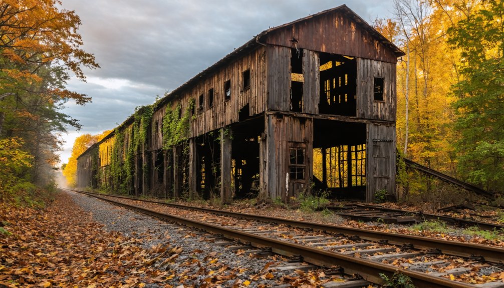
Vanished Without a Trace
Much like other frontier settlements of its era, Point Pleasant gradually faded into obscurity through a perfect storm of challenges.
You’ll find no ghostly remnants of this once-hopeful settlement at the confluence of Big Pine and Mud Pine Creeks – the wilderness has completely reclaimed the land where it stood.
The historical mysteries surrounding Point Pleasant’s disappearance run deep.
Disease fears from nearby Hindostan’s epidemic, combined with the town’s geographic isolation and weak economic foundation, likely drove settlers away.
Like the fate of Baldwin’s hoop factory that produced over 30,000 barrel hoops daily before vanishing completely, Point Pleasant’s industrial aspirations proved fleeting.
Without census records, diaries, or archaeological evidence, you can’t pinpoint exactly when or why the last residents left.
The town’s demise was so complete that even its paper trail vanished, leaving behind only old plat maps as proof it ever existed.
Warren County’s Paper Town Legacy
As frontier settlements emerged across Warren County in the 1830s, Point Pleasant joined several other “paper towns” that never fulfilled their founders’ ambitious visions.
You’ll find its remains near the confluence of Big Pine Creek and Mud Pine Creek, where John H. Bartlett’s dream of a thriving community encountered economic failure.
While Bartlett officially platted Point Pleasant on July 14, 1830, the settlement never grew beyond basic infrastructure.
Despite its official establishment in 1830, Point Pleasant remained little more than a surveyor’s dream on paper.
Unlike successful Warren County towns such as West Lebanon and Williamsport, Point Pleasant couldn’t sustain growth beyond a single residence, liquor store, and possible saw mill.
Today, the town’s legacy lives on primarily through historical records, serving as a reflection of the challenges faced by many paper towns during Indiana’s early settlement period.
Nature Reclaims Its Territory
If you visit the former site of Point Pleasant today, you’ll find a pristine wilderness where Rocky Ford’s creek ecosystems have thoroughly reclaimed the land.
The convergence of Big Pine Creek and Mud Pine Creek continues to shape the landscape, creating a natural haven where wildlife thrives in place of the forgotten structures.
Nature’s complete dominion over the area serves as a demonstration to the resilience of untamed environments, as no trace remains of the paper town that once existed here.
Creek Ecosystems Today
Today’s creek ecosystems in Point Pleasant showcase nature’s remarkable ability to reclaim abandoned territories.
You’ll find clear waters teeming with aquatic life, a demonstration of ecological resilience after years of natural restoration. The creeks now feature diverse habitats, from calm pools to energetic riffles, supporting a variety of fish species that have returned to these waters.
Local community efforts have played an essential role in this biodiversity restoration, with volunteers helping maintain creek habitats and participating in conservation projects.
The surrounding vegetation has stabilized the creek banks, preventing erosion and creating sustainable environments for wildlife. As microorganisms enrich the soil and nutrients cycle naturally through the system, these waterways continue to evolve into increasingly complex and healthy ecosystems that you’re free to explore and appreciate.
Untamed Wilderness Returns
The untamed wilderness of Point Pleasant tells a compelling story of nature’s patient reclamation.
You’ll find native hardwoods like oak, hickory, and maple have replaced the town’s old structures, while ferns and wildflowers carpet the forest floor. Through natural succession spanning two centuries, the abandoned settlement near Rocky Ford has transformed into a thriving ecosystem.
This wildlife resurgence has brought white-tailed deer, raccoons, and countless songbirds back to their ancestral habitat.
The confluence of Big Pine Creek and Mud Pine Creek now supports diverse aquatic life, with healthy riparian zones protecting water quality.
The site’s ecological balance demonstrates nature’s resilience – where buildings once stood, you’ll now discover undisturbed forest and farmland, proving that when humans step back, wilderness flourishes unrestrained.
Frequently Asked Questions
What Did Native Americans Call the Area Before Point Pleasant?
You’d be surprised to learn that Point Pleasant wasn’t in Indiana but in West Virginia. Native tribes, particularly the Shawnee, called the Ohio River Valley area “Kenawha” before European settlement.
Were There Any Known Accidents or Deaths in Point Pleasant?
You won’t find any documented fatal incidents here – available historical records show no evidence of accidents or deaths in this small village’s brief existence during its settled period.
What Was the Average Land Price During Point Pleasant’s Existence?
You won’t find specific land value records from Point Pleasant’s era, though typical Indiana property sales in the 1830s ranged from $1.25 to $5 per acre for undeveloped land.
Did Any Famous Pioneers or Travelers Pass Through Point Pleasant?
You won’t find any famous pioneers or documented travelers passing through, as historical records show no major pioneer routes there. The town’s minimal development didn’t attract notable traveler anecdotes.
Were There Any Archaeological Excavations Conducted at the Point Pleasant Site?
Like pieces of a scattered puzzle, you’ll find limited archaeological findings at the site, with no major formal excavations documented. Local historical reports mention basic surface discoveries but lack detailed excavation techniques.
References
- https://kids.kiddle.co/Point_Pleasant
- https://www.heraldtimesonline.com/story/lifestyle/home-garden/2020/05/01/ghost-towns-in-ohio-and-indiana/43807535/
- https://theclio.com/entry/171695
- https://www.youtube.com/watch?v=sNnDNhorvq0
- https://en.wikipedia.org/wiki/Point_Pleasant
- http://freepages.rootsweb.com/~gtusa/history/usa/in.htm
- https://dbpedia.org/page/Point_Pleasant
- https://en.wikipedia.org/wiki/List_of_ghost_towns_in_Indiana
- https://kids.kiddle.co/List_of_ghost_towns_in_Indiana
- https://pphsm.org/timelines-and-sites/