You’ll find Prescott Township’s story beneath the waters of Massachusetts’ Quabbin Reservoir. Founded in 1822 and named after Revolutionary War hero Colonel William Prescott, this rural community met its end in 1938 when state authorities disincorporated it alongside three other towns. By 1946, the Swift River Valley Project had submerged Prescott under 412 billion gallons of water, displacing 2,500 residents and erasing 242 miles of roads. The reservoir’s depths still hold countless untold tales of this lost community.
Key Takeaways
- Prescott, Massachusetts was disincorporated in 1938 along with three other towns to create the Quabbin Reservoir water supply system.
- The town’s complete submersion began in 1939 when flooding started, turning the community into an underwater ghost town.
- Before flooding, authorities demolished 1,100 structures and relocated 7,600 graves from the affected towns, including Prescott.
- Founded in 1822, Prescott had historical significance as home to Revolutionary War hero Colonel William Prescott and Daniel Shay.
- The town’s transformation contributed to the creation of a 412-billion-gallon reservoir that now supplies water to Greater Boston.
The Rise and Fall of Prescott Township
Founded in 1822, Prescott Township emerged from portions of Pelham and New Salem in Massachusetts, taking its name from Revolutionary War hero Colonel William Prescott. Built on Equivalent Lands originally allocated to Connecticut Colony settlers, the township became a symbol of community resilience during early American resistance movements, particularly during Shay’s Rebellion.
You’ll find rich historical narratives woven through Prescott’s past, from Daniel Shay’s homestead to the mysterious tales of Dogtown’s outcasts. To assist users searching for information about this historic location, Wikipedia maintains a disambiguation page that distinguishes this Prescott from other places sharing the name.
Despite remaining the least populous among Swift River Valley towns with only 300 residents by 1900, Prescott maintained its rural character until 1938. That year, the government disincorporated the township to create the Quabbin Reservoir, forcing residents to relocate and leaving their former home largely submerged beneath the waters that would supply Boston’s growing needs. Today, the unsubmerged portion exists as Prescott Peninsula, a protected wildlife sanctuary closed to public access.
The Swift River Valley Project Timeline
You’ll find that the Swift River Valley Project‘s construction phase began in 1930 with intensive land clearing, grave relocations, and the building of essential infrastructure like the Winsor Dam.
The physical transformation of the valley continued through August 14, 1939, when workers sealed the Swift River diversion tunnel to begin flooding the basin. The project’s legal foundation was established when the Swift River Act provided the necessary funding for construction in 1927.
The flooding phase lasted from 1939 to 1946, gradually filling the 412-billion-gallon reservoir at roughly 500,000 gallons per day until it reached its full capacity of 25,000 acres. The project ultimately displaced 2,500 residents from their homes across the four towns of Prescott, Dana, Greenwich, and Enfield.
Construction Timeline 1930-1939
The massive Swift River Valley Project began in 1930 with the construction of two critical earthen dams – Goodnough Dike and Winsor Dam – to create what would become the Quabbin Reservoir.
These earthen structures, completed by 1935, featured watertight concrete chambers beneath massive earth masses.
From 1933 to 1939, workers blasted and built the 25-mile Quabbin Aqueduct to transport water toward Boston.
During this period, you’d have witnessed the dramatic transformation of Prescott’s history and community legacy as over 40,000 acres were cleared.
By 1938, Prescott and three other towns were officially disincorporated, with roughly 2,500 residents forced to leave.
Workers demolished or burned most buildings, relocated cemeteries, and abandoned the Boston and Albany Railroad’s Athol Branch to prepare for the valley’s flooding.
Chief Engineer Frank E. Winsor oversaw the entire construction process from start to completion.
The reservoir finally reached its full capacity after seven years of filling with water from local sources and rainfall.
Flooding Years 1939-1946
After sealing a critical tunnel on August 14, 1939, the Swift River Valley‘s transformation into the Quabbin Reservoir began its seven-year flooding process.
You’d have witnessed the gradual submergence of four towns – Dana, Enfield, Greenwich, and Prescott – which had already been officially disincorporated in 1938. The flooding impacts were immense: 2,500 residents lost their homes, 1,100 structures were demolished, and 7,600 graves were relocated. The communities held a Farewell Ball on April 27, 1938, marking their final days as functioning towns.
Workers removed 31.5 miles of railroad tracks, abandoned 242 miles of roads, and relocated 36 miles of highways. The community displacement forever changed the region’s landscape, as crews cleared all vegetation before the waters rose. The reservoir ultimately created a 412 billion gallon water supply for Greater Boston’s growing population.
Last Days of a Lost Community
During its final decade, Prescott’s transformation from thriving community to reservoir bed unfolded through a series of decisive events.
By 1928, you’d have witnessed the town’s declining population surrender its administration to the state. Originally settled for its rich farmland, the town had prospered through agriculture before its decline. As community memories faded, the government seized remaining properties through eminent domain in 1938, leading to Prescott’s official disincorporation on April 28.
The town’s water rights were acquired by the Metropolitan Water District in 1895 as Boston sought new water supplies.
The lost identity of 2,500 displaced residents marked the end of an era, as guards blocked roads and enforced evacuation. Workers systematically cleared every structure, removed 7,500 remains from local cemeteries, and stripped the land bare.
Engineering Marvel: Building Quabbin Reservoir
You’ll find the Quabbin Reservoir project’s most impressive feat in its dual earthen dams – the 2,640-foot Winsor Dam and Goodnough Dike – which were engineered between 1927 and 1947 to create a watertight basin from the Swift River Valley.
The construction required the integration of a sophisticated 24.6-mile underground aqueduct system, complete with shafts and support buildings, to channel pristine water directly to Boston.
To maximize the reservoir’s efficiency, engineers designed strategic water delivery systems that included baffle dams, intake structures, and outlet buildings connected by 36 miles of service roads.
Massive Dam Construction Project
While initial proposals for the Swift and Ware Rivers water supply emerged in 1895, the massive Quabbin Reservoir construction project didn’t begin until 1926, when the Massachusetts legislature authorized it under Chapter 375 Acts.
Two major earthen structures, Winsor Dam and Goodnough Dike, anchored the ambitious dam engineering effort between 1930 and 1939.
The water management project required clearing 60,000 acres, with workers relocating infrastructure and preparing the Swift River Valley for submersion.
You’ll find impressive statistics in the construction: the dams were designed to hold over 400 billion gallons of water.
After completion in 1939, it took seven years for the reservoir to reach full capacity, with the Swift and Ware Rivers gradually filling the basin until 1946.
Underground Aqueduct Engineering Systems
Beyond the massive dams, an intricate underground aqueduct system formed the engineering backbone of the Quabbin Reservoir project.
You’ll find these engineering marvels buried 200 to 500 feet beneath the surface, carved directly into bedrock and lined with concrete for maximum durability.
The system’s natural siphon principle defies conventional limits, moving water through deep tunnels without the need for pumping.
Water purification occurs naturally as it flows through distinct thermal layers – from cold Wachusett water to warm surface waters.
The aqueduct’s design preserves these essential layers while allowing extended residence time for natural light and mixing processes to enhance water quality.
Modern tunnel boring machines have revolutionized this type of construction, replacing the manual labor methods of the past.
Strategic Water Supply Design
Since its inception, the Quabbin Reservoir stands as one of America’s most ambitious water supply projects, engineered with a staggering 412 billion gallon capacity across 40 square miles.
You’ll find an intricate network of dams, control structures, and transmission systems designed to deliver pristine water while maintaining strict quality standards.
The reservoir’s watershed management strategy covers 187 square miles, with 57% of lands under state ownership to protect water quality.
You won’t find swimming or direct contact recreation here – it’s all part of a calculated design to prevent contamination.
The system’s sophisticated monitoring networks and control gates, like those at Shafts 1, 2, 9, and 12, allow precise flow regulation.
Through carefully planned forestry practices and land-use restrictions, the reservoir continues to serve as a marvel of strategic water infrastructure.
Relocation and Remembrance: Moving the Dead
As part of the Quabbin Reservoir project, authorities undertook the massive task of relocating over 7,500 deceased individuals from more than thirty cemeteries across Dana, Enfield, Greenwich, and Prescott.
The grave relocation process required careful coordination between state agencies and local communities before flooding could begin. Most remains were transported to the newly established Quabbin Park Cemetery in Ware, Massachusetts.
The community impact of this massive undertaking continues to resonate today.
You’ll find former residents and their descendants gathering for commemorative events at the Quabbin Park Cemetery, which serves as a focal point for collective mourning.
The Swift River Valley Historical Society organizes annual tours of Prescott Peninsula, while oral histories and artifacts help preserve the memory of these displaced communities.
Transportation Networks Redrawn
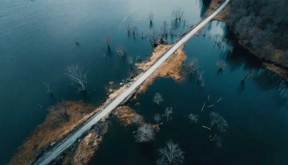
When construction of the Quabbin Reservoir began in 1939, engineers faced the complex task of dismantling Prescott’s entire transportation infrastructure. They removed local roads and bridges, while railway lines were abandoned or rerouted outside the watershed.
The flooding required massive transportation shifts as Winsor Dam and Goodnough Dike severed existing corridors across the Swift River Valley.
You’ll find today’s access limitations reflect this transformation. The reservoir’s numbered gates (1-21) replaced former open routes, with many permanently closed for security.
Service roads now exist solely for authorized personnel maintaining the water infrastructure. Surrounding towns like Belchertown and Ware had to adapt their road networks, creating bypass routes around protected zones.
Former transport corridors have become trail systems, accessible mainly by foot or bike.
Environmental Transformation of the Valley
The transformation of Swift River Valley into the Quabbin Reservoir stands as one of America’s most ambitious environmental reconfigurations.
You’ll find this massive landscape transformation created a 39-square-mile artificial reservoir with 181 miles of shoreline, forever altering the valley’s natural character.
The ecological impacts extend far beyond the initial flooding.
Today, you’ll see dense forests covering 89% of the 23,000-acre watershed, acting as natural biofilters that maintain the reservoir’s pristine water quality.
These forests, carefully monitored since the 1960s through Continuous Forest Inventory plots, protect the water supply for 2.7 million residents.
While historical challenges like acid rain have been overcome, you’ll now find new threats emerging, from invasive species to climate change impacts, requiring constant vigilance to preserve this engineered ecosystem.
Preserving the Memory of Prescott Today

Through carefully planned preservation efforts, Prescott’s memory lives on at multiple sites around the Quabbin Reservoir area.
You’ll find over 7,500 carefully relocated graves at Quabbin Park Cemetery, where former residents now rest in dignity. The Massachusetts DCR offers interpretive programs that’ll connect you to the town’s legacy through guided tours and educational presentations.
You can explore Prescott’s history through preserved records at the University of Massachusetts archives, which house town documents and artifacts.
The area’s designated trails let you witness geographic remnants of the former settlement, while memorial plaques mark significant locations.
Local historical societies maintain active community engagement through commemorative events, and they’ve collected oral histories to guarantee memory preservation for future generations.
Frequently Asked Questions
What Happened to the Household Pets During the Town’s Evacuation?
You’ll find no direct records of pet rescue efforts, but families likely took their animals when relocating in 1938. Some animal abandonment probably occurred, though exact numbers weren’t documented.
Did Any Residents Refuse to Leave Their Homes Until Forcibly Removed?
While resident resistance existed from the project’s start, there’s no documented evidence of forced relocations in Prescott. You’ll find the evacuation was systematic and legal, though unquestionably traumatic for residents.
Are There Any Underwater Structures Still Visible During Drought Conditions?
You’ll spot some house foundations during extreme droughts, but don’t get too excited – underwater visibility is mostly limited to Dana’s remains. Prescott’s structures rarely emerge from Quabbin’s murky depths.
What Was the Average Compensation Paid to Displaced Prescott Property Owners?
You won’t find exact average displacement compensation figures since historical records don’t specify individual payments, though you’ll know property values were assessed at pre-flooding levels when landowners received their one-time settlements.
Were Any Historical Artifacts Recovered From Prescott Before the Flooding?
While you’d think they’d grab everything shiny, officials mainly focused on moving 6,601 graves. Historical artifact recovery was limited to documenting stone walls and foundations – most town relics sleep beneath the waves now.
References
- http://findingaids.library.umass.edu/ead/mums021
- https://www.youtube.com/watch?v=sZGMqwtMeLw
- https://thepursuitofhistory.org/2022/01/24/towns-of-the-swift-river-valley-lost-to-the-quabbin-reservoir/
- https://en.wikipedia.org/wiki/Quabbin_Reservoir
- https://www.harvardmagazine.com/2023/08/quabbin-reservoir-lost-towns-elena-palladino
- https://historyofmassachusetts.org/ghost-towns-massachusetts/
- https://en.wikipedia.org/wiki/Prescott
- https://www.geotab.com/ghost-towns/
- https://www.outoftheoffice4good.com/post/hiking-to-the-abandoned-town-of-dana-massachusetts
- https://en.wikipedia.org/wiki/List_of_ghost_towns_in_Massachusetts
