You’ll find America’s riverbank ghost towns submerged due to massive federal dam projects in the mid-20th century that transformed over 600,000 miles of rivers into reservoirs. These communities, already weakened by economic decline and the Great Depression, faced mandatory evacuation as the government prioritized hydroelectric power and water management. Indigenous peoples and local residents received inadequate compensation for their displacement. The stories of these lost communities continue to surface when drought conditions expose their haunting remains.
Key Takeaways
- Mid-20th century dam construction for hydroelectric power and water management led to intentional flooding of numerous riverside communities.
- Economic decline from shifting transportation methods and single-industry dependence made many riverbank towns unsustainable.
- Federal infrastructure projects authorized displacement of communities through Flood Control Acts, often with inadequate compensation.
- The Great Depression accelerated town abandonment as younger residents migrated to cities, leaving aging populations behind.
- Government policies prioritized dam development over community preservation, systematically erasing historical settlements through mandatory relocations.
The Rise and Fall of 19th Century River Valley Settlements
While rivers have always served as natural highways for human migration and trade, the establishment of 19th-century American river valley settlements marked a transformative period in the nation’s expansion.
You’ll find that settlement patterns closely followed waterways, with communities sprouting at strategic river crossings and confluences like St. Louis. These locations weren’t chosen by chance – they offered fertile soil for farming, easy transportation for goods, and access to valuable resources like timber and fur. The Louisiana Purchase in 1803 dramatically expanded American settlement opportunities along major waterways by doubling the size of U.S. territory. Thomas Jefferson’s vision of an empire of liberty drove much of this westward expansion along the Mississippi River.
However, this growth came at a devastating cost to indigenous communities, who’d long inhabited these regions. Disease epidemics weakened their resistance to displacement, while settler colonial strategies deliberately encircled tribal lands.
The rivers that once sustained native populations became corridors of colonial expansion, fundamentally altering both the social and ecological landscape of America’s river valleys.
Federal Dam Projects: Reshaping America’s Waterways
You’ll find that America’s mid-20th century federal dam construction reshaped entire regions through massive infrastructure projects spanning from the Columbia River to the Tennessee Valley.
These initiatives primarily served to generate hydroelectric power while creating reservoirs that submerged countless riverside communities, forcing the relocation of residents and permanently altering historical settlement patterns. The resulting reservoirs and impoundments led to lethal temperatures for native fish populations.
The construction of major dams like those in the Columbia River Basin fundamentally transformed local economies from river-based trade and fishing to industrial-scale power generation and irrigation systems, with government officials in the 1940s and 1950s viewing tribal fishery destruction as a benefit during dam planning.
Major Construction Initiatives Nationwide
During the “Big Dam Era” from 1930 to 1970, federal agencies transformed America’s waterways through an unprecedented construction campaign that resulted in approximately 84,000 dams nationwide.
You’ll find these massive projects impounded 600,000 miles of rivers – roughly 17% of America’s total river length – forever altering the nation’s landscape.
The dam engineering feats were staggering. At Hoover Dam alone, workers excavated over 1.5 million cubic yards of earth while pioneering new construction techniques. These innovative projects served as multipurpose dams that revolutionized infrastructure development.
Under federal oversight, agencies like the Bureau of Reclamation and Army Corps of Engineers managed complex bidding processes and coordinated massive concrete pours. States like Georgia contributed significantly with projects like the Aberdeen Lock and Dam creating vital waterways.
These projects served multiple purposes: irrigation, flood control, recreation, and industrial cooling water.
The scale was immense – just look at Hoover Dam, which now supplies water to 16 million people and irrigates 1.5 million acres.
Power Generation Drives Development
As federal agencies commenced on massive dam construction projects across America’s waterways, power generation emerged as a primary driver of development.
You’ll discover how these initiatives fundamentally altered river ecosystems and displaced communities in pursuit of hydroelectric power.
- Federal dams reshaped entire watersheds, controlling water flow specifically for power generation needs.
- Native American tribes faced forced relocation as their ancestral lands and sacred sites vanished underwater.
Salmon populations plummeted from over 10 million to 1 million due to these massive construction projects.
– Some dam operators later abandoned hydroelectric operations due to costly federal licensing requirements.
Many of these massive structures are now reaching critical age points, with 73 percent of dams projected to exceed 50 years old by 2025.
– Solar power increasingly replaces hydroelectric capacity as aging dams face removal.
These power generation projects delivered electricity but at a steep cost – disrupting natural river flows, blocking fish migration, and forever changing the social fabric of riverbank communities.
Today’s energy landscape shows a shift toward balancing power needs with environmental and cultural preservation.
Relocating Communities For Progress
While the promise of progress through federal dam projects brought new infrastructure to America’s waterways, it came at an enormous human cost. You’ll find that thousands of residents, particularly Indigenous communities, were forced to abandon their homes and ancestral lands. The government’s relocation policies, justified by flood control and hydropower needs, often provided inadequate compensation while destroying community resilience.
The Flood Control Acts of 1928 and 1944 authorized massive displacement campaigns, with projects like the Garrison Dam flooding 90% of three affiliated tribes’ territory. This systematic erasure has contributed to historical amnesia, as once-thriving riverbank communities disappeared beneath reservoir waters. Recent efforts like the Klamath River restoration demonstrate a shift toward acknowledging past injustices and returning rivers to their natural state. The removal of four dams will restore 300-400 miles of vital fish habitat, helping repair decades of environmental damage.
You’re witnessing the lasting impact today, as displaced populations still struggle with the loss of their cultural heritage, traditional livelihoods, and deep-rooted social networks.
Economic Decline Before the Waters Rose
Before the waters claimed these riverside communities, many had already experienced devastating economic decline through various interconnected factors.
You’ll find that economic sustainability and community resilience were severely challenged as these towns faced multiple pressures that eroded their viability:
- Transportation shifts hit hard as railroads replaced river commerce, eliminating vital economic functions.
- Many communities relied too heavily on single industries like mining or agriculture, leaving them vulnerable when those sectors faltered.
- The Great Depression accelerated existing declines by depleting local capital and reducing demand.
- Young residents migrated to cities seeking better opportunities, leaving aging populations and shuttered businesses.
These economic struggles often meant that by the time dam projects arrived, many riverbank communities had already lost significant population and commercial activity, making their eventual submersion less contested.
Life in the Valley: Communities Lost to Progress
Before the dams flooded their valleys, these towns supported vibrant communities where families worked mills, farmed fertile riverside land, and sustained close-knit social bonds for generations.
You’ll find that communities like Dana, Enfield, and Greenwich exemplified typical valley life until the 1930s, when 2,500 residents faced mandatory relocation for the Quabbin Reservoir project.
As you explore these lost communities’ stories, you’ll discover how residents, particularly older generations with lifelong connections to their towns, gathered for emotional farewells before abandoning their homes to the rising waters.
Valley Life Before Dams
Throughout America’s river valleys, vibrant communities once flourished along natural waterways, establishing intricate networks of trade, agriculture, and cultural exchange. You’d find a world where river access shaped every aspect of daily life, from economic survival to community interaction.
- Indigenous settlements thrived for centuries at prime fishing spots like Celilo Falls, maintaining sustainable practices.
- Small forts and trading posts dotted the riverbanks, serving as crucial hubs for commerce and social gatherings.
- Farmers relied on seasonal floods to nourish their crops while moving goods downstream via rafts and boats.
- Local economies centered around fishing, timber harvesting, and agriculture, all sustained by the river’s natural cycles.
These self-sufficient communities maintained a delicate balance with their environment, one that would soon face unprecedented change.
Stories of Forced Relocation
As waves of development swept across America’s river valleys, Indigenous communities faced systematic displacement from their ancestral lands through forced relocations that forever altered the nation’s cultural landscape.
You’ll find evidence of this displacement trauma in the Trail of Tears, where 60,000 Native Americans were forcibly marched westward, facing disease, starvation, and death. Their cultural survival was severely compromised as they lost access to traditional hunting grounds, sacred sites, and sustainable agricultural practices.
The economic impact was devastating – relocated tribes encountered infertile lands, chronic unemployment, and forced dependency on government support.
Today, these historical wounds continue to deepen as climate change forces coastal Indigenous communities to abandon their lands once again, perpetuating cycles of displacement that threaten traditional ways of life.
Environmental Impact of Reservoir Creation
When artificial reservoirs flood vast areas of land, they trigger a complex chain of environmental consequences that extend far beyond their shorelines.
You’ll find that reservoir emissions release significant amounts of methane as submerged organic matter decomposes, while disrupted sediment transport starves downstream ecosystems of essential nutrients.
- Methane emissions spike during initial flooding, accounting for 5.2% of human-caused methane releases
- Trapped sediments create “dead zones” that block natural river flow and nutrient cycles
- Flooding destroys existing carbon sinks like forests and agricultural lands
- Altered water temperatures and oxygen levels devastate native fish populations
The environmental toll isn’t just immediate – it’s lasting.
These changes ripple through interconnected ecosystems, from riverbanks to coastal waters, fundamentally altering landscapes that once sustained thriving communities and diverse wildlife.
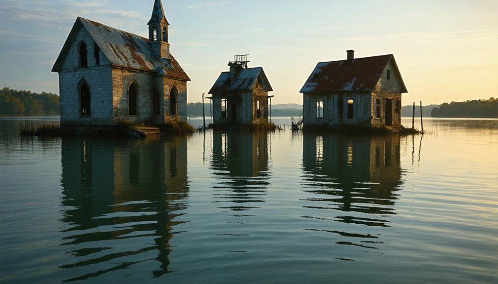
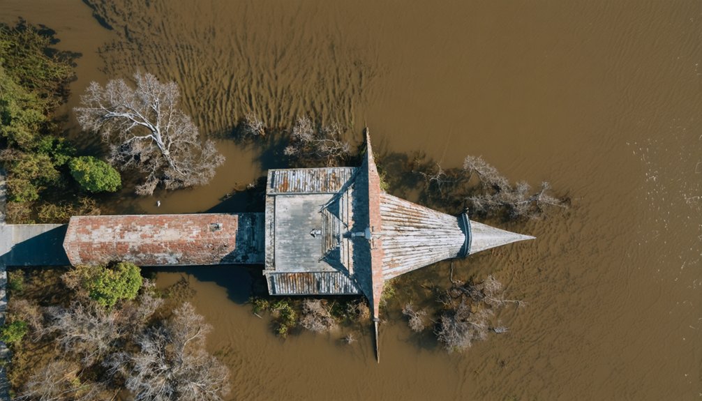
Ghost Towns Beneath the Surface: A Hidden History
The creation of America’s vast reservoir system didn’t just transform ecosystems – it erased entire communities from the map.
You’ll find forgotten histories of submerged settlements across the nation, from Gad, West Virginia beneath Summersville Lake to Loyston, Tennessee under Norris Lake’s waters.
When government agencies like the Army Corps of Engineers and TVA built massive dams, they forced thousands from their homes.
The flooding of Preston Bend, Hagerman, and other towns for Lake Texoma in 1944 left only memories behind.
At Fort Berthold Reservation, 325 families watched their lands disappear under Lake Sakakawea.
During droughts and drawdowns, you can glimpse these lost places.
Lake Mead’s falling waters revealed St. Thomas, Nevada, while Lake Texoma’s recession exposed old gravestones – temporary windows into America’s submerged past.
Cultural Legacy and Local Folklore
Three enduring cultural legacies define America’s riverbank ghost towns: vibrant community histories, haunting folklore, and persistent local traditions.
These abandoned settlements weave cultural connections through time, from Native American heritage to post-Civil War communities of freed African Americans.
Forgotten riverside towns tell an unbroken story, linking ancient indigenous settlements with the hopeful communities of newly emancipated people.
- Old Cahawba’s glowing orbs and mysterious apparitions fuel haunting narratives that keep the town’s memory alive.
- Chaperito’s distinctive cemetery headstones reveal the rich ethnic and religious fabric of past riverside life.
- Wild dog tales from Cahawba symbolize survival amid isolation and abandonment.
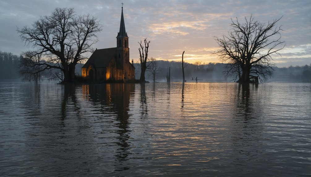
- Flagstaff’s submerged church steeples spark underwater legends that captivate locals.
You’ll find these stories preserved not just in archaeology, but in the living memory of communities that still tell tales of their drowned and deserted predecessors.
Each ghost town’s legacy enriches America’s cultural landscape, even long after its physical structures have vanished.
Among the most intriguing are the abandoned towns in the United States, each telling a unique story of a bygone era. Visitors can explore remnants of these once-thriving communities, which serve as poignant reminders of the country’s ever-changing landscape. From the dust of the desert to the overgrown forests, these sites invite reflection on what it means to leave a place behind.
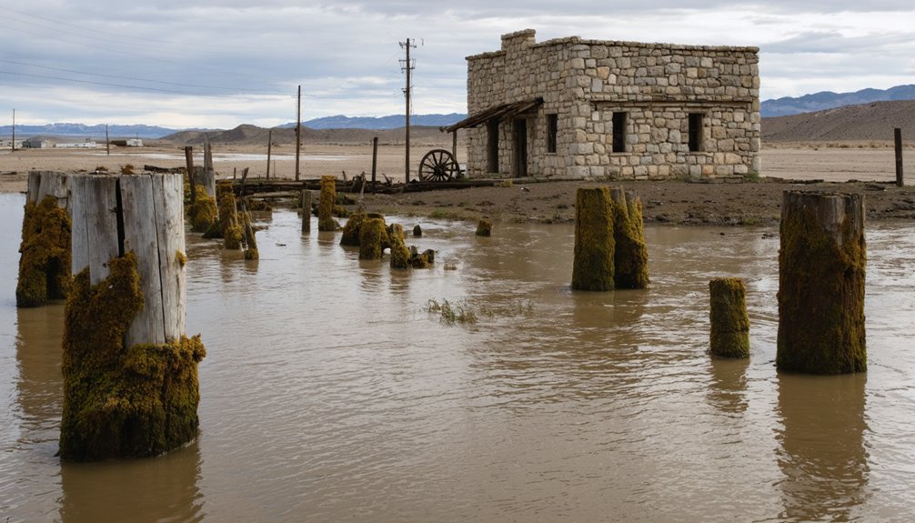
Drought Reveals the Past: Temporary Time Capsules
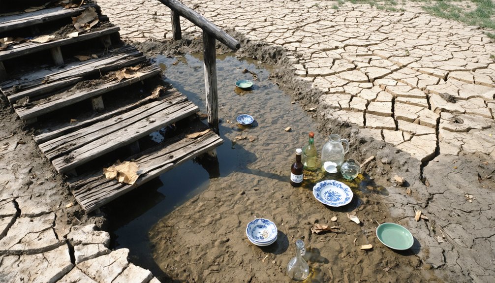
When severe droughts strike reservoirs across America, you’ll witness the remarkable resurfacing of long-submerged ghost towns that have rested beneath the waters for decades.
You can explore these temporary exposures of historical settlements, where foundations, artifacts, and structures emerge like time capsules from their watery tombs.
Your window to examine these preserved remnants of 19th and early 20th-century life is brief, as rising water levels will eventually reclaim these sites, concealing them once again beneath the reservoir’s surface.
Hidden History Surfaces Again
Severe droughts across America’s waterways have disclosed remarkable glimpses into submerged history, as falling water levels expose long-hidden ghost towns and artifacts beneath major reservoirs.
These temporary time capsules reveal hidden artifacts from communities sacrificed for progress, offering you rare chances to witness submerged heritage firsthand.
- The steamboat North Alabama has emerged from the Missouri River’s depths, its hull a symbol of 1870s river commerce.
- Former towns like Lemoyne reveal their foundations, streets, and root cellars as Lake McConaughy’s waters recede.
- Lake Mead’s dropping levels expose St. Thomas, Nevada, a community flooded by Hoover Dam’s construction.
- Building remains and personal belongings connect modern visitors with displaced residents’ stories.
While these discoveries spark historical interest, they also remind you of the environmental and social costs of large-scale water management projects.
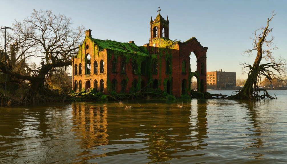
Ruins Tell Their Tales
Each newly exposed ghost town brings its own remarkable story to light, as falling water levels transform submerged ruins into open-air museums.
You’ll find the ruins’ significance extends far beyond crumbling foundations – they’re windows into America’s pioneering spirit, from 19th-century gold rush settlements to Native American communities displaced by progress.
These temporary revelations offer rare archaeological insights through artifacts that paint vivid pictures of daily life: ice cream parlors in Mormon settlements, root cellars of farming communities, and remnants of the Gentry Hotel in St. Thomas.
While you can’t remove these historical treasures, you’re free to photograph and study them before rising waters reclaim them.
Each drought-exposed foundation, brick wall, and personal relic tells a story of resilience, adaptation, and the price of development.
Preserving Memories: Documentation and Archives
As riverbank ghost towns faced imminent submersion, extensive documentation efforts emerged to preserve their historical legacy.
Despite archival challenges like time constraints and rising water levels, organizations like the Civilian Conservation Corps and National Park Service worked systematically to safeguard historical memories before sites disappeared underwater.
Racing against rising waters, dedicated teams worked tirelessly to preserve history before these riverbank communities vanished forever beneath the surface.
- Museums, such as Lost City Museum, now house recovered artifacts and serve as crucial memory preservation centers.
- Archaeological teams combined traditional excavation with modern sonar technology to document underwater sites.
- The 1930s saw systematic documentation of sites, including relocation of 175 structures from Neversink, NY.
- Multi-disciplinary teams of archaeologists, historians, and conservationists reconstructed site contexts through fieldwork and archival research.
Today, you’ll find these preserved memories in regional museums, which continue to educate visitors about these lost communities while supporting local economies through heritage tourism.
Modern Water Management vs. Historical Conservation
While modern water management strategies have delivered essential infrastructure benefits, they’ve often come at the steep cost of submerging historical communities. You can see this tension clearly in projects like the Quabbin Reservoir, where Boston’s water needs trumped the preservation of entire towns.
These decisions weren’t just about infrastructure – they fundamentally altered the cultural landscape of America’s waterways.
Today’s water management challenges highlight this ongoing conflict. As droughts reveal long-submerged structures, you’re forced to confront the trade-offs between progress and preservation.
The submergence of Native American settlements, pioneer towns, and ancestral burial grounds raises significant questions about whose history gets preserved. While dams and reservoirs serve vital functions in flood control and water supply, their creation has permanently erased countless pages of American history.
Frequently Asked Questions
Can Scuba Divers Legally Explore Submerged Ghost Towns?
Like diving into history itself, you can legally explore submerged ghost towns while following scuba regulations – just don’t remove artifacts or disturb sites without proper permits from state authorities.
What Happens to Underwater Structures After Decades of Submersion?
You’ll find extensive structural decay through chemical corrosion, microbial attack, and physical erosion. Underwater archaeology reveals how saltwater deteriorates metals, concrete weakens, and wood rots over decades of submersion.
How Do Property Rights Work for Land Beneath Reservoir Waters?
Like a chess game where pieces shift control, you’ll find property ownership beneath reservoirs depends on whether waters were navigable at statehood – states control those, while feds regulate non-navigable ones.
Are There Plans to Drain Any Reservoirs to Restore Historic Towns?
You won’t find any active plans to drain reservoirs for historic preservation. Current restoration projects focus on dam removal for ecological benefits, not exposing submerged towns beneath reservoir waters.
Do Fish Populations Thrive Around Submerged Building Remains?
Like ancient ruins sheltering modern nomads, submerged building remains create complex fish habitat that supports thriving populations. You’ll find these aquatic ecosystems teeming with diverse species seeking refuge and breeding grounds.
References
- https://www.sfchronicle.com/bayarea/article/Reservoir-ghost-towns-offer-glimpse-of-history-6677377.php
- https://devblog.batchgeo.com/ghost-towns/
- https://www.mentalfloss.com/geography/wanderlust/creepiest-ghost-towns-united-states
- https://www.geotab.com/ghost-towns/
- https://www.loveexploring.com/gallerylist/188219/the-us-state-with-the-most-ghost-towns-revealed
- https://247wallst.com/special-report/2018/11/02/30-american-ghost-towns-3/
- https://en.wikipedia.org/wiki/Lists_of_ghost_towns_in_the_United_States
- https://jasontdunn.com/files/ghost_towns_big_cities.pdf
- https://www.blm.gov/visit/fairbank-historic-townsite
- https://www.lovemoney.com/gallerylist/86648/americas-empty-ghost-towns-and-why-theyre-abandoned-today