If you’re planning a ghost town road trip, Allenhurst, Florida deserves a spot on your list. This forgotten fishing village on Merritt Island once housed around 50 residents near Haulover Canal before NASA quietly bought out the entire community in the 1960s. Today, almost nothing remains except a small gravesite on federal land. Route 3 gets you close, but you’ll need permission to visit. Stick around to uncover everything you need to know before you go.
Key Takeaways
- Allenhurst, once a fishing community on Merritt Island near Haulover Canal, was erased in 1963 when NASA acquired the land for Kennedy Space Center.
- No structures remain today; the only physical marker is a small gravesite on NASA-controlled land.
- Access requires contacting Kennedy Space Center for permission, as the site is on federal property not open to the public.
- Approach the gravesite via Route 3 near Haulover Canal, suitable for two-wheel-drive vehicles.
- Allenhurst is one of 17 NASA-displaced towns; nearby ghost towns like Shiloh and Courtenay can extend your road trip.
What Was Allenhurst Before NASA Took Over?
Before NASA reshaped the Florida coastline, Allenhurst was a quiet fishing community tucked onto Merritt Island in Brevard County, thriving near the waters of Haulover Canal.
By 1939, around 50 residents called it home, building their lives around sport fishing and waterfront recreation. It earned recognition as one of the area’s leading fishing communities, drawing anglers who valued direct access to rich local wildlife and open water.
You won’t find many historical photographs documenting daily life there — it was small, unhurried, and largely undocumented. But what existed was genuine: a tight-knit settlement shaped by the rhythms of the water rather than commercial ambition.
Allenhurst wasn’t a boomtown. It was a place where people chose a simpler, nature-connected life — until outside forces made that choice for them.
How Allenhurst Went From Fishing Village to Ghost Town
When NASA began acquiring land on Merritt Island in 1963, Allenhurst’s fate was sealed. The federal government bought out residents and cleared the land to make way for Kennedy Space Center’s expansion.
Families who’d built their lives around Allenhurst’s rich fishing heritage had no choice but to leave.
What had once been a thriving waterfront community — one of the region’s leading sport fishing destinations — was demolished almost entirely. No structures survived the shift.
NASA absorbed the land, erasing decades of ghost town history before the town even earned that label.
Today, only a small gravesite remains on NASA-controlled property, serving as a quiet marker of what once existed. You won’t find streets or buildings — just land that space exploration claimed and time has largely forgotten.
What Survives at the Allenhurst Site Today?
Though Allenhurst once buzzed with anglers and waterfront life, almost nothing physical survives today. When you visit, you’ll find that NASA’s expansion erased nearly every structure the community built. No buildings stand. No docks remain. The landscape offers little proof that roughly 50 people once called this place home.
What you *will* find is a small gravesite sitting quietly on NASA-controlled property. That burial ground anchors the local legends surrounding Allenhurst and keeps ghost town myths alive for curious travelers like you. It’s the town’s last honest footprint.
Don’t expect a marked historic district or interpretive signage. You’re stepping onto active federal land near Merritt Island, so access is limited. Research entry requirements before you go, and bring realistic expectations alongside your sense of adventure.
Is the Allenhurst Gravesite Accessible to Visitors?
That gravesite pulls at your curiosity, but reaching it isn’t as simple as plugging an address into your GPS. The remaining burial ground sits on NASA-controlled property, which means access follows federal land rules rather than open public trails. You can’t simply drive out and wander the site freely.
Your best move is to contact Kennedy Space Center in advance and ask about authorized access or guided opportunities. Some visitors connect with local historical groups who arrange periodic visits tied to Merritt Island’s fishing history and community displacement narratives.
Route 3 near Haulover Canal puts you in the general vicinity, and 2WD conditions make the approach manageable. But respect the boundaries — honoring this forgotten community means following the rules that now govern its final resting place.
Where Is Allenhurst Located on Merritt Island?
You’ll find Allenhurst on Merritt Island, a barrier island nestled between the Indian River and the Banana River in Brevard County, Florida.
The former settlement sat near Haulover Canal, the waterway that once made it a natural hub for sport fishing and waterfront recreation.
To reach the site today, you’ll follow Route 3, also known as Kennedy Parkway, which cuts through the area now controlled by NASA.
Merritt Island’s Geographic Position
Merritt Island sits wedged between the Indian River Lagoon to the west and the Banana River to the east, forming a narrow strip of Florida coastline that feels both isolated and ecologically rich. This barrier island stretches roughly 25 miles long, positioned just east of Titusville and north of Cocoa.
You’re standing in a place where cultural heritage runs deep, shaped by fishing communities, Indigenous history, and Cold War ambition. The island’s geography made it naturally appealing for settlement — sheltered waterways, abundant marine life, and accessible canal routes like Haulover Canal defined daily life here.
Local legends tied to these fishing villages still drift through conversations among longtime residents. That layered past is exactly what makes a road trip through Merritt Island feel like genuine discovery rather than ordinary tourism.
Near Haulover Canal
Where exactly did Allenhurst sit on this long, layered island? You’ll find its footprint near Haulover Canal, tucked into the northern stretch of Merritt Island where freshwater and saltwater once traded places with the tides. That waterway wasn’t just scenery — it was the lifeblood of a historic fishing culture that drew anglers and settlers alike to this remote, sun-baked edge of Brevard County.
The canal gave Allenhurst its identity and its economy. Residents built their lives around casting lines and reading currents. But that same isolated geography made community displacement easier when NASA came knocking in 1963. There was no dense urban buffer to complicate the buyouts. Just a quiet waterfront settlement, swallowed whole by the expanding ambitions of the space age.
Accessing Via Route 3
Getting there means trading beachside sprawl for the quieter spine of the island. Route 3, also called Kennedy Parkway, runs directly through Merritt Island and puts you closest to where Allenhurst once stood. You’ll follow a road that cuts through land shaped by both fishing history and federal ambition — a stretch that feels open, unhurried, and honestly a little forgotten.
Keep Haulover Canal on your mental map as you steer. The community stories tied to this area are faint now, absorbed by NASA’s controlled property lines and decades of silence. There’s no welcome sign, no marker crowd.
What you’re steering toward is a sliver of memory — a small gravesite sitting on land that once held a tight-knit waterfront town.
How to Reach the Allenhurst Site From Kennedy Parkway
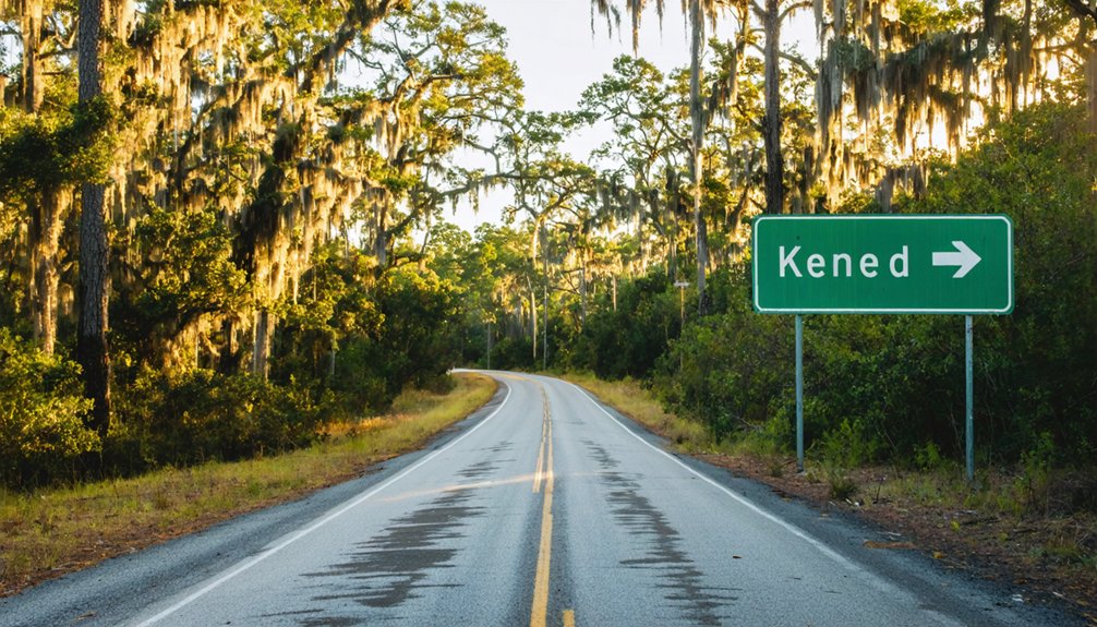
You’ll want to start your approach on Route 3, also known as Kennedy Parkway, which serves as your main corridor toward the former Allenhurst site.
From there, navigate toward Haulover Canal on Merritt Island, using the waterway as your landmark anchor since the original town grew up around it.
Once you’re near the canal, look for the small gravesite area tucked within NASA-controlled property — it’s the only visible remnant you’ll find on the ground.
Starting From Kennedy Parkway
Kennedy Parkway (Route 3) is your starting point for reaching what little remains of Allenhurst, placing you on a road that cuts through NASA’s vast Merritt Island property. You’ll be driving through land that once held a living, breathing fishing community — one with its own historical architecture, local legends, and waterfront identity.
Today, that world is gone, absorbed by space-age ambition in 1963. As you travel Kennedy Parkway, watch for access points near Haulover Canal, where Allenhurst once thrived.
The road is manageable in a standard 2WD vehicle, so you won’t need specialized equipment. Keep your expectations grounded — what awaits you isn’t a restored district but a quiet, largely erased landscape where a small gravesite marks the town’s final, stubborn presence.
Once you’re moving along Kennedy Parkway, your next focus is Haulover Canal — the waterway that once defined Allenhurst’s identity as a fishing community. Follow the parkway north until the canal comes into view, cutting through Merritt Island’s flat, open landscape.
This stretch carries local legends of anglers who built their lives around these waters before NASA’s arrival erased nearly everything.
Don’t expect historical architecture or roadside markers pointing you toward the old townsite. The land is NASA-controlled, and access is limited.
What you’re steering toward is more atmosphere than monument — a place where the canal still flows exactly as it did when 50 residents called this home.
Keep your eyes open, move deliberately, and let the landscape tell the story the signage won’t.
Locating The Gravesite Area
From Kennedy Parkway, the gravesite area sits close to Haulover Canal on NASA-controlled land — and that distinction matters. You’re not wandering into a preserved historic district with marked trails and visitor centers. This is restricted federal property, which means access requires awareness and respect for current boundaries before you arrive.
The gravesite stands as one of the few remaining historical landmarks connecting modern visitors to Allenhurst’s vanished fishing community. Local legends suggest the settlement once thrived with sport fishermen and waterfront families before NASA’s 1963 expansion erased nearly everything.
Route 3 along Kennedy Parkway puts you closest to the general vicinity. Research current NASA access policies before visiting — regulations shift, and the last thing you want is turning back at a security checkpoint.
What You’ll Actually See When You Visit Allenhurst

Unlike many historic sites where remnants of buildings or infrastructure hint at a community’s past, Allenhurst offers almost nothing to the naked eye. You won’t find historical artifacts scattered across the landscape or interpretive signs explaining what once stood here.
NASA’s land acquisition erased nearly every physical trace of this former fishing community.
What you’ll find is the small gravesite area, a quiet, sobering reminder that real families built their lives here before the space age swallowed everything.
Local legends about displaced residents and a thriving angling culture are really all that survive alongside those modest grave markers.
Come with realistic expectations. You’re visiting a place defined more by absence than presence, and that erasure tells its own powerful story about progress and the communities it leaves behind.
When to Visit Allenhurst and What to Bring
Planning your visit well makes a real difference at a site like Allenhurst, where the experience depends heavily on your own preparation rather than on-site amenities or guided tours.
Fall and winter months offer cooler temperatures and fewer insects, making outdoor exploration far more comfortable. Florida’s summer heat and humidity can make any roadside stop feel punishing.
For visitor safety, wear closed-toe shoes, bring water, and pack insect repellent. Since you’re navigating NASA-adjacent property near Haulover Canal, check access conditions before heading out.
Respect any historical preservation boundaries around the gravesite — don’t disturb markers or remove anything from the area.
Bring a camera, a paper map as backup, and a charged phone. You’re exploring on your own terms, so come prepared to make the most of it.
Other Ghost Towns Displaced by Kennedy Space Center
Allenhurst wasn’t the only community NASA erased when Kennedy Space Center took shape in the early 1960s. Across Merritt Island, roughly 17 towns and settlements vanished as the government bought out residents and cleared the land for space program infrastructure.
If you’re already road-tripping through this stretch of Florida, you’ll find that exploring these other lost communities deepens your understanding of just how much the Space Age cost the people who already called this place home.
Communities NASA Displaced
While Allenhurst wasn’t the only community swallowed up by NASA’s rapid expansion in the 1960s, its story is part of a much larger displacement. Around 17 communities once thrived across Merritt Island, each carrying its own historical fishing culture, local economy, and tight-knit identity.
NASA’s land acquisition erased them almost entirely, leaving behind little more than scattered ghost town artifacts and faded memories. Towns like Shiloh, Wilson, and Orsino disappeared just as Allenhurst did — residents bought out, structures demolished, and land absorbed into what became Kennedy Space Center.
When you visit this region, you’re not just standing near one lost town. You’re standing at the edge of an entire erased world, where families, livelihoods, and communities were quietly traded for the space age.
Lost Towns Of Merritt Island
Merritt Island once held nearly 17 distinct communities, each shaped by Florida’s waterways, fishing culture, and frontier spirit. NASA’s land acquisition in 1963 erased most of them, leaving behind stories worth knowing before you visit.
Here are four lost towns that shared Allenhurst’s fate:
- Shiloh – A farming settlement swallowed by space center expansion
- Courtenay – A citrus-driven community lost to federal buyouts
- Aurantia – Once a thriving grove town, now completely vanished
- Wilson – A small waterfront village displaced alongside its neighbors
Historical preservation efforts have been minimal across all these sites. You’ll find no museums or markers for most of them.
Knowing their names keeps their memory alive, even when the land doesn’t.
Planning a Florida Ghost Town Road Trip Around Allenhurst
If you’re planning a ghost town road trip through Florida, Allenhurst makes for a compelling stop on Merritt Island near Haulover Canal. Follow Route 3 along Kennedy Parkway, and you’ll enter territory steeped in local legends of fishing communities swallowed by the space age.
A 2WD vehicle handles the access roads fine, making it an easy detour.
The site itself sits on NASA-controlled property, so don’t expect historical artifacts or preserved structures. What remains is a small gravesite — a quiet marker of the roughly 50 residents who once called this fishing town home before 1963’s land acquisition erased it.
Pair your visit with nearby Canaveral National Seashore for fuller context of what this stretch of Florida coastline looked like before Kennedy Space Center changed everything.
Frequently Asked Questions
Was Allenhurst Ever Officially Incorporated as a Florida Municipality?
Like Brigadoon fading at dawn, Allenhurst never gained official incorporation. You won’t find it on municipal records — it’s purely ghost town tourism territory now, where abandoned landmarks whisper stories of a fishing community NASA’s ambitions quietly erased.
Are There Any Historical Photographs of Allenhurst Still Available Today?
You’ll find limited images of Allenhurst through historical photo archives, but they’re scarce given the town’s erasure. Dedicated ghost town preservation researchers remain your best resource for uncovering rare photographs documenting this vanished Florida fishing community.
How Many Residents Were Displaced When NASA Acquired Allenhurst’s Land?
Like sand swept away by a rising tide, Allenhurst’s roughly 50 residents couldn’t escape NASA land acquisition’s reach. You’d find resident displacement was total — everyone was bought out and relocated when NASA absorbed the community around 1963.
Did Allenhurst Have a Post Office or School Before Demolition?
The available records don’t confirm whether Allenhurst had a post office or school before demolition. As you explore its ghost town remnants and forgotten landmarks, you’ll find its fishing community identity remains its most documented legacy.
Are Any Descendants of Allenhurst Residents Still Living in Brevard County?
With 50 residents in 1939, Allenhurst’s roots run deep. You’ll likely find descendants still living in Brevard County — genealogy research and local family stories can connect you to the people who once called this fishing community home.
References
- https://en.wikipedia.org/wiki/Allenhurst
- https://www.ghosttowns.com/states/fl/allenhurst.html
- http://www.gribblenation.org/2018/02/ghost-town-tuesday-ghost-towns-of.html