Salem, KS
County:
Greenwood
Zip Code:
Latitude / Longitude:
38°01’15″N 096°26’01″W
Elevation:
1,565 ft (477 m)
Time Zone:
Central (CST) (UTC-6)
Established:
Disestablished:
Comments:
Salem Township is a township in Greenwood County, Kansas, USA.
Remains:
Salem Township covers an of 90.72 square miles (235.0 km2) and contains no incorporated settlements. The ghost town of Teterville is located in the township.
Current Status:
As of the 2000 census, its population was 35.
Remarks:
The streams of Battle Creek and Swing Creek run through this township.
Santa Fe, KS
County:
Zip Code:
Latitude / Longitude:
Elevation:
Time Zone:
Central (CST) (UTC-6)
Established:
Disestablished:
Comments:
Remains:
Current Status:
Remarks:
Saratoga, KS
County:
Zip Code:
Latitude / Longitude:
Elevation:
Time Zone:
Central (CST) (UTC-6)
Established:
Disestablished:
Comments:
Remains:
Current Status:
Remarks:
Saxman, KS
County:
Rice
Zip Code:
Latitude / Longitude:
38°16’50″N 98°07’27″W
Elevation:
1,631 ft (497 m)
Time Zone:
Central (CST) (UTC-6)
Established:
Disestablished:
Comments:
Saxman is an unincorporated community in southwestern Wilson Township, Rice County, Kansas, United States. Located along Cow Creek just above its confluence with Jarvis Creek, it lies along local roads southeast of Lyons, the county seat of Rice County.
Remains:
For millennia, the land now known as Kansas was inhabited by Native Americans. In 1803, most of modern Kansas was secured by the United States as part of the Louisiana Purchase. In 1854, the Kansas Territory was organized, then in 1861 Kansas became the 34th U.S. state. In 1867, Rice County was founded.
Current Status:
In May 2007, Saxman was severely affected by flooding from Cow Creek. The flooding washed away roads and farms and damaged many of the community’s residences. Several of the community’s residents were forced to evacuate.
Remarks:
A post office was opened in Saxman in 1891, and remained in operation until it was discontinued in 1952.
Shaffer, KS
County:
Zip Code:
Latitude / Longitude:
Elevation:
Time Zone:
Central (CST) (UTC-6)
Established:
Disestablished:
Comments:
Remains:
Current Status:
Remarks:
Sheridan, KS
County:
Cowley
Zip Code:
Latitude / Longitude:
37°16’14″N 096°46’52″W
Elevation:
1,266 ft (386 m)
Time Zone:
Central (CST) (UTC-6)
Established:
Disestablished:
Comments:
Sheridan Township is a township in Cowley County, Kansas, USA.
Remains:
Sheridan Township covers an of 35.76 square miles (92.6 km2) and contains no incorporated settlements. According to the USGS, it contains one cemetery, Silver Creek.
Current Status:
As of the 2000 census, its population was 159.
Remarks:
The streams of Plum Creek and Plum Creek run through this township.
Sherlock, KS
County:
Finney
Zip Code:
Latitude / Longitude:
37°57’36″N 101°01’14″W
Elevation:
2,953 ft (900 m)
Time Zone:
Central (CST) (UTC-6)
Established:
Disestablished:
Comments:
Sherlock Township is a township in Finney County, in the U.S. state of Kansas.
Remains:
Sherlock Township covers an area of 162.03 square miles (419.7 km2) and contains one incorporated settlement, Holcomb. According to the USGS, it contains one cemetery, Toper.
Current Status:
As of the 2000 census, its population was 2,758.
Remarks:
Shipton, KS
County:
Saline
Zip Code:
Latitude / Longitude:
38° 54′ 50″ N, 97° 40′ 56″ W
Elevation:
Time Zone:
Central (CST) (UTC-6)
Established:
Disestablished:
Comments:
Shipton is an unincorporated community in Saline County, Kansas, in the United States.
Remains:
The post office in Shipton was discontinued in 1895.
Current Status:
Remarks:
Sibley, KS
County:
Cloud
Zip Code:
Latitude / Longitude:
39°36’54″N 97°42’5″W
Elevation:
1,375 ft (419 m)
Time Zone:
Central (CST) (UTC-6)
Established:
Disestablished:
Comments:
Sibley was a settlement in Cloud County, Kansas, United States, north of Concordia and the Republican River.
Remains:
Sibley was founded in 1869, and named for Lake Sibley. It was once in the running for the county seat but lost in an 1870 run-off election against Concordia.
Current Status:
The population is now abandoned as a town and the land is privately owned and used for farming. It is considered a ghost town.
Remarks:
Sidney, KS
County:
Zip Code:
Latitude / Longitude:
Elevation:
Time Zone:
Central (CST) (UTC-6)
Established:
Disestablished:
Comments:
Remains:
Current Status:
Remarks:
Silkville, KS
County:
Franklin
Zip Code:
Latitude / Longitude:
38°27’00″N 95°29’21″W
Elevation:
Time Zone:
Central (CST) (UTC-6)
Established:
Disestablished:
Comments:
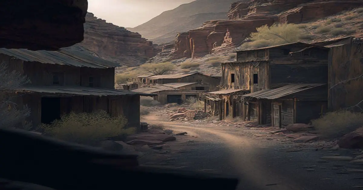
Silkville is a ghost town in Williamsburg Township, Franklin County, Kansas, United States. Its elevation is 1,161 feet (354 m), and it is located at 38°27’0″N 95°29’21″W (38.4500149, -95.4891477), along U.S. Route 50 southwest of Williamsburg.
Remains:
The settlement was founded in the late 1800s by a Frenchman named Ernest de Boissière, who was a believer in Charles Fourier’s idea of a utopian socialism. Silkville was a sericulture-based settlement, and remuneration was based on the proportion of production for each settler. Silkville’s silk was praised at the Centennial Exposition in Philadelphia in 1876, but loss of settlers and difficulty in selling the silk resulted in the settlements collapse. Today, only a few buildings remain.
Current Status:
Today, little remains of Silkville. Many of the original buildings were destroyed by a 1916 fire, and only three stone structures survive: the settlement’s school house, and two barns. The original chateau that Boissiere constructed—which, at the time of its construction cost US$10,000—was destroyed in the aforementioned fire, and a modern home was built over the west end of the ruin, utilizing some of the stone from the original. One of the modern day barns was once the settlement’s cocoonery, although it was reduced to a one-level building after a tornado damaged the top floor. In 1972, these buildings were added to the National Register of Historic Places because of their significance in the history of Kansas. The aspects of the community seen as most significant historically were its nature as an intentional community and its practice of sericulture.
Remarks:
The settlement was established in 1870 by Frenchman Ernest de Boissière. Because Boissière had been born into a noble family and had political inclinations—which were heavily inspired by the specific socialist philosophy of Charles Fourier—opposed by France’s then-ruler Napoleon III, he was forced to flee. Boissière first settled in New Orleans, but soon received heavy criticism for his decision to financially support orphaned black children. He then decided to move to Kansas; he concluded that the state afforded him both the potential to practice his political ideas and create the type of community he desired. Boissière then purchased between 3000 and 3500 acres of land in the county from the Kansas Educational Association of the Methodist Episcopal Church in 1869 and went about setting up his intentional settlement.
Sitka, KS
County:
Clark
Zip Code:
Latitude / Longitude:
37°10’30″N 99°39’5″W
Elevation:
Time Zone:
Central (CST) (UTC-6)
Established:
1909
Disestablished:
Comments:
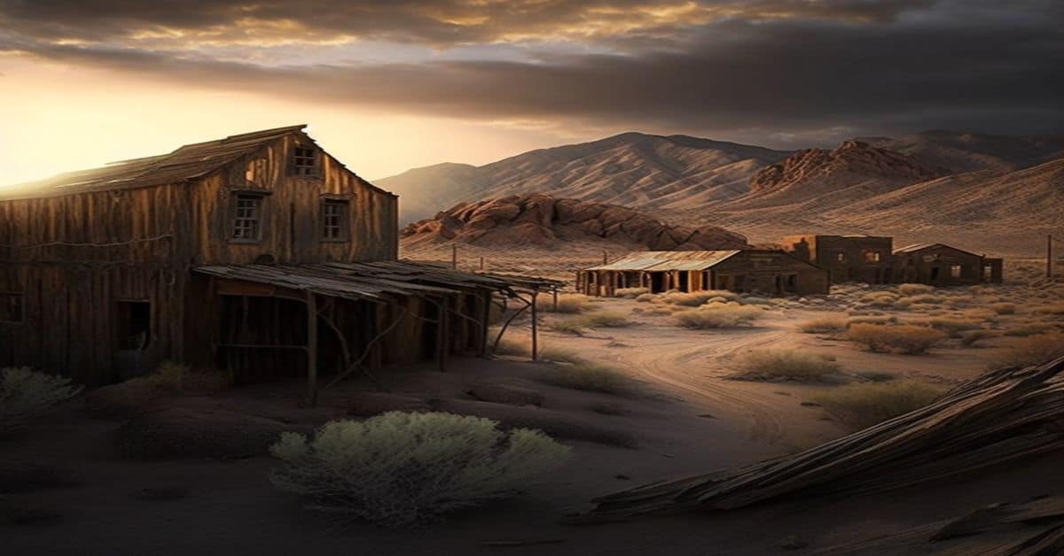
Sitka is an unincorporated community in Clark County, Kansas, United States.
Remains:
Sitka was founded in 1909. Its post office was closed on May 22, 1964. The Atchison, Topeka and Santa Fe depot, built in 1930, has been moved to Dodge City and is now part of the Boot Hill Museum.
Current Status:
The town today consists of only one occupied house, a grain elevator, a few vacant buildings, and numerous ruins. Most of the town is on private property.
Remarks:
Six-Mile House, KS
County:
Zip Code:
Latitude / Longitude:
Elevation:
Time Zone:
Central (CST) (UTC-6)
Established:
Disestablished:
Comments:
Remains:
Current Status:
Remarks:
Skiddy, KS
County:
Morris
Zip Code:
Latitude / Longitude:
38°52’5″N 96°47’40″W
Elevation:
1,240 ft (380 m)
Time Zone:
Central (CST) (UTC-6)
Established:
1870
Disestablished:
Comments:
Skiddy is an unincorporated community in northern Morris County, Kansas, United States.
Remains:
Skiddy was founded in 1870. It was named after railroad magnate Francis Skiddy. Between March 11, 1879, and August 3, 1883, it was renamed Camden.
Current Status:
The post office in Skiddy was discontinued in 1953. The Missouri–Kansas–Texas Railroad served Skiddy for many years, and the grain elevator adjacent to the railroad tracks still stands today.
Remarks:
Smileyberg, KS
County:
Zip Code:
Latitude / Longitude:
Elevation:
Time Zone:
Central (CST) (UTC-6)
Established:
Disestablished:
Comments:
Remains:
Current Status:
Remarks:
Smoky Hill City, KS
County:
Ellis
Zip Code:
Latitude / Longitude:
38° 45′ 42.4″ N, 99° 31′ 55.9″ W
Elevation:
Time Zone:
Central (CST) (UTC-6)
Established:
Disestablished:
Comments:
Smoky Hill City is an abandoned ghost town in Ellis County, Kansas, United States. It lies approximately 12 miles (19 km) southwest of Hays.
Remains:
The land was bought by Charles K. Holliday of Topeka, and a townsite plat was filed with the county in 1899. Holliday began selling town lots. Some of the first residents came from the town of Chetolah, just across the Smoky Hill River. Chetolah had been founded ten years earlier in the anticipation of a railroad connection that was never built. With the influential Hollidays backing the new town of Smoky Hill City, residents of Chetolah deserted to the new town.
Current Status:
The designation of Smoky Hill City as a townsite was vacated by Ellis County in 1905, at the request of Charles Holliday. The settlement survived for several more years, but was eventually completely abandoned.
Remarks:
Charles Holliday was the son of railroad magnate Cyrus K. Holliday. Both father and son believed that the contained valuable mineral deposits. The town was situated on the north bank of the Smoky Hill River to serve the gold mines that Charles Holliday imagined would spring up to mine the supposed gold-bearing shale along the Smoky Hill River valley.
Spring Lake/Artesian City, KS
County:
Zip Code:
Latitude / Longitude:
Elevation:
Time Zone:
Central (CST) (UTC-6)
Established:
Disestablished:
Comments:
Remains:
Current Status:
Remarks:
Springdale, KS
County:
Leavenworth
Zip Code:
Latitude / Longitude:
39° 15′ 32.4″ N, 95° 7′ 26.4″ W
Elevation:
Time Zone:
Central (CST) (UTC-6)
Established:
Disestablished:
Comments:
Springdale is an unincorporated community in Leavenworth County, in the U.S. state of Kansas.
Remains:
Springdale was platted in 1860. A post office was established at Springdale in 1860, and remained in operation until it was discontinued in 1907.
Current Status:
Remarks:
Springfield, KS
County:
Zip Code:
Latitude / Longitude:
Elevation:
Time Zone:
Central (CST) (UTC-6)
Established:
Disestablished:
Comments:
Remains:
Current Status:
Remarks:
Stanton, KS
County:
Miami
Zip Code:
Latitude / Longitude:
38° 32′ 36″ N, 95° 3′ 16″ W
Elevation:
Time Zone:
Central (CST) (UTC-6)
Established:
Disestablished:
Comments:
Stanton is an unincorporated community in Miami County, Kansas, in the United States.
Remains:
Stanton was founded in 1855. Stanton had a post office from 1857 until 1903.
Current Status:
Remarks:
Stockdale, KS
County:
Zip Code:
Latitude / Longitude:
Elevation:
Time Zone:
Central (CST) (UTC-6)
Established:
Disestablished:
Comments:
Remains:
Current Status:
Remarks:
Strawberry, KS
County:
Zip Code:
Latitude / Longitude:
Elevation:
Time Zone:
Central (CST) (UTC-6)
Established:
Disestablished:
Comments:
Remains:
Current Status:
Remarks:
Strawn, KS
County:
Coffey
Zip Code:
66839
Latitude / Longitude:
38°16’N 95°44’W
Elevation:
1,102 ft (336 m)
Time Zone:
Central (CST) (UTC-6)
Established:
Disestablished:
Comments:
New Strawn is a city in Coffey County, Kansas, United States.
Remains:
The city of New Strawn came about when John Redmond Reservoir was built, causing the original town of Strawn to be claimed by the Army Corp of Engineers for flood . The old city of Strawn is usually available for exploration. The streets are still distinguishable, although the land was rescaped after the demolition of the buildings. The school at “old” Strawn had a two-room school with first through fourth grades in one room and fifth through eighth grade in the second room. Church services were held in the same building on Sunday.
Current Status:
As of the 2010 census, the city population was 394.
Remarks:
New Strawn is noted in the for the top-notch fishing in its city lake, and for its Fourth of July Fireworks show.
Stringtown/Woodstock, KS
County:
Zip Code:
Latitude / Longitude:
Elevation:
Time Zone:
Central (CST) (UTC-6)
Established:
Disestablished:
Comments:
Remains:
Current Status:
Remarks:
Stull, KS
County:
Douglas
Zip Code:
Latitude / Longitude:
38°58’16″N 95°27’22″W
Elevation:
938 ft (286 m)
Time Zone:
Central (CST) (UTC-6)
Established:
Disestablished:
Comments:
Stull is an unincorporated community in Douglas County, Kansas, United States. Founded in the mid-1800s, the settlement was initially known as Deer Creek until it was renamed after its first postermaster, Sylvester Stull.
Remains:
It seems likely that the town was founded in 1856; during this time it was originally called Deer Creek. The was settled mainly by people of German and Pennsylvania Dutch ancestry, and by 1857, six families were living in the vicinity. In that same year, the settlers constructed a stone church on land donated by Jacob Hildenbrand; this was later dubbed the “Evangelical Emmanuel Church” (in 1859, Hildenbrand donated more land for use as a cemetery). Until 1908, the sermons at the small country chapel were preached in German. On April 27, 1899, a post office was established in the small community, headed by Sylvester Stull. Soon after the office was established, the residents of the community began referring to their settlement as “Stull”. According to the book Soil of Our Souls, the United States post office simply used the name of the postmaster to refer to the postal office, but other sources suggest that the name may have been chosen by the community to memorialize Stull’s service in the . Regardless of its origin, the name stuck, the post office itself was discontinued in 1903.
Current Status:
The Stull Cemetery has gained an ominous reputation due to urban legends involving Satan, the occult, and a purported “gateway to Hell”. The rumors about the cemetery were popularized by a November 1974 issue of the University Daily Kansan (the student newspaper of the University of Kansas), which claimed that the Devil himself appeared in Stull twice a year: once on Halloween, and once on the spring equinox. After this article, the legend began to grow, eventually becoming more and more exaggerated. Soon, people said that the cemetery was the location of one of the seven gates to Hell. Eventually, the nearby Evangelical Emmanuel Church ruin became part of the story. People claimed that it was “possessed” by the Devil, and that bottles thrown against its wall would not be shattered. When the chapel’s roof was destroyed during a storm, some said that rain water would not fall into the structure, even though its interior was exposed to the elements. With all this said, most academics, historians, and local residents are in agreement that the legend of the cemetery is false, not based on local folklore, and is perhaps best explained as the product of imaginative college students.
Remarks:
By the turn of the 21st century, the eastern wall of the Evangelical Emmanuel Church ruin had collapsed, and in early 2002, the structure’s western wall caved in following a windstorm. In March of that year, the building was demolished. Initially, locals were unsure who had approved the razing, but it was eventually revealed that John Haase, a Lecompton resident who owned the land upon where the church was located, had authorized the demolition. Haase had been contacted a few days before by the Douglas County sheriff’s department, who expressed their worry that the abandoned structure was at risk of collapsing and possibly injuring someone.
Sumner City, KS
County:
Zip Code:
Latitude / Longitude:
Elevation:
Time Zone:
Central (CST) (UTC-6)
Established:
Disestablished:
Comments:
Remains:
Current Status:
Remarks:
Sun City, KS
County:
Barber
Zip Code:
67143
Latitude / Longitude:
37°22’45″N 98°55’3″W
Elevation:
1,670 ft (509 m)
Time Zone:
Central (CST) (UTC-6)
Established:
1872
Disestablished:
Comments:
Sun City is a city in Barber County, Kansas, United States, along the Medicine Lodge River.
Remains:
Sun City was founded in 1872. The first post office in Sun City was established in August 1873.
Current Status:
As of the 2010 census, the city population was 53.
Remarks:
Sunflower Village (Clearview City), KS
County:
DeSoto, Johnson
Zip Code:
Latitude / Longitude:
38°56’31.90″N 95°0’11.9″W
Elevation:
Time Zone:
Central (CST) (UTC-6)
Established:
1942
Disestablished:
Comments:
Sunflower Village, also known as Clearview City, was a historic complex used to house the workers of the now defunct Sunflower Army Ammunition Plant in DeSoto, Johnson County, Kansas, United States.
Remains:
In 1960, the of Sunflower Village reached nearly 18,000 during the Vietnam War when production of ammunition at the plant was at its peak. Following the war, steadily declined durning the mid-1970s, dropping to 4,200 by 1980.
Current Status:
In 1987, 6 acres of houses in the eastern portion of Sunflower Village were demolished due to damage and age. That population is now home to Countryside Elementary School.
Remarks:
Superior, KS
County:
McPherson
Zip Code:
Latitude / Longitude:
Elevation:
Time Zone:
Central (CST) (UTC-6)
Established:
Disestablished:
Comments:
Superior Township is a township in McPherson County, Kansas, in the United States.
Remains:
Superior Township was organized in 1874.
Current Status:
Remarks:
Sveadal, KS
County:
Zip Code:
Latitude / Longitude:
Elevation:
Time Zone: Central (CST) (UTC-6)
Established:
Disestablished:
Comments:
Remains:
Current Status:
Remarks: