Palisade, NV
County:
Eureka
Zip Code:
Latitude / Longitude:
40°36′37″N 116°11′55″W / 40.61028°N 116.19861°W / 40.61028 -116.19861
Elevation:
Time Zone:
Pacific (PST) (UTC-8)
Established:
Disestablished:
Comments:
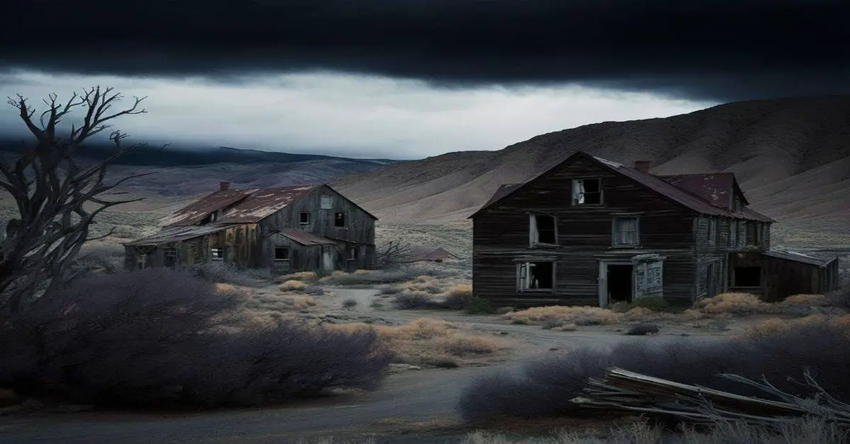
Palisade (originally called Palisades) is located in Eureka County in the northeastern section of the state of Nevada, in the western United States. It is about 10 miles (16 km) south of Carlin, and about 33 miles (53 km) southwest of Elko. Although now a virtual ghost town, it had a rich history following construction of the Transcontinental Railroad. Palisade Canyon (also called “12-Mile” and “10-Mile Canyon”), an important obstacle to the construction and operation of the railroad, lies just to the west.
Remains:
Palisade was the site of an elaborate hoax during the early 1870s, probably to boost tourism. Whenever a train arrived, the residents were said to stage rampant gunfights and bank robberies. Nobody was privy to knowledge of the hoax except the residents, and the showmanship died off after several years. In reality, crime in Palisade was low and the town did not even have a sheriff.
Current Status:
Since the 1920s, the town was owned by relatives of Atlanta businessman John Sexton, who sold the entire town at an auction on April 26, 2005, in San Francisco. The town was sold to an unidentified bidder for $150,000. John Sexton, who had not visited Palisade for some 35 years, said he sold the town because he needed tuition money for his daughter to go to college.
Remarks:
In 1932, according to legend, Palisade may have been the site of a possible assassination attempt on the life of President Herbert Hoover. Shortly before Hoover’s train was to pass through the town, one railroad inspector said he came across a vagrant by a trestle with 22 sticks of dynamite. Two men skirmished with the inspector and then fled, but another inspector disputed the story and said the vagrant did not have dynamite.
Palmetto, NV
County:
Esmeralda
Zip Code:
Latitude / Longitude:
37° 26′ 40″ N, 117° 41′ 41″ W
Elevation:
Time Zone:
Pacific (PST) (UTC-8)
Established:
Disestablished:
Comments:
Palmetto, Nevada is a ghost town in Esmeralda County, in the U.S. state of Nevada.
Remains:
Palmetto was founded and established in 1866, the time when silver was found.
Current Status:
Although the town was abandoned in a year, folks returned in 1906 when mines were reopened and several businesses started up as well. However, this lasted only a few months as well, as people abandoned Palmetto for Blair. The same kind of attempt at a comeback was made in 1920 with the same results. All that stands today are the remains of old buildings.
Remarks:
Parran, NV
County:
Churchill
Zip Code:
Latitude / Longitude:
Elevation:
Time Zone:
Pacific (PST) (UTC-8)
Established:
Disestablished:
Comments:
Remains:
Current Status:
Remarks:
Pine Grove Site, NV
County:
Zip Code:
Latitude / Longitude:
Elevation:
Time Zone:
Pacific (PST) (UTC-8)
Established:
Disestablished:
Comments:
Remains:
Current Status:
Remarks:
Pioneer, NV
County:
Nye
Zip Code:
Latitude / Longitude:
37°00′19″N 116°47′02″W / 37.00528°N 116.78389°W / 37.00528
Elevation:
4,222 ft (1,287 m)
Time Zone:
Pacific (PST) (UTC-8)
Established:
Disestablished:
Comments:
Pioneer is a ghost town in Nye County, in the U.S. state of Nevada. Beginning as a mining camp near the Mayflower and other gold mines in northern Bullfrog Hills, it became a formal town in 1908 and flourished briefly until fire destroyed much of its business district in 1909 and litigation delayed mining. Population peaked at an estimated 2,500 in 1908, and the community survived at least through the closing of the Pioneer post office in 1931. Mining continued near the town site through 1941. Few remnants of Pioneer structures survived through the end of the 20th century.
Remains:
Pioneer is on the north side of the Bullfrog Hills along Pioneer Road, a gravel road off U.S. Route 95. It is about 7 miles (11 km) north of Beatty, 8 miles (13 km) northeast of the ghost towns of Rhyolite and Bullfrog, and 130 miles (210 km) northwest of Las Vegas. Desert springs in or near the Oasis Valley of the Amargosa River are 2 to 4 miles (3.2 to 6.4 km) east of Pioneer. Donovan Mountain in the Bullfrog Hills rises to 5,597 feet (1,706 m) above sea level near Sarcobatus Flat slightly west of the ghost town, and the northeastern corner of Death Valley National Park is about 3 miles (4.8 km) further west.
Current Status:
As of 2004, little remained of Pioneer aside from “quite a bit of debris, levelled building sites, a few boards, and perhaps some foundations” and, nearby, remnants of the Mayflower headframe and ore bin.
Remarks:
Pioneer developed from a primitive mining camp near the Mayflower, Pioneer, and other gold mines on the north side of the Bullfrog Hills. These mines were part of the Bullfrog Mining District, which included mines on the south side of the hills in places like Rhyolite and Bullfrog. Industrialist Charles M. Schwab, who invested heavily in the Montgomery-Shoshone Mine near Rhyolite, also invested in the Mayflower in 1906. A Pioneer town-site company was formed in 1908 and began grading roads and selling lots. In that year, a daily stagecoach began making runs between Pioneer and the mining town of Springdale, about 2 miles (3.2 km) to the northeast along the Bullfrog Goldfield Railroad. Another daily stagecoach linked Pioneer and Rhyolite in 1909 along a road constructed for the purpose.
Poeville, NV
County:
Washoe
Zip Code:
89506
Latitude / Longitude:
39°35′28.4″N 119°54′22.09″W / 39.591222°N 119.9061361°W / 39.591222
Elevation:
Time Zone:
Pacific (PST) (UTC-8)
Established:
Disestablished:
Comments:
Poeville, also known as Peavine until 1863, is the site of a historical mining town, established in 1864. John Poe, a professional promoter from Michigan allegedly related to Edgar Allan Poe, discovered rich gold and silver veins in 1862 on the slopes of Peavine Mountain. After the discovery of ore, Poe announced that the veins comprised the next Comstock Lode; he presented extracted ore at the state fair of 1864 as rich in content. As a result, the former mining camp, called Poe City (Poeville) or Podunk (Poedunk), grew to 200 people by 1864. Ore production in the mining district and population peaked around 1873-1874 with several hundred people living in town, supported by three hotels and a post office. The post office, named “Poeville”, operated between September 1, 1874, and March 24, 1878.
Remains:
The smelting of the sulfide-rich ores with the primitive technology of the time directly at town was difficult, and also water resources were scarce. The situation improved in 1866, when the extracted ore was freighted to smelters by wagon to Cisco, California, and, after the completion of the Central Pacific Railroad, by rail to Sacramento, California. Income from the mines was low, for the extracted ore was rich not in gold, but in copper. Mining activity rapidly slowed, then ceased altogether in the late 1870s. By 1880, only 15 people remained in town. Nothing can be seen today of the former town. Several small mining claims were in operation near the town site since that time.
Current Status:
The Golden Fleece Mine was operated by the Golden Fleece Gold & Silver Mining Company, incorporated on February 2, 1875, which held one patented claim on the site. W. F. Stewart had published a geological report on the mine in 1879, which had an eight-foot vein of ore.
Remarks:
Poeville, according to the Nevada Bureau of Mines and Geology, was situated on the flat area to the right on Peavine Road, where the road turns up a switchback to the left (latitude: 39.591221, longitude: -119.906137).
Potosi, NV
County:
Clark
Zip Code:
Latitude / Longitude:
Elevation:
Time Zone:
Pacific (PST) (UTC-8)
Established:
Disestablished:
Comments:
Potosi or Potosi Camp, was called Crystal City in the 1870s, a mining ghost town in Clark County, Nevada. It lies at an elevation of 5705 feet.
Remains:
The Potosi Mine 35°57’44″N 115°32’12″W is thought to be the site of the oldest lode mine in Nevada. Its lead deposits were discovered in 1847 but it was not until 1856 that Mormon miners from their colony of Las Vegas Springs began a lead mine there. Operations ceased in 1857 after 9,000 lbs of lead were extracted due to difficulties in smelting the ore.
Current Status:
Nothing further was done with the mine until 1861. That year the Colorado Mining Company, began to mine silver in the Potosi Mine. They first set up a large smelter at Potosi Spring 35°58’14″N 115°32’28″W and established Potosi as its mining camp. Potosi had a population of 100 until mining ceased there in 1863.
Remarks:
After the Salt Lake and San Pedro Railroad was built through Clark County in 1905, it became possible to mine zinc in the Potosi Mine. From 1906 to 1928, zinc was mined there.
Quartz Mountain, NV
County:
Zip Code:
Latitude / Longitude:
Elevation:
Time Zone:
Pacific (PST) (UTC-8)
Established:
Disestablished:
Comments:
Remains:
Current Status:
Remarks:
Ragtown, NV
County:
Churchill
Zip Code:
Latitude / Longitude:
39°30′14″N 118°55′01″W / 39.50389°N 118.91694°W / 39.50389
Elevation:
Time Zone:
Pacific (PST) (UTC-8)
Established:
Disestablished:
Comments:
Ragtown, Nevada, is a Churchill County ghost town of an abandoned 1854 trading post west of Fallon.
Remains:
Twelve miles northwest of Fallon exhausted immigrants in 1854 recuperated alongside the Carson River after a trip across the Forty Mile Desert. The station was named because of the many rags cast off by the travelers. The tattered garments after being washed were hung in the bushes to dry. In 1855, Jules Remey and Julius Brenchley stated that it consists of “three huts, formed by poles covered with rotten canvas full of holes.”
Current Status:
The Ragtown post office was active from May 14, 1864 to May 29, 1867 and from May 5, 1884 to April 19, 1887. Ragtown, Leeteville, St Clair, and Fallon Nevada as mapped in 1910. Leeteville location is where the original Ragtown was established. Leeteville was a post office that existed from January 28, 1895 to June 12, 1907 named for James Leete. Esther M Leete was the first postmistress.
Remarks:
Rawhide, NV
County:
Mineral
Zip Code:
Latitude / Longitude:
39° 1′ 0″ N, 118° 23′ 28″ W
Elevation:
Time Zone:
Pacific (PST) (UTC-8)
Established:
Disestablished:
Comments:
Rawhide, Nevada was a town in Mineral County, Nevada, approximately 55 miles southeast of Fallon. The site of Rawhide has been dismantled by recent mining activity, with little or nothing remaining to be seen.
Remains:
Rawhide was a mining town that exemplifies many of the towns which sprang up in Nevada during the silver and gold rushes in the state’s history. Rawhide was less a town born on the actual finding of large silver or gold deposits, and more on the manipulation of greed and desire for “the next big thing”. That there was silver and gold in the hills surrounding Rawhide is indisputable, but the town itself existed more on promotion, self-serving aggrandizement, and showy displays by the promoters and developers of the town alluding to wealth and success that didn’t exist relative to the size of the town. Fueling this was stock manipulation by unscrupulous mining stock brokers that funneled millions into the accounts of the manipulators, but provided little return on investment to the stockholders. There were riches to be made, and these schemers preyed on the common desire of investors of the time to get rich quick. Rawhide provided them a perfect milieu to fleece their victims.
Current Status:
The stone jail house of Rawhide was moved eventually to Hawthorne for safekeeping, where it remains today. Additionally, a small cemetery was still visible near Stingaree Gulch, a mile north of town. However, new mining technologies for obtaining fine gold particles from ore deposits, and an upswing in gold prices, brought renewed interest to the Rawhide area in the late 1980s. A large mining operation (The Denton-Rawhide Mine), operated jointly by Kennecott Minerals and Pacific Rim Mining Corp. created a huge open pit mine, which completely over-ran the original site of Rawhide. The mine wound down operations in 2002-2003, and the pit itself has been permitted for use as a landfill; however the landfill is not in operation yet (as of March 2008). Visitors to the area will find nothing remaining of what was once Rawhide.
Remarks:
The location of Rawhide is approximately 55 miles SE of Fallon, NV and approximately 35 miles NE of Hawthorne, NV. As mentioned above, the Rawhide-Denton Mine has removed any trace of Rawhide, and there is nothing of the town left to see. Rawhide was at 39°01’00″N 118°23’28″W, at an elevation of 5082 feet (1549m).
Rochester, NV
County:
Pershing
Zip Code:
Latitude / Longitude:
40°17′20″N 118°10′13″W / 40.28889°N 118.17028°W / 40.28889 -118.17028
Elevation:
Time Zone:
Pacific (PST) (UTC-8)
Established:
Disestablished:
Comments:
Rochester, Nevada, was a silver-mining town in Pershing County, Nevada, USA, approximately 110 mi (180 km) east of Reno. Rochester is the collective name for three different sites: Rochester Heights, Upper Rochester and Lower Rochester, spread out along a 3 mi (4.8 km) stretch of Rochester Canyon. When gold was discovered here in the 1860s by immigrants from Rochester, New York, there was only one camp, at the upper end of the canyon. Later this became known as Rochester Heights (often, along with Upper Rochester, called “Old Town”). Exploration and mining was on a fairly small scale from the 1860s, with the ore processed on a small scale, or shipped by wagon to larger towns for milling.
Remains:
In 1986, Coeur d’Alene Mines began large scale open pit mining operations on Nenzel Hill and beyond. This new operation (Coeur Rochester, and in 2003 the nearby Packard Mine) has buried nearly all of Upper Rochester under large mine tailing piles. Lower Rochester still has many foundations and some wooden structures, one of which is the remains of a large mill building. Additionally, the remains of the wood towers for the tramway can still be seen on the hillside, and the old rail bed of the Nevada Short Line can be followed much of the way through the canyon.
Current Status:
It is now a ghost town. Lower Rochester is still accessible to visitors, but was largely destroyed by a wildfire in 2012; Upper Rochester has been buried under mine tailings of the more recent Coeur Rochester open pit mine.
Remarks:
Rochester is at an elevation of 5,563 ft (1,696 m) approximately 110 miles east from Reno on Interstate 80; from there turn south east on a dirt road for 10.2 mi (16.4 km) to the location of Lower Rochester town site.
Rhyolite, NV
County:
Nye
Zip Code:
Latitude / Longitude:
36°54′14″N 116°49′45″W / 36.90389°N 116.82917°W / 36.90389
Elevation:
3,819 ft (1,164 m)
Time Zone:
Pacific (PST) (UTC-8)
Established:
1904
Disestablished:
Comments:
Rhyolite is a ghost town in Nye County, in the U.S. state of Nevada. It is in the Bullfrog Hills, about 120 miles (190 km) northwest of Las Vegas, near the eastern edge of Death Valley. The town began in early 1905 as one of several mining camps that sprang up after a prospecting discovery in the surrounding hills. During an ensuing gold rush, thousands of gold-seekers, developers, miners and service providers flocked to the Bullfrog Mining District. Many settled in Rhyolite, which lay in a sheltered desert basin near the region’s biggest producer, the Montgomery Shoshone Mine.
Remains:
Rhyolite declined almost as rapidly as it rose. After the richest ore was exhausted, production fell. The 1906 San Francisco earthquake and the financial panic of 1907 made it more difficult to raise development capital. In 1908, investors in the Montgomery Shoshone Mine, concerned that it was overvalued, ordered an independent study. When the study’s findings proved unfavorable, the company’s stock value crashed, further restricting funding. By the end of 1910, the mine was operating at a loss, and it closed in 1911. By this time, many out-of-work miners had moved elsewhere, and Rhyolite’s population dropped well below 1,000. By 1920, it was close to zero.
Current Status:
The Rhyolite historic townsite, maintained by the Bureau of Land Management, is “one of the most photographed ghost towns in the West”.[47] Ruins include the railroad depot and other buildings, and the Bottle House, which the Famous Players Lasky Corporation, the parent of Paramount Pictures, restored in 1925 for the filming of a silent movie, The Air Mail. The ruins of the Cook Bank Building were used in the 1964 film The Reward and again in 2004 for the filming of The Island. Orion Pictures used Rhyolite for its 1987 science-fiction movie Cherry 2000 depicting the collapse of American society. Six-String Samurai (1998) was another movie using Rhyolite as a setting. The Rhyolite-Bullfrog cemetery, with many wooden headboards, is slightly south of Rhyolite.
Remarks:
Tourism flourished in and near Death Valley in the 1920s, and souvenir sellers set up tables in Rhyolite to sell rocks and bottles on weekends. In the 1930s, Revert Mercantile of Beatty acquired a Union Oil distributorship, built a gas station in Beatty, and supplied pumps in other locations, including Rhyolite. The Rhyolite service station consisted of an old caboose, a storage tank, and a pump, managed by a local owner. In 1937, the train depot became a casino and bar called the Rhyolite Ghost Casino, which was later turned into a small museum and curio shop that remained open into the 1970s. In 1984, Belgian artist Albert Szukalski created his sculpture The Last Supper on Golden Street near the Rhyolite railway depot. The art became part of the Goldwell Open Air Museum, an outdoor sculpture park near the southern entrance to the ghost town.
Rio Tinto, NV
County:
Elko
Zip Code:
Latitude / Longitude:
41°48′34″N 115°58′51″W / 41.80944°N 115.98083°W / 41.80944 -115.98083
Elevation:
6,096 ft (1,858 m)
Time Zone:
Pacific (PST) (UTC-8)
Established:
Disestablished:
Comments:
Rio Tinto is a ghost town in Elko County, Nevada in the United States.
Remains:
Rio Tinto was one of the last mining boom towns. It was named after the prosperous copper mines in Andalusia, Spain that produced ore for 3,000 years.. The discovery of copper mines near Rio Tinto is credited to Franklyn Hunt who had explored in the west for many years. Hunt had found traces of copper a few miles from Mountain City, Nevada. He had claimed his discovery, but no one except the Davidson brothers had enough faith in Hunt to grub stake him. For years, Hunt predicted that ore would be found at 250-foot (76 m). He found copper in 1932. This information spread and started a rush in the area, including creation of the town. Rio Tinto was not affected by the onset of World War II.
Current Status:
The decline of the mine began after the end of the war: the price of copper had deceased and the mine became unprofitable. All operations had ceased by 1948 and Rio Tinto quickly became a ghost town. Some cleanup was done, and many of the old buildings were moved. Nowadays what remains are a few houses and the school (the largest building).
Remarks:
Rioville, NV
County:
Clark
Zip Code:
Latitude / Longitude:
36°9′0″N 114°23′57″W / 36.15000°N 114.39917°W / 36.15000
Elevation:
Time Zone:
Pacific (PST) (UTC-8)
Established:
Disestablished:
Comments:
Rioville, Nevada (first known as Junction City) was a settlement founded by Latter-day Saints in what they thought was Utah Territory in 1869, now under Lake Mead and within Clark County, Nevada.
Remains:
Junction City, was located on the Colorado River, above its confluence with the Virgin River (also known as the Rio Virgin). Stone’s Ferry was purchased in 1870 and moved to a location adjacent to Junction City in 1876 and renamed Bonelli’s Ferry after its new owner Daniel Bonelli. After being deserted by its first Mormon settlers in 1871, new settlers came in the 1880s, and renamed the town Rioville. It had its own post office from 1881-1906.
Current Status:
The site of Rioville has been submerged under Lake Mead since the 1930s.
Remarks:
On July 8, 1879, Rioville became the uppermost landing for steamboats of the Colorado River, when Captain Jack Mellon piloted the steamboat Gila up river through Boulder Canyon to the town, making it the high water head of navigation on the Colorado River. From then until 1887 when silver mining activity declined, steamboats in high water, and from 1879 to 1882 the sloop Sou’Wester in low water, carried locally mined salt to process silver ore in El Dorado Canyon.:78 By the 1890s the settlement was virtually abandoned but the post office lingered to 1906 and the ferry until 1934.
Ruby Hill, NV
County:
Eureka
Zip Code:
Latitude / Longitude:
39° 30′ 16.99″ N, 115° 59′ 7.01″ W
Elevation:
Time Zone:
Pacific (PST) (UTC-8)
Established:
Disestablished:
Comments:
Ruby Hill is now a ghost town in Eureka County, in the central part of the U.S. state of Nevada, approximately 2.6 mi (4.2 km) west of the town of Eureka, Nevada. In 1910, the town was destroyed by a powerful storm that washed away the railroad and other buildings and left the town uninhabitable.
Remains:
In 1865, an Indian showed a piece of “mineral-bearing” rock to Owen Farell, M. G. Cough, and Alonzo Monroe. The men looked at the rock and immediately recognized that there might be more rocks just like that one. For ten dollars, they talked the Indian into showing them where he had found the rock. Upon payment, the Indian directed them to a spot about two and a half miles west of the township of Eureka, Nevada. On this site, the northwestern side of Prospect Mountain, the Buckeye and Champion mines were established. In the early 1870s, a mining town followed. The town took its name from the ruby silver that had been discovered there and became known as Ruby Hill. A post office was built and services commenced on September 23, 1873, until its closure on November 30, 1901. The town was serviced by the railroad and the route of the train was named after Ruby Hill. The train would take the ores produced at the mine to the smelters in Eureka.
Current Status:
It wasn’t until the early 1880s that some mines were reopened. But that didn’t last long and by 1885 there were only two residents left in Ruby Hill. There was much on again off again activity during the years until 1928 brought an end to all mining activity at Ruby Hill. Because the camp was active for only a few years at a time, few permanent buildings were ever constructed. Most of the mines are high in the mountains, and access is extremely difficult. Though the ruins are not extensive, Ruby Hill is worth the trip, primarily because of its setting in the history rich Fish Creek Range of Eureka County.
Remarks:
Ruth, NV
County:
White Pine
Zip Code:
89319
Latitude / Longitude:
39°16′42″N 114°59′18″W / 39.27833°N 114.98833°W / 39.27833
Elevation:
6,880 ft (2,100 m)
Time Zone:
Pacific (PST) (UTC-8)
Established:
Disestablished:
Comments:
Ruth is a census-designated place (CDP) in White Pine County, Nevada, United States. Founded in 1903, it had a population of 440 at the 2010 census. Ruth was built as a company town for the adjacent Robinson Mine, a large open-pit copper mine, which is still in operation as of 2012.
Remains:
Ruth began as a settlement for workers of the White Pine Copper Company in 1903. It derived its name from the Ruth mining claim which was named for Ruth McDonald, daughter of the original owner of the mining claim. With the opening Nevada Northern Railway in the year 1906 copper production began to boom. In 1905, Daniel C. Jackling “evaluated a low-grade copper prospect”, which he turned into “an impressive open-pit and satellite cave (the Veteran Mine).” Jackling went on to become president of the Nevada Consolidated Copper Company.
Current Status:
By 1910 the settlement was already established a small distance from the first site. Ruth was a company town for the Nevada Consolidated Copper Company: the houses belonged to the mine and the city and were administered by them. Saloons and bordellos were not permitted in the company town but were plentiful in the neighboring community of Riepetown. A mine explosion in Ruth on July 12, 1912, killed ten people. In 1919 Ruth was the site of a labor dispute when 150 copper miners walked out demanding higher wages. Although some claimed the strike was instigated by the Industrial Workers of the World the leaders were actually from the Western Federation of Miners. At the beginning of the Great Depression, Ruth had almost 2,300 inhabitants.
Remarks:
In 1978 Kennecott closed the mines in Ruth, which went into decline. The elementary school closed in 1986. BHP reopened the mine in 1996. From 1996 to 1999, the BHP Nevada Railroad was based here. The mine closed again in 1999. Quadra FNX Mining reopened the Robinson Mine in 2004, and it is still in full production as of 2015. The Nevada Northern Railway Museum maintains some track in the area. Ruth is the inspiration for the Stephen King novel Desperation.
San Juan, NV
County:
Clark
Zip Code:
Latitude / Longitude:
Elevation:
Time Zone:
Pacific (PST) (UTC-8)
Established:
Disestablished:
Comments:
San Juan or Upper Camp is a ghost town that was a mining camp of the Eldorado Mining District, established in 1861 in the Nevada Territory.
Remains:
Current Status:
It was located in the upper reach of El Dorado Canyon, just below the present day location of Nelson in Clark County, Nevada. Its ore was transported by steamboats of the Colorado River.
Remarks:
Scossa, NV
County:
Pershing
Zip Code:
Latitude / Longitude:
40°44′23.6″N 118°35′47.4″W / 40.739889°N 118.596500°W / 40.739889 -118.596500
Elevation:
5,289 ft (1,612 m)
Time Zone:
Pacific (PST) (UTC-8)
Established:
Disestablished:
Comments:
Gold was discovered in the northwest spur of the Antelope mountain range to the south of Scossa in 1930, by James and Charles Scossa. Their claim, the North Star Mine, was later renamed and consolidated into the Dawes Gold Mine, Inc. Another large operation, the Hawkeye Mine, began operations in 1934, after a second large discovery of gold deposits. The mining town of Scossa serviced both of these mines, as well as others in the surrounding area.
Remains:
By 1939 most of the gold and silver available to be mined in the Scossa mining district had been extracted, and the mining camp went into decline. Smaller gold and titanium mining operations, less successful, were continued as late as 1955; today, the site is completely abandoned.
Current Status:
One known building still stands at the site of the Scossa mining town. In addition, other debris and evidence of the town’s existence still exists in and around the location, such as a large metal tank and other building materials.
Remarks:
Seven Troughs, NV
County:
Pershing
Zip Code:
Latitude / Longitude:
Elevation:
Time Zone:
Pacific (PST) (UTC-8)
Established:
Disestablished:
Comments:
Remains:
Current Status:
Remarks:
Silver Canyon, NV
County:
Zip Code:
Latitude / Longitude:
Elevation:
Time Zone:
Pacific (PST) (UTC-8)
Established:
Disestablished:
Comments:
Remains:
Current Status:
Remarks:
Simonsville, NV
County:
Clark
Zip Code:
Latitude / Longitude:
36°33′46″N 114°26′40″W / 36.56278°N 114.44444°W / 36.56278 -114.44444
Elevation:
1,325 ft (404 m)
Time Zone:
Pacific (PST) (UTC-8)
Established:
Disestablished:
Comments:
Simonsville is a ghost town in Clark County, Nevada, that was located on the east bank of the Muddy River west of the south end of the Overton Airport in the Moapa Valley.
Remains:
Simonsville was originally called Mill Point for the grist mill first built there by James Leithead. The name was changed to Simonsville in December 1865, named after Orrawell Simons who would build another mill there in 1866. Simonsville was abandoned in 1870 like most of the Mormon farms and settlements in the Moapa Valley, due to a tax dispute with the Nevada state government, and it was never reoccupied.
Current Status:
The site of Simonsville is occupied by more recent structures.
Remarks:
Sprucemont, NV
County:
Elco
Zip Code:
Latitude / Longitude:
40°33’08″N 114°49’18″W”
Elevation:
3,930 ft (1,198 m)
Time Zone:
Pacific (PST) (UTC-8)
Established:
Disestablished:
Comments:
Spruce Mountain is a mountain in Elko County, Nevada, United States. It ranks twenty-fifth among the most topographically prominent peaks in the state. The summit is at 10,267 feet (3,129 m). Spruce Mountain is on a northeast–southwest trending ridge with a parallel Spruce Ridge to the northwest. To the east, a low section of hills connects the mountain to the south end of the Pequop Mountains. US Route 93 passes the southwest end of the mountain. The peak is on public land administered by the Bureau of Land Management and thus has no access restrictions.
Remains:
The western side of the mountain was the site of copper, silver, and lead mining during the late 19th century. The settlement of Sprucemont on the western slope of the mountain supported the mining activity and existed from 1868 through about 1900 and is now a ghost town. Electronics researcher Ralph Hartley was born at Sprucemont in 1888.
Current Status:
Remarks:
Saint Joseph, NV
County:
Clark
Zip Code:
Latitude / Longitude:
36° 34′ 22″ N, 114° 26′ 59″ W
Elevation:
Time Zone:
Pacific (PST) (UTC-8)
Established:
Disestablished:
Comments:
Saint Joseph is a ghost town in Clark County, Nevada, that was located on the east bank of the Muddy River west of the north end of the Overton Airport in the Moapa Valley.
Remains:
Saint Joseph was established in 1865, on the east bank of the Muddy River, five miles north of Overton, Nevada. The settlement was named for Joseph W. Young, one of the colonists and a son of Brigham Young. Its post office in Paiute County, Arizona, was established August 26, 1867. Saint Joseph was burned down in 1868 and its original site was abandoned, the population, post office and the town name moved to the settlement of West Point what is now Logandale, Nevada.
Current Status:
The site of the original Saint Joseph is barren.
Remarks:
The new Saint Joseph like the other Mormon settlements in the Moapa Valley was abandoned in 1871 due to a tax dispute with the state of Nevada. Its post office closed in October 1871. However it became active again in May 1876. Following the Mormon return to Overton in 1880, in November 1883 the post office operations were closed at Saint Joseph and moved to Overton.
St. Thomas, NV
County:
Clark
Zip Code:
Latitude / Longitude:
36° 27′ 57″ N, 114° 22′ 13″ W
Elevation:
Time Zone:
Pacific (PST) (UTC-8)
Established:
Disestablished:
Comments:
St. Thomas, Nevada is a ghost town in Clark County, Nevada, near where the Muddy River flows into the Colorado River. St. Thomas was purchased by the US Federal Government and abandoned as the waters of Lake Mead submerged the town in the 1930s. However, as the level of Lake Mead dropped in the 2000s, the ruins of the town resurfaced. It is now located within the Lake Mead National Recreation Area.
Remains:
The town was founded by Mormon settlers led by Thomas Smith in 1865. With a population of about 500 at its peak, St. Thomas became an established town of farms and businesses, and was at one point the county seat of Pahute County. The frontier settlement is noted as the endpoint of explorer John Wesley Powell’s first Colorado River expedition, the Powell Geographic Expedition of 1869.
Current Status:
The ruins of St. Thomas, which became visible after the water level in Lake Mead lowered, are protected by the National Park Service as a historic site. The cemetery was relocated to Overton, Nevada where there is a St. Thomas interpretive center with a staff archaeologist doing on-going research into the history and settlement of the Muddy River.
Remarks:
When the Mormons left in 1871, others claimed their abandoned properties. One of the few to remain was Daniel Bonelli of St. Thomas, who farmed, mined and owned Bonelli’s Ferry on the Colorado River at Junction City later Rioville. After being deserted by most of its first settlers, new Mormon settlers came to the St. Thomas and other places in the area in the 1880s. The construction of Hoover Dam and the resulting rise in the waters of the Colorado River forced the abandonment of the town, with the last resident, Hugh Lord, leaving June 11, 1938.
Star City, NV
County:
Pershing
Zip Code:
Latitude / Longitude:
40° 32′ 40″ N, 118° 8′ 30″ W
Elevation:
Time Zone:
Pacific (PST) (UTC-8)
Established:
Disestablished:
Comments:
Star City was a silver-mining boom town in Pershing County, Nevada. It was located in the Star Mining District. It is now a ghost town. The site is marked as Nevada Historical Marker 231.
Remains:
Star City was established in 1861 when rich silver ore deposits were discovered in the area. During its height from 1864 to 1865 the town was home to 1,200 people. It also housed two hotels, three general stores, a Wells-Fargo office, a church and more than a dozen saloons. The largest mine in the Star Mining District was the Sheba Mine, which produced about $5 million in silver by 1868. That same year the ore deposit began to run out. An 1868 account remarks on Star City: “So sudden was its decline that the daily mail, the express office and the telegraph office are all in operation yet, though the entire population consists of a single family.”
Current Status:
By 1871, only 78 people remained in Star City. Today the only reminders of the town are crumbling foundations and rusted mill equipment.
Remarks:
A rare map references Star City on an early Map of the Overland Railroad route for the Central Pacific Railroad as “Ostar City,” between Humboldt and Humboldt Wells, Nevada by mistake.
Stillwater, NV
County:
Churchill
Zip Code:
Latitude / Longitude:
39° 31′ 18″ N, 118° 32′ 50″ W
Elevation:
Time Zone:
Pacific (PST) (UTC-8)
Established:
Disestablished:
Comments:
Stillwater is a 19th-century ghost town of Churchill County, Nevada. Stillwater became the county seat of Churchill County in 1868, when the town was an important mail stage stop. In 1903 the seat of government moved to Fallon, Nevada.
Remains:
In July 1862, a station of the Central Overland California and Pikes Peak Express Company was established in Churchill County. Its name was derived from the Stillwater Slough which was a deep sluggish waterway. Settlers began arriving in the fall of 1862 and the spring of 1863, and the town of Stillwater grew up around the station. It became the county seat in December 1868, at which time the population of Stillwater was about 150.
Current Status:
The county seat and courthouse were moved to Fallon in 1902, and the decline of Stillwater was hastened. The Stillwater National Wildlife Refuge was established in 1949.
Remarks:
Sulphur, NV
County:
Humboldt
Zip Code:
Latitude / Longitude:
40°52′29″N 118°44′12″W / 40.87472°N 118.73667°W / 40.87472
Elevation:
Time Zone:
Pacific (PST) (UTC-8)
Established:
Disestablished:
Comments:
Sulphur, Nevada, is a ghost town in Humboldt County, Nevada that was a Feather River Route station in the Black Rock Desert along the Kamma Mountains.
Remains:
Current Status:
Remarks:
Tempiute, NV
County:
Lincoln
Zip Code:
89001
Latitude / Longitude:
37°38’48″N 115°44’43″W
Elevation:
4,840 ft (1,480 m)
Time Zone:
Pacific (PST) (UTC-8)
Established:
Disestablished:
Comments:
Rachel is a census-designated place (CDP) in Lincoln County, Nevada, United States. As of the 2010 census it had a population of 54. As the closest habitation to the Nellis Air Force Range and Area 51, Rachel enjoys a modest celebrity, particularly among aviation enthusiasts and UFO hunters. North of the town is the Quinn Canyon Range, which has the ghost town of Adaven.
Remains:
Rachel is over 100 miles (160 km) north of Las Vegas in the Great Basin desert, along Nevada Highway 375 (the “Extraterrestrial Highway”). The tiny town receives a substantial number of visitors and tourists, catered to by a small tourist shop, a 12-room motel, and an alien-themed restaurant and bar, the Little A’Le’Inn. Several unpaved roads near Rachel lead from Highway 375 across the terrain to the boundary of Area 51. Rachel’s resident population generally numbers around 50 inhabitants. Some of Rachel’s inhabitants are involved in ranching. Most of the year-round inhabitants live in mobile homes. Rachel has never had a post office. The children are bused to Alamo, Nevada for school.
Current Status:
Remarks:
Rachel was founded in May 1973 by a local alfalfa farmer named D.C. Day. The community was first known as Tempiute Village, and then later as Sand Springs. On February 15, 1977, the town was renamed Rachel after the first baby born in the valley, Rachel Jones. Sadly, Rachel Jones died on May 23, 1980. In memory of her, Rachel residents created a cemetery and memorial park. In 1980, the Rachel Baptist Mission, Rachel’s only church, began service in a donated mobile home. Since then, a part-time pastor has come to Rachel for religious services every Sunday morning.
Tenabo, NV
County:
Nye
Zip Code:
Latitude / Longitude:
Elevation:
Time Zone:
Pacific (PST) (UTC-8)
Established:
Disestablished:
Comments:
Remains:
Current Status:
Remarks:
Thomas, NV
County:
Zip Code:
Latitude / Longitude:
Elevation:
Time Zone: Pacific (PST) (UTC-8)
Established:
Disestablished:
Comments:
Remains:
Current Status:
Remarks:
Treasure City, NV
County:
Zip Code:
Latitude / Longitude:
Elevation:
Time Zone:
Pacific (PST) (UTC-8)
Established:
Disestablished:
Comments:
Remains:
Current Status:
Remarks:
Tybo, NV
County:
Zip Code:
Latitude / Longitude:
38°22′12″N 116°24′04″W / 38.37000°N 116.40111°W / 38.37000
Elevation:
6,588 ft (2,008 m)
Time Zone:
Pacific (PST) (UTC-8)
Established:
Disestablished:
Comments:
Tybo is an unincorporated community in Nye County, Nevada, United States. Tybo is 8 miles (13 km) northwest of U.S. Route 6 and 10 miles (16 km) northeast of Warm Springs. The community was established in the 1870s as a silver mining town. Its name came from the Shoshone word tybbabo or tai-vu, meaning “white man’s district”. The community prospered in the 1870s; its population neared 1000, and it had a school, post office, and newspaper by the end of the decade. A variant is Tyboe found on Wheeler’s map of 1871.
Remains:
Current Status:
Remarks:
The Tybo Charcoal Kilns in Tybo are located on the National Register of Historic Places.
Unionville, NV
County:
Pershing
Zip Code:
Latitude / Longitude:
40°26′45″N 118°07′20″W / 40.44583°N 118.12222°W / 40.44583
Elevation:
5,050 ft (1,539 m)
Time Zone:
Pacific (PST) (UTC-8)
Established:
Disestablished:
Comments:
Unionville is a small hamlet in Pershing County, Nevada, located south of I-80 and just east of State Route 400 on Unionville Road, with the most recent population estimate being approximately 20 people. The town’s best years were during the 1870s, when it was an active mining and prospecting town serving the surrounding hilly region. For a brief time, Samuel Langhorne Clemens lived there and prospected, but left without having had much success. Currently, the hamlet consists of a single business – a tourist inn – and a few small houses clustered along or near the gravel roadway which permits vehicular ingress and egress. The nearest paved road, an extension of this gravel road, is about 7 miles to the east. The nearest services of any sort, other than those available at the inn, are approximately one hour’s drive away.
Remains:
Now in Pershing County, Unionville was the original county seat for Humboldt County, serving in that capacity from its founding in July 1861 until the seat was relocated to Winnemucca in 1873. The big mining boom at Unionville occurred between 1863 and 1870. During that time, the population was reported to be as high as 1,500 persons. Mark Twain arrived in Unionville with the intention of prospecting for silver in 1862, describing the town as consisting of “eleven cabins and a liberty-pole”. As is common in most mining communities, after the boom, the town experienced a decline soon afterwards. By 1870, it was discovered that there was little rich ore in the district. The decline was speeded by the completion of the Central Pacific Railroad through the Humboldt valley, and the establishment of Winnemucca as a major trading and shipping center.
Current Status:
There is now no formal government as such in the hamlet of Unionville, which is unincorporated. Some abandoned buildings such as Twain’s cabin and a one-room schoolhouse remain standing in various stages of disrepair, but there is no ongoing, active effort to preserve any of these. Unionville is frequently referred to as a ghost town. Just north of the town’s limits is a cemetery, which may still be used for occasional burials. A few hundred yards farther into the county, there is a fork in the main road. Aerial photographs reveal a large cemented foundation upon which stand two large structures, along with two or three smaller structures of relatively recent vintage. These structures are Unionville’s local garbage dumping grounds.
Remarks:
Vernon, NV
County:
Pershing
Zip Code:
Latitude / Longitude:
40°25′34″N 118°47′23″W / 40.42611°N 118.78972°W / 40.42611 -118.78972
Elevation:
4,646 feet (1,416 m)
Time Zone:
Pacific (PST) (UTC-8)
Established:
Disestablished:
Comments:
Vernon, was a small mining town, now a ghost town, located in Pershing County, Nevada northwest of Lovelock.
Remains:
The town was founded in 1905 to serve as a base for the nearby mines in the Seven Troughs mining district. The mines remained active for the better part of 3–4 years, but by 1910 the ore was pretty much played out, and the mines began to reduce operations and / or close down entirely. As this happened, the town itself began to dwindle (down to a population of only 300 in 1907), and by 1918 so few people were left in Vernon and the nearby area that the post office closed its doors. At this time, many of the wooden buildings were torn down and moved to the nearby town/camp of Tunnel, where activity was on the increase. This spelled the end of Vernon as a town, and the last residents moved on shortly thereafter.
Current Status:
To reach the site of Vernon today you can take the two-laned paved road leading out to the Eagle-Pitcher diatomaceous earth mine (look for signs indicating this) 14 miles from Lovelock towards Vernon. Bearing away from the mine road onto a dirt road will take you the last 12 miles to the site of Vernon. The site itself is easily recognizable by the remains of the old stone jail (heavily vandalized), some depressions from old building foundation locations, and wood debris scattered about in the sagebrush.
Remarks:
Vya, NV
County:
Washoe
Zip Code:
Latitude / Longitude:
41° 35′ 32″ N, 119° 51′ 38″ W
Elevation:
Time Zone:
Pacific (PST) (UTC-8)
Established:
Disestablished:
Comments:
Vya, Nevada is a small ghost town located in Washoe County, in northwestern Nevada, United States. It is about 10 miles (16 km) to the east of the California state line, north of Forty Nine Canyon. Not much remains of the small town, which essentially died in the 1920s. Just two wooden buildings can still be seen—the Vya Post Office and Library. The Vya Post Office was still listed as active, and had a postmaster, until 1941. The settlement was named for Vya Wimer, the first European heritage baby born in the valley.
Remains:
Current Status:
The vicinity of Vya has since evolved into the Old Yella Dog Ranch, a working guest ranch, with facilities for RV’s and camping.
Remarks:
In the winter of 1993, a young man named Jim Stolpa, his wife, and baby, became snowbound while driving through northern Nevada. After an almost 30-hour, 50-mile (80 km) walk, Stolpa was found near Vya. The Stolpas’ ordeal was made into a movie, Snowbound: The Jim and Jennifer Stolpa Story. Vya remains a ghost town to this day.
White Cloud City, NV
County:
Churchill
Zip Code:
Latitude / Longitude:
39° 50′ 56″ N, 118° 13′ 8″ W
Elevation:
Time Zone:
Pacific (PST) (UTC-8)
Established:
Disestablished:
Comments:
White Cloud City, also known as Coppereid, is a ghost town inside Churchill County country, in Nevada, United States. It had a total population of 40 people. However nobody lives there today.
Remains:
Coppereid was coined for John T Reid who mined copper. The community had a post office from April 1907 to June 1914.
Current Status:
White Cloud City was named for the canyon which were known for its iron mines that were discovered in 1898.
Remarks:
White Plains, NV
County:
Zip Code:
Latitude / Longitude:
Elevation:
Time Zone:
Pacific (PST) (UTC-8)
Established:
Disestablished:
Comments:
Remains:
Current Status:
Remarks:
Wonder, NV
County: Churchill
Zip Code:
Latitude / Longitude: 39°26′22″N 118°03′11″W / 39.43944°N 118.05306°W / 39.43944 -118.05306
Elevation: 5,853 ft (1,784 m)
Time Zone: Pacific (PST) (UTC-8)
Established:
Disestablished:
Comments: Wonder, Nevada, was a town in Churchill County, Nevada, approximately 39 miles (63 km) east of Fallon at an elevation of 5,853 ft (1,784 m). Today Wonder is a deserted ghost town. Wonder was established in May 1906 when prospectors from the town of Fairview discovered rich quartz veins in a dry wash north of Chalk Mountain. As was typical of the era of the ‘second’ silver rush in Nevada, hundreds of people soon flocked to the site, and the town of Wonder was born.
Remains: A newspaper, the Wonder Mining News, began delivering issues by August, and soon thereafter the town had its own post office. By the fall of 1906 Wonder was going full-bore; it had a stage line connecting it to both Fairview and Fallon, and the usual assortment of stores, assay offices, freight depot, restaurants, hotels, boarding houses, and- of course- saloons. Several mining concerns were formed in Wonder, but the highest yield operation was the Nevada Wonder Mining Company. Backed by capital from eastern concerns, its operations produced the largest yields in silver and gold from the mines, and in 1913 a large mill was built onto the hillside just to the east of the town, were the ore was soon being processed. For the better part of 11 years Wonder was an active and bustling mining town, but the veins in the mines did not go on indefinitely, and by 1919 they had played out, and the town began to slowly slide into obscurity. The post office was soon closed, and many of the buildings themselves were torn down to be moved on to other mining camps. Those that did remain crumbled over the years as the harsh Nevada winters and summers took their toll. There was a brief resurgence in mining activity in the 1930s (although nowhere near the same as had occurred earlier), but it was short-lived.
Current Status: Today the site of Wonder can be reached by taking a dirt road off the Dixie Valley road, which is off US 50 East heading east from Fallon. The site of Wonder is recognizable by the remains of the large mill which can still be found on the hillside east of town, and some scattered wood remains in the valley where the town site was. Several depressions of foundations for buildings which once stood may also be found. One should be extremely careful while exploring the area, as open pits leading down into old mine shafts present a hazard for falling. While some pits may have fences that mark such dangerous cavities, many have fallen into disuse, leading to possible injury.
Remarks: The gold and silver veins of Wonder consist mostly of quartz, adularia (a hydrothermal feldspar) and brecciated volcanic rock. The ore minerals, which are contained mostly as fine disseminations within the veins, include acanthite (silver sulfide), gold and several silver halides. Wonder is classified as a low-sulfidation (adularia-sericite) epithermal deposit. The veins were deeply oxidized, and there was some secondary enrichment; both of these factors made the Wonder veins more economical to mine.