
Starting in San Antonio, you’re within an hour or two of some of South Texas’s most compelling ghost towns. Helena sits about 70 miles out, Old D’Hanis less than 50, and Panna Maria fills out a tight Karnes County cluster worth combining into one loop. Plan your drive between November and March, when temperatures stay manageable and ruins feel genuinely atmospheric. Get your route, gear list, and county-by-county breakdown sorted before you hit the road.
Key Takeaways
- Start in San Antonio and plan a clockwise loop covering 150–250 miles, targeting county clusters to minimize backtracking and windshield time.
- Visit nearby ghost towns like Helena, Old D’Hanis, and Panna Maria, each offering unique historic ruins and immigrant settlement heritage.
- Travel between November and March to avoid dangerous summer heat exceeding 100°F during outdoor cemetery walks and ruins exploration.
- Pack essentials including 64 oz of water, a first-aid kit, offline GPS apps, paper maps, and a portable power bank.
- Respect private property by researching land ownership beforehand, observing posted signs, and never removing artifacts from historical sites.
The Best Ghost Towns Within a Day’s Drive of San Antonio
Whether you have a full day or just a long afternoon, San Antonio puts you within striking distance of some of Texas’s most atmospheric ghost towns. Head southeast on US 181 toward Helena, roughly 70 miles away, where you’ll find ghost town architecture frozen since the railroad bypassed it in 1886.
Drive west on US 90 instead, and Old D’Hanis rewards you with stone ruins tied to an 1847 Alsatian settlement. Rural road conditions on farm-to-market routes can slow your pace to 45–55 mph, so plan accordingly.
Combining Helena, Panna Maria, and nearby Karnes County sites into a single loop lets you cover 150–250 miles while experiencing several distinct layers of Texas frontier history without backtracking unnecessarily.
Why Fall and Winter Are the Only Seasons Worth Planning Around
Once summer temperatures exceed 100°F across exposed South Texas townsites, any enthusiasm for wandering through open ruins fades fast. Seasonal safety isn’t just a suggestion here — it’s the difference between a memorable adventure and a miserable retreat to your car’s air conditioning.
Weather considerations point clearly toward November through March as your prime window. Cooler temperatures make cemetery walks and ruin exploration genuinely enjoyable rather than punishing. You’ll move freely, linger longer, and actually absorb what you’re seeing.
Fall and winter also deliver something summer never can — comfortable daylight hours without brutal midday heat. You’re chasing history through open landscapes with zero shade, so plan accordingly. Lock in your dates between late fall and early spring, and the experience delivers everything you came for.
Helena, Old D’Hanis, and the Other Stops That Actually Deliver
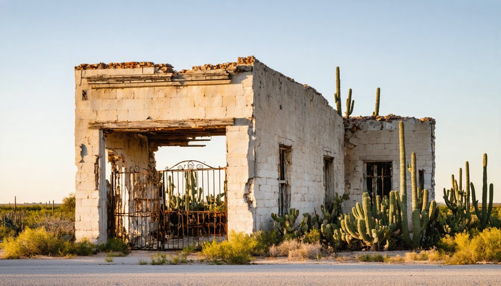
Not every ghost town earns its place on an itinerary, but Helena and Old D’Hanis both do. Helena once served as Karnes County’s seat until the railroad bypassed it in 1886, effectively freezing it in time. You’ll find local legends tied to its courthouse square and a raw sense of historic preservation that feels unscripted.
Head west toward Old D’Hanis, and you’ll walk among stone ruins from Henri Castro’s 1847 Alsatian settlement — tangible history you can actually touch.
If you’re extending your loop, Terlingua Ghost Town delivers atmosphere in abundance, and Panna Maria rounds out the Karnes County cluster efficiently.
Each stop pulls its weight, giving you real stops with real stories rather than roadside disappointments dressed up with signage.
How Long It Takes To Reach Each Site From the City
Knowing where to go is only half the equation — knowing how long it’ll take gets you there without blowing the whole day on windshield time. From San Antonio, Helena sits about 70 miles out via US 181, roughly an hour to 90 minutes depending on stops.
Knowing where to go is only half the equation — knowing how long it’ll take gets you there.
Old D’Hanis runs closer — under an hour west on US 90, around 50 miles. Both reward the drive with genuine historical preservation you won’t find behind a gift shop counter.
Factor in road condition once you leave the highways; farm-to-market and county routes drop your average speed to 45–55 mph. Build that buffer into your timeline.
A realistic day loop covering four to eight sites stays between 150 and 250 miles — ambitious but completely doable if you start early.
How To Build Your Route Around South Texas County Clusters
Grouping your stops by county keeps you from crisscrossing the region and burning unnecessary miles behind the wheel. Karnes County alone rewards this strategy, packing Helena, Panna Maria, and the Polish Triangle sites close enough together to hit in a single efficient loop.
Once you’ve mapped your clusters using tools like TexasEscapes or BatchGeo, you can string adjacent counties together and build a route that maximizes exploration without wasting your day on windshield time.
Grouping Sites By County
When you’re mapping out a South Texas ghost town road trip, organizing your stops by county clusters cuts down on windshield time and keeps your day moving efficiently. Bexar County alone holds 10+ ghost-town-related locations, making it a natural anchor for your loop. Layer in neighboring counties for maximum historical preservation and local legends per mile.
Start with these three cluster priorities:
- Karnes County – Helena, Panna Maria, and the Polish Triangle offer layered settlement history within a tight radius.
- Medina County – Old D’Hanis delivers Alsatian stone ruins dating to 1847.
- Bexar County core – Use San Antonio as your base, reducing repositioning time between clusters.
Grouping strategically means more exploration, less driving, and a fuller experience of South Texas’s forgotten past.
Reducing Windshield Time
Building your route around county clusters is the single most effective way to shrink drive time without sacrificing depth. When you anchor stops within the same county, you’re spending more time exploring historical preservation sites and less time staring at empty highway.
Karnes County alone delivers Helena, Panna Maria, and the Polish Triangle within a tight radius. That’s multiple layers of local legends, abandoned courthouses, and immigrant heritage packed into one efficient loop.
Tools like TexasEscapes and BatchGeo help you visualize site density before you ever leave the driveway. Plot your clusters first, then connect them with the shortest logical path.
Farm-to-market roads slow your speed but keep stops close together. You’ll cover more ground, burn less fuel, and actually absorb what you’re seeing.
Mapping Your Loop Strategy
Once you’ve mapped your county clusters and cut the dead miles, the next move is stitching those clusters into a loop that flows logically from start to finish. Think of it like urban planning — every stop should connect intentionally, not randomly.
South Texas rewards structured routing because the sites sit in natural arcs across Bexar, Karnes, and surrounding counties.
Build your loop around these three principles:
- Start and end in San Antonio to anchor your route with reliable fuel and services.
- Move clockwise through county clusters — Helena east, Old D’Hanis west — to avoid retracing roads.
- Prioritize cultural preservation sites like cemeteries and ruins during peak daylight hours for both safety and visibility.
Efficiency here means more exploration, less driving.
Staying on Track When Ghost Town Roads Drop Your Signal

Rural South Texas ghost town routes can swallow your cell signal without warning, leaving you stranded mid-loop on an unmarked county road. These sites carry deep cultural preservation value and historical significance, but none of that matters if you can’t find them.
Before you leave San Antonio, preload offline GPS apps with every rural route on your itinerary. Pack paper maps as a genuine backup, not an afterthought. Bring a fully charged phone and a portable power bank, because isolated townsites offer no conveniences.
Tools like TexasEscapes and BatchGeo let you scout site density and download coordinates ahead of time. Plan your loop during daylight hours, keep your tank full, and treat every unpaved county connector as a potential dead zone. Preparation buys you freedom out there.
What To Bring on a Rural Ghost Town Drive in South Texas
Before you roll out of San Antonio, pack a paper map alongside your offline GPS app, since cell coverage fades fast on rural county routes.
Toss in a first-aid kit, a portable power bank, and enough water for unexpected delays at isolated sites.
South Texas heat can push well past 100°F even at exposed ruins, so lightweight, breathable clothing and a wide-brim hat aren’t optional—they’re essential.
Navigation Tools And Maps
Traveling South Texas ghost town routes isn’t as simple as plugging an address into Google Maps—cell coverage drops fast once you leave the main highways, and many of these sites don’t have a digital footprint worth relying on. Go prepared and stay independent out there:
- Download offline GPS apps like Maps.me or Google Maps offline before you leave—preload every rural county route on your planned loop.
- Carry paper maps of Bexar and surrounding counties; they won’t lose signal mid-route when you’re chasing historical preservation gold.
- Use TexasEscapes and BatchGeo to identify site clusters before departure, saving serious windshield time.
A fully charged phone paired with a portable power bank keeps your photography tips-worthy shots uploading and your emergency contacts reachable.
Emergency Preparedness Essentials
South Texas ghost town roads will test your preparedness fast—once you’re past the main highways, you’re deep in rural terrain with spotty cell service, extreme heat potential, and no corner store in sight. Pack a portable power bank, extra water, and a paper map before you chase local legends through Karnes County’s forgotten corridors.
Temperatures routinely exceed 100°F in summer, so stick to November through March for comfortable exploration. Bring sturdy footwear for walking exposed ruins where historical preservation efforts remain minimal. Travel with a companion whenever possible, and load offline GPS maps before you leave San Antonio.
A basic emergency kit—jumper cables, a first-aid kit, and snacks—keeps your freedom to roam intact without turning a great adventure into a roadside crisis.
Comfort Gear For Heat
Once you leave San Antonio’s city limits and push into the open ranch land toward Helena or Old D’Hanis, the heat stops being a background concern and becomes the main event. Summer temperatures routinely crack 100°F, and exposed ruins offer zero shade. Pack smart so the heat doesn’t cut your day short.
- Insulated water bottle – Carry at least 64 oz per person; dehydration kills momentum fast.
- Wide-brim hat and UV shirt – Protect yourself during long walks across open townsites where historical preservation efforts leave ruins unshaded.
- Lens cloth and lens hood – Heat haze distorts images; these photography tips keep your shots crisp at midday.
Visit November through March if possible—you’ll move freely, stay longer, and see more.
How To Explore Abandoned Townsites Without Getting Into Trouble
Exploring abandoned townsites is rewarding, but a few smart habits keep you out of trouble and off private property. Always research land ownership before you arrive. Many sites sit on private ranches, and trespassing carries real legal consequences in Texas. Look for public access points, historical markers, or county roads that border the site legally.
Respect historical preservation by leaving everything exactly as you find it. Pocketing artifacts or disturbing ruins damages irreplaceable history for future visitors. Local legends surrounding these sites add atmosphere, but don’t let curiosity push you past fences or posted signs.
Travel during daylight, stick to marked paths when they exist, and let someone know your route. These simple steps protect both you and the places you’re exploring.
Day Trip or Extended Loop: Which Option Fits Your Schedule?

With your safety habits locked in and your respect for the land established, the next question becomes purely practical: how much time do you actually have?
A focused day trip covers 150–250 miles and fits 4–8 sites comfortably. An extended loop lets you slow down for deeper historical preservation work and richer photographic opportunities.
Consider these options before you leave:
- Half-day run – Drive US 181 to Helena, roughly 70 miles from San Antonio, and return by afternoon.
- Full-day loop – Combine Helena, Panna Maria, and Old D’Hanis into one connected route through Karnes County.
- Multi-day extended trip – Push southwest toward Terlingua and Marfa for maximum freedom and exploration.
Either way, travel November through March for the best conditions.
Frequently Asked Questions
Are There Entrance Fees to Visit Ghost Towns Near San Antonio?
Most ghost towns near San Antonio don’t charge entrance fees, so you’re free to explore! You’ll find incredible photography opportunities among historic ruins, though some sites with active historical preservation efforts may request small voluntary donations.
Can Children Safely Join a South Texas Ghost Town Road Trip?
Surprisingly, ghost towns aren’t just for thrill-seekers! You can bring children along, supporting historical preservation while ensuring family safety by visiting during daylight, traveling with companions, and preparing for exposed, rugged terrain together.
Which Ghost Towns Near Bexar County Allow Overnight Camping?
No ghost towns near Bexar County officially offer overnight camping, but you’ll find nearby state parks supporting historical preservation. Watch for wildlife encounters after dark, so embrace your freedom wisely and camp at designated sites instead.
Are Any Bexar County Ghost Town Sites Wheelchair Accessible?
Like rough diamonds waiting to be polished, historical preservation efforts are slowly sparking accessibility improvements at some sites. You’ll want to call ahead, as wheelchair access varies widely across Bexar County’s ghost town locations.
Do Local Guided Tours Exist for South Texas Ghost Town Routes?
Local guided tours aren’t widely advertised, but you’ll find historical preservation groups occasionally organizing excursions. You can independently explore incredible photography opportunities across South Texas ghost towns, charting your own course through untamed, historically rich landscapes on your terms.
References
* https://www.traveltexas.com/articles/post/spooky-roadtrip/



