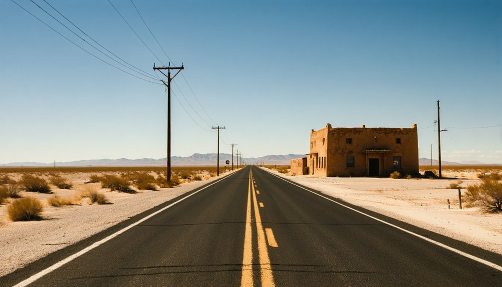
Planning a ghost town road trip to Salt Flat, Texas means heading east on U.S. 62/180, about 90 miles from El Paso, where crumbling cafés and rusted canopies rise from the Chihuahuan Desert like forgotten relics. You’ll explore a crossroads shaped by Native American salt harvesting, violent 19th-century conflicts, and a highway boom that quietly faded. Visit in spring or fall, carry extra water, and drive slow—there’s far more to this windswept stretch than first meets the eye.
Key Takeaways
- Salt Flat sits along U.S. Routes 62 and 180 in Hudspeth County, Texas, roughly 90 miles east of El Paso at 3,730 feet elevation.
- Visit during spring, fall, or winter to avoid dangerous summer heat that makes outdoor exploration uncomfortable and unsafe.
- Explore abandoned cafés, gas stations, and rusted roadside structures offering cinematic photography opportunities against dramatic desert backdrops.
- Carry extra fuel, water, and supplies, as amenities are scarce; nearby Van Horn and Sierra Blanca provide essential services.
- Combine the trip with visits to Guadalupe Mountains National Park and Carlsbad Caverns for a fuller regional road trip experience.
What Is Salt Flat, Texas: and Why Visit?
Tucked along U.S. Routes 62 and 180 in northeastern Hudspeth County, Salt Flat sits about 90 miles east of El Paso at 3,730 feet elevation. It’s a true ghost town — abandoned buildings, crumbling gas stations, and the quiet hum of desert wind replacing what was once a busy highway stop.
But Salt Flat isn’t just photogenic decay. It carries deep cultural heritage, rooted in centuries of Native American, Spanish, and Mexican salt use. It is also shaped by the violent local legends surrounding the El Paso Salt War.
Later, it rose as a roadside community born from highway ambition. Then it quietly faded when the water table dropped and traffic patterns shifted.
If you crave wide-open spaces and stories written into the landscape, Salt Flat delivers something raw and real.
The History Behind Salt Flat, Texas
Salt Flat’s story stretches back long before the first gas pump was installed or the first highway was paved. Native American groups harvested salt from this basin for centuries, long before Spanish colonizers or Mexican settlers arrived to claim their share. That competition over salt mining rights eventually exploded into the El Paso Salt War of the 1860s, a bitter dispute that left dozens dead.
The modern town you’re visiting today didn’t emerge from that conflict. It was born in 1929 when Edwin Hammack saw opportunity in a new highway connecting El Paso to Carlsbad Caverns. He opened a store and gas station, others followed, and Salt Flat briefly thrived as a desert roadside stop.
That window of prosperity, however, wouldn’t stay open long.
How the El Paso Salt War Put This Region on the Map
Before the highway brought travelers and the gas stations brought commerce, this stretch of desert was already the center of a violent, decades-long fight over something far more basic: salt.
Native Americans, Spanish colonizers, and Mexican settlers had harvested these flats for centuries, underscoring the region’s deep cultural significance. But by the 1860s, ownership disputes over the deposits exploded into what history calls the El Paso Salt War, or the San Elizario Salt War. The conflict claimed anywhere from a dozen to 30 lives, depending on the account.
For centuries, these salt flats were sacred ground — until ownership disputes turned them into a battlefield.
The economic impact was undeniable — salt meant survival and trade in this arid landscape.
When you drive through today, remember you’re crossing ground that people once fought and died to control. That history runs beneath every mile of pavement.
What You’ll Actually See When You Arrive?
When you pull off U.S. 62/180, you’ll find a scatter of abandoned buildings, including the ghostly shells of old cafés and gas stations that once kept highway travelers fueled and fed. These weathered structures make for striking photographs, their peeling paint and sagging rooflines telling a quiet story of roadside ambition gone dry.
Beyond the ruins, the broad Salt Basin playa and the distant ridgeline of the Guadalupe Mountains stretch across your view, giving the whole scene a stark, cinematic scale.
Abandoned Buildings Still Standing
What remains of Salt Flat today tells a quiet, weathered story you’ll read in crumbling walls and rusted metal rather than historical markers. The urban decay here isn’t staged or curated — it’s raw and honest, shaped by decades of desert wind and economic abandonment.
You’ll spot the bones of former gas stations, a collapsed café, and roadside structures that once kept highway travelers fed and fueled. These aren’t recognized historical landmarks with interpretive signs, so you’ll piece the story together yourself from what’s still standing.
Walk the roadside slowly. Peeling paint, broken glass, and sagging rooflines each mark a different chapter of the town’s rise and fall. Bring your camera, your curiosity, and respect for structures that won’t survive many more desert seasons.
Roadside Remnants Worth Photographing
Arriving at Salt Flat, you’ll find a sparse but photogenic scatter of decay stretched along U.S. 62/180 — rusted gas station canopies, hollow concrete-block buildings with caved-in roofs, and sun-bleached signage that’s more texture than text now. These aren’t manicured exhibits; they’re raw historical artifacts sitting exactly where commerce once thrived.
You’ll recognize the bones of Edwin Hammack’s original roadside vision — structures that once fueled cars, fed travelers, and connected the desert to Carlsbad Caverns tourism. Their cultural significance runs deeper than aesthetics.
Each crumbling wall reflects salt-trade history, early highway America, and a community that peaked quietly then emptied just as quietly. Bring a wide-angle lens. The flat Chihuahuan Desert backdrop amplifies every rusted edge and shadowed doorway into something worth framing.
Surrounding Desert Landscape Views
Step out of your car on U.S. 62/180 and the landscape hits you immediately — a vast, flat basin stretching toward distant mountain ranges with almost nothing interrupting the sightline. The Salt Basin playa spreads across the Texas-New Mexico border, a broad gypsum flat that shifts color with the light, turning silver-white under midday sun and warm amber at dusk.
The Guadalupe Mountains rise sharply to the northwest, framing the scene with rugged elevation contrast. You’ll find unexpected freedom here — wide open space that rewards slow observation.
Wildlife spotting opportunities exist along the basin edges, where desert species move through the scrub. After exploring, nearby stops offer local cuisine that reflects genuine West Texas culture, making the drive feel like a complete, purposeful experience rather than just a detour.
The Best Time of Year to Make the Drive
Because Salt Flat sits in the high Chihuahuan Desert at nearly 3,730 feet, the seasons hit harder than you might expect for a Texas location. Summer temperatures climb aggressively, making exploration uncomfortable and potentially dangerous.
You’ll find the drive far more rewarding during these windows:
- Spring (March–May): Mild temperatures and clear skies make exploring abandoned structures easier, giving you space to absorb local folklore surrounding the El Paso Salt War.
- Fall (September–November): Cooler air returns, and the desert light is exceptional for photographing preservation challenges facing Salt Flat’s deteriorating buildings.
- Winter (December–February): Crowds disappear entirely, offering solitude across the broad Salt Basin playa.
Plan your route along U.S. 62/180 and arrive with plenty of daylight to roam freely.
How to Get to Salt Flat on U.S. 62/180?
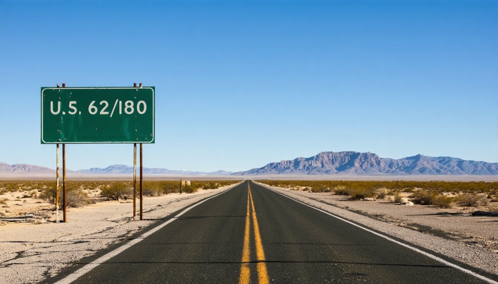
The drive to Salt Flat is straightforward once you’re on U.S. 62/180, the same highway that gave the town its reason to exist. Head east from El Paso roughly 90 miles, and you’ll roll through open desert with the Guadalupe Mountains rising to your north. The route is direct, unhurried, and genuinely scenic.
Stop in nearby Sierra Blanca or Van Horn if you want local cuisine before pushing into the emptier stretches.
Keep your eyes open for wildlife spotting opportunities along the basin flats — pronghorn and desert birds aren’t uncommon.
You’ll know you’ve arrived when abandoned structures appear roadside, quietly marking what was once a busy highway stop. No complicated navigation required — just follow the highway and let the landscape do the storytelling.
Guadalupe Mountains, Dell City, and What’s Worth Stopping For Nearby
Once you’ve taken in Salt Flat’s abandoned roadside relics, you’re already within striking distance of Guadalupe Mountains National Park, where rugged peaks and ancient fossil reef trails reward a short detour west on U.S. 62/180.
Swing north toward Dell City and you’ll find a surprisingly productive farming community that tapped the same underground water that ironically drained the salt flats into decline.
Between these stops, pull over and scan the vast Salt Basin Playa stretching toward the New Mexico border — that pale, shimmering expanse is the same geological feature that drew Native Americans, Spanish colonizers, and eventually a handful of determined Texans to settle this remote desert corridor.
Guadalupe Mountains National Park
Jutting up from the Chihuahuan Desert just a short drive from Salt Flat, the Guadalupe Mountains offer one of the most dramatic landscape shifts you’ll encounter on this stretch of U.S. 62/180. Local folklore ties these peaks to the broader ghost town legends that shaped this region’s identity. Here’s what makes stopping worthwhile:
- El Capitan Peak – An iconic desert landmark rising 8,085 feet, visible for miles along the highway.
- Guadalupe Peak Trail – Texas’s highest point at 8,749 feet, rewarding hikers with sweeping desert views.
- McKittrick Canyon – A hidden oasis with rare foliage, flowing water, and striking geological history.
The park sits roughly 35 miles west of Salt Flat, making it an effortless addition to your route.
Dell City’s Farming History
Tucked behind the Guadalupe Mountains about 35 miles north of Salt Flat, Dell City tells a surprisingly different story than the ghost town you just left behind. While Salt Flat faded as its water sources dried up, Dell City actually grew because of underground water.
Farmers discovered a productive aquifer beneath the high desert floor in the 1940s, and agricultural life took root almost overnight. The farming history here reads like a contrast study — one community collapsed as irrigation pumping lowered the water table, while another thrived on that same underground supply.
You’ll see working farms and open fields that feel almost surreal against the stark desert backdrop. It’s a quick detour that adds real depth to understanding how water shaped everything out here.
Salt Basin Playa Views
Stretching across the New Mexico-Texas border, the Salt Basin playa is one of the most quietly dramatic landscapes you’ll encounter on this route. These wide-open playa views reward anyone willing to slow down and actually look.
The gypsum flats shimmer under desert light, creating an almost surreal flatness framed by the Guadalupe Mountains rising sharply to the northwest.
Three stops worth adding to your route:
- Guadalupe Mountains National Park – hike rugged trails with sweeping salt basin views from elevation
- Salt Flat Playa pulloffs – photograph the open basin directly along U.S. 62/180
- Dell City Road detour – approach the playa from the agricultural edge for a contrasting perspective
You’ve got open road and open sky here — use both.
How to Build Your Full Ghost Town Road Trip
Salt Flat sits at the natural center of a road trip that’s bigger than one ghost town. Pair it with Guadalupe Mountains National Park to the northwest, where rugged trails replace abandoned storefronts. Push east toward Carlsbad Caverns, following the same highway Edwin Hammack bet his livelihood on back in 1929.
Salt Flat is just the beginning. The highway Edwin Hammack staked his future on still runs through it all.
Each stop deepens your understanding of local folklore tied to salt wars, desert survival, and vanishing communities. Drive through Sierra Blanca for courthouse history and regional context.
Travel U.S. 62/180 slowly, stopping wherever something catches your eye. Modern preservation efforts are sparse here, so photograph everything thoughtfully. The desert doesn’t wait.
Build your itinerary loosely, keep your tank full, carry extra water, and let the landscape dictate your pace rather than a rigid schedule.
Frequently Asked Questions
Is There Cell Phone Service or Wi-Fi Available in Salt Flat?
Don’t expect reliable cell coverage in Salt Flat’s remote desert setting — you’ll likely face serious cell coverage issues. Embrace it as a perfect digital detox while you explore the abandoned buildings and vast, breathtaking Guadalupe Mountain landscapes freely.
Are There Any Hotels or Campgrounds Near Salt Flat, Texas?
Salt Flat’s ghost-town silence contrasts with Guadalupe Mountains National Park nearby, where you’ll find campgrounds perfect for wildlife observation and historical preservation exploration. You won’t find hotels directly in Salt Flat, so plan your stay in nearby Sierra Blanca or Dell City.
Can Visitors Legally Enter or Photograph the Abandoned Buildings?
You’ll want to research abandoned building photography legal access regulations carefully before exploring Salt Flat’s crumbling structures. Most sit on private property, so always seek owner permission to avoid trespassing issues and photograph freely without legal consequences.
Is Salt Flat, Texas Accessible for Visitors With Mobility Limitations?
Salt Flat’s rugged desert terrain lacks accessibility features and wheelchair-friendly pathways, so you’ll face uneven ground and deteriorating structures. You can still experience the haunting landscape from your vehicle along U.S. 62/180 comfortably.
Are Pets Allowed When Visiting the Salt Flat Ghost Town Area?
You’ll generally find no strict pet policies blocking your visit, but you should check local regulations before arriving. Keep your pets leashed, carry water, and watch for the harsh desert heat throughout your exploration.
References
- https://www.legendsofamerica.com/salt-flat-texas/
- https://nuttyhiker.com/ghost-town-salt-flat-texas/
- https://www.reddit.com/r/AbandonedPorn/comments/32wlgw/the_closedforbusiness_1929vintage_salt_flat_cafe/
- https://www.youtube.com/watch?v=0es4BPUPS68
- https://blog.txfb-ins.com/texas-travel/city-spotlight-salt-flat/
- https://en.wikipedia.org/wiki/Salt_Flat
- https://www.texasescapes.com/TOWNS/Texas_ghost_towns/SaltFlatTexas/SaltFlatTx.htm
- https://www.ghosttowns.com/states/tx/saltflat.html



