Planning a ghost town road trip to Treece, Kansas means stepping into one of America’s most haunting industrial casualties. You’ll find massive chat piles, cracked roads, and orange-tinted toxic water where a thriving mining community once stood. Treece sits in southeastern Kansas near the Oklahoma border, accessible via US-69 south from Pittsburg. Bring an N95 mask, sturdy boots, and a healthy respect for unstable ground. There’s far more to uncover about this toxic time capsule than you’d expect.
Key Takeaways
- Treece, Kansas, sits in southeastern Ottawa County; access it via US-69 south from Pittsburg, then local county roads with GPS guidance.
- Visit in spring or fall for optimal weather, photography conditions, and wildlife observation opportunities.
- Wear an N95 mask and sturdy boots, avoid touching soil or water, and stay on established paths.
- The landscape features massive chat piles, cracked pavement, abandoned foundations, and orange-tinted acid mine drainage pools.
- Pair your visit with nearby Picher, Oklahoma, for broader context on the Tri-State Mining District’s boom-and-bust legacy.
Where Treece, Kansas Is and How to Get There
Tucked into the far southeastern corner of Kansas, Treece sits just north of the Kansas-Oklahoma border in Ottawa County, roughly 90 miles southeast of Joplin, Missouri. The closest major reference point is Picher, Oklahoma, literally just across the state line.
To reach Treece, take US-69 south from Pittsburg, Kansas, then follow local county roads toward the border. You won’t find a welcome center or visitor parking — that’s part of the appeal. You’re arriving on your own terms to explore raw mining history and whatever town relics remain scattered across a contaminated landscape.
GPS will get you close, but expect rough roads and minimal signage. Come with a full tank, a curious mind, and a healthy respect for the site’s toxic legacy.
Why Did Treece Turn Into a Ghost Town?
Once you roll into Treece, the emptiness hits you immediately — and understanding why starts with the ground beneath your feet.
Treece’s mining history built this town fast and hollowed it out faster. Lead and zinc extraction drove decades of prosperity, but the environmental legacy it left behind was brutal — contaminated soil, poisoned water, and ground so unstable that sinkholes swallowed roads whole.
What You’ll Actually See When You Arrive
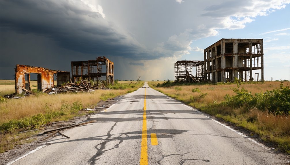
When you pull up to Treece, you won’t find restored storefronts or historic signage — you’ll find toxic chat piles, broken roads, and stretches of landscape that look more industrial wasteland than small-town America.
The chat piles, massive mounds of crushed mining waste, still dominate the skyline and leach heavy metals into the surrounding soil.
Look toward the drainage areas and you’ll spot the orange-tinted water that signals acid mine drainage, a vivid and unsettling reminder of the contamination that drove every last resident out.
Toxic Chat Piles
The most striking feature you’ll notice as you approach Treece isn’t a building or a street sign — it’s the massive gray-white mounds of chat, the crushed rock waste left behind after decades of lead and zinc extraction. These piles are a direct, unfiltered record of the region’s mining history, rising from flat land like silent monuments to industrial excess.
They contain lead, cadmium, and other heavy metals that leach into soil and water. Environmental cleanup efforts have addressed portions of the contamination, but chat piles remain a defining feature of the landscape.
Don’t let curiosity pull you too close — direct contact with the material carries real health risks. You’re looking at the physical cost of a boom that once fueled a nation’s war machine.
Abandoned Roads Remaining
Driving into Treece, you’ll notice almost immediately that the roads tell the story better than any remaining structure could. Cracked pavement ends without warning, swallowed by subsidence or simply bulldozed during environmental cleanup. Some stretches disappear into overgrown lots where houses once stood. Others lead to nowhere, terminating at empty foundations or chain-link fencing marking contaminated zones.
You’re fundamentally navigating a grid that once served a population exceeding thousands, now reduced to fractured asphalt and faded curbing. The historical significance hits hardest here — these roads carried mining trucks, school buses, and families who’d no idea what decades of lead exposure were quietly doing.
Move carefully, stay alert for soft ground, and respect any posted barriers. The land itself remains unstable beneath your tires.
Orange Contaminated Water
One of the first things you’ll notice beyond the broken roads is the water — and it doesn’t look like any water you’d expect. Standing pools and streams cut through the landscape in shades of deep orange and rust, a direct result of decades of mining history catching up with the earth beneath your feet.
Acid mine drainage leaches iron and heavy metals through abandoned shafts and chat piles, staining everything it touches. That unnatural color isn’t a trick of light — it’s the environmental impact made visible, raw and unfiltered.
Don’t touch it, don’t wade through it, and keep pets clear. What you’re seeing is fundamentally a wound the land can’t close, left behind by an industry that stripped everything and walked away.
Lead Contamination, Sinkholes, and Access Risks at Treece
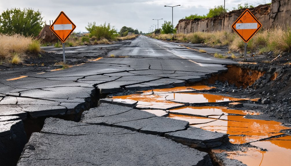
Before you step out of your car at Treece, you need to understand that the ground itself can harm you — lead-contaminated soil and dust still pose serious health risks, especially if you’re breathing in particulates or touching exposed surfaces.
The land also has a history of sudden, violent collapse, with sinkholes opening without warning, including one 1966 chasm that swallowed part of a roadway and measured 300 feet across and 200 feet deep.
There’s no safe, marked public access to the site, so treat the entire area as a hazard zone rather than a casual stop.
Lead Exposure Health Risks
Although Treece looks like a quiet, forgotten stretch of Kansas landscape, the ground beneath your feet carries serious risks that make this place unlike most ghost town destinations.
Lead contamination here isn’t a distant concern — it’s in the soil, the dust, and the air you breathe when the wind kicks up. Children face the highest danger, but adults aren’t immune to the health hazards either.
Prolonged or repeated exposure can damage the nervous system, kidneys, and cardiovascular health. Environmental cleanup efforts have addressed some of the worst contamination, yet the site remains compromised.
If you visit, avoid touching soil, keep windows up while driving through, and don’t let curiosity pull you closer to chat piles or standing water. Your freedom to explore comes with real responsibility here.
Sinkhole And Ground Collapse
Beyond the lead-laced soil and contaminated water, Treece hides another danger that’s far less visible until it’s too late — the ground itself can give way without warning. Decades of mining history left an underground maze of hollowed-out tunnels and weakened earth beneath the townsite. When those voids collapse, they collapse fast.
Investigators documented more than 100 ground collapse incidents across the area, with one 1966 chasm stretching 300 feet wide and plunging 200 feet deep after swallowing part of a roadway.
Environmental cleanup efforts addressed surface contamination, but subsurface instability is far harder to fix. If you’re planning a visit, understand that the ground you’re walking on may be compromised. Stay on established paths, watch for depressions or cracking soil, and never explore abandoned mine structures.
Site Access Safety Warnings
Visiting Treece means accepting that nearly every element of the site carries real risk. Lead-contaminated dust rises easily from disturbed soil, and no amount of historical preservation curiosity justifies breathing it in without proper respiratory protection.
The ground beneath you may look solid, but decades of tunneling left voids that can collapse without warning. Sinkholes have opened suddenly, swallowing roadways whole.
You won’t find maintained trails or posted boundaries marking safe zones. Orange-tinted water pooling across the landscape signals acid mine drainage — don’t touch it.
Community stories here carry weight, but so does your responsibility to protect yourself while uncovering them. Bring an N95 mask, sturdy boots, and a charged phone. Tell someone where you’re going before you arrive.
Best Time of Year to Visit Treece, Kansas
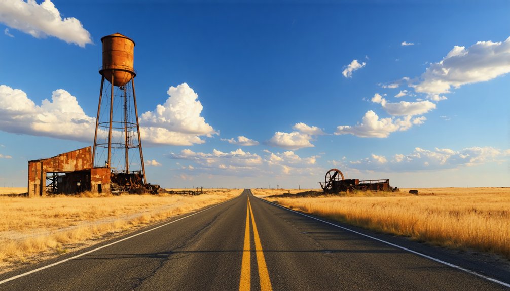
Since Treece sits along the Kansas-Oklahoma border with little shade or shelter remaining, the best time to visit is spring (April–May) or fall (September–October), when temperatures stay mild and manageable. Summer heat in this exposed, open landscape can become brutal, while winter brings unpredictable plains storms that make traversing torn-up roads genuinely risky.
Spring offers soft light ideal for photographing the remnants that matter for historical preservation documentation, and wildflowers occasionally push through the contaminated soil in a strange, striking contrast. Fall delivers crisp air and clearer sightlines across the chat piles.
Both seasons also support wildlife observation, as birds and small animals have reclaimed parts of the abandoned townsite. Plan your visit during weekday mornings to avoid any lingering weekend foot traffic near the perimeter.
How Picher, Oklahoma Fits Into a Treece Day Trip
Picher, Oklahoma sits just across the state line from Treece, making it a natural and essential companion stop on any day trip through the Tri-State Mining District. Together, these two towns tell a complete story of boom, collapse, and environmental cleanup efforts that reshaped an entire region.
Picher and Treece together complete the story — two ghost towns, one haunting legacy of boom and collapse.
Picher once anchored the district’s mining history as one of its most productive communities, reaching a combined peak population with Treece of more than 20,000 residents.
Today, you’ll find similarly haunting landscapes — toxic chat piles, abandoned foundations, and orange-tinted water that signals decades of contamination.
Pairing both stops lets you absorb the full scale of what extraction cost this region.
Plan to spend time in each location, and bring water since neither site offers services.
What to Pack for a Treece Ghost Town Visit
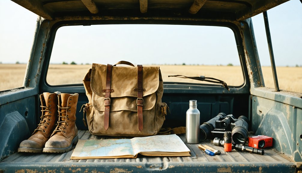
Because Treece’s landscape is defined by toxic chat piles, unstable ground, and zero remaining services, what you pack can genuinely affect your safety. You’re entering a contaminated ghost town with no stores, no water, and unpredictable terrain. Come prepared:
- N95 respirator mask — lead dust is invisible but real
- Sturdy closed-toe boots — sinkholes and debris make every step a decision
- Printed research and maps — local myths and historical artifacts give context no cell signal can provide
- Water and snacks — the nearest services are miles away
Don’t treat this like a casual detour. Treece rewards curious, self-sufficient travelers who respect both its dangers and its history. Pack smart, stay on stable ground, and leave nothing behind.
Who Should Add Treece to Their Route : and Who Should Skip It
Knowing what to pack tells you something important about what Treece actually demands from a visitor — and that’s worth sitting with before you commit to the route.
If you care about historical preservation, environmental consequence, and the human cost behind industrial collapse, Treece rewards your attention. You’ll leave with a sharper understanding of community impact and what happens when a town gets sacrificed for resources.
But if you’re chasing photo-ready storefronts or walkable history, skip it. Treece doesn’t offer that. Demolition and contamination have stripped the site down to raw, uncomfortable truth — chat piles, broken roads, and orange water.
You’re not sightseeing here; you’re witnessing. Add Treece to your route only if you’re ready to engage honestly with a place that gave everything and got very little back.
More Kansas Ghost Towns Worth Combining With the Drive
If Treece has already earned a place on your Kansas itinerary, you’ll want to round out the drive with other ghost towns that add historical depth without backtracking too far. Kansas offers several abandoned communities that carry genuine historical significance and reward curious travelers willing to explore off-highway routes.
Consider adding these stops:
- Elgin, Kansas – A quiet remnant with scattered foundations and open prairie atmosphere.
- Dunlap, Kansas – Once a cattle-drive hub with a fading but traceable mining legacy.
- Matfield Green, Kansas – A small Flint Hills ghost town surrounded by dramatic landscape.
- Rozel, Kansas – A former railroad town stripped down to bare essentials.
Each stop deepens your understanding of how boom-and-bust cycles shaped Kansas communities long before Treece became the region’s most cautionary example.
Frequently Asked Questions
What Minerals Were Primarily Extracted During Treece’s Peak Mining Years?
With $20 billion in ore extracted, you’ll discover Treece’s mineral diversity centered on lead, zinc, and iron ore. Miners used intensive mining techniques to pull these resources free, fueling America’s wartime ammunition needs.
How Did Treece, Kansas Get Its Name?
You’ll find that Treece got its name from realtor J. O. Treece, a detail that’s central to mining town preservation. Understanding historic ghost town dynamics deepens your connection to this fascinating, freedom-rich abandoned landscape.
How Large Was the Combined Peak Population of Treece and Picher?
You’ll find that Treece and Picher’s combined peak population surpassed 20,000 people. Mining innovations fueled that remarkable growth, but population decline eventually stripped both towns down to near-ghost status, leaving behind only haunting remnants of their once-thriving communities.
When Did Treece Officially Establish Its First Post Office?
Imagine stumbling upon historic architecture steeped in local legends — Treece opened its first post office in 1917. That single moment officially marked the town’s birth, pulling you straight into a fascinating mining era you won’t forget.
Approximately How Much Ore Value Did the Tri-State Mining District Produce Overall?
You’ll be amazed knowing the Tri-State Mining District produced roughly $20 billion worth of ore! Advanced mining technology drove that massive output, but you can’t ignore the devastating environmental impact it left scarring the land forever.
References
- https://www.businessinsider.com/photos-of-ghost-town-treece-kansas-2017-4
- https://en.wikipedia.org/wiki/Treece
- https://www.youtube.com/watch?v=zyj1rXAVIRM
- https://porzucki.com/Treece-KS-Ghost-Town-in-the-Making
- https://www.facebook.com/groups/TopekaHistoryGeeks/posts/9194642290580852/
- https://www.reddit.com/r/todayilearned/comments/20vkg1/til_the_city_of_treece_kansas_was_abandoned_and/
- https://www.nytimes.com/2012/05/20/magazine/last-ones-left-in-treece-kan-a-toxic-town.html
- https://www.daneamales.com/statement-test-1
- https://www.nytimes.com/2009/09/14/us/14kansas.html
- https://ominous.app/browse/site/18631