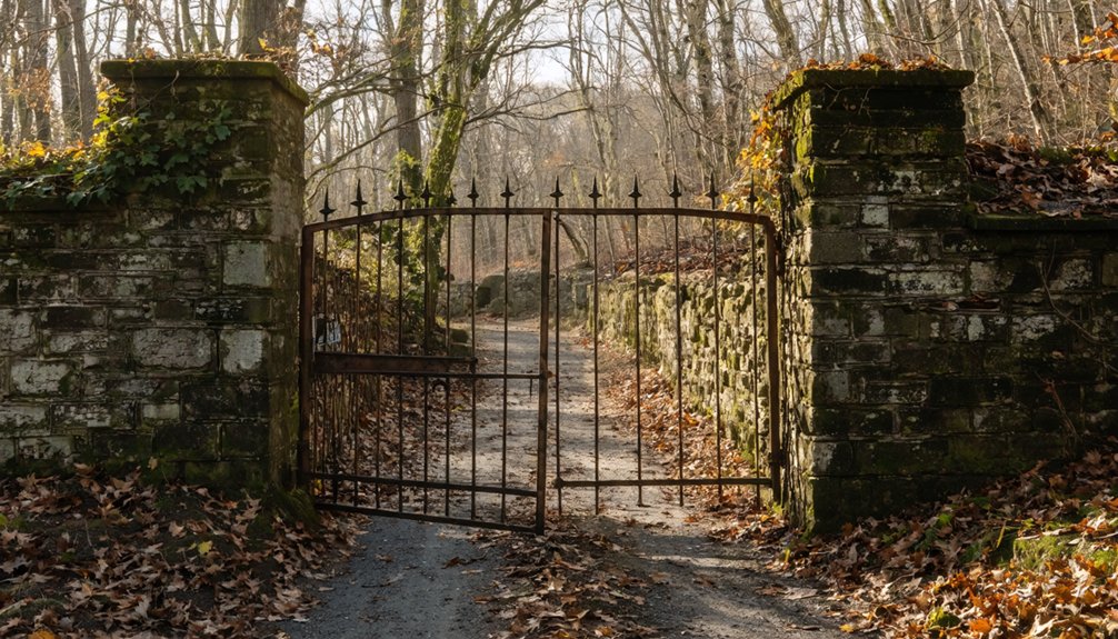
Planning a ghost town road trip to South Scituate means timing your visit around drought conditions, typically late summer or early fall, when the Scituate Reservoir drops low enough to expose submerged foundations, stone walls, and remnants of a village deliberately erased in the 1920s. Take Route 6 West from Providence, wear waterproof boots, and watch for pull-offs along Route 116. There’s far more buried history here than the waterline first reveals.
Key Takeaways
- South Scituate is a submerged Rhode Island ghost town, cleared for a reservoir that buried over 1,000 buildings and erased an entire community.
- Visit during extreme drought in late summer or fall, when receding water reveals stone foundations, property walls, and remnants of former settlements.
- Take Route 6 West from Providence or scenic Route 116 through rural terrain to reach the Scituate Reservoir area efficiently.
- Park at small pull-offs along Route 116 or Trimtown Road, and bring waterproof boots, polarized sunglasses, and printed maps for exploration.
- Monitor Rhode Island water authority updates for reservoir levels, respect restricted boundaries, and wear proper footwear on slippery, uneven terrain.
What Happened to South Scituate, Rhode Island?
Once a thriving agricultural and industrial village in Rhode Island’s Town of Scituate, South Scituate vanished more than a century ago—not from neglect or disaster, but by deliberate design. Authorities cleared the entire village to construct a 3,200-foot earthen dam and aqueduct system, creating a reservoir that would serve the state’s growing population.
The community impact was staggering: workers demolished or burned 1,195 buildings across multiple villages, including homes, barns, schools, churches, and mills. Approximately 700 additional structures were buried beneath six feet of earth, now resting under 80 feet of water.
The historical significance of what was lost runs deep—you’re looking at an entire way of life intentionally erased to make way for modern infrastructure.
When Can You See the South Scituate Ghost Town?
Rarely does a ghost town reveal itself on schedule—but South Scituate follows nature’s timeline, not yours. The submerged architecture only surfaces during periods of extreme drought, when water levels drop enough to expose stone property walls and building foundations that have sat silent beneath 80 feet of water for over a century.
You can’t book this experience—you have to watch for it. Monitor the Scituate Reservoir’s water levels throughout summer and fall, when drought conditions are most likely to pull back the curtain on this ghost town history. Local news and Rhode Island water authority updates are your best resources for timing a visit.
When the conditions align, you’ll walk terrain that hasn’t been visible in decades.
How Do You Get to the Scituate Reservoir?
Catching the reservoir at the right moment means nothing if you can’t find your way there. The Scituate Reservoir sits in central Rhode Island, easily reachable via scenic routes that wind through historic New England countryside.
Historical landmarks dot the roads leading in, giving you context before you even arrive.
Pack your map and head toward Scituate from Providence using Route 6 or Route 116. Here’s what you’ll want to know:
- Route 6 West offers the most direct path from Providence
- Route 116 provides quieter, scenic routes through rural terrain
- Pull-offs near the dam allow safe viewing access
- Drought periods make shoreline exploration most rewarding
You’re chasing history on your own terms—make sure you’re headed in the right direction.
Stone Walls, Foundations, and What the Drought Reveals
When drought levels drop far enough, six feet of earth and eighty feet of water surrender their secrets—and what you’ll find along the Scituate Reservoir‘s exposed shoreline reads like a blueprint of vanished lives.
Stone remnants emerge from the receding waterline—property walls still tracing lot boundaries, foundations marking exactly where families built their homes, barns, and mills.
These aren’t random ruins. They’re structured evidence of a community that existed before 1,195 buildings were demolished or burned to make way for progress.
Not random ruins—structured evidence of 1,195 demolished lives, erased deliberately and buried beneath progress.
The historical significance here is visceral rather than academic. You’re reading a landscape that Rhode Island buried and largely forgot.
Come during a severe drought, and the reservoir grants rare permission to witness what most residents never see—a town still mapped in stone beneath the water.
Other Submerged Scituate Villages Near the Reservoir
South Scituate wasn’t the only village swallowed by the reservoir—Ashland, Kent, Richmond, and the western half of North Scituate all disappeared beneath the same rising water.
These lost villages collectively represent a historical significance that most Rhode Islanders never fully reckon with. You’re not just visiting one erased community; you’re standing above several.
Other submerged Scituate communities include:
- Ponaganset Village – once a thriving settlement along productive mill streams
- Rockland Village – cleared and consumed alongside its neighbors
- Saundersville – another forgotten name buried under decades of silence
- Elmdale and Wilbur Hollow – smaller communities erased without ceremony
Knowing these names transforms your visit.
You’re not just sightseeing—you’re bearing witness to an entire region deliberately reclaimed by water.
Best Time to Visit, Parking, and What to Bring
Your best chance of spotting South Scituate’s sunken stone walls and foundations comes during periods of extreme drought, when water levels drop enough to expose the reservoir’s ghostly remnants.
Park along the reservoir’s accessible roadways and scout the shoreline carefully, since the visible ruins shift depending on current water conditions.
Pack sturdy waterproof boots, a camera, and a detailed map of the original village layout so you can identify what you’re actually looking at when the past surfaces.
Optimal Drought Season Visits
Late summer and early fall are prime times to explore the Scituate Reservoir, when prolonged drought conditions draw down water levels enough to expose the ghostly remnants of stone walls and building foundations that once defined South Scituate’s streets and property lines.
These seasonal windows reveal the historical significance of what’s typically hidden beneath 80 feet of water.
Watch for these ideal visiting conditions:
- Water levels dropping visibly along reservoir shorelines, exposing stone foundations
- August through October offering the longest drought-influenced exposure windows
- Local news and USGS water monitoring sites tracking reservoir levels in real time
- Early morning visits providing clearer sightlines before afternoon haze settles over the water
You’re witnessing history that most Rhode Islanders never see—don’t miss the opportunity.
Parking Areas and Access
Once you’ve identified the right drought window to visit, getting yourself to the reservoir’s edge requires knowing where to park and how to approach the site responsibly.
Your parking options are limited but manageable—small pull-offs along Route 116 and Trimtown Road give you legal stopping points without blocking traffic. From these spots, access routes lead you down toward the waterline through open terrain that rewards careful footing.
You’re not traversing a developed trail system here; you’re moving through raw landscape where the ground shifts unpredictably near the exposed shoreline. Bring sturdy boots, a detailed map, and plenty of water.
Respect posted boundaries—some reservoir edges remain restricted. Move deliberately, stay aware of changing water levels, and you’ll reach those submerged foundations without incident.
Essential Gear to Pack
Seven items can make or break a visit to the Scituate Reservoir’s exposed shoreline, and skipping any one of them turns an exploratory outing into a genuine hardship.
This ghost town landscape demands respect and preparation.
Pack these essentials before leaving home:
- Waterproof boots — submerged foundations stay muddy long after drought conditions expose them
- Polarized sunglasses — they cut glare and reveal submerged stone walls beneath shallow water
- Printed historical maps — cell service disappears quickly along remote shoreline stretches
- Camera with extra batteries — document architectural remnants carrying genuine historical significance
Bring layered clothing since reservoir winds shift unpredictably.
Pack drinking water because no facilities exist along the exposed shoreline.
A walking stick helps navigate uneven, slippery foundation edges without injury.
You’re exploring actual history here—treat your preparation accordingly.
Frequently Asked Questions
Are There Guided Tours Available at the Scituate Reservoir Ghost Town?
The knowledge doesn’t confirm guided tours, but you can explore ghost town history independently. During droughts, you’ll uncover reservoir legends firsthand, spotting submerged foundations and stone walls rising from the water’s depths.
Is Swimming or Kayaking Permitted on the Scituate Reservoir?
The knowledge base doesn’t confirm swimming or kayaking permissions. You’ll want to check with local authorities for current water safety regulations and kayaking tips before paddling above those hauntingly submerged ghost town foundations.
Were Residents Compensated When Their Homes Were Demolished for the Reservoir?
While records don’t detail every homeowner experience, residents were indeed compensated — though no payment could match the historical significance of losing ancestral homes. You’d have watched your entire world demolished, erased beneath 80 feet of water forever.
Can Visitors Access the Reservoir Area Year-Round Without Restrictions?
The knowledge doesn’t confirm year-round reservoir accessibility or seasonal restrictions. You’d want to check Rhode Island’s water authority for current access rules before planning your visit, especially during drought periods when submerged foundations become visible.
Are There Nearby Restaurants or Accommodations for Ghost Town Road Trippers?
You’ll find a treasure trove of local dining and lodging options nearby! Scituate’s surrounding towns overflow with cozy inns and eateries, so you’re never far from refueling before diving back into your ghost town adventure.
References
- https://www.youtube.com/watch?v=JdOJzLC7m4c
- https://en.wikipedia.org/wiki/List_of_ghost_towns_in_Rhode_Island
- https://www.rimonthly.com/haunted-places-rhode-island/
- https://www.youtube.com/watch?v=hAVOfTGz1Lc
- https://www.youtube.com/watch?v=4C0ajLzzzVI
- https://preservation.ri.gov/sites/g/files/xkgbur406/files/pdfs_zips_downloads/survey_pdfs/scituate.pdf