Toonerville, Missouri is a ghost town hidden in St. Charles County that you won’t want to miss on your next road trip. It earned its quirky name from a *Toonerville Folks* comic strip sign at a long-gone roadside gas station. Today, there’s nothing left standing, but that’s exactly the charm. Pack your water, fuel up, and bring paper maps before heading out. Stick around to uncover everything this forgotten community and its surroundings have to offer.
Key Takeaways
- Toonerville, Missouri, is an unincorporated ghost town in St. Charles County with no buildings, commercial structures, or visible historic remains.
- The community’s name derives from the *Toonerville Folks* comic strip, popularized by a humorous roadside gas station sign.
- From St. Louis, take Route 66 westward into St. Charles County, using Columbus Bottom Conservation Area as a navigation landmark.
- Pack water, snacks, paper maps, a first aid kit, and a full fuel tank, as no commercial amenities exist nearby.
- The adjacent Busch Wildlife Area and Columbus Bottom Conservation Area offer outdoor activities, including wildlife spotting and nature exploration.
What Is Toonerville, Missouri?

Tucked into St. Charles County, Missouri, Toonerville is an unincorporated community sitting at latitude 38° 41′ 30 N and longitude 90° 44′ 0 W.
Don’t expect a bustling town — Toonerville demographics reveal a quiet roadside settlement with no municipal government, no commercial structures, and no formal services.
What you’ll find instead is a place rich in Toonerville culture, rooted in an unlikely origin story. A local gas station owner once displayed a sign featuring a character from the beloved *Toonerville Folks* comic strip, and the name stuck. The community literally grew around that single roadside stop.
A gas station sign featuring a comic strip character gave this quiet Missouri community its unforgettable name.
Bordered by St. Louis County to the east and Warren County to the west, Toonerville rewards curious travelers who appreciate history hiding in plain sight.
How Did Toonerville Get Its Unusual Name?
Few ghost town names carry as much personality as Toonerville, and its origin story is as quirky as you’d expect.
The Toonerville Origins trace back to a roadside gas station where the owner had a sharp sense of humor and a love for popular culture. He displayed an image from the *Toonerville Folks* comic strip on his station’s sign, and that Comic Inspiration stuck.
Travelers passing through began referencing the spot by the cartoon’s name, and eventually the entire community adopted it. What started as a clever roadside marketing move became a permanent identity for this small Missouri community.
You’re fundamentally visiting a place named after a joke that worked — and honestly, that makes the road trip even more worth taking.
What’s Left to See in Toonerville Today?
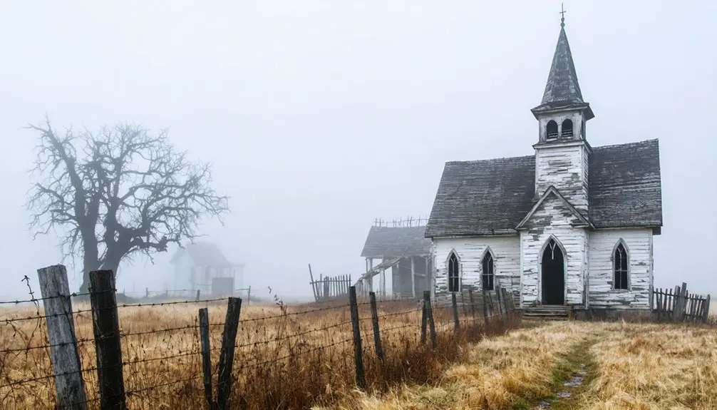
If you’re hoping to find remnants of the original gas station that put Toonerville on the map, you’ll come away empty-handed — no historic buildings, structures, or marked sites survive today.
The community exists in name only, leaving little more than an unincorporated crossroads to mark the spot.
What you *can* do is explore the surrounding natural beauty, including the nearby Busch Wildlife Area, which offers a worthwhile reason to make the trip.
No Visible Historic Remains
Toonerville doesn’t offer much to see once you arrive, and that’s part of what makes it such a fascinating ghost town stop. No buildings, no railroad tracks, no cemetery, and no restored structures greet you at this unincorporated community. The original gas station that gave Toonerville its identity has left behind zero visible footprint.
Yet that absence carries its own ghost town allure. You’re standing at a place that existed, thrived briefly, and quietly faded — leaving only its name on a map. That kind of roadside nostalgia hits differently than a polished historic site.
You feel the weight of what was without anyone curating the experience for you. Toonerville rewards curious, independent travelers who find meaning in the spaces history forgot to preserve.
Surrounding Natural Areas
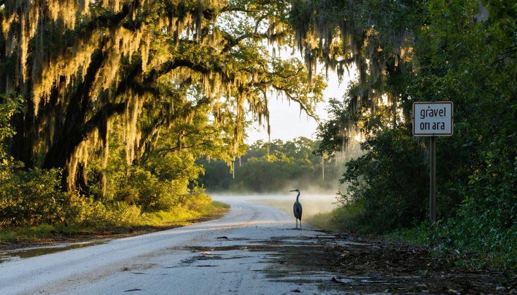
While Toonerville itself offers no historic structures to photograph, the surrounding natural landscape gives you a solid reason to make the trip. The adjacent Busch Wildlife Area delivers some of Missouri’s best natural attractions, where open fields, forests, and wetlands stretch across thousands of acres.
You’ll find wildlife encounters around every trail bend — white-tailed deer, migratory waterfowl, and wild turkey move freely through this preserved corridor.
To the east, the Columbus Bottom Conservation Area adds another layer of outdoor exploration, offering river access and bottomland habitat worth your time.
These natural spaces reward travelers who prefer open skies over crowded tourist traps. Toonerville’s ghost town status makes it the perfect excuse to escape into terrain that demands nothing from you except your presence.
How to Get to Toonerville From St. Louis
If you’re starting your ghost town road trip from St. Louis, Route 66 is your gateway west into St. Charles County.
You’ll follow the historic highway as it cuts through the region, keeping Warren County to your west and St. Louis County fading behind you.
Your final approach brings you into Toonerville’s unincorporated stretch, where the Columbus Bottom Conservation Area serves as a handy landmark to confirm you’ve arrived.
Starting Point In St. Louis
St. Louis makes the perfect launching pad for your ghost town adventure. Before you hit the road, soak in some St. Louis history at the Gateway Arch, a powerful reminder of America’s westward expansion spirit.
From there, your road trip tips start with heading west on I-44, which connects you directly to St. Charles County where Toonerville quietly waits.
You’ll want to fuel up and grab supplies before leaving the city, since Toonerville offers no municipal services or commercial stops. Columbus Bottom Conservation Area serves as an excellent final waypoint before reaching the community itself.
Keep your map handy, because unincorporated communities like Toonerville don’t always appear on standard GPS navigation. Embrace the open road and the freedom of discovering Missouri’s forgotten corners on your own terms.
Route 66 Travel Path
Route 66 is your ticket west from St. Louis into ghost town legends and open road freedom. This historic corridor carries you straight toward Toonerville, threading through St. Charles County’s quiet landscape where Route 66 history breathes through every mile marker.
Follow these key steps to navigate your path:
- Depart St. Louis heading west on Route 66, crossing into St. Charles County.
- Access I-44 using the Newburg exit as your reliable checkpoint along the corridor.
- Continue toward Toonerville, watching for the Columbus Bottom Conservation Area as your landmark anchor.
You’re not just driving a road — you’re tracing a legendary American route that once connected dreamers, drifters, and wanderers.
Toonerville waits quietly at the end of your Route 66 journey.
Final Approach To Toonerville
As you leave St. Louis, the city’s noise fades and travel anticipation builds with every mile westward into St. Charles County.
You’re heading toward Toonerville, an unincorporated community tucked near the Busch Wildlife Area, bordered by Warren County to the west and St. Louis County behind you.
Your final approach follows Route 66, the historic corridor that once connected travelers across America’s heartland.
Keep Columbus Bottom Conservation Area on your radar as a useful orientation point near the route.
You won’t find municipal signs or government markers welcoming you — Toonerville has no official boundaries, no commercial structures, and no municipal services.
What you’ll find instead is quiet Missouri countryside and the quiet satisfaction of reaching a place most travelers never knew existed.
Busch Wildlife Area: The Natural Landmark Next to Toonerville
Nestled right next to Toonerville, the Busch Wildlife Area is one of St. Charles County’s most rewarding natural escapes.
After exploring the ghost town, step into this sprawling refuge and embrace the freedom of wide-open wilderness.
Here’s why you should explore it:
- Wildlife activities like hiking, fishing, and hunting give you hands-on access to Missouri’s diverse ecosystem.
- Nature photography opportunities abound, with wetlands, forests, and open fields attracting eagles, deer, and migratory birds.
- The area offers unstructured exploration, letting you set your own pace and path.
You don’t need a packed itinerary here.
Just bring your camera, lace up your boots, and let the landscape guide you.
Pack light, move slow, and let the wild Missouri landscape lead the way.
It’s the perfect complement to your Toonerville ghost town adventure.
Start Your Toonerville Trip at Columbus Bottom Conservation Area
Before you head into Toonerville‘s quiet, roadside past, kick off your adventure at Columbus Bottom Conservation Area — a natural gateway that sets the tone for the entire trip.
This expansive Conservation Area sits along the Missouri River, offering open trails, wildlife watching, and sweeping bottomland views that remind you why road trips like this matter.
You’ll find Columbus Bottom delightfully unhurried — no crowds, no admission fees, just open land and river air.
Spend a morning walking the trails or scanning the sky for migrating birds before pointing your vehicle toward Toonerville.
The contrast between Columbus Bottom’s wide natural expanse and Toonerville’s forgotten roadside identity makes the journey feel intentional.
Start here, breathe it in, then follow the road toward a community that history almost completely swallowed.
The Route 66 Corridor That Connects Toonerville to St. Louis
Once you’ve explored Columbus Bottom Conservation Area, you’ll hop onto Route 66, the legendary highway that strings together the entire St. Louis-to-Toonerville corridor.
Along the way, you’ll pass through remote stops like Dodge, Cayuga, and May, each adding a layer of roadside history to your journey.
Finally, you’ll roll into Toonerville itself, an unincorporated ghost community in St. Charles County that’s as quiet as the comic strip name it carries is colorful.
Route 66 Starting Point
Route 66 is your launching pad for reaching Toonerville, threading through the St. Louis metro before opening into open Missouri countryside.
This legendary highway delivers raw freedom and authentic American road culture at every mile.
Follow these route highlights for a smarter drive:
- Begin in St. Louis – Jump onto Route 66 heading west, leaving the city’s skyline behind.
- Watch for I-44 access – Use the Newburg exit as a key navigation checkpoint along your path.
- Plan remote stops – Hit Dodge, Cayuga, May, and Dessa to experience true roadside Missouri.
Travel tips: carry cash, fuel up often, and embrace the unexpected.
Toonerville doesn’t announce itself loudly, so stay alert and enjoy every unscripted mile leading there.
Key Stops Along Route
Stretching west from St. Louis, Route 66 drops you into a string of remote stops worth exploring.
You’ll pass through Dodge, Cayuga, May, and Dessa—each carrying its own Historical Anecdotes tied to Missouri’s roadside past. These aren’t polished tourist destinations; they’re raw, quiet remnants of a faster era.
As you roll closer to Toonerville, the landscape thins out and the stories thicken. Toonerville Legends trace back to a gas station owner who hung a comic strip character on his sign, accidentally naming an entire community.
Along the way, swing through the Columbus Bottom Conservation Area for a natural reset before hitting the final stretch.
Every stop adds texture to the trip, turning a simple drive into something you’ll actually remember.
Reaching Toonerville Finally
Two lanes of Route 66 pull you directly from St. Louis into a stretch of Missouri history you won’t forget.
This corridor delivers raw, unfiltered Toonerville history without tourist traps or staged attractions. You’re driving toward a place that earned its community significance through a simple roadside gas station and a beloved comic strip image.
Before you arrive, lock in these three essentials:
- Access Toonerville from I-44 via the Newburg exit
- Use Columbus Bottom Conservation Area as your launching point
- Expect no municipal services — this is unincorporated freedom
The road doesn’t hand you comfort; it hands you context.
You’ll understand exactly why this small, unnamed stretch of St. Charles County still pulls curious travelers off the highway and into something genuinely real.
Dodge, Cayuga, and May: The Ghost Towns Near Toonerville
Along the route connecting Toonerville to the broader St. Charles County region, you’ll encounter three compelling ghost towns: Dodge, Cayuga, and May. These forgotten communities carry local legends that paint vivid pictures of lives once lived along Missouri’s backroads.
Each ghost town offers a distinct glimpse into rural history, where bustling activity has surrendered to silence and overgrowth. You won’t find tourist infrastructure here — that’s exactly the point.
These ghost towns reward curious travelers who embrace the unexpected and chart their own course. Stop at Dessa too, another remote waypoint worth exploring.
Pack your camera, fuel up before leaving St. Charles County’s main corridors, and give yourself enough time to wander freely. These communities don’t wait for you — they simply exist, quietly daring you to discover them.
What to Pack and Plan for Unincorporated Stops Like Toonerville

Visiting unincorporated communities like Toonerville means leaving behind the conveniences you’d normally take for granted.
There’s no municipal infrastructure, no corner store, and no emergency services nearby. Smart road trip planning makes the difference between a memorable adventure and a frustrating detour.
Your packing essentials should include:
- Full fuel tank and paper maps — GPS signals and gas stations aren’t guaranteed along Route 66 corridors near Toonerville.
- Water and snacks — No commercial structures exist here, so carry everything you’ll need.
- First aid kit and portable charger — Remote stops demand self-sufficiency.
You’re trading comfort for freedom, and that’s exactly the point.
Pack deliberately, plan your route through Columbus Bottom Conservation Area, and embrace the raw, unfiltered experience these ghost towns offer.
Why Small Roadside Communities Like Toonerville Still Draw Visitors
There’s something quietly magnetic about a place like Toonerville that no polished tourist destination can replicate. You’re not chasing manufactured experiences here — you’re tracing the outline of a life once lived along a forgotten stretch of road.
That roadside nostalgia hits differently when you realize a simple gas station sign inspired an entire community’s identity.
Sometimes the smallest things leave the deepest marks — a painted sign, a gas pump, a name that stuck.
Small stops like Toonerville remind you that history doesn’t always wear a museum badge. Sometimes it’s just a crossroads, a name on a map, and the story behind it.
That community charm — subtle, unguarded, and completely unhurried — is exactly what draws free-spirited travelers off the interstate. You choose your own pace, your own discoveries. Nobody’s selling you anything. That freedom is the whole point.
Frequently Asked Questions
What Time Zone Does Toonerville, Missouri Observe for Travel Planning?
You’ll never run out of time exploring Toonerville! It observes the Central Time Zone (UTC-6). Keep these travel tips in mind: adjust your clocks accordingly so you don’t miss a single time zone adventure.
What Are the Exact GPS Coordinates for Locating Toonerville, Missouri?
You’ll find Toonerville, Missouri at latitude 38° 41′ 30″ N and longitude 90° 44′ 0″ W. Lock these coordinates into your GPS for road trip tips exploring this fascinating ghost town history firsthand!
Are There Any Municipal Services Available for Visitors in Toonerville?
Over 30 million Americans explore unincorporated communities yearly—you won’t find municipal services in Toonerville. It offers zero tourist amenities, so plan ahead for visitor safety. You’re free to roam, but you’re entirely self-sufficient out here!
What Counties Border St. Charles County Where Toonerville Is Located?
You’ll find St. Louis County bordering St. Charles County to the east and Warren County to the west — both rich in County Attractions and Local History waiting to complement your Toonerville ghost town adventure!
What Comic Strip Originally Inspired the Naming of Toonerville, Missouri?
You’ll love this comic strip history gem — the “Toonerville Folks” strip, featuring its beloved Toonerville Trolley character, creatively inspired the town’s name after a gas station owner immortalized the charming comic image on his roadside sign.
References
- https://www.youtube.com/watch?v=LNAm0sZuNyw
- https://www.onlyinyourstate.com/trip-ideas/missouri/road-trip-through-mo-ghost-towns
- https://www.youtube.com/watch?v=Ih-ii_Y1Ljk
- https://www.legendsofamerica.com/mo-ghosttowns/
- https://www.reddit.com/r/StLouis/comments/1lt7g66/anyone_know_of_any_actually_interesting_and_fully/
- https://www.youtube.com/watch?v=o-Svvt0QcTo
- https://en.wikipedia.org/wiki/List_of_ghost_towns_in_Missouri
- https://sites.rootsweb.com/~motttp/history/ghost_towns/index.htm
- https://www.youtube.com/watch?v=wMTrm84oFhQ
- https://www.youtube.com/watch?v=ERFnlJ5pjBg