Planning a ghost town road trip to Whitetail, South Dakota starts in Rapid City, just 50 miles and one hour away via I-90 East. You’ll follow Forest Service Road 330 into the Black Hills, where crumbling foundations and weathered structures from an 1890s gold rush still stand. Bring a high-clearance vehicle, offline maps, and emergency supplies since cell service is limited. There’s far more to this haunting destination than meets the eye.
Key Takeaways
- Whitetail is approximately 50 miles southeast of Rapid City, accessible via I-90 East to Exit 390, then Whitetail Road.
- Use Forest Service Road 330 for deeper access; high-clearance or off-road vehicles are strongly recommended due to rough terrain.
- The ghost town dates to 1890, featuring crumbling foundations, weathered structures, and old mine openings from the failed gold rush.
- Park at Whitetail Creek Campground, which offers overnight camping and easy access to trails, including the scenic Whitetail Peak Trail.
- Carry water, a first-aid kit, and offline maps, as cell service is limited and facilities are minimal throughout the area.
How to Get to Whitetail From Rapid City
Reaching Whitetail from Rapid City takes roughly an hour, covering about 50 miles southeast through some of the Black Hills‘ most striking terrain.
You’ll follow scenic routes that wind through dense pine forests and dramatic ridgelines, passing historical landmarks that hint at the region’s gold rush past.
Take I-90 East to Exit 390, then turn onto Whitetail Road toward the trailhead. From there, Forest Service Road 330 carries you deeper into the hills, connecting you to Castle Creek Road heading west.
You’ll want a capable vehicle since sections get rough, especially after rain. Navigation coordinates N43.840657, W103.376041 keep you on track where cell service fades.
Pack water, a first-aid kit, and enjoy every mile — this drive earns its place on any road tripper’s list.
What Will You Actually See When You Arrive at Whitetail?
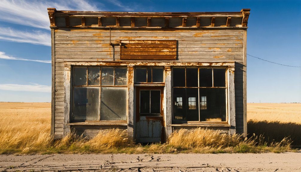
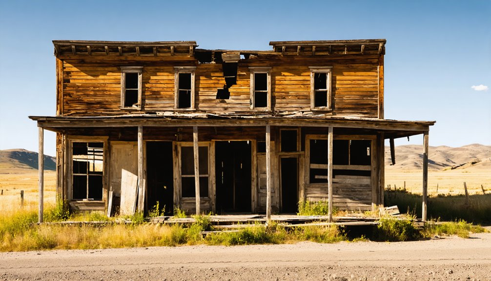
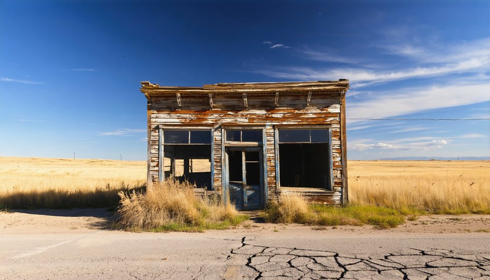
What greets you at Whitetail isn’t a polished historic site — it’s a raw, quietly haunting landscape that rewards curious eyes.
You’ll find ghostly remnants of the 1890s mining era scattered across the hillsides — crumbling foundations, weathered structures, and the quiet suggestion of lives once lived here. Several buildings still stand, though time hasn’t been gentle with them.
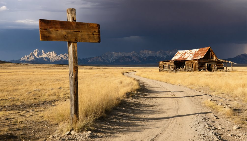
Beyond the ruins, scenic landscapes pull your attention in every direction. Whitetail Peak rises nearby, pine forests frame the terrain, and Castle Creek threads through the valley below.
The peaks, the pines, the creek below — the scenery here competes fiercely with the ruins for your attention.
Old mine openings dot the surrounding hills, visible reminders of the gold rush dreams that built this place.
Don’t rush it. Walk slowly, look closely, and let the silence do the talking.
How Whitetail Went From Gold Rush Camp to Ghost Town
When you stand among Whitetail’s crumbling foundations, you’re looking at the bones of a dream that collapsed almost as quickly as it formed.
Miners rushed into the Black Hills in 1890, chasing quartz veins they believed were loaded with gold, but the ground gave up more mica, silver, and graphite than the riches they’d imagined.
Once word spread that the gold wasn’t there in meaningful quantities, the camp emptied out, leaving behind a handful of structures and a silence that’s held ever since.
Gold Rush Origins
Like so many forgotten corners of the Black Hills, Whitetail’s story begins with gold fever. In 1890, prospectors flooded into this rugged stretch of South Dakota, convinced that quartz veins running through the hills would make them rich.
Gold mining operations launched quickly, drawing hopeful fortune-seekers enthusiastic to stake their claims and carve out a new life on their own terms.
But the earth had different plans. Miners uncovered less gold than expected, finding mica, silver, and graphite deposits instead.
The camp’s historical significance lies not in the riches it produced, but in what it reveals about the restless American spirit — the willingness to chase possibility into wild, uncharted territory.
Mining Camp Decline
Once the promise of gold faded, Whitetail’s decline came swiftly and without ceremony. The mining impact left behind scattered foundations and empty structures where a bustling camp once stood.
Community decline followed as miners packed up and moved toward richer strikes, leaving Whitetail to the pines and silence.
Walking through the site today, you’ll notice three clear signs of that rapid abandonment:
- Crumbling foundations from structures built during the brief gold rush boom
- Visible mine openings cut into surrounding hillsides, now quiet and overgrown
- Scattered remnants of what were once homes housing roughly six families by 1900
Whitetail didn’t die dramatically — it simply emptied. That rawness is exactly what makes exploring it feel so worth the drive.
Where Do You Park and Camp Near Whitetail?
Where you park sets the tone for your entire Whitetail adventure. Your best bet is Whitetail Creek Campground, which handles both standard vehicles and off-road rigs without issue.
Parking options here are straightforward — pull in, unload your gear, and you’re within easy reach of the trail network connecting Castle Peak to Whitetail Peak.
If you’re staying overnight, the camping facilities at Whitetail Creek Campground give you a solid base for exploring the surrounding Black Hills terrain.
You’ll wake up close to Castle Creek, pine ridges, and the remnants of the mining era scattered across the hillsides.
Forest Service Road 330 also provides access if you’re arriving by ATV or off-road vehicle.
Just confirm current road conditions before committing to that route.
Which Trails Connect Whitetail Peak to Castle Creek?
How you move through this landscape matters — the trail network here links Whitetail Peak directly to Castle Creek, giving you a connected route through some of the Black Hills’ most rugged terrain.
These trail descriptions reveal peak connections that reward explorers who prefer routes with purpose and scenery.
Here’s what you’ll encounter along the way:
- Whitetail Peak Trail — climbs through dense ponderosa pine, delivering panoramic views before descending toward the creek corridor below.
- Castle Creek Road connector — runs west from Forest Service Road 330, threading between rocky outcroppings and old mining scars.
- ATV-accessible spur trails — branch off toward Whitetail Creek Campground, letting you loop back without retracing your steps.
Together, these routes give you genuine freedom to explore on your own terms.
What Should You Know Before Driving Out to Whitetail?
Before you head out to Whitetail, know that Forest Service Road 330 provides the primary access route, and road conditions can shift quickly depending on recent weather.
You’ll want a high-clearance or off-road vehicle to handle the rugged terrain comfortably.
Once you’re out there, don’t count on your phone — cell service drops off fast in the remote sections surrounding Whitetail Peak, so carry a paper map, water, and a basic first-aid kit before you leave pavement behind.
Road Conditions And Access
Getting out to Whitetail isn’t exactly a Sunday drive, so you’ll want to plan your route carefully before hitting the road.
Road conditions and access routes vary depending on the season and your vehicle type.
Here’s what to expect before you roll out:
- Take I-90 to Exit 390, then follow Whitetail Road toward the trailhead — this is your primary access route into the area.
- Forest Service Road 330 connects you deeper into the Black Hills, but it’s best suited for high-clearance or off-road vehicles on rougher stretches.
- Castle Creek Road branches west off FS-330, giving you another angle into the surrounding terrain.
Park at Whitetail Creek Campground and explore from there on foot or by ATV.
Cell Service And Safety
Once you leave the main highway behind, cell coverage drops off fast in the Black Hills — so don’t count on your phone to bail you out if something goes wrong near Whitetail.
Remote stretches along Forest Service Road 330 and the trails connecting Castle Peak to Whitetail Peak can leave you completely off the grid.
Emergency preparedness isn’t optional out here — it’s essential. Pack enough water for your full trip, toss a first-aid kit in your vehicle, and let someone know your route before you head out.
Download offline maps while you still have a signal, and plot your coordinates (N43.840657, W103.376041) in advance.
Stay out of unstable structures, leave artifacts where you find them, and respect posted boundaries. The Black Hills reward prepared travelers.
Why Is Whitetail Considered a True South Dakota Ghost Town?
Although the term “ghost town” gets thrown around loosely, Whitetail earns the label honestly. Founded during the 1890 Black Hills gold rush, it boomed briefly, then emptied just as fast when the riches didn’t pan out.
What you’ll find today confirms its historical significance:
- Abandoned structures and crumbling foundations still mark where miners once lived and worked, giving you a raw, unfiltered window into the past.
- A population that vanished — by 1900, only roughly six houses remained, and eventually even those residents moved on.
- No active commerce or residents — no stores, no services, just open land and silence.
You’re not visiting a recreated attraction here. Whitetail is the real deal — untouched, unglamourized, and completely yours to explore on your own terms.
Frequently Asked Questions
What Elevation Is Whitetail, South Dakota Located at Above Sea Level?
You’ll find Whitetail, South Dakota’s ghost town geography sitting at roughly 2,400 feet above sea level. That elevation significance shapes its rugged Black Hills terrain, crisp air, and stunning panoramic views you won’t forget.
How Many Houses Existed in Whitetail by the Year 1900?
By 1900, you’d have found roughly 6 houses defining Whitetail’s entire world! Exploring Whitetail history today, you’ll discover these abandoned structures — crumbling foundations whispering stories of a once-thriving mining community that once promised untold riches and absolute freedom.
What Minerals Were Discovered at Whitetail Besides Gold?
You’ll find that mineral exploration at Whitetail uncovered mica, silver, and graphite deposits beyond gold. These discoveries carry historical significance, revealing how the site’s true underground treasures shaped the community’s brief but fascinating mining legacy.
Is There Cell Service Available Throughout the Whitetail Wilderness Area?
Like a fading signal fire, cell coverage dims as you venture deeper into Whitetail’s rugged terrain. You’ll find wilderness connectivity unreliable in remote sections, so download your maps and embrace the untamed freedom before you go.
What County Is the Whitetail Ghost Town Located In?
You’ll find Whitetail’s ghost town history nestled in Buffalo County, South Dakota. This rugged landscape holds local legends from its 1890s mining past, inviting you to explore its freedom-filled, untamed wilderness and crumbling historical foundations.
References
- https://en.wikipedia.org/wiki/List_of_ghost_towns_in_South_Dakota
- https://www.youtube.com/watch?v=kpkBy_2SxlA
- https://blackhillsatvdestinations.com/rochford-ghost-town/
- https://www.powderhouselodge.com/black-hills-attractions/fun-attractions/ghost-towns-of-western-south-dakota/?2021_TAG
- https://myxoadventures.com/the-ghost-town-of-spokane-south-dakota/
- https://www.youtube.com/watch?v=CgAngtZwhTI
- https://www.youtube.com/watch?v=GQH5mp2emBw
- https://33travels.com/ghost-towns-in-south-dakota/
- https://www.youtube.com/watch?v=7zKYq52nY5o
- https://www.roadsideamerica.com/tip/55850


