Calcite, SD
County:
Meade
Zip Code:
Latitude / Longitude:
Elevation:
Time Zone:
Central (CST) (UTC-6)
Established:
Disestablished:
Comments:
Remains:
Current Status:
Remarks:
Canyon City, SD
County:
Pennington
Zip Code:
Latitude / Longitude:
Elevation:
Time Zone:
Central (CST) (UTC-6)
Established:
Disestablished:
Comments:
Remains:
Current Status:
Remarks:
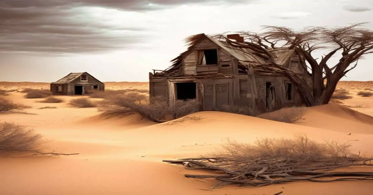
Carbonate, SD
County:
Lawrence
Zip Code:
Latitude / Longitude:
44°24′00″N 103°52′07″W / 44.3999839°N 103.8685367°W / 44.3999839
Elevation:
5,558 ft (1,694 m)
Time Zone:
Central (CST) (UTC-6)
Established:
1881
Disestablished:
1939
Comments:
Carbonate, also known as Carbonate Camp, West Virginia, Virginia, and Carbonate City (1881-1939), is a ghost town located in Lawrence County, South Dakota, United States. The town was first known as West Virginia, then Virginia, and later Carbonate Camp and Carbonate for its carbonate mineral ores.
Remains:
James Ridpath first settled the area around 1880 and staked out the West Virginia Mine. There, he discovered the carbonate ore, a mixture of silver and lead, that would cause the town to prosper. Carbonate was founded in July 1881, after an article appeared in the Black Hills Daily Times about the ore and created an influx of settlers. By August, 200 men had settled in the town in tents and began placer mining for gold; a wagon road to Spearfish was completed that same month. A reservoir was built so that the residents would not have to use the same springs that the livestock did. A fund dedicated to growing the camp began in Deadwood, and several saloons, shops, and restaurants moved into the town. Two barbershops, two laundries, an office, and a drug store also emerged, among other businesses. The Carbonate Reporter was the first newspaper in the town, and The Nugget was established later, in 1886. By September, the outside interest in the town had started to fade, and the rush to settle in Carbonate slowed down. In June 1883, mining operations were suspended because the roads had fallen into such disrepair that they could not be used. Ridpath, hoping to attract newcomers, planted an apple orchard and a strawberry bed.
Current Status:
Carbonate is located in the Black Hills of west-central Lawrence County, South Dakota, United States. The climate of Carbonate is the same as the rest of western South Dakota; it is hot in the summer and freezing in the winter. It is located about 4 miles east of the ghost town of Maitland, near Squaw Creek, or 5 miles north of Trojan, 10.5 miles southeast of Spearfish, and 7 miles northwest of Central City. While the houses were very scattered, the main site encircled an open valley. Only the buildings’ foundations are left.
Remarks:
In 1888 and 1889, a diphtheria epidemic struck the area; the fumes from the smelter had killed every cat in the town and probably opened the door to respiratory diseases and illnesses spread by rats. Signs reading “Keep out: Black Diphtheria!” stayed in place until 1910. Silver prices began to decline in 1891, and soon, the town was largely abandoned. In 1900, the town’s Hugginson Hotel was torn down for lumber to be used at the nearby Cleopatra Mill. In 1901, the mine was reworked and produced another 18,511 ounces (524,800 g) of silver and 91 metric tons (90 long tons; 100 short tons) of lead. In 1911, the mine was accidentally flooded and drove the owners out. Iron Hill continued operation until the 1930s, and today, only one house and headframe are the only remnants of the mine. Carbonate’s last resident, an old man named Raspberry Brown, died in 1939.
Cartersville, SD
County:
Lawrence
Zip Code:
Latitude / Longitude:
Elevation:
Time Zone:
Central (CST) (UTC-6)
Established:
Disestablished:
Comments:
Remains:
Current Status:
Remarks:
Carterville, SD
County:
Pennington
Zip Code:
Latitude / Longitude:
Elevation:
Time Zone:
Central (CST) (UTC-6)
Established:
Disestablished:
Comments:
Remains:
Current Status:
Remarks:
Carwye, SD
County:
Meade
Zip Code:
Latitude / Longitude:
Elevation:
Time Zone:
Central (CST) (UTC-6)
Established:
Disestablished:
Comments:
Remains:
Current Status:
Remarks:
Cascade, SD
County:
Fall River
Zip Code:
Latitude / Longitude:
Elevation:
Time Zone:
Central (CST) (UTC-6)
Established:
Disestablished:
Comments:
Remains:
Current Status:
Remarks:
Castle Rock, SD
County:
Butte
Zip Code:
Latitude / Longitude:
44° 57′ 52″ N, 103° 25′ 28″ W
Elevation:
Time Zone:
Central (CST) (UTC-6)
Established:
Disestablished:
Comments:
Castle Rock is an unincorporated community in Butte County, in the U.S. state of South Dakota.
Remains:
A post office called Castle Rock was established in 1910, and remained in operation until 1972. The community took its name from Castle Rock Butte.
Current Status:
Remarks:
Castleton, SD
County:
Pennington
Zip Code:
Latitude / Longitude:
Elevation:
Time Zone:
Central (CST) (UTC-6)
Established:
Disestablished:
Comments:
The town was abandoned twice: first in 1880, when the mines failed; and again in the 1890s.
Remains:
Current Status:
Remarks:
Castleville, SD
County:
Zip Code:
Latitude / Longitude:
Elevation:
Time Zone:
Central (CST) (UTC-6)
Established:
Disestablished:
Comments:
The location of the town is unknown other than that it was located in or around the Black Hills. It could have also been located in Wyoming.
Remains:
Current Status:
Remarks:
Centennial City, SD
County:
Lawrence
Zip Code:
Latitude / Longitude:
Elevation:
Time Zone:
Central (CST) (UTC-6)
Established:
Disestablished:
Comments:
Existed around 1876
Remains:
Current Status:
Remarks:
Centennial Park, SD
County:
Lawrence
Zip Code:
Latitude / Longitude:
Elevation:
Time Zone:
Central (CST) (UTC-6)
Established:
Disestablished:
Comments:
Remains:
Current Status:
Remarks:
Channing, SD
County:
Lawrence
Zip Code:
Latitude / Longitude:
Elevation:
Time Zone:
Central (CST) (UTC-6)
Established:
Disestablished:
Comments:
It was a very small town that was only shown on one map. It was about 3 miles northwest of Nemo.
Remains:
Current Status:
Remarks:
Cheyenne Falls, SD
County:
Fall River
Zip Code:
Latitude / Longitude:
Elevation:
Time Zone:
Central (CST) (UTC-6)
Established:
Disestablished:
Comments:
A very small community that never had a large population. It had a post office in 1900.
Remains:
Current Status:
Remarks:
Coal Springs, SD
County:
Perkins
Zip Code:
Latitude / Longitude:
45° 26′ 30″ N, 102° 6′ 28″ W
Elevation:
Time Zone:
Central (CST) (UTC-6)
Established:
Disestablished:
Comments:
Coal Springs is an extinct town in Perkins County, in the U.S. state of South Dakota. The GNIS classifies it as a populated place.
Remains:
Coal Springs was laid out in 1908, and named for the fact the community was located in a coal mining district. A post office called Coal Springs was established in 1909, and remained in operation until 1954.
Current Status:
Remarks:
Cold Springs, SD
County:
Custer
Zip Code:
Latitude / Longitude:
Elevation:
Time Zone:
Central (CST) (UTC-6)
Established:
Disestablished:
Comments:
This mining town once had a school and cemetery.
Remains:
Current Status:
Remarks:
Conata, SD
County:
Pennington
Zip Code:
Latitude / Longitude:
43° 43′ 43″ N, 102° 11′ 20″ W
Elevation:
Time Zone:
Central (CST) (UTC-6)
Established:
Disestablished:
Comments:
Conata is an ghost town in Pennington County, in the U.S. state of South Dakota. The GNIS classifies it as a populated place.
Remains:
Current Status:
Conata had its start in 1907 when the Milwaukee Railroad was extended to that point. A post office called Conata was established in 1908, and remained in operation until 1954.
Remarks:
Copper Camp, SD
County:
Pennington
Zip Code:
Latitude / Longitude:
Elevation:
Time Zone:
Central (CST) (UTC-6)
Established:
Disestablished:
Comments:
Remains:
Current Status:
Remarks:
Creston, SD
County:
Zip Code:
Latitude / Longitude:
43° 54′ 38″ N, 102° 41′ 56″ W
Elevation:
Time Zone:
Central (CST) (UTC-6)
Established:
Disestablished:
Comments:
Creston is an unincorporated community in Pennington County, in the U.S. state of South Dakota.
Remains:
A post office called Creston was established in 1886, and remained in operation until 1946. The community’s name is a transfer from Creston, Iowa.
Current Status:
Remarks:
Cyanide, SD
County:
Lawrence
Zip Code:
Latitude / Longitude:
Elevation:
Time Zone:
Central (CST) (UTC-6)
Established:
Disestablished:
Comments:
Was in the same mining district as Balmoral, Preston, and Dacy.
Remains:
Current Status:
Remarks:
Dacy, SD
County:
Lawrence
Zip Code:
Latitude / Longitude:
Elevation:
Time Zone:
Central (CST) (UTC-6)
Established:
Disestablished:
Comments:
Was in the same mining district as Balmoral, Cyanide, and Preston.
Remains:
Current Status:
Remarks:
Dansby, SD
County:
Custer
Zip Code:
Latitude / Longitude:
Elevation:
Time Zone:
Central (CST) (UTC-6)
Established:
Disestablished:
Comments:
Had a maximum population of 50-75 people. Also named Danby.
Remains:
Current Status:
Remarks:
Deerfield, SD
County:
Pennington
Zip Code:
Latitude / Longitude:
44° 1′ 2″ N, 103° 50′ 3″ W
Elevation:
Time Zone:
Central (CST) (UTC-6)
Established:
Disestablished:
Comments:
Deerfield is an unincorporated community in Pennington County, in the U.S. state of South Dakota.
Remains:
A post office called Deerfield was established in 1892, and remained in operation until 1954. The community was so named on account of the area being a favorite hunting ground of deer.
Current Status:
Remarks:
Deermont, SD
County:
Butte
Zip Code:
Latitude / Longitude:
Elevation:
Time Zone:
Central (CST) (UTC-6)
Established:
Disestablished:
Comments:
Remains:
Current Status:
Remarks:
Devoe, SD
County:
Faulk
Zip Code:
Latitude / Longitude:
Elevation:
Time Zone:
Central (CST) (UTC-6)
Established:
Disestablished:
Comments:
Remains:
Current Status:
Remarks:
Diamond City, SD
County:
Lawrence
Zip Code:
Latitude / Longitude:
Elevation:
Time Zone:
Central (CST) (UTC-6)
Established:
Disestablished:
Comments:
Existed around 1880
Remains:
Current Status:
The surviving ruins of the town were torn down in 1967
Remarks:
Dumont, SD
County:
Lawrence
Zip Code:
Latitude / Longitude:
Elevation:
Time Zone:
Central (CST) (UTC-6)
Established:
Disestablished:
Comments:
Remains:
Current Status:
Remarks:
Dyce, SD
County:
Moody
Zip Code:
Latitude / Longitude:
Elevation:
Time Zone:
Central (CST) (UTC-6)
Established:
Disestablished:
Comments:
Historic post office.
Remains:
Current Status:
Remarks:
East Sioux Falls, SD
County:
Minnehaha
Zip Code:
Latitude / Longitude:
43° 31′ 39″ N, 96° 39′ 7″ W
Elevation:
Time Zone:
Central (CST) (UTC-6)
Established:
Disestablished:
Comments:
East Sioux Falls was a city located in southeastern Minnehaha County, South Dakota located about 6 miles east of Sioux Falls along with South Dakota Highway 42 on the Big Sioux River.
Remains:
During the 1880s, the quarrying of a distinctive pink stone known as jasper or quartzite had developed into a successful business in Sioux Falls. In 1887, the Sioux Falls Granite Company opened four quarries six miles due east of downtown Sioux Falls in Split Rock Township. This area had an abundance of quartzite along the bluffs overlooking the Big Sioux River and exposure to the Earth’s surface ensured that the stone could be easily mined. Hundreds of workers and their families settled in a nearby community known at the time as Ives.
Current Status:
Numerous structures were built in East Sioux Falls including worker’s cottages, post office, town hall, depot, schoolhouse, general store, hotel, grain elevator, stable, saloons, and jail. The remains of several buildings are still visible within the nature area.
Remarks:
The city felt the impact of a slowing economy in 1891 and economic problems mounted with the depression of 1893. The tough economic times of the 1890s pushed the Sioux Falls Granite Company into bankruptcy and the property was acquired by George H. Perry who operated the East Sioux Falls Quarry Company for a time. By the turn of the century, concrete had taken the place of stone as a building material. These events contributed to the out-migration of residents from East Sioux Falls and forced the city to give up its charter in 1913. People continued to reside in the community until the last few structures were demolished in the late 1980s.
Elizabethtown, SD
County:
Lawrence
Zip Code:
Latitude / Longitude:
Elevation:
Time Zone:
Central (CST) (UTC-6)
Established:
Disestablished:
Comments:
Later incorporated into Deadwood.
Remains:
Current Status:
Remarks:
Elmore, SD
County:
Lawrence
Zip Code:
Latitude / Longitude:
Elevation:
Time Zone:
Central (CST) (UTC-6)
Established:
Disestablished:
Comments:
Remains:
Current Status:
Remarks:
Emmet, SD
County:
Union
Zip Code:
57004
Latitude / Longitude:
42°57′9″N 96°44′35″W / 42.95250°N 96.74306°W / 42.95250
Elevation:
1,299 ft (396 m)
Time Zone:
Central (CST) (UTC-6)
Established:
Disestablished:
Comments:
Emmet is a ghost town in Emmet Township, Union County, South Dakota, South Dakota, United States.
Remains:
The Emmet community started as early as 1871. The area was settled by an Irish-German colony, originating from Galena, Illinois. The community once had a general store, Emmet Hall, and St. Joseph’s Catholic Church.
Current Status:
The old Emmet Hall building (also known as Forrester’s Hall) stood for a few decades. It was located approximately half a mile north and two miles west of the St. Joseph Cemetery. The multisided building was best known as the place where Lawrence Welk and his band once performed. After the 1950s, the building was no longer used as a dance hall and was converted for farm use. Two large sliding doors were added to the building’s west side; and, the building was reported to have been used to store grain and to house sheep. The demolition of the building was reported to have occurred in November 2015.
Remarks:
Eventually, the railroads passed through larger towns, causing populations and businesses in smaller communities such as Emmet to move away. Today, the only physical remnant of the Emmet community is the parsonage and the St. Joseph Cemetery, which surrounds the site where the old Catholic church once stood. This cemetery is still commonly known as the Emmet Cemetery.
Englewood, SD
County:
Lawrence
Zip Code:
Latitude / Longitude:
44° 17′ 49″ N, 103° 47′ 5″ W
Elevation:
Time Zone:
Central (CST) (UTC-6)
Established:
Disestablished:
Comments:
Englewood is an unincorporated community in Lawrence County, in the U.S. state of South Dakota.
Remains:
Englewood was established as Ten-Mile Ranch, a stagecoach stop in the late 1870s. The name was changed when Englewood became a railroad center with the construction of the Spearfish branch leading from there in 1893. A roundhouse, depot, water tower, and small yard made Englewood a bustling railroad spot for many years. A post office called Englewood was established in 1892 and remained in operation until 1943. The community most likely was named after Englewood, Chicago.
Current Status:
Remarks:
Etta, SD
County:
Pennington
Zip Code:
Latitude / Longitude:
43°52′51″N 103°25′07″W / 43.8808213°N 103.4185236°W / 43.8808213
Elevation:
577 ft (1 395 m)
Time Zone:
Central (CST) (UTC-6)
Established:
Disestablished:
Comments:
Etta, also known as Etta Camp and Etta Mine, is a ghost town in Pennington County, South Dakota, United States. It was a successful mining town, known for its discovery of the largest spodumene crystal ever found.
Remains:
Etta was in existence before the nearby town of Keystone. It was first started by the Harvey Peak Tin Mining, Milling, and Manufacturing Company as a mica mining camp. However, the ore was revealed to actually be cassiterite, a tin ore; this discovery caused dozens of new mines to spring up all over the Black Hills. Most of these mines were not successful because there was not a large amount of tin in the area. The company built a mill and smelter in 1883. During the mining operations, a large lump of tin weighing 1,200 pounds (540 kg) was melted from hand-picked cassiterite deposits; the miners described it as being as “big as a small boy.” This tin was displayed to potential shareholders in London, England in order to raise support for the company. However, the company dissolved after a lawsuit, and the mine ceased operation until 1898. That year, the mine began producing spodumene, a lithium ore, and became well known for its huge crystals.
Current Status:
The largest spodumene crystal in the world was found in the mine. Until about 1900, Etta had the only post office in the Keystone area, and by that time, its population was 24. In the 1920s, the mining operations flourished. The mine shut down in 1959, and the town was eventually abandoned. All that remains are the foundations of the smelter and mill, as well as the mine itself.
Remarks:
Etta is located in the Black Hills of Pennington County, South Dakota, United States. It is about one-half mile south of Keystone, South Dakota, and can be accessed using the Glendale road and turning south from U.S. Route 16A.
Eureka, SD
County:
Pennington
Zip Code:
Latitude / Longitude:
Elevation:
Time Zone:
Central (CST) (UTC-6)
Established:
Disestablished:
Comments:
Was mentioned in an 1879 newspaper article. Its location is unknown.
Remains:
Current Status:
Remarks:
Evans Place, SD
County:
Lawrence
Zip Code:
Latitude / Longitude:
Elevation:
Time Zone:
Central (CST) (UTC-6)
Established:
Disestablished:
Comments:
Its exact location is unknown.
Remains:
Current Status:
Remarks:
Everts, SD
County:
Walworth
Zip Code:
Latitude / Longitude:
Elevation:
Time Zone:
Central (CST) (UTC-6)
Established:
Disestablished:
Comments:
Remains:
Current Status:
Remarks:
Fair View, SD
County:
Pennington
Zip Code:
Latitude / Longitude:
Elevation:
Time Zone:
Central (CST) (UTC-6)
Established:
Disestablished:
Comments:
Existed around 1887
Remains:
Current Status:
Remarks:
Farmingdale, SD
County:
Pennington
Zip Code:
Latitude / Longitude:
43° 57′ 33″ N, 102° 53′ 2″ W
Elevation:
Time Zone:
Central (CST) (UTC-6)
Established:
Disestablished:
Comments:
Farmingdale is an unincorporated community in Pennington County, in the U.S. state of South Dakota.
Remains:
A post office called Farmingdale was established in 1887, and remained in operation until 1973. A large share of the early settlers being farmers caused the name to be selected.
Current Status:
Remarks:
Firesteel, SD
County:
Davison
Zip Code:
Latitude / Longitude:
Elevation:
Time Zone:
Central (CST) (UTC-6)
Established:
Disestablished:
Comments:
Remains:
Current Status:
Remarks:
Flatiron, SD
County:
Lawrence
Zip Code:
Latitude / Longitude:
44°19′35″N 103°46′07″W / 44.3263733°N 103.7685318°W / 44.3263733
Elevation:
5,436 ft (1,657 m)
Time Zone:
Central (CST) (UTC-6)
Established:
Disestablished:
Comments:
Flatiron, formerly known as Yellow Creek or Flat Iron City, is a ghost town in Lawrence County, South Dakota, United States. It was known for its highly successful gold mining.
Remains:
As people began to move into the Black Hills, several cabins sprang up around Yellow Creek in the Black Hills. In 1894, the town began to be staked out but was not yet fully founded; when the area boomed around May 1896, a series of large buildings and small cabins, including a two-story boarding house, was built. Flatiron was first advertised on a billboard as Flat Iron City. Freshwater springs were located nearby, and a well was dug. Eventually, it became known as Yellow Creek, and then again as Flatiron.
Current Status:
The town prospered because of the mine. Shortly after its founding, it had one dozen homes. By 1915, it had about 30 buildings, including a school, several large mills, many stores, and a post office. The tailings covered one side of a nearby large valley. In 1927, a powerful flood resulting from heavy rain caused these accumulated tailings to slump. The railroad, train, and engine were buried under several feet of sand, killing the engineer in the process. The tracks were not uncovered until around 1974, when Lead and Deadwood, two neighboring towns, began to use the tailings to sand icy roads during winter. The mines eventually shut down and the town was completely abandoned. More than 80% of the town has sunk into the caving tunnels below, and the rest are only foundations.
Remarks:
Flatiron is located in the Black Hills of east-central Lawrence County, South Dakota, United States. It is located about 2 miles south of Lead, South Dakota. The town itself is built on the side of a hill and near a large valley. To the north is the abandoned Little Blue Mine.
Flora, SD
County:
Custer
Zip Code:
Latitude / Longitude:
Elevation:
Time Zone:
Central (CST) (UTC-6)
Established:
Disestablished:
Comments:
Was a tin mining town. Its exact location is unknown.
Remains:
Current Status:
Remarks:
Floral, SD
County:
Pennington
Zip Code:
Latitude / Longitude:
Elevation:
Time Zone:
Central (CST) (UTC-6)
Established:
Disestablished:
Comments:
Remains:
Current Status:
Remarks:
Folsom, SD
County:
Custer
Zip Code:
Latitude / Longitude:
43° 49′ 31″ N, 102° 52′ 12″ W
Elevation:
Time Zone:
Central (CST) (UTC-6)
Established:
Disestablished:
Comments:
Folsom is an unincorporated community in Custer County, in the U.S. state of South Dakota.
Remains:
A post office called Folsom was established in 1886, and remained in operation until 1948. The community was named after Frances Folsom Cleveland, First Lady of the United States.
Current Status:
Remarks:
Forest City, SD
County:
Potter
Zip Code:
Latitude / Longitude:
45° 0′ 10″ N, 100° 18′ 1″ W
Elevation:
Time Zone:
Central (CST) (UTC-6)
Established:
Disestablished:
Comments:
Forest City is an unincorporated community in Potter County, in the U.S. state of South Dakota.
Remains:
A post office called Forest City was established in 1884 and remained in operation until 1943. The community was so named for a nearby tract of forest.
Current Status:
Remarks:
Fountain City, SD
County: Lawrence
Zip Code:
Latitude / Longitude:
Elevation:
Time Zone: Central (CST) (UTC-6)
Established:
Disestablished:
Comments: Also called Mountain City. Was incorporated into Deadwood.
Remains:
Current Status:
Remarks: