
North Dakota’s mining ghost towns are remnants of a lignite coal industry that collapsed within a single generation. You’ll find sites like Sims, Haynes, and Zap scattered across Morton, Adams, and Mercer Counties, where resource depletion and railroad abandonment severed communities from economic survival. Standing brick buildings, grain elevators, and rail alignments still mark many locations. Cross-referencing GNIS records, county directories, and geological survey data helps you pinpoint these sites accurately—and there’s far more to uncover about what shaped their rise and fall.
Key Takeaways
- North Dakota’s mining ghost towns, like Sims and Haynes, were largely driven by lignite coal extraction and railroad expansion in the late 1800s.
- Towns collapsed when coal seams depleted, underground fires destroyed mines, or rail lines were discontinued, cutting off essential transportation and supply chains.
- Notable ghost towns include Sims (Morton County), Haynes (Adams County), Zap (Mercer County), and informal mining camps near Wilton in McLean County.
- Remaining remnants vary by site, including grain elevators, brick buildings, foundations, and visible railroad grades depending on abandonment timing and weathering.
- Researchers can locate these sites by cross-referencing GNIS records, county directories, railroad maps, and lignite coal data from the North Dakota Geological Survey.
What Drove North Dakota’s Mining Boom and Bust?
Lignite coal and railroad expansion drove North Dakota’s mining boom in the late 1800s, with towns like Sims in Morton County emerging in 1883 to supply both fuel and brick to a rapidly industrializing region.
Rail lines determined which settlements thrived, connecting extraction sites to broader markets and enabling rapid population growth. When rail patterns shifted and coal demand declined, those same towns collapsed just as quickly.
Economic diversification never took hold in most mining communities, leaving residents with no fallback when primary industries failed.
Environmental impacts from extraction also degraded surrounding land, making agricultural recovery difficult and accelerating abandonment.
You can trace North Dakota’s boom-bust cycle directly through these vanished settlements—each one a precise record of how single-industry dependence, infrastructure dependency, and resource depletion combine to erase communities entirely.
How Railroad Expansion Built These Lignite Coal Towns
Railroad expansion didn’t just connect North Dakota’s lignite coal towns—it created them. Rail lines determined where settlements formed, which mines got developed, and which communities thrived.
Railroad expansion didn’t just connect lignite coal towns across North Dakota—it created them entirely from scratch.
Towns like Sims in Morton County existed precisely because railroads needed local coal supplies and brick materials to sustain operations. Without rail access, lignite deposits held little commercial value.
You’re looking at a direct cause-and-effect relationship between historic transportation infrastructure and settlement patterns. Railroads platted townsites, attracted homesteaders, and established economic hierarchies across the region.
When lines shifted or discontinued, towns collapsed just as deliberately as they’d been built.
Today, cultural preservation efforts document these railroad-coal interdependencies, helping you understand why specific counties like Morton and McKenzie contain disproportionate concentrations of abandoned, rail-dependent mining settlements.
The Most Notable Mining Ghost Towns in North Dakota
When you examine North Dakota’s most notable mining ghost towns, Sims in Morton County stands out as the clearest example of a lignite coal town that rose and fell with railroad-era resource extraction. Founded in 1883 and still recognized for its preserved structures.
You’ll find that most surviving mining-era relics share a common profile: they were platted along rail lines, built around coal extraction, and abandoned once mining became unprofitable or transportation patterns shifted.
Tracking these sites gives you a precise lens through which to analyze how lignite coal development shaped and then erased entire communities across the state.
Sims Coal Mining Town
Among North Dakota’s mining ghost towns, Sims stands out as one of the most historically significant. Founded in 1883 in Morton County, it developed around lignite coal extraction, supplying brick and fuel during North Dakota’s railroad expansion era.
Miners targeted a productive coal seam beneath the surrounding prairie, applying early mining techniques suited to shallow lignite deposits. The town’s identity was inseparable from its industrial output.
When coal demand declined and extraction became economically unviable, Sims lost its economic foundation rapidly. Residents dispersed, and infrastructure fell into disrepair.
Today, Sims remains one of North Dakota’s better-preserved railroad coal towns, offering you a direct look at how resource dependency shaped — and ultimately doomed — small settlements across the region’s open landscape.
Lignite Coal Ghost Towns
Lignite coal shaped North Dakota’s settlement patterns as directly as it hollowed them out. When coal seam extraction became unprofitable or mining technology advanced beyond what small operations could sustain, towns emptied fast. You’ll find these sites scattered statewide, each representing a community that formed around resource extraction and collapsed when it stopped.
Most Notable Lignite Coal Ghost Towns:
- Sims – Morton County; railroad coal town founded 1883, well-preserved structures remain
- Haynes – Adams County; lignite-driven settlement abandoned after seam depletion
- Zap – Mercer County; coal-dependent economy that declined sharply post-extraction
- Wilton-area camps – McLean County; informal mining settlements with no surviving infrastructure
These towns didn’t fail randomly. They followed a predictable extraction cycle you can still trace through county records and federal place-name archives.
Mining-Era Railroad Relics
Railroad expansion and coal extraction operated as a single economic engine in North Dakota, and the ghost towns they left behind reflect that entanglement directly. When you examine sites like Sims in Morton County, you’re analyzing a preserved intersection of both forces. Its town architecture still communicates the operational logic of a coal-supply depot built around rail access.
Mining equipment remnants anchor the site historically, confirming extraction preceded settlement patterns rather than following them. Charbonneau and Tagus follow comparable structural trajectories, each platted along rail corridors and abandoned once economic utility collapsed.
You can trace these towns not as failures but as deliberate industrial installations that served their purpose and stopped. Understanding that distinction gives you a sharper, more accurate framework for interpreting North Dakota’s mining-era railroad landscape.
What Survives at These Abandoned North Dakota Sites

What remains at North Dakota’s abandoned sites varies considerably depending on the town’s origin, abandonment date, and exposure to weathering and land reuse.
You’ll find that historical architecture survives best where towns declined slowly rather than collapsed suddenly. Local legends often fill gaps where physical evidence has disappeared entirely.
Four categories of remnants you’re likely to encounter:
- Standing structures – grain elevators, brick buildings, or coal-related foundations at sites like Sims
- Collapsed remnants – rotted timber frames, crumbling walls, and overgrown lots
- Infrastructure traces – rail alignments, road grades, and fence lines marking original town grids
- Documented absence – submerged or fully reclaimed sites where only federal place-name records confirm prior existence
Knowing which category a site falls into helps you plan visits efficiently.
Why So Many Coal Towns Collapsed Within a Generation
When you examine the collapse of North Dakota’s coal towns, you’ll find that lignite demand and railroad dependency created a fragile economic pairing.
Once demand dropped or a rail line rerouted, a town lost both its market and its supply chain simultaneously.
You’re looking at settlements that couldn’t survive either disruption independently, let alone both at once.
Lignite Demand Rapidly Faded
Lignite coal powered North Dakota’s early homestead economy, but its collapse came fast—often within a single generation of a town’s founding. Several converging forces drove abandonment:
- Cheaper energy alternatives — oil and natural gas undercut lignite’s market value rapidly after the 1920s.
- Coalbed fires — spontaneous underground combustion destroyed viable seams, making continued extraction dangerous and unprofitable.
- Rail-line withdrawals — without freight infrastructure, mining towns couldn’t ship product competitively.
- Environmental restoration costs — post-extraction land remediation became financially prohibitive for small operators, accelerating closure decisions.
You can trace this pattern across Morton and McKenzie counties, where thriving extraction sites became barren lots within decades.
The market didn’t gradually fade—it shifted decisively, leaving towns structurally intact but economically hollow and permanently depopulated.
Rail Lines Abandoned Towns
Cheaper energy alternatives gutted lignite’s profitability, but rail abandonment delivered the killing blow. When railroads pulled their lines, coal towns lost their only economic artery. Supply chains collapsed, operators couldn’t move product, and residents left within months.
You can trace this pattern across Morton, McKenzie, and Mountrail counties, where ghost towns cluster along former rail corridors.
Without rail access, no urban revitalization effort could sustain these communities. Infrastructure costs became prohibitive, and state investment followed population, not nostalgia.
Today, tourism development offers the only realistic path toward preserving what remains. Some sites retain structures worth documenting, but most exist solely as coordinates on federal place-name records.
Rail abandonment didn’t just empty these towns—it permanently severed their connection to any viable economic future.
How to Find North Dakota Mining Ghost Towns Today
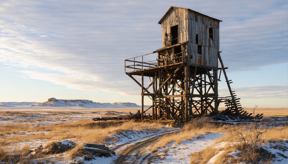
Tracking down North Dakota’s mining ghost towns requires cross-referencing multiple source types, since no single inventory covers every site thoroughly. Federal place-name archives, county historical societies, and local folklore each fill gaps the others miss. Preservation efforts vary widely, so always verify current site conditions before traveling.
No single source maps every ghost town—cross-reference federal archives, county societies, and local folklore to fill the gaps.
Use these four research strategies:
- Cross-reference federal GNIS records with county-level ghost-town directories to identify discrepancies and confirmed vanished sites.
- Contact Morton and McKenzie County historical societies for unpublished maps and verified settlement dates.
- Overlay railroad alignment maps against abandoned-townsite coordinates to locate coal-era sites like Sims.
- Check lignite coal extraction records from the North Dakota Geological Survey to pinpoint resource-driven abandonment patterns.
Combining these methods gives you the most accurate, independent picture of accessible sites.
Frequently Asked Questions
Are Any North Dakota Mining Ghost Towns Listed on Federal Preservation Registers?
You’ll find some North Dakota mining ghost towns listed on federal preservation registers as historic landmarks. Verify each site’s status independently, as preserved mining equipment and structural remnants often strengthen eligibility for official federal recognition.
How Do Different Sources Define Ghost Town Status in North Dakota?
Differing definitions demand your attention: some sources strictly specify zero-population sites, while others include declining settlements. You’ll find historical preservation criteria and tourism development goals actively shape how researchers classify and communicate North Dakota’s ghost town status.
Were Any Coal Towns Submerged or Permanently Flooded After Abandonment?
You won’t find specific coal towns confirmed as submerged, but Lake Sakakawea’s flooding did permanently erase several North Dakota sites. Coal mine flooding and submerged ghost towns remain incompletely documented, so you’d need deeper archival verification to confirm mining-specific cases.
Which North Dakota Counties Have the Highest Concentration of Mining Ghost Towns?
You’ll find Morton and McKenzie counties holding the highest concentrations, where historical mining techniques shaped lignite extraction hubs. These operations’ impact on local ecosystems accelerated abandonment, leaving clustered ghost towns across both counties’ landscapes.
Do Any Mining Ghost Towns in North Dakota Still Have Remaining Residents?
You’ll find that most mining ghost towns have zero remaining residents, though some semi-abandoned sites support historic preservation efforts and mining tourism initiatives, letting you explore authentic remnants while communities actively maintain what’s left of their heritage.
References
- https://en.wikipedia.org/wiki/List_of_ghost_towns_in_North_Dakota
- https://ghostsofnorthdakota892857007.wordpress.com/2015/10/30/true-ghost-towns-population-zero/
- https://www.youtube.com/watch?v=8GO57Im_dss
- https://www.reddit.com/r/northdakota/comments/12furtz/scariest_towns_in_nd/
- https://en.wikipedia.org/wiki/List_of_ghost_towns_in_South_Dakota
- https://ghosttowntrails.com/north-dakota
- https://urbex-maps.com/en/blog/abandoned-places-north-dakota-6-iconic-urbex-spots
- https://www.ghosttowns.com/states/nd/nd.html