To plan your ghost town road trip to Kern, Alaska, head south on the Seward Highway past Girdwood and pull off at the first available stop. You’ll bushwhack through dense marsh vegetation, cross the Alaska Railroad tracks carefully, and search for the lone railroad marker that proves Kern ever existed. Visit between May and June before thick overgrowth swallows the trail. There’s far more to know before you go.
Key Takeaways
- Kern is a ghost town south of Girdwood, nearly erased by the 1964 earthquake, tsunami, and avalanches, with only a railroad marker remaining.
- Visit between May and June when snowpack retreats, overgrowth is minimal, and roads and artifacts are most accessible.
- Head south on Seward Highway past Girdwood, take the first pulloff, and bushwhack through marsh to reach the site.
- Always scan both directions for active trains before crossing the Alaska Railroad right of way to access the townsite.
- Pack waterproof boots, layered clothing, GPS navigation, bear spray, and an emergency kit for safe exploration of the challenging terrain.
Kern, Alaska: A Ghost Town the 1964 Earthquake Nearly Erased
When the 9.2 magnitude earthquake struck Alaska in 1964, it didn’t just shake the ground — it sent a tsunami crashing through Kern, effectively wiping the town off the map. What remains today is a hauntingly overgrown townsite south of Girdwood, where faint road outlines hide beneath dense marsh vegetation.
The 1964 earthquake didn’t just shake Alaska — it sent a tsunami swallowing Kern whole, erasing an entire town from existence.
Avalanches have since claimed whatever the tsunami spared, making historical preservation nearly impossible here.
You won’t find standing structures or interpretive signs. Instead, you’ll discover raw wilderness slowly reclaiming human history. Wildlife encounters are practically guaranteed as you bushwhack through the marsh, so stay alert.
A railroad marker still bearing the name “Kern” stands as the lone reminder that people once called this place home. It’s ghost town exploration at its most unfiltered.
How to Find the Kern Townsite Off the Seward Highway
Finding the Kern townsite is half the adventure, and knowing where to look saves you from driving past it entirely. Head south on the Seward Highway past Girdwood, then take the first pulloff you spot. From there, you’ll bushwhack through marsh and cross the Alaska Railroad right of way to reach the overgrown townsite.
- Watch for trains before crossing the railroad tracks
- Wear waterproof boots through the marsh terrain
- Spot the railroad marker labeled “Kern” as your confirmation
- Stay alert for wildlife encounters with bears common in the area
- Use overcast lighting for photography tips that capture the eerie, overgrown atmosphere without harsh shadows
A faint road outline beneath the vegetation confirms you’ve arrived at one of Alaska’s most quietly haunting locations.
The Best Time of Year to Visit Kern Without Getting Snowed Out
Timing your visit to Kern correctly makes the difference between a rewarding bushwhack and a snow-buried dead end. Aim for May through June, when snowpack retreats enough to expose the faintly visible roads and historical artifacts still hiding beneath the vegetation.
You’ll move through the marsh with purpose rather than fighting chest-deep drifts blocking every step.
Arrive too late into summer, and the overgrowth thickens considerably, swallowing what little remains. Go too early, and icy terrain turns a simple crossing into a dangerous gamble.
May and June also offer the best wildlife encounters, with the forest waking up and active around the old townsite.
Keep your senses sharp, your boots waterproof, and your schedule flexible enough to respect what this remote Alaskan terrain demands.
How to Pack for the Bushwhack Into Kern
You’ll want to pack smart before you bushwhack into Kern, because the marsh surrounding the townsite will punish anyone who shows up underprepared. Waterproof boots with solid ankle support are non-negotiable.
Layered, moisture-wicking clothing will keep you moving comfortably through the overgrown terrain. Toss in a basic emergency kit, a navigation tool, and a way to communicate, since you’re heading into a remote corner of Chugach National Forest with no structures, no residents, and no margin for careless planning.
Essential Gear To Pack
Packing for the bushwhack into Kern isn’t complicated, but getting it wrong will turn an exciting detour into a miserable slog. The marsh is unforgiving, and you’ll want your hands free for balance when crossing the railroad right of way. Stay sharp for wildlife encounters and historical artifacts hiding beneath the overgrowth.
- Waterproof boots to handle the marsh crossing without soaking your feet
- Trekking poles for stability across uneven, vegetated terrain
- Bear spray for surprise wildlife encounters in this remote national forest
- Navigation tools like a GPS or downloaded offline map
- Emergency kit including a first aid kit, emergency blanket, and communication device
Pack light but pack smart — Kern rewards the prepared adventurer.
Footwear And Clothing Choices
Getting your gear list right is only half the battle — what you wear into Kern’s marsh will determine whether you push through comfortably or turn back early. Waterproof boots are non-negotiable; the saturated ground between the highway and the old townsite will swallow regular hiking shoes whole.
Layer your clothing for Alaska’s unpredictable conditions — breathable base layers with a windproof shell handle the region’s shifting temperatures effectively. Gaiters protect your legs during the bushwhack and keep marsh debris out of your boots while you search for historical artifacts buried beneath the overgrowth.
Wear muted, earthy tones to minimize disruption during potential wildlife encounters with the area’s natural inhabitants. Avoid cotton entirely — wet cotton steals heat fast, and Kern’s remote location leaves no margin for careless choices.
What to Watch Out for Before You Cross the Railroad Tracks
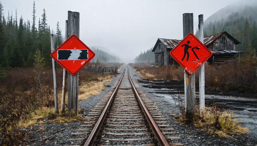
Before you step foot on the Alaska Railroad right of way, scan both directions carefully — trains move fast and pass frequently through this stretch. You’re crossing active rails deep in Chugach National Forest, where wildlife encounters and local legends are part of the terrain.
Watch for these hazards before crossing:
- Active trains — listen for vibrations on the rails before stepping over
- Limited sightlines — curves in the track reduce your reaction time considerably
- Wildlife encounters — bears and moose move through this corridor regularly
- Unstable footing — ballast rock shifts underfoot, especially when you’re moving quickly
- Distractions — local legends about the site may pull your focus; stay alert
Cross quickly, deliberately, and never linger on the tracks.
Other Ghost Towns Along the Seward Highway Worth Stopping For
While you’re traveling the Seward Highway, you won’t want to skip the haunting remnants of Portage, where the 1964 earthquake left quake-tilted homes and drowned forests still visible from the road.
Further along your route, Dyea pulls you in with the legendary Chilkoot Trail, a historic Klondike launch point now swallowed by marsh and forest.
If you’re ready to push deeper into Alaska’s ghost town circuit, McCarthy and Kennecott reward the effort with intact copper mine mills and a richer, more structured look at the region’s mining past.
Portage’s Earthquake-Damaged Remnants
Driving south on the Seward Highway, you’ll spot Portage’s haunting remnants without even leaving your car. The 1964 earthquake tilted homes and drowned entire forests, leaving ghostly tree skeletons standing in flooded ground. These historical artifacts tell a raw, unfiltered story of nature’s power.
Watch for these highlights as you pass through:
- Quake-tilted homes still visible from the highway
- Drowned forests frozen in time since 1964
- Wildlife encounters with moose and waterfowl near flooded flats
- Dramatic mountain backdrops framing the destruction
- Easy roadside viewing requiring zero hiking effort
Portage demands no bushwhacking, no railroad crossings — just pull over and absorb the wreckage. It’s a perfect complement to your Kern stop, proving the 1964 earthquake reshaped this entire highway corridor permanently.
Dyea And Chilkoot Trail
Portage shows you what the 1964 earthquake left behind along this corridor, but Dyea tells a completely different story of abandonment — one rooted in gold rush fever rather than geological violence.
Once a roaring Klondike launch point packed with stampeders chasing mining history, Dyea collapsed almost overnight after Skagway’s railroad rendered it obsolete. No railroad markers guided travelers here — the railroad simply never came, and that absence killed the town.
Today, marsh and forest have swallowed nearly everything. What draws you here now is the Chilkoot Trail, a legendary 33-mile route that still carries the echo of desperate ambition through its mountain passes.
Lace up, pack smart, and walk the same ground those gold-hungry prospectors once scrambled across chasing fortunes they mostly never found.
McCarthy And Kennecott Mines
From Dyea’s gold rush ghost story, shift your focus east toward two sites that punch even harder into Alaska’s mining legacy — McCarthy and Kennecott. McCarthy still breathes with a population of 28, while Kennecott’s mills stand as monuments to Alaska’s richest copper veins. Local flora reclaims old structures fast, so explore deliberately.
- Walk through Kennecott’s intact mill buildings for rare industrial history
- Watch for wildlife sightings along the route, including moose and eagles
- Cross the legendary Kuskulana River Bridge for a dramatic canyon view
- Photograph McCarthy’s weathered storefronts before vegetation swallows them
- Time your arrival between May and June for the clearest trail access
These two destinations sharpen any ghost town itinerary into something truly unforgettable.
Frequently Asked Questions
Is a Permit Required to Visit Kern Within Chugach National Forest?
You don’t need a permit to visit Kern, but you’ll want to check wildlife regulations and camping restrictions before exploring. Embrace your freedom responsibly within Chugach National Forest’s rugged, adventure-filled boundaries!
Can You See Kern’s Railroad Marker From the Seward Highway Pulloff?
You won’t spot Kern’s railroad history from the pulloff’s scenic viewpoints, but venture past the marsh and tracks, and you’ll find the surviving railroad marker waiting to reward your free-spirited exploration nearby.
Are Hunting Treestands Present Year-Round or Only During Hunting Season?
You’ll find hunting treestands present year-round within Kern’s wild wildlife habitats, though hunters actively use them during hunting season. Seasonal foliage transforms the overgrown townsite, making these rugged structures more visible during winter’s bare, adventurous landscape.
How Long Does the Bushwhack From the Pulloff to Kern Typically Take?
Like stepping into the wild unknown, you’ll navigate marsh and railroad tracks in roughly 15–20 minutes. Watch for wildlife encounters along the way, and don’t miss scenic viewpoints before you’re swallowed by Kern’s overgrown, adventurous silence.
Is the Alaska Railroad Right of Way Legal to Cross at This Location?
The knowledge doesn’t confirm whether the railroad crossing here is legal. You’ll want to check Alaska Railroad’s legal regulations before you cross, as trespassing on railroad right of ways can carry serious consequences for your adventurous plans.
References
- https://www.youtube.com/watch?v=10BQpBJaDgY
- https://www.ghosttowns.com/states/ak/kern.html
- https://motorcyclemojo.com/2015/09/alaska-ghost-towns/
- https://www.youtube.com/watch?v=TC_KPrhDByY
- https://thealaskafrontier.com/ghost-towns-in-alaska/