Planning a ghost town road trip to Mapes, North Dakota means heading 4 miles east of Highway 2 near Lakota into a place time has forgotten. You’ll find weathered foundations, crumbling wooden structures, and echoes of Great Northern Railway days stretching back to 1883. Pack water, sturdy shoes, and a full tank of gas before you go. There’s far more to this haunting prairie destination than you’d expect.
Key Takeaways
- Mapes is located in Nelson County, 4 miles east of Highway 2 near Lakota, with rural roads requiring checked conditions before traveling.
- Bring essentials including water, snacks, sturdy shoes, sunscreen, a flashlight, and a first aid kit for a safe visit.
- Visit during late spring or early fall to avoid summer heat, winter snow, and impassable spring mud roads.
- Historical remnants include weathered foundations, deteriorating wooden structures, abandoned farm equipment, and visible Great Northern Railway corridor traces.
- Mapes declined after the Great Northern Railway collapsed, cutting economic lifelines and eventually reducing residents to just 20 before abandonment.
What Is Mapes, North Dakota?
Nestled in Nelson County, North Dakota, Mapes is a ghost town that once hummed with the promise of frontier life. Founded in 1883, Mapes history traces back to an era when the Great Northern Railway connected isolated settlements to sprawling opportunity. Settlers arrived with ambition, and for a time, the town thrived.
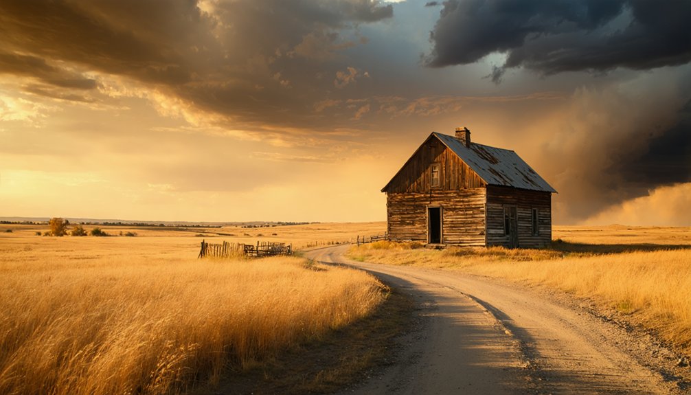
Mapes geography places it at 48° 01′ 52″ N latitude, sitting 1,493 feet above sea level, just 4 miles east of Highway 2 near Lakota. It’s remote, open, and unapologetically wild — exactly the kind of place that calls to free spirits.
Perched at 1,493 feet, Mapes stretches wild and open — a remote frontier calling to restless souls.
Today, zero permanent residents remain. The post office closed, the railroad vanished, and silence reclaimed the land.
But Mapes still stands as a compelling chapter in North Dakota’s frontier story.
How To Get To Mapes From Highway 2
Four miles stand between Highway 2 and the quiet ruins of Mapes — a short drive that feels like stepping back through time. Your directions overview is straightforward: head east from the highway near Lakota, and you’ll reach the site without complicated navigation.
That said, road conditions in rural Nelson County can shift unexpectedly, so check local reports before you leave.
For practical travel tips, download offline maps before departing since cell service disappears quickly once you leave the highway corridor. A full tank matters more than you’d think out here — gas stations don’t appear on demand.
You’re trading convenience for freedom, and that’s exactly the point. The landscape opens wide, the traffic thins out, and Mapes waits quietly at the end of that short, unhurried road.
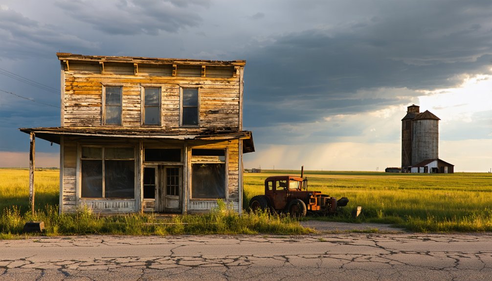
What Still Stands in Mapes Today
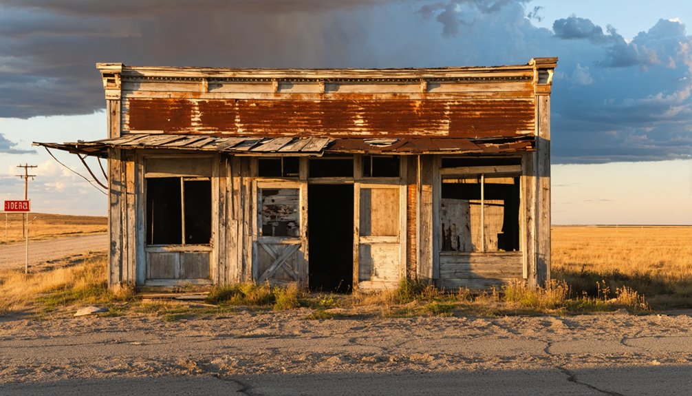
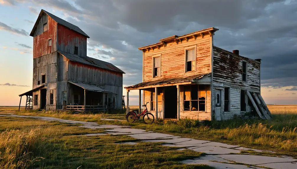
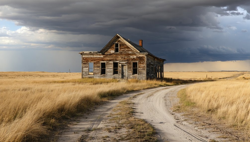
When you arrive in Mapes, you’ll find only scattered historical remnants where a once-thriving community stood.
You can still spot aging structural traces that hint at the town’s late 19th-century peak, though time and abandonment have claimed most of what existed.
These quiet ruins connect you to a past shaped by railroad ambition and agricultural promise that ultimately faded away.
Historical Remnants Still Visible
Though time has stripped Mapes of its population, it hasn’t erased every trace of the life that once thrived here.
You’ll still find remnants carrying real historical significance, and their architectural features tell stories words can’t fully capture.
Look for these visible survivors scattered across the site:
- Weathered building foundations marking original lot lines
- Deteriorating wooden structures frozen in quiet decay
- Remnants of the Great Northern Railway corridor
- Abandoned farm equipment reclaimed slowly by prairie grass
- Crumbling walls reflecting late 19th-century construction methods
Each element connects you to a community that once bustled with ambition.
Walking through Mapes feels less like tourism and more like stepping into an open-air archive.
You’re free to interpret the silence however feels right to you.
Standing Structural Remains
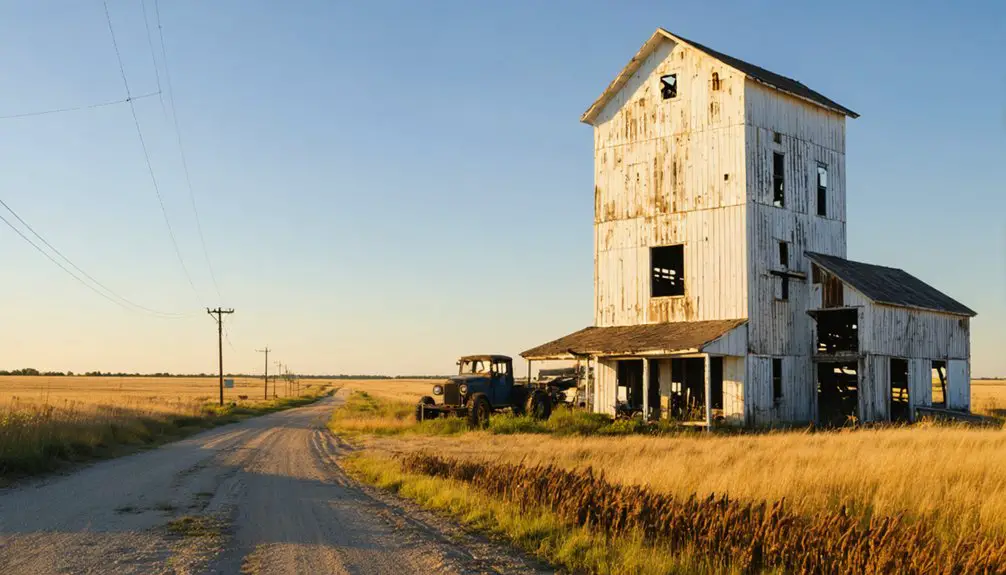
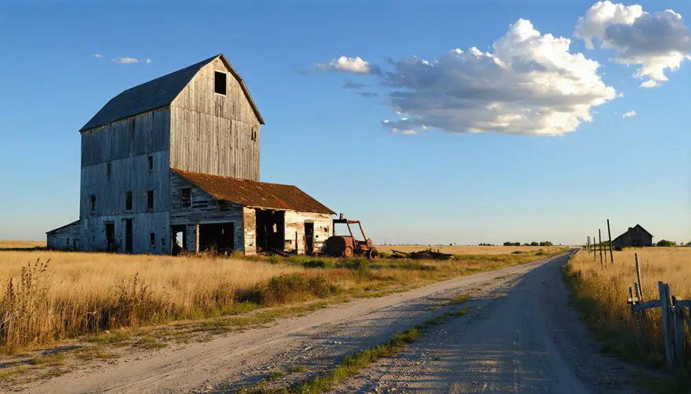
Scattered across the Mapes site, a handful of structures still push back against the relentless prairie wind. You’ll find weathered wooden frames leaning at precarious angles, their boards silvered by decades of sun and frost.
These abandoned structures whisper stories of a community that once thrived along the Great Northern Railway corridor. Crumbling foundations mark where homes and businesses once anchored daily life, while scattered historical artifacts — rusted hardware, broken crockery, worn timber — surface beneath the grass.
A deteriorating grain elevator silhouette remains the most commanding landmark, standing as a monument to the agricultural ambitions that briefly flourished here.
You’re fundamentally walking through an open-air museum with no admission fee and no curator — just raw, unfiltered history dissolving slowly back into the North Dakota earth.
Traces Of Past Settlement
Mapes doesn’t announce itself — you have to look for it. The settlement patterns here speak quietly through scattered remnants that reward careful observation.
Walk the site and you’ll find historical artifacts embedded in the landscape itself:
- Weathered foundation stones marking where homes once stood
- Overgrown lots outlining former streets and property boundaries
- Rusted metal fragments from abandoned farm equipment
- Collapsed wooden structures slowly returning to the earth
- Faint road traces indicating the town’s original grid layout
Each detail tells you something real about the people who built their lives here after 1883. Nothing’s been preserved or curated — it’s raw and honest.
That authenticity is exactly what makes Mapes worth finding. You’re reading the land directly, without interpretation between you and the past.
Why Did Mapes, North Dakota Become a Ghost Town?
Like so many small towns that once dotted the Northern Plains, Mapes didn’t fade quietly — it was pulled apart by the very forces that built it. The Great Northern Railway once gave Mapes its heartbeat, drawing settlers who believed the land promised permanence.
But railroad decline severed that lifeline, cutting off the commerce and mobility the town depended on. Without reliable rail access, agricultural support collapsed alongside it. Farmers couldn’t move crops efficiently, businesses couldn’t sustain themselves, and families started making hard choices.
One by one, they left. The post office eventually closed, sealing the town’s fate. By the time census records noted just 20 residents, the end was already written.
Today, zero permanent residents remain — just open sky, silence, and the freedom to imagine what once was.
What To Bring Before You Drive Out to Mapes
Before you make the drive out to Mapes, there are 6 essentials you’ll want packed and ready.
This remote stretch of North Dakota offers no stores, no services, and no cell signal, so these packing essentials and safety tips aren’t optional:
- Water and snacks to fuel your exploration
- Sturdy shoes for uneven ground and historical debris
- Sunscreen and a hat against the open prairie sun
- A flashlight for shadowed corners of forgotten structures
- A first aid kit since medical help is miles away
Download your offline maps before leaving, too.
Once you’re 4 miles east of Highway 2, you’re on your own. That independence is exactly what makes Mapes worth visiting.
When Is the Best Time To Visit Mapes?
When you visit matters as much as where you go, and Mapes rewards those who time it right. The best seasons for exploring this forgotten corner of North Dakota are late spring and early fall. May and September deliver mild temperatures, manageable winds, and enough daylight to soak in every crumbling detail.
Weather considerations are serious here. Summer heat bakes the open plains with little shade to protect you, while winter transforms the landscape into an unforgiving, snow-locked expanse.
Spring mud can make unpaved roads nearly impassable, cutting off your access entirely.
Early morning visits during shoulder seasons offer the clearest skies and the quietest atmosphere, letting you connect with Mapes on your own terms.
Plan around the land, and it’ll give you something worth remembering.
Ghost Towns in North Dakota Worth Adding to Your Route
Mapes won’t be the only ghost town calling your name once you’ve caught the exploration bug. North Dakota’s wide-open landscape hides several forgotten settlements worth weaving into your route, each carrying its own historical significance.
Here are five ghost towns worth your detour:
- Hartland – Ward County, 4 miles west of Carpio
- Tagus – Mountrail County, founded in 1900
- Temple – An abandoned township in Williams County near the border
- Van Hook – Mountrail County, echoing a quieter past
- Charbonneau – McKenzie County, abandoned in the 1960s
Every stop deepens your ghost town exploration, revealing layers of lives once fully lived.
String these destinations together, and you’ll piece together North Dakota’s forgotten history mile by mile.
Frequently Asked Questions
What Time Zone Does Mapes, North Dakota Currently Observe?
You’ll find that Mapes, North Dakota, observes Central Standard Time (UTC-6). As you explore its historical significance, this time zone connects you to the freedom of the open plains where pioneers once built their dreams.
How Many Families Were Recorded in Mapes During the 2010 Census?
Like echoes of a fading dream, census demographics reveal 7 families called Mapes home during the 2010 census. Family migration had already taken its toll, leaving you with only whispers of a once-vibrant community.
What Is the Exact Elevation of Mapes Above Sea Level?
You’ll find Mapes sitting at an elevation of 1,493 feet (455 meters) above sea level, where the elevation significance enhances the nostalgic charm of its historical landmarks, giving you that liberating sense of standing above forgotten history.
What Were the Geographic Coordinates of Mapes, North Dakota?
You’ll find Mapes sitting at 48° 01′ 52″ N and 98° 13′ 37″ W — coordinates that’ll guide your ghost town exploration deep into North Dakota history, where forgotten freedom once thrived on the open prairie.
When Exactly Was the Town of Mapes First Established?
Like a seed finding fertile soil, you’ll find Mapes’ town history took root in 1883. Pioneers pursued settlement reasons tied to railroad promise and open land, planting their dreams freely across North Dakota’s sprawling plains.
References
- https://urbex-maps.com/en/blog/abandoned-places-north-dakota-6-iconic-urbex-spots
- https://en.wikipedia.org/wiki/List_of_ghost_towns_in_North_Dakota
- https://mapcarta.com/23722522
- https://latitude.to/map/us/united-states/cities/minot-air-force-base/articles/226528/tagus-north-dakota
- https://ghostsofnorthdakota892857007.wordpress.com/2015/10/30/true-ghost-towns-population-zero/
- https://www.grhs.org/pages/sheridanco
- https://en.wikipedia.org/wiki/Category:Former_populated_places_in_North_Dakota
- https://ghost-towns.close-to-me.com/states/north-dakota/
- https://ndgenweb.com/sioux/mapsindex.htm
- https://freepages.history.rootsweb.com/~gtusa/usa/nd.htm