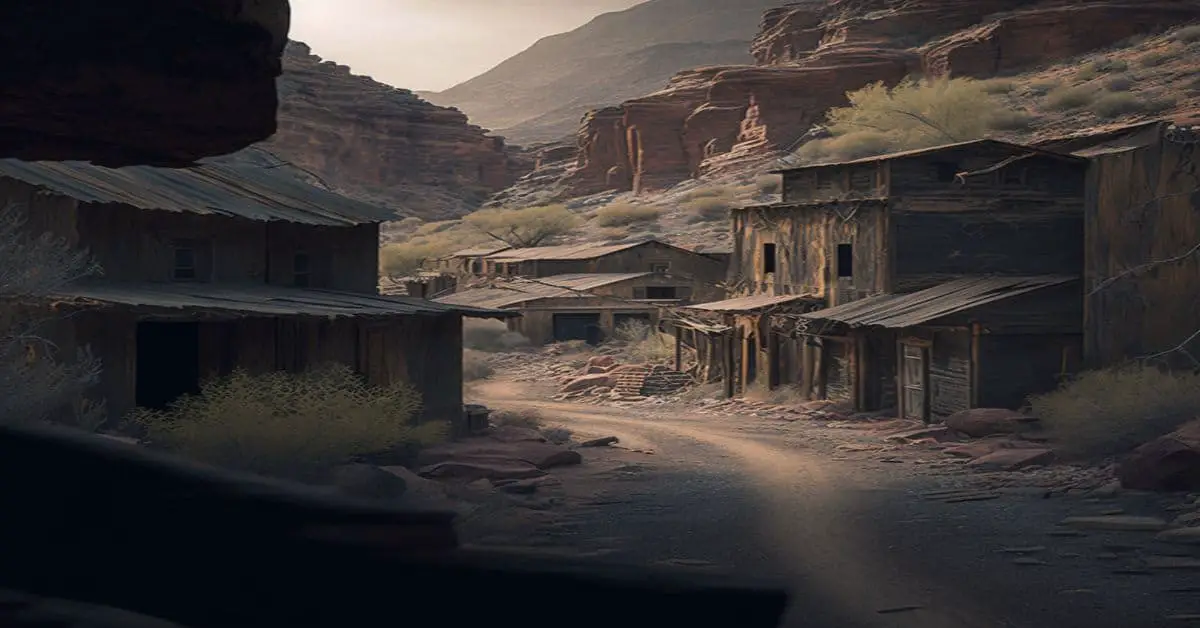
Neosho Falls, KS
County:
Woodson
Zip Code:
66758
Latitude / Longitude:
38°0’21″N 95°33’24″W
Elevation:
974 ft (297 m)
Time Zone:
Central (CST) (UTC-6)
Established:
Disestablished:
Comments:
Neosho Falls is a city in Woodson County, Kansas, United States.
Remains:
Neosho Falls was founded in 1857, making it the oldest town and first county seat in Woodson County. It was named from the Neosho River, on which it is situated. The first post office in Neosho Falls was established in May 1857. Neosho Falls was originally platted and extensively improved by a company led by Benjamin F. Goss and his brother N. S. Goss, who would later organize a company of cavalry in the to fight for the Union in the American Civil War.
Current Status:
As of the 2010 census, the city population was 141.
Remarks:
The town served as an inspiration for the 1988 album In the Spirit of Things by the rock band Kansas.
Neuchatel, KS
County:
Nemaha
Zip Code:
Latitude / Longitude:
39° 34′ 5″ N, 96° 12′ 7″ W
Elevation:
Time Zone:
Central (CST) (UTC-6)
Established:
Disestablished:
Comments:
Neuchatel is an unincorporated community in Nemaha County, Kansas, United States.
Remains:
Neuchatel was founded in 1870 by French and Swiss immigrants.
Current Status:
Remarks:
Newbury, KS
County:
Wabaunsee
Zip Code:
Latitude / Longitude:
39° 5′ 5″ N, 96° 10′ 31″ W
Elevation:
Time Zone:
Central (CST) (UTC-6)
Established:
Disestablished:
Comments:
Newbury is an unincorporated community in Wabaunsee County, Kansas, in the United States.
Remains:
A post office was opened in Newbury in 1870, and remained in operation until it was discontinued in 1888.
Current Status:
Remarks:
Nirwana City, KS
County:
Zip Code:
Latitude / Longitude:
Elevation:
Time Zone:
Central (CST) (UTC-6)
Established:
Disestablished:
Comments:
Remains:
Current Status:
Remarks:
Octagon City, KS
County:
Allen
Zip Code:
Latitude / Longitude:
37° 45′ 38.88″ N, 95° 25′ 22.8″ W
Elevation:
Time Zone:
Central (CST) (UTC-6)
Established:
Disestablished:
Comments:
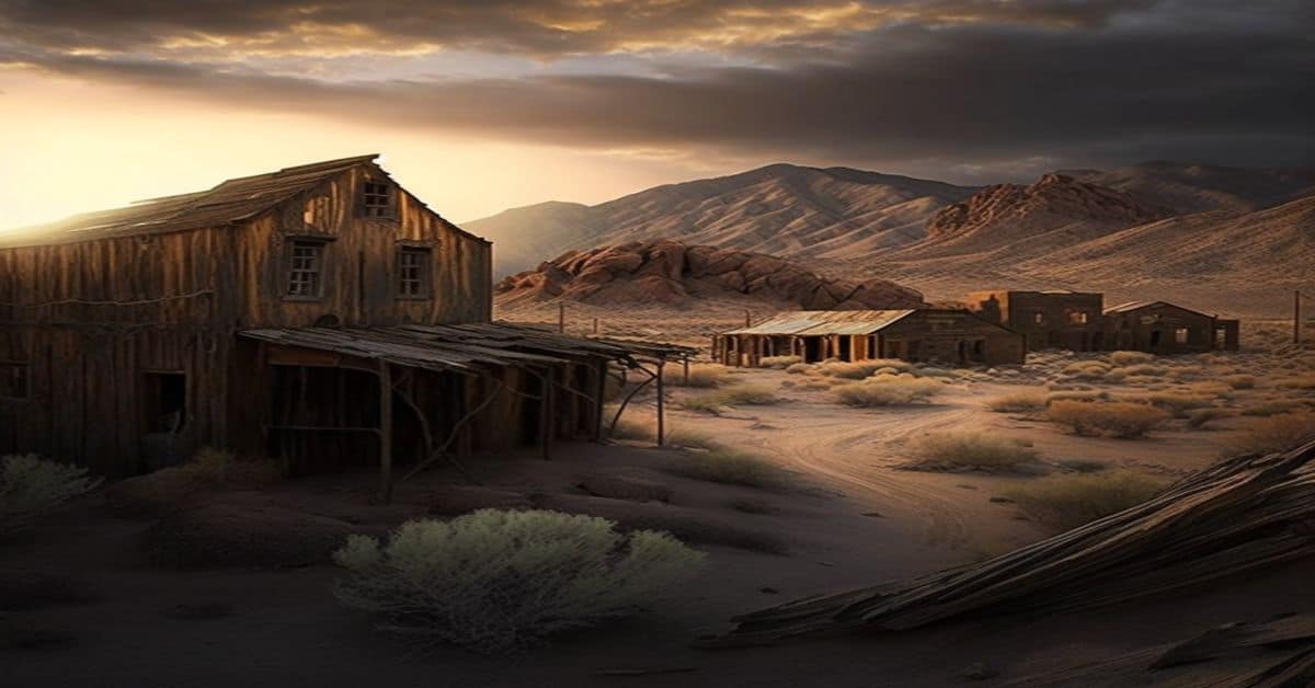
Octagon City is a ghost town in Allen County, Kansas, United States. It was a failed intentional community that was founded in 1856 about six miles (10 km) south of Humboldt, Kansas near the Neosho River. It was created by the Vegetarian Kansas Emigration Company, headed by prominent vegetarian Henry Clubb and entrepreneurs Charles DeWolfe and John McLaurin. The original intent was to build a vegetarian commune on the south side of the Neosho River for vegetarians only, but investor interest in a non-vegetarian moral community was much higher and so the decision was made to build Octagon City on the north side of the Neosho River to make the entire project sustainable. Members of Octagon City were under oath to educate their children and uphold a moral lifestyle.
Remains:
The city’s design was influenced by Orson Squire Fowler, a leading advocate of octagon house architecture. Octagon City would feature an octagonal town square from which would radiate eight roads. Between the roads, in a four-square-mile , sixty-four families would build octagonal farmhouses with octagonal barns.
Current Status:
Very few of those remaining past summer had any intention of making permanent homes in Kansas. They waited only for opportunities to get away. By 1857 only four of the original residents were left, and the survivors reported more illness as the weather became warmer again.
Remarks:
The population remained remote until 1873 with the arrival of the railroad. The town of Chanute, Kansas sprung up four miles (6 km) south of the former commune. Nothing survives of the settlement except the tributary Vegetarian Creek. A marker was erected near the site in 1986, but due to repeated vandalism it was removed in 2001 and donated to the St. Paul/Neosho County Museum.
Ohio City, KS
County:
Zip Code:
Latitude / Longitude:
Elevation:
Time Zone:
Central (CST) (UTC-6)
Established:
Disestablished:
Comments:
Remains:
Current Status:
Remarks:
Oil Hill, KS
County:
Butler
Zip Code:
Latitude / Longitude:
37° 50′ 10″ N, 96° 53′ 8″ W
Elevation:
1,332 ft (406 m)
Time Zone:
Central (CST) (UTC-6)
Established:
Disestablished:
Comments:
Oil Hill, Kansas was an unincorporated community in Butler County, Kansas, United States.
Remains:
The town was formed during the oil boom in Butler County. A post office was established in Oil Hill in 1917, and remained in operation until it was discontinued in 1958. The town no longer exists and is considered a ghost town.
Current Status:
Oil Hill Elementary School is named to commemorate the history of the town.
Remarks:
Old Clear Water, KS
County:
Zip Code:
Latitude / Longitude:
Elevation:
1,772 ft (845 m)
Time Zone:
Central (CST) (UTC-6)
Established:
Disestablished:
Comments:
Remains:
Current Status:
Remarks:
Old Kiowa, KS
County:
Barber
Zip Code:
67070
Latitude / Longitude:
37°1’3″N 98°29’5″W
Elevation:
1,332 ft (406 m)
Time Zone:
Central (CST) (UTC-6)
Established:
Disestablished:
Comments:
Kiowa is a city in Barber County, Kansas, United States.
Remains:
Kiowa was founded in 1872. It was named for the Kiowa people. On June 7, 1900, anti-saloon advocate Carrie Nation vandalized her first saloon in Kiowa.
Current Status:
As of the 2010 census, the city population was 1,026.
Remarks:
In 1905, the Denver, Enid and Gulf Railroad was built from Enid, Oklahoma to Kiowa. In 1907, it was sold to the Atchison, Topeka and Santa Fe Railway. In 1996, the line from Kiowa to Blanton, Oklahoma was abandoned.
Old Montezuma, KS
County:
Gray
Zip Code:
67867
Latitude / Longitude:
37°35’43″N 100°26’32″W
Elevation:
2,772 ft (845 m)
Time Zone:
Central (CST) (UTC-6)
Established:
Disestablished:
Comments:
Montezuma is a city in Gray County, Kansas, United States.
Remains:
Montezuma was founded in 1879, and relocated in 1912 to the Santa Fe Railroad. It was named for Moctezuma II, ruler of the Aztec empire.
Current Status:
As of the 2010 census, the city population was 966.
Remarks:
Ottumwa, KS
County:
Coffey
Zip Code:
Latitude / Longitude:
38° 16′ 40″ N, 95° 47′ 56″ W
Elevation:
Time Zone:
Central (CST) (UTC-6)
Established:
Disestablished:
Comments:
Ottumwa is an unincorporated community in Coffey County, Kansas, in the United States.
Remains:
A post office was established in Ottumwa in 1857, and remained in operation until it was discontinued in 1906.
Current Status:
Remarks:
Owl City, KS
County:
Zip Code:
Latitude / Longitude:
Elevation:
Time Zone:
Central (CST) (UTC-6)
Established:
Disestablished:
Comments:
Remains:
Current Status:
Remarks:
Oxford, KS
County:
Sumner
Zip Code:
67119
Latitude / Longitude:
37°16’29″N 97°10’11″W
Elevation:
1,188 ft (362 m)
Time Zone:
Central (CST) (UTC-6)
Established:
Disestablished:
Comments:
Oxford is a city in Sumner County, Kansas, United States.
Remains:
Oxford was founded in 1871 at the site of a former trading post. Oxford was incorporated as a city in 1879. It was named after Oxford University, in England.
Current Status:
As of the 2010 census, the city population was 1,049.
Remarks:
Padonia, KS
County:
Brown
Zip Code:
Latitude / Longitude:
39° 55′ 24″ N, 95° 33′ 46″ W
Elevation:
Time Zone:
Central (CST) (UTC-6)
Established:
Disestablished:
Comments:
Padonia is an unincorporated community in Padonia Township, Brown County, Kansas, in the United States.
Remains:
The first settlement at Padonia was made in 1854. The community was named for Jesse Padon, a pioneer settler. A post office was established in Padonia in 1857, and remained in operation until it was discontinued in 1933.
Current Status:
Remarks:
Palermo, KS
County:
Doniphan
Zip Code:
Latitude / Longitude:
39° 43′ 57″ N, 94° 58′ 36″ W
Elevation:
Time Zone:
Central (CST) (UTC-6)
Established:
Disestablished:
Comments:
Palermo is an unincorporated community in Doniphan County, Kansas, in the United States.
Remains:
A post office was opened in Palermo in 1855, and remained in operation until it was discontinued in 1904.
Current Status:
Remarks:
Pardee, KS
County:
Atchison
Zip Code:
Latitude / Longitude:
39° 29′ 7″ N, 95° 17′ 16″ W
Elevation:
Time Zone:
Central (CST) (UTC-6)
Established:
Disestablished:
Comments:
Pardee is a ghost town in Atchison County, in the U.S. state of Kansas.
Remains:
Pardee was platted in 1857, and named for Pardee Butler, a local reverend and abolitionist. A post office was established at Pardee in 1858, and remained in operation until it was discontinued in 1903.
Current Status:
Remarks:
Paris, KS
County:
Zip Code:
Latitude / Longitude:
39°5′9″N 96°45′45″W / 39.08583°N 96.76250°W / 39.08583
Elevation:
Time Zone:
Central (CST) (UTC-6)
Established:
Disestablished:
Comments:
Remains:
Current Status:
Remarks:
Pawnee, KS
County:
Geary
Zip Code:
Latitude / Longitude:
39°5’6″N 96°45’42″W
Elevation:
1,053 ft (321 m)
Time Zone:
Central (CST) (UTC-6)
Established:
Disestablished:
Comments:
Pawnee is a ghost town in Geary County, Kansas, United States, which briefly served as the first official capital of the Kansas Territory in 1855. Pawnee was the territorial capital for exactly five days – the legislature met there from July 2 to July 6 – before legislators voted to move the capital to Shawnee Mission, which is located in present-day Fairway. It may be the shortest-lived capital of any U.S. state or territory (Colorado City also served as the capital of the newly established Colorado Territory for five days in 1862 but was not federally recognized).
Remains:
For many millennia, the Great Plains of North America was inhabited by nomadic Native Americans. From the 16th century to 18th century, the Kingdom of France claimed ownership of large parts of North America. In 1762, after the French and Indian War, France secretly ceded New France to Spain, per the Treaty of Fontainebleau. In 1802, Spain returned most of the land to France. In 1803, most of the land for modern day Kansas was acquired by the United States from France as part of the 828,000 square mile Louisiana Purchase for 2.83 cents per acre. In 1854, the Kansas Territory was organized.
Current Status:
Today the museum features exhibits on Kansas Territory, rail and river travel in the region, and the history of Pawnee. Because it is now part of a military installation, arrangements must be made in advance for the general public to visit the museum. A driving tour of the base is available, featuring several historic sites, including the First Territorial Capitol.
Remarks:
Many residents left town with the legislators immediately after their adjournment on July 6. Those who did not were faced with a cholera outbreak in August. Fort Riley was also affected. Union Pacific Railroad lines reached the abandoned town in 1866 – as part of a transcontinental route approved by the Pawnee legislature – passing just yards away from the north side of the capitol. Its passage through Pawnee was due in part to the unreliability of the nearby river for navigation.
Pearlette, KS
County:
Zip Code:
Latitude / Longitude:
Elevation:
Time Zone:
Central (CST) (UTC-6)
Established:
Disestablished:
Comments:
Remains:
Current Status:
Remarks:
Peoria, KS
County:
Franklin
Zip Code:
Latitude / Longitude:
38° 35′ 5″ N, 95° 8′ 56″ W
Elevation:
1,749 ft (838 m)
Time Zone:
Central (CST) (UTC-6)
Established:
Disestablished:
Comments:
Peoria is an unincorporated community in Franklin County, Kansas, in the United States.
Remains:
Peoria was founded in the late 1850s. it was named for the Peoria tribe, who once owned the town site.
Current Status:
A post office opened in Peoria in 1857, closed in 1859, reopened in 1860, and closed permanently in 1934.
Remarks:
Peterton, KS
County:
Osage
Zip Code:
Latitude / Longitude:
37°52′42″N 100°40′37″W / 37.87833°N 100.67694°W / 37.87833
Elevation:
Time Zone:
Central (CST) (UTC-6)
Established:
Disestablished:
Comments:
Peterton is an unincorporated community in Osage County, Kansas, in the United States.
Remains:
A post office was opened in Peterton in 1876, and remained in operation until it was discontinued in 1904.
Current Status:
Remarks:
Pierceville, KS
County:
Finney
Zip Code:
67868
Latitude / Longitude:
37°52’42″N 100°40’37″W
Elevation:
2,749 ft (838 m)
Time Zone:
Central (CST) (UTC-6)
Established:
Disestablished:
Comments:
Pierceville is a small unincorporated community in Finney County, Kansas, United States. Pierceville is located along U.S. Routes 50 and 400, 12 miles (19 km) southeast of Garden City. Pierceville had a post office with ZIP code 67868, but it was disestablished April 11, 1992. A few houses, a community building, an empty elementary school, a grain elevator, and a church are all that remain of the community.
Remains:
The post office was established on June 10, 1873, and the town began to grow with a store and dugouts. Then tragedy struck on July 3, 1874. Indians who had been defeated in a fight in Texas were heading north and were looking for settlements along the Santa Fe Railroad. Once they got to Pierceville, they set fire to the store and chased the train that came through the town firing their arrows at the train and into the windows. It was learned later that this was the same group of Indians who had attacked the German family and killed the parents, a son and a small child before kidnapping the four daughters. The girls were with the Indians during the attack on Pierceville but were rescued later.
Current Status:
It was not until 1878 that a house and a store were built and the post office was reestablished on July 24. The town was platted in 1886 and the was 400. There was a newspaper, hotel and a hardware store. By 1930, the population was 166.
Remarks:
The Western Trail (a cattle trail) played a part in the founding of this town. The Barton Brothers drove a herd of 3,000 cattle over the trail, and the cattle were the first to feed on the government lands in western Kansas. In the fall of 1872, they came to the and established a ranch along the Arkansas River. The Atchison, Topeka and Santa Fe Railway was laying track in southwestern Kansas, and they chose the Barton Ranch as headquarters for the town site. It was named Pierceville in honor of Chas. W. and Carlos Pierce, who were members of the original Atchison & Topeka Railroad company.
Pleasant Plains, KS
County:
Osborne
Zip Code:
Latitude / Longitude:
39°20’10″N 99°01’06″W
Elevation:
1,939 ft (591 m)
Time Zone:
Central (CST) (UTC-6)
Established:
Disestablished:
Comments:
Deliverance (initially Pleasant Plain) was a small settlement in Mt Ayr Township, Osborne County, Kansas, United States.
Remains:
Pleasant Plain was issued a post office in 1878. The post office name was changed to Deliverance in 1894. The post office was discontinued in 1904.
Current Status:
There is nothing left of Deliverance.
Remarks:
Pond City, KS
County:
Zip Code:
Latitude / Longitude:
Elevation:
Time Zone:
Central (CST) (UTC-6)
Established:
Disestablished:
Comments:
Remains:
Current Status:
Remarks:
Port Landis, KS
County:
Zip Code:
Latitude / Longitude:
Elevation:
Time Zone:
Central (CST) (UTC-6)
Established:
Disestablished:
Comments:
Remains:
Current Status:
Remarks:
Port William, KS
County:
Zip Code:
Latitude / Longitude:
37°56’20″N 97°1’9″W
Elevation:
1,037 ft (316 m)
Time Zone:
Central (CST) (UTC-6)
Established:
Disestablished:
Comments:
Remains:
Current Status:
Remarks:
Potwin Place, KS
County:
Butler
Zip Code:
67123
Latitude / Longitude:
38°45′37″N 95°12′48″W / 38.76028°N 95.21333°W / 38.76028
Elevation:
1,342 ft (409 m)
Time Zone:
Central (CST) (UTC-6)
Established:
1885
Disestablished:
Comments:
Potwin is a city in Butler County, Kansas, United States. It is named after the town site land owner Charles Potwin.
Remains:
In 1854, the Kansas Territory was organized, then in 1861 Kansas became the 34th U.S. state. In 1855, Butler County was established within the Kansas Territory, which included the land for modern day Potwin. Potwin was incorporated as a town on April 8, 1885. This land, owned by Charles Potwin, whereby the town received its name, became a station for the Missouri Pacific Railroad, instigated by William I. Joseph, known as the Father of Potwin.
Current Status:
As of the 2010 census, the city population was 449.
Remarks:
In 1802, Spain returned most of the land to France. In 1803, most of the land for modern day Kansas was acquired by the United States from France as part of the 828,000 square mile Louisiana Purchase for 2.83 cents per acre.
Prairie City, KS
County:
Douglas
Zip Code:
Latitude / Longitude:
38°45’37″N 95°12’48″W
Elevation:
1,037 ft (316 m)
Time Zone:
Central (CST) (UTC-6)
Established:
Disestablished:
Comments:
Prairie City was founded in 1855 by James Lane, Dr. William Graham, Louis (Lewis) F. Green and Salmon S. Prouty after a dispute between Graham and Henry Barricklow of nearby Palmyra. A post office opened in 1856 with John R. Winton serving as postmaster. The Heber Institute was started by the Protestant Episcopal Church in 1856 but never opened. The building became Prairie City School District No. 1.
Remains:
The first printing press in Kansas was used in Prairie City by Prouty to publish The Freeman’s Champion which ran for 40 weeks. Prouty bought the press in 1857 from the Ottawa Baptist Mission in Franklin County. Prouty would leave Prairie City in 1868 and move to Topeka where he would found the Topeka Journal which would later merge to become the Topeka Capital-Journal
Current Status:
On March 24, 1883, Douglas County commissioners had certain streets and alleys vacated. Today, little remains to mark the city except a few houses, a cemetery and the ruins of an old Catholic church. The Midland Railway from Baldwin passes by a sign pointing out where the depot, newspaper, post office and store used to be.
Remarks:
Quindaro, KS
County:
Zip Code:
Latitude / Longitude:
39° 9′ 14″ N, 94° 39′ 42″ W
Elevation:
Time Zone:
Central (CST) (UTC-6)
Established:
Disestablished:
Comments:
Quindaro Townsite is an archaeological district in the vicinity of North 27th Street and the Missouri Pacific Railroad tracks in Kansas City, Kansas. It was placed on the National Register of Historic Places on May 22, 2002.
Remains:
The settlement was established by abolitionists in late 1856, with construction starting in 1857. The town was rapidly settled by migrants aided by the New England Emigrant Aid Company, who were trying to help secure Kansas as a free territory. One of a number of villages hugging the narrow bank of the Missouri River under the bluffs, the town was a Free State port-of-entry for abolitionist forces of Kansas. It was established as part of the resistance to stop the westward spread of slavery. Quindaro’s people also aided escaped slaves from Missouri and linked them to the Underground Railroad.
Current Status:
An archaeological study in 1987-1988 required for a public project revealed the remains of the 1850s townsite. The foundations of 20 main buildings, two outbuildings, three wells, and one cistern were found. From original maps, newspapers and letters, researchers know other structures exist. Because of the significance of the town, the townsite has been designated an archaeological district on the National Register of Historic Places. A number of public history projects have been undertaken to engage the public and share the discoveries.
Remarks:
After Kansas was established as a free state, there was less unique need for the port and the growth slowed in the commercial district. At the same time the economy in Kansas suffered from over-speculation. In 1862 classes were started for children of former slaves, and in 1865 a group of men chartered Quindaro Freedman’s School (later Western University), the first black school west of the Mississippi River. Former slaves continued to gather in the residential community, which became mostly African American by the late 19th century. The was incorporated into Kansas City in the early 20th century. Gradually the lower commercial townsite was abandoned and became overgrown. The townsite was rediscovered during archaeological study in the late 1980s, which revealed many aspects of the 1850s town.
Randolph, KS
County:
Riley
Zip Code:
66554
Latitude / Longitude:
39°25’50″N 96°45’36″W
Elevation:
1,237 ft (377 m)
Time Zone:
Central (CST) (UTC-6)
Established:
Disestablished:
Comments:
Randolph is a city in Riley County, Kansas, United States. It is the center of Jackson Township. Randolph was originally called Waterville, and under the latter name was laid out in 1856. It was renamed Randolph in honor Gardner Randolph, a pioneer settler.
Remains:
Randolph was originally located a mile east of its present location. When the Tuttle Creek reservoir began filling up in 1962, it affected ten towns and entirely submerged four of them (from north to south): Cleburne at 39°31’49″N 96°38’6″W, Randolph, Garrison Cross and Stockdale. The only town to rebuild elsewhere was Randolph, where the streets are named after the submerged towns.
Current Status:
As of the 2010 census, the city population was 163.
Remarks:
The ruins of the original town are visible on the north side of Kansas Highway 16 as it crosses the lake. The downtown of the original settlement is above the waterline on an island in the marshes at the northern tip of the lake. The island is occasionally accessible by foot when Fancy Creek is low, but the channels of Fancy Creek and the Big Blue River shift frequently making access to the ruins unpredictable. This is locally known as “Old Randolph.”
Ransomville, KS
County:
Franklin
Zip Code:
Latitude / Longitude:
38° 30′ 23″ N, 95° 25′ 33″ W
Elevation:
Time Zone:
Central (CST) (UTC-6)
Established:
Disestablished:
Comments:
Ransomville is an unincorporated community in Franklin County, Kansas, in the United States.
Remains:
Ransomville was named for J. H. Ransom, who founded the first store around which the town was built up.
Current Status:
A post office was opened in Ransomville in 1881, and remained in operation until it was discontinued in 1915.
Remarks:
Ravanna, KS
County:
Finney
Zip Code:
Latitude / Longitude:
38°09’35″N 100°22’57″W
Elevation:
2,559 ft (780 m)
Time Zone:
Central (CST) (UTC-6)
Established:
1882
Disestablished:
Comments:
Ravanna is a ghost town in Finney County, Kansas, United States. It is located approximately 30 miles (48 km) east-northeast of Garden City.
Remains:
In 1887, it was one of two towns that vied to become the county seat of the now defunct Garfield County, which merged into Finney County in 1893. The post office in Ravanna closed permanently in 1922.
Current Status:
Remarks:
Ray, KS
County:
Zip Code:
Latitude / Longitude:
Elevation:
Time Zone:
Central (CST) (UTC-6)
Established:
Disestablished:
Comments:
Remains:
Current Status:
Remarks:
Raymond, KS
County:
Rice
Zip Code:
67573
Latitude / Longitude:
38°16’42″N 98°24’54″W
Elevation:
1,726 ft (526 m)
Time Zone:
Central (CST) (UTC-6)
Established:
Disestablished:
Comments:
Raymond is a city in Rice County, Kansas, United States. It is named after Emmons Raymond, former Director of the Atchison, Topeka and Santa Fe Railway. As of the 2010 census, the city population was 79.
Remains:
For millennia, the land now known as Kansas was inhabited by Native Americans. In 1803, most of modern Kansas was secured by the United States as part of the Louisiana Purchase. In 1854, the Kansas Territory was organized, then in 1861 Kansas became the 34th U.S. state. In 1867, Rice County was founded.
Current Status:
Remarks:
Raymond was founded in 1871, making it the oldest town in Rice County. The first post office in Raymond was established in 1872. At one point in its history Raymond was known as a wild “cowtown” and was a stop on the Santa Fe Railroad, but the town has been in decline since the 1950s.
Reamsville, KS
County:
Smith
Zip Code:
Latitude / Longitude:
39° 55′ 48″ N, 98° 52′ 1″ W
Elevation:
Time Zone:
Central (CST) (UTC-6)
Established:
Disestablished:
Comments:
Reamsville (also Beaver) is an unincorporated community in Smith County, Kansas, United States.
Remains:
A post office was opened in Reamsville ca. 1880, and remained in operation until it was discontinued in 1941.
Current Status:
Remarks:
Redwing, KS
County:
Barton
Zip Code:
Latitude / Longitude:
38°31’19″N 98°39’52″W
Elevation:
1,811 ft (552 m)
Time Zone:
Central (CST) (UTC-6)
Established:
Disestablished:
Comments:
Redwing (also Red Wing) is an unincorporated community in central Cheyenne Township, Barton County, Kansas, United States, in the central part of the state. Located at 38°31’19″N 98°39’52″W (38.5219557, -98.6645233), it lies at an elevation of 1811 feet (552 m). Redwing sits 1.5 miles (2.4 km) northwest of the northern edge of the Cheyenne Bottoms Wildlife , 6.0 miles (9.7 km) east of the city of Hoisington, and 7.0 miles (11 km) west of the city of Claflin.
Remains:
There was a grain elevator and tavern in years past. A post office operated in Redwing between 1892 and 1955.
Current Status:
Remarks:
Reece, KS
County:
Greenwood
Zip Code:
Latitude / Longitude:
37° 47′ 56″ N, 96° 26′ 47″ W
Elevation:
Time Zone:
Central (CST) (UTC-6)
Established:
Disestablished:
Comments:
Reece is an unincorporated community in Greenwood County, Kansas, in the United States.
Remains:
A post office was opened in Reece in 1870, and remained in operation until it was discontinued in 1975. The post office in town was called Collins until 1883.
Current Status:
Remarks:
Richland, KS
County:
Shawnee
Zip Code:
Latitude / Longitude:
38°53’01″N 95°32’23″W
Elevation:
935 ft (285 m)
Time Zone:
Central (CST) (UTC-6)
Established:
Disestablished:
Comments:
Richland was a town in southeastern Shawnee County, Kansas. It is notable for being the birthplace of Georgia Neese Clark Gray, the first female Treasurer of the United States.
Remains:
In October 1854, Charles Matney settled in the that was to become Richland, near the confluence of Camp Creek with the Wakarusa River. In 1857 a post office was opened north of town and a schoolhouse was constructed, out of logs, on the northeast corner of Matney’s land. Richland eventually became the center of a rich agricultural region and its businesses included a bank, a barber shop, a church, two blacksmiths, two doctors, a pharmacy, several lodges, a hotel and a general store. in the early 1870s, Richland became a station on the St. Louis, Lawrence and Denver Railroad however the railroad would be short lived and the railroad stopped running in 1894.
Current Status:
The post office closed in 1969 and the last of the town was leveled in 1974. Today little remains of Richland, only some ruins of buildings, fragments of paved streets and the cemetery. Most of town site was located on land owned by the U.S. Army Corps of Engineers. U.S. Geological Survey quadrangle maps show the original location to be at 38.887699, -95.528589, at elevation 900 ft., and COE brochure says Flood Control Pool is at 903.4 ft.
Remarks:
Richmond, KS
County:
Franklin
Zip Code:
66080
Latitude / Longitude:
38°24’9″N 95°15’11″W
Elevation:
1,024 ft (312 m)
Time Zone:
Central (CST) (UTC-6)
Established:
Disestablished:
Comments:
Richmond is a city in Franklin County, Kansas, United States.
Remains:
Richmond was founded in 1870. It was named for John C. Richmond, a local farmer who donated forty acres of land to the railroad for a station location.
Current Status:
As of the 2010 census, the city population was 464.
Remarks:
The first post office in Richmond was established in April, 1870.
Rising Sun, KS
County:
Zip Code:
Latitude / Longitude:
Elevation:
Time Zone:
Central (CST) (UTC-6)
Established:
Disestablished:
Comments:
Remains:
Current Status:
Remarks:
Rollin, KS
County:
Zip Code:
Latitude / Longitude:
Elevation:
Time Zone:
Central (CST) (UTC-6)
Established:
Disestablished:
Comments:
Remains:
Current Status:
Remarks:
Rome, KS
County:
Zip Code:
Latitude / Longitude:
Elevation:
Time Zone:
Central (CST) (UTC-6)
Established:
Disestablished:
Comments:
In June 1867, to better serve the railroad, the Army relocated Fort Hays 15 miles northwest to a site near where the railroad was to cross Big Creek, a tributary of the Smoky Hill River. Seeing a business opportunity, Buffalo Bill Cody and railroad contractor William Rose founded the settlement of Rome, Kansas near the fort’s new location. Within a month, the of Rome grew to over 2,000. Webb, meanwhile, established the Big Creek Land Company and then surveyed and platted a town site, which he named Hays City after the fort, roughly one mile east of Rome. The railroad reached Hays City soon thereafter and constructed a depot there. The railroad’s arrival, combined with a cholera epidemic that hit Rome in the late summer of 1867, drove Rome businesses and residents to relocate to Hays City. Within a year, Rome was completely abandoned. As the western terminus of the railway, Hays City grew rapidly, serving as the supply point for territories to the west and southwest.
Remains:
Current Status:
Southwest of Hays, the Kansas Historical Society maintains the Fort Hays State Historic Site. It consists of four of the fort’s original structures and a visitor’s center. Other sites related to the ’s frontier period include Boot Hill, the city’s earliest cemetery, and a historical marker at the site of the ill-fated town of Rome.
Remarks:
Rosalia, KS
County:
Butler
Zip Code:
67132
Latitude / Longitude:
37°48’55″N 96°37’11″W
Elevation:
1,519 ft (463 m)
Time Zone:
Central (CST) (UTC-6)
Established:
Disestablished:
Comments:
Rosalia is an unincorporated community and CDP in Butler County, Kansas, United States.
Remains:
Rosalia was platted in 1883. The town was named by its first postmaster for his wife.
Current Status:
As of the 2010 census it had a population of 171.
Remarks:
In June 2014, Symphony In The Flint Hills was held a few miles northeast of Rosalia with over 7000 in attendance.
Roxbury, KS
County:
McPherson
Zip Code:
Latitude / Longitude:
38°33’3″N 97°25’49″W
Elevation:
1,339 ft (408 m)
Time Zone:
Central (CST) (UTC-6)
Established:
Disestablished:
Comments:
Roxbury is an unincorporated community and census-designated place about 14.8 miles east of Lindsborg in McPherson County, Kansas, United States. The population was 100 at the 1910 census.
Remains:
In 1802, Spain returned most of the land to France. In 1803, most of the land for modern day Kansas was acquired by the United States from France as part of the 828,000 square mile Louisiana Purchase for 2.83 cents per acre.
Current Status:
Remarks:
In 1854, the Kansas Territory was organized, then in 1861 Kansas became the 34th U.S. state. In 1867, McPherson County was established within the Kansas Territory, which included the land for modern day Moundridge. The original name for the was Colfax, which was established in 1871 as a trading post. It was renamed to Roxbury on March 4, 1875 due to an act of legislature.
Runnymede, KS
County: Harper
Zip Code:
Latitude / Longitude: 37° 21′ 23″ N, 97° 55′ 47″ W
Elevation:
Time Zone: Central (CST) (UTC-6)
Established:
Disestablished:
Comments: Runnymede is an unincorporated community in Harper County, Kansas, United States. It was named after Runnymede, in England.
Remains: Runnymede was touted by an Irish promoter as a planned community in Kansas to wealthy Irish, British and Scottish families in the United Kingdom as a place in a “dry” state where their sons could come to begin a career as gentlemen farmers. Begun in 1888, the speculative though impressive scheme essentially collapsed within four years. The livery stable burned down in 1890. Other buildings were moved two miles south close to the new constructed rail line. In 1891, the large church was moved to the city of Harper, Kansas where it now serves as a museum.
Current Status: The centerpiece of the town was a hotel that was partly disassembled and moved to into the recently opened Cherokee Strip in Alva, Oklahoma in 1893. It remains in use there today, thanks to a successful local effort at restoration.
Remarks: A post office was opened in Runnymede in 1879, and remained in operation until it was discontinued in 1944.